Franklin County Map, Missouri

Franklin County Map Collection

We allow you to use our Franklin County map. Attribution is required.
Franklin County, Missouri

Franklin County is in the east-central part of Missouri. It’s where the Ozark foothills start to flatten out as you head towards St. Louis. The Missouri River cuts right through it.
This place has stories to tell. German immigrants left their mark here. You can still see it in the architecture and taste it in the wine.
Speaking of wine, the eastern part of the county is in the middle of Missouri wine country. Hermann, just across the river, gets all the attention. But Franklin County has got some hidden gems.
| Category | Details |
|---|---|
| County Name | Franklin County |
| County Seat | Union |
| Population | Approximately 105,000 |
| Cities, Towns, and Communities | Washington, Union, Pacific, Sullivan, New Haven, St. Clair, Gerald, Gray Summit |
| Interstates and Highways | I-44, US 50, US 66, MO 100, MO 47 |
| FIPS Code | 29-071 |
| Total Area (Land and Water) | 931 square miles (Land: 923 sq mi, Water: 8 sq mi) |
| Adjacent Counties (and Direction) | Warren County (North), St. Charles County (Northeast), St. Louis County (Northeast), Jefferson County (East), Washington County (Southeast), Crawford County (Southwest), Gasconade County (West) |
| Time Zone | Central Time Zone (CT) |
| State | Missouri |
| Coordinates | 38.4216° N, 91.0933° W |
| Etymology | Named after Benjamin Franklin, a Founding Father of the United States |
| Major Landmarks | Shaw Nature Reserve, Missouri Botanical Garden, Meramec Caverns, Route 66 State Park |
| Website | Franklin County Website |
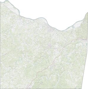
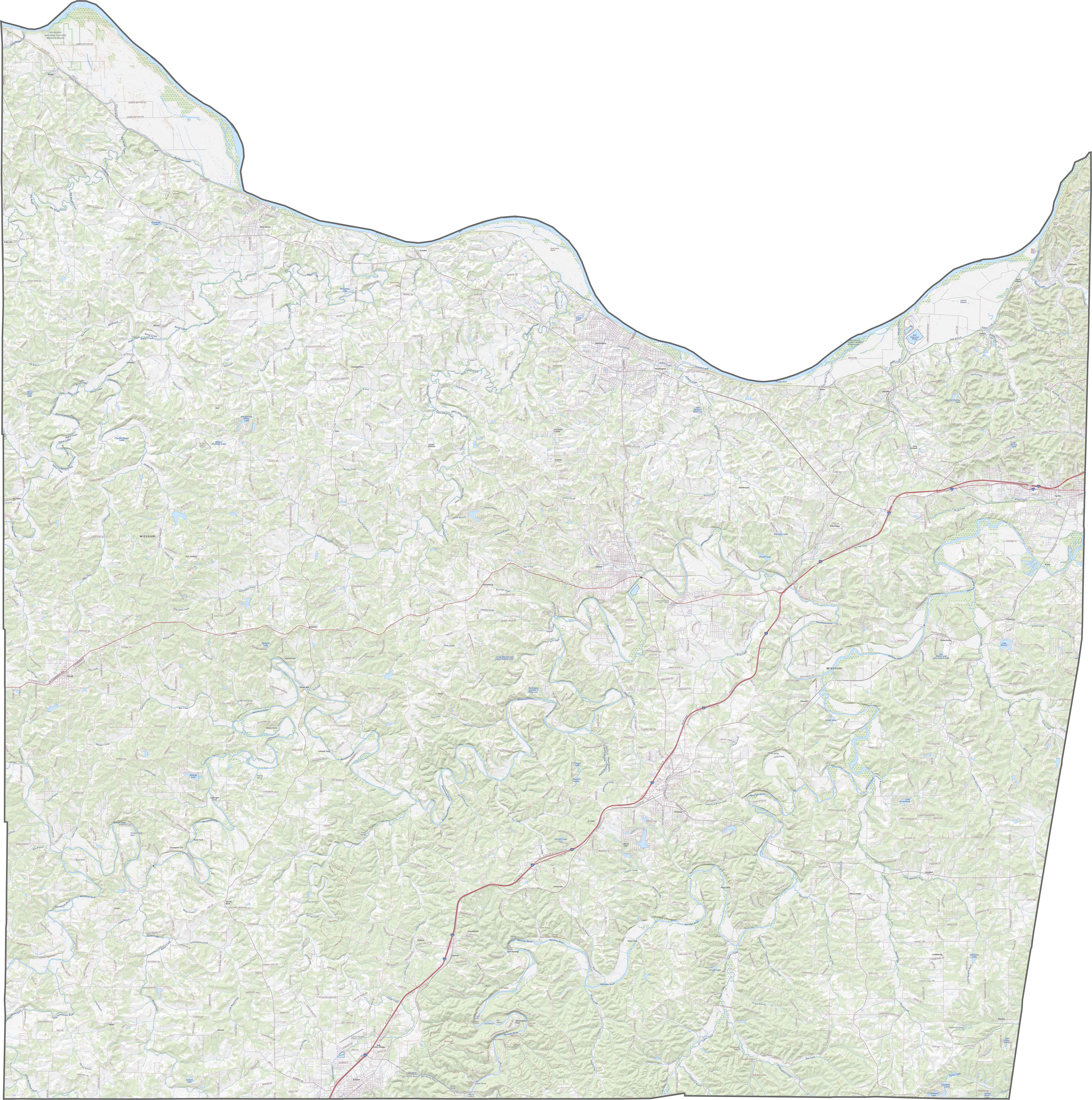
TRANSPORTATION MAP
Franklin County Road Map
See our road map of Franklin County to familiarize yourself with its network of roads. Use our zoom tool to get a closer look at every highway and backroad.
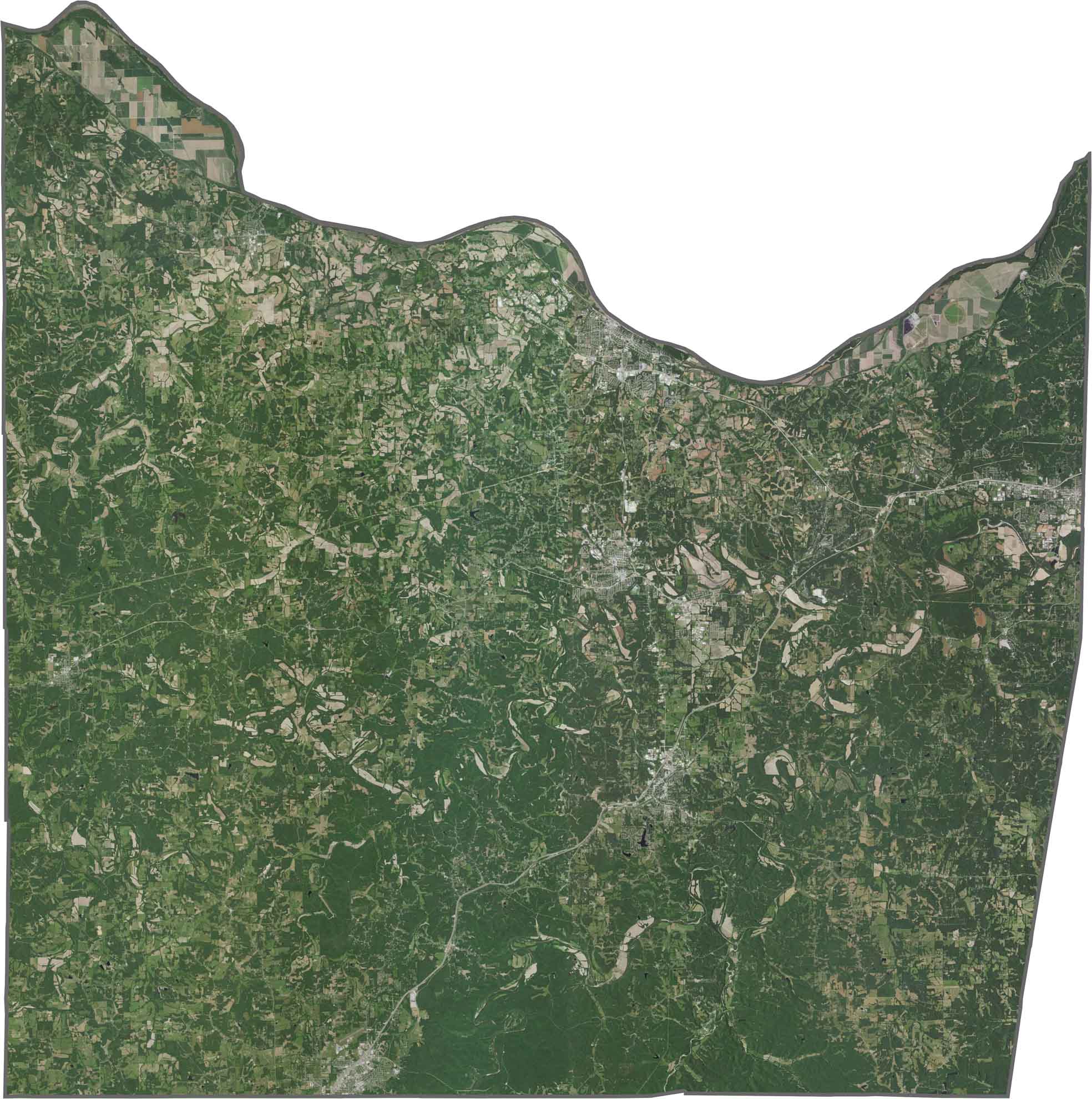
SATELLITE IMAGERY
Franklin County Satellite Map
Our satellite map of Franklin County shows off its forests, farms, and towns. Thick forests cover much of the southern half. Although the northern areas have more open farmland, woods still break up the fields. But towns like Union and Washington stand out brightly against all the green.
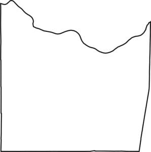
OUTLINE MAP
Franklin County Blank Map
Franklin County has a curvy, irregular northern border because of the Missouri River. Although it lies close to the Mississippi, Franklin doesn’t actually border another state.

Neighboring Counties
Here are the 7 neighboring counties of Franklin County:


Missouri County Map

Explore the Show-Me State. We have all 114 county maps as your guide to smoky BBQ, Ozark trails, and sunsets over the mighty Mississippi. From St. Louis to Branson, Missouri has something on every road.