Johnson County Map, Indiana

Johnson County Map Collection


We allow you to use our Johnson County map. Attribution is required.
Johnson County, Indiana

Johnson County sits just south of Indianapolis. Greenwood, on the north end, is basically an extension of Indy, with its malls and chain restaurants.
But when you head south, you’ll reach the county seat of Franklin. Here, you’ll find a classic small town home to Franklin College. Plus, it has actually been voted Indiana’s best Main Street, in the downtown area.
The county is mostly flat, with some gentle hills in the southern part. The county has some surprisingly good parks, like Johnson County Park and Atterbury Fish and Wildlife Area. Johnson County is growing fast, and is a place in transition.
| Category | Details |
|---|---|
| County Name | Johnson County |
| County Seat | Franklin |
| Population | 173,000 (estimated) |
| Cities, Towns, and Communities | Franklin, Greenwood, Bargersville, Whiteland, New Whiteland, Trafalgar, Edinburgh (partially), Princes Lakes, Morgantown (partially) |
| Interstates and Highways | I-65, US-31, IN-37, IN-44, IN-135 |
| FIPS Code | 18-081 |
| Total Area (Land and Water) | 321 square miles (Land: 320 sq mi, Water: 1 sq mi) |
| Adjacent Counties (and Direction) | Marion County (North), Shelby County (East), Bartholomew County (Southeast), Brown County (Southwest), Morgan County (West) |
| Time Zone | Eastern Time Zone (ET) |
| State | Indiana |
| Coordinates | 39.4823° N, 86.0524° W |
| Etymology | Named after John Johnson, a judge of the Indiana Supreme Court |
| Major Landmarks | Johnson County Museum of History, Historic Artcraft Theatre, Mallow Run Winery, Franklin College |
| Website | Johnson County Website |
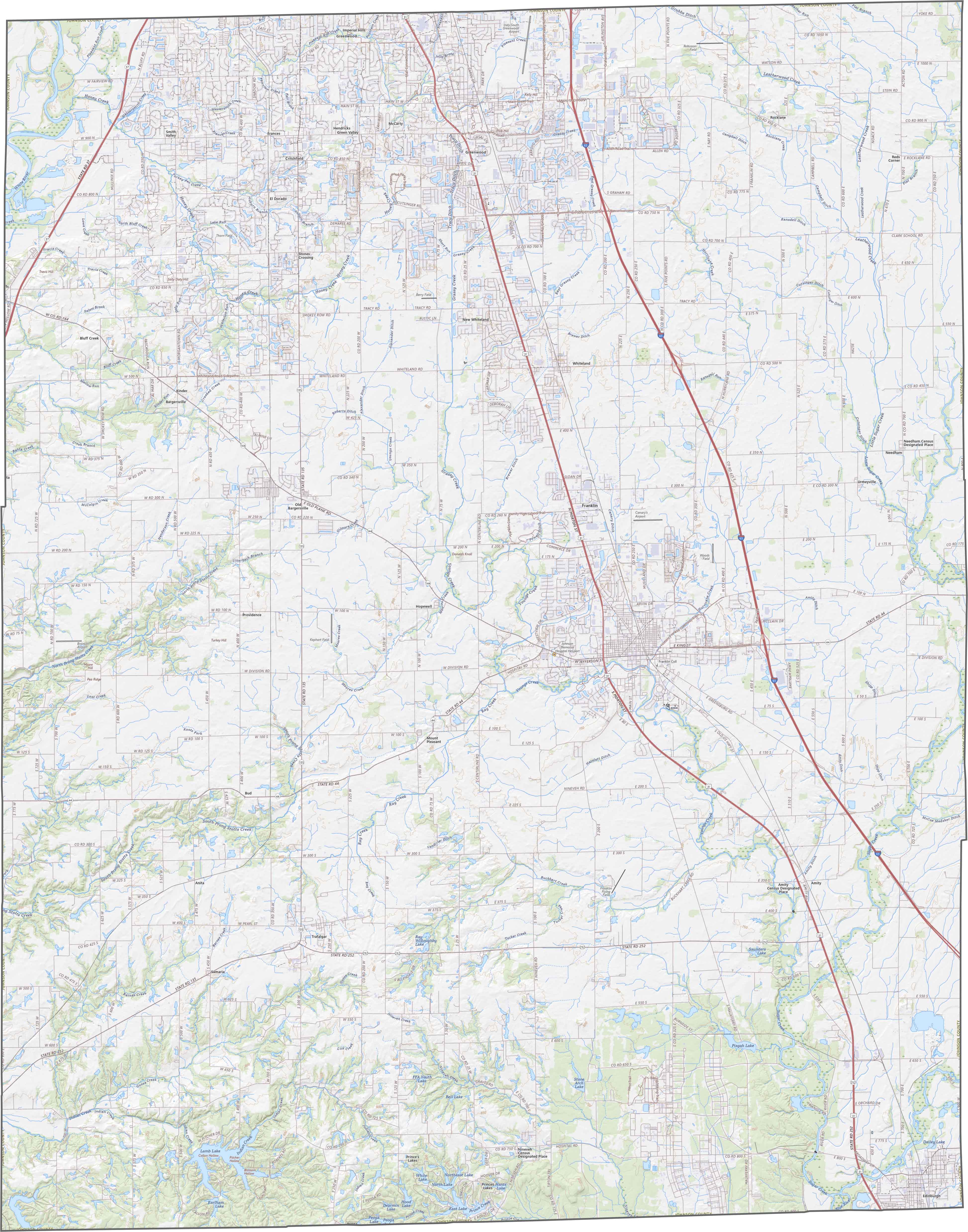
TRANSPORTATION MAP
Johnson County Road Map
Johnson County features a mix of gently rolling hills and flat plains. While the northern sections near Indianapolis show more development, the southern areas retain their rural character with productive farmland.
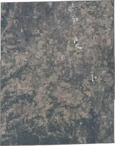
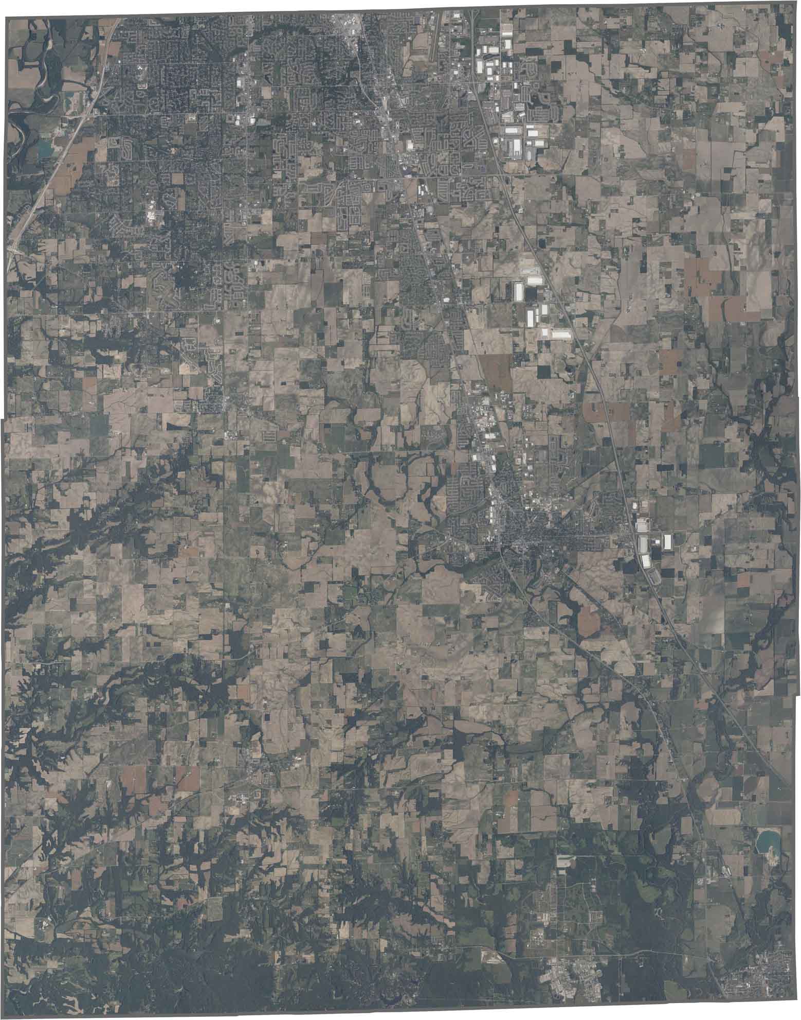
SATELLITE IMAGERY
Johnson County Satellite Map
Johnson County has expanding suburban developments with distinctive urban area, especially along the I-65 corridor. Rural areas show rectangular farm fields and scattered woodlots, with the winding Blue River.
OUTLINE MAP
Johnson County Blank Map
Johnson County forms a slightly elongated rectangle stretching north-south. Straight survey lines define most boundaries.

Neighboring Counties
Here are the 5 neighboring counties of Johnson County:


Indiana County Map

Explore the Hoosier State. 92 counties worth of backroads, skyline views, and small-town magic. This is your glovebox passport to diner pies, covered bridges, and Lake Michigan sunsets.