Dauphin County Map, Pennsylvania

Dauphin County Map Collection
We allow you to use our Dauphin County map. Attribution is required.
Dauphin County, Pennsylvania

Dauphin County is where the action is. It’s home to Harrisburg, the state capital, right in the south-central part of the state. The Susquehanna River runs through it, giving the area a scenic backdrop.
But it’s not all government buildings and suit-and-tie affairs. Hersheypark, yeah, that Hershey, is here too. Chocolate and roller coasters, what’s not to love? Visitors will dig the Pennsylvania State Museum. It’s packed with cool stuff from way back when.
Wildwood Park is a hidden gem for nature lovers. Birdwatching, anyone? The area has some solid schools, including Penn State Harrisburg. Sports fans can catch a Harrisburg Senators game. Yep, they’re the local baseball team.
| Category | Details |
|---|---|
| County Name | Dauphin County |
| County Seat | Harrisburg |
| Population | Approximately 290,000 |
| Cities, Towns, and Communities | Harrisburg, Hershey, Middletown, Hummelstown, Paxtang, Steelton, Highspire |
| Interstates and Highways | Interstate 81, Interstate 83, Interstate 283, U.S. Highway 22, U.S. Highway 322 |
| FIPS Code | 42-043 |
| Total Area (Land and Water) | 558 square miles (525 sq mi land, 33 sq mi water) |
| Adjacent Counties (and Direction) | Northumberland County (North), Schuylkill County (Northeast), Lebanon County (East), Lancaster County (South), York County (Southwest), Cumberland County (West), Perry County (West), Juniata County (Northwest) |
| Time Zone | Eastern Time Zone (EST) |
| State | Pennsylvania |
| Coordinates | 40°22’N, 76°47’W |
| Etymology | Named after Louis-Joseph, Dauphin of France |
| Major Landmarks | Hersheypark, Pennsylvania State Capitol Complex, National Civil War Museum, Fort Hunter Mansion and Park |
| Website | Dauphin County Website |
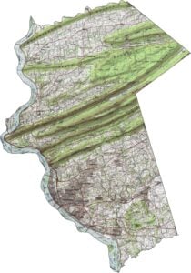
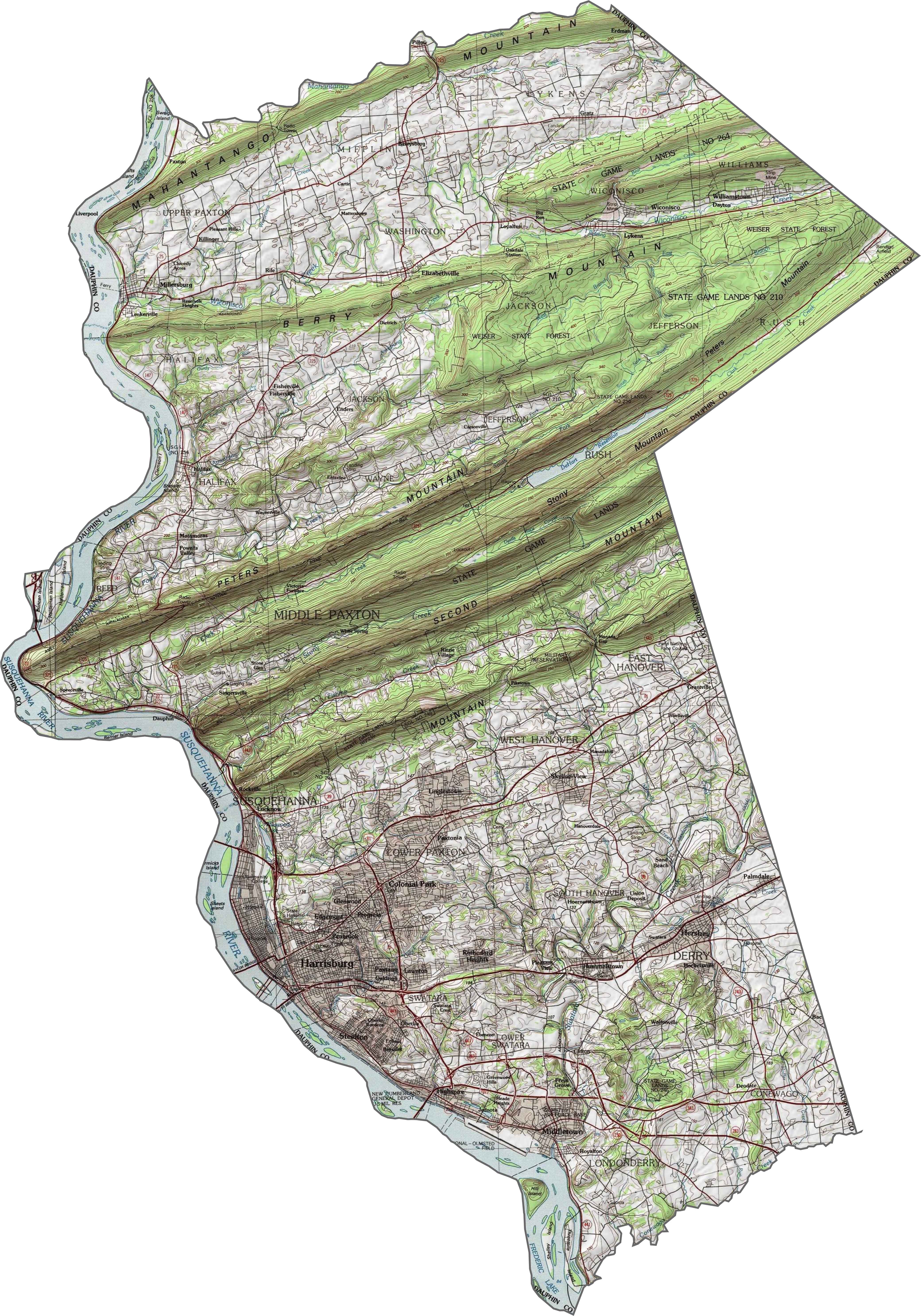
PHYSICAL MAP
Dauphin County Topographic Map
Dauphin County includes part of the Susquehanna River valley, but also climbs into rugged hills. The north and central areas are heavily ridged, with steep elevations and narrow gaps. The land flattens toward the river in the south, opening up near the city. It’s a big mix of high and low.
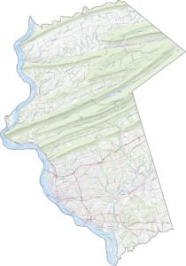
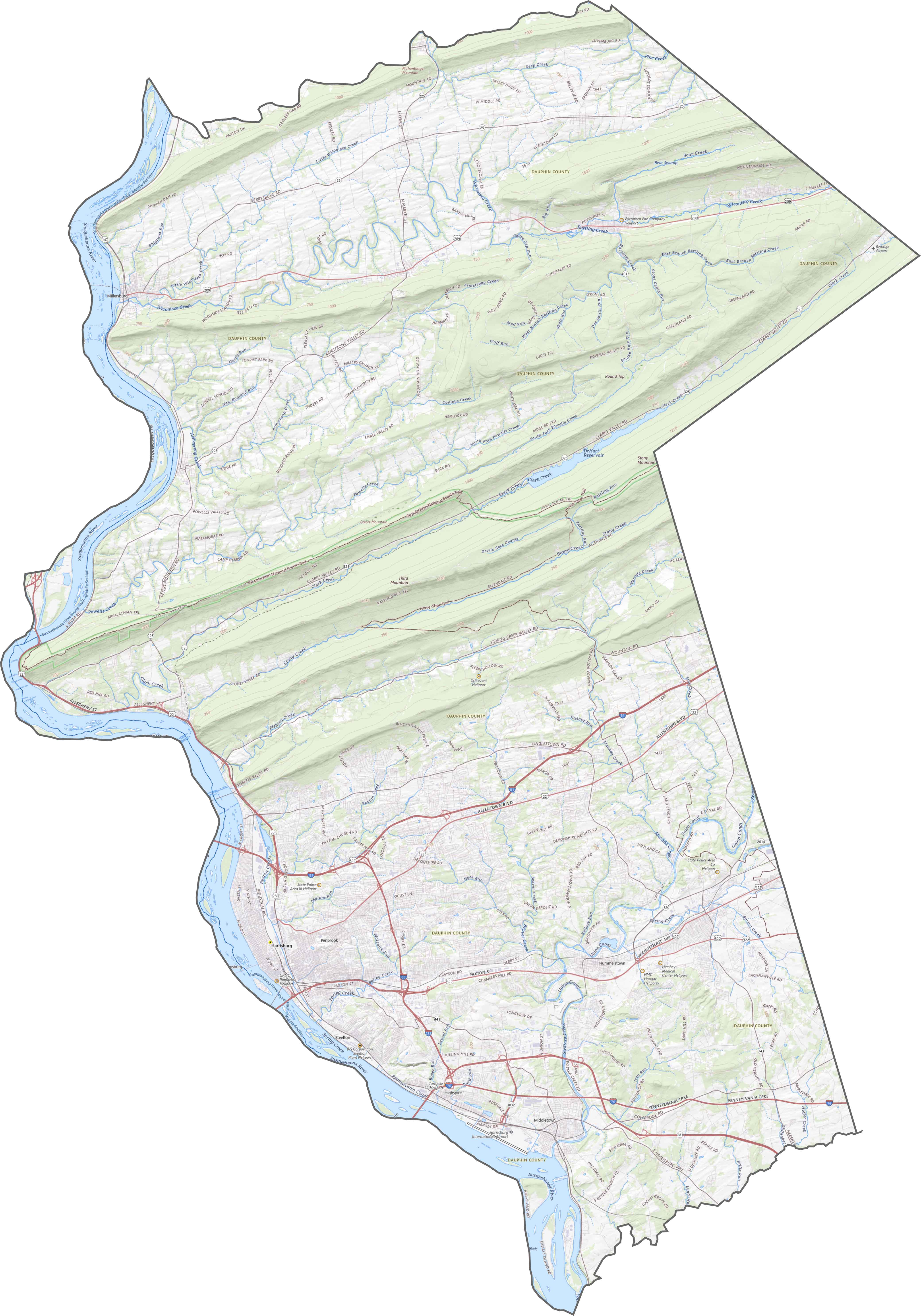
TRANSPORTATION MAP
Dauphin County Road Map
This county has a strong network of highways, especially near Harrisburg. Major roads like I-81 and I-83 are here. In rural zones, highways thin out, but still link the towns. You can zoom in on our road map to get better acquainted.
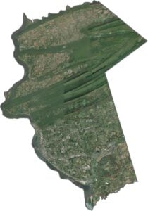
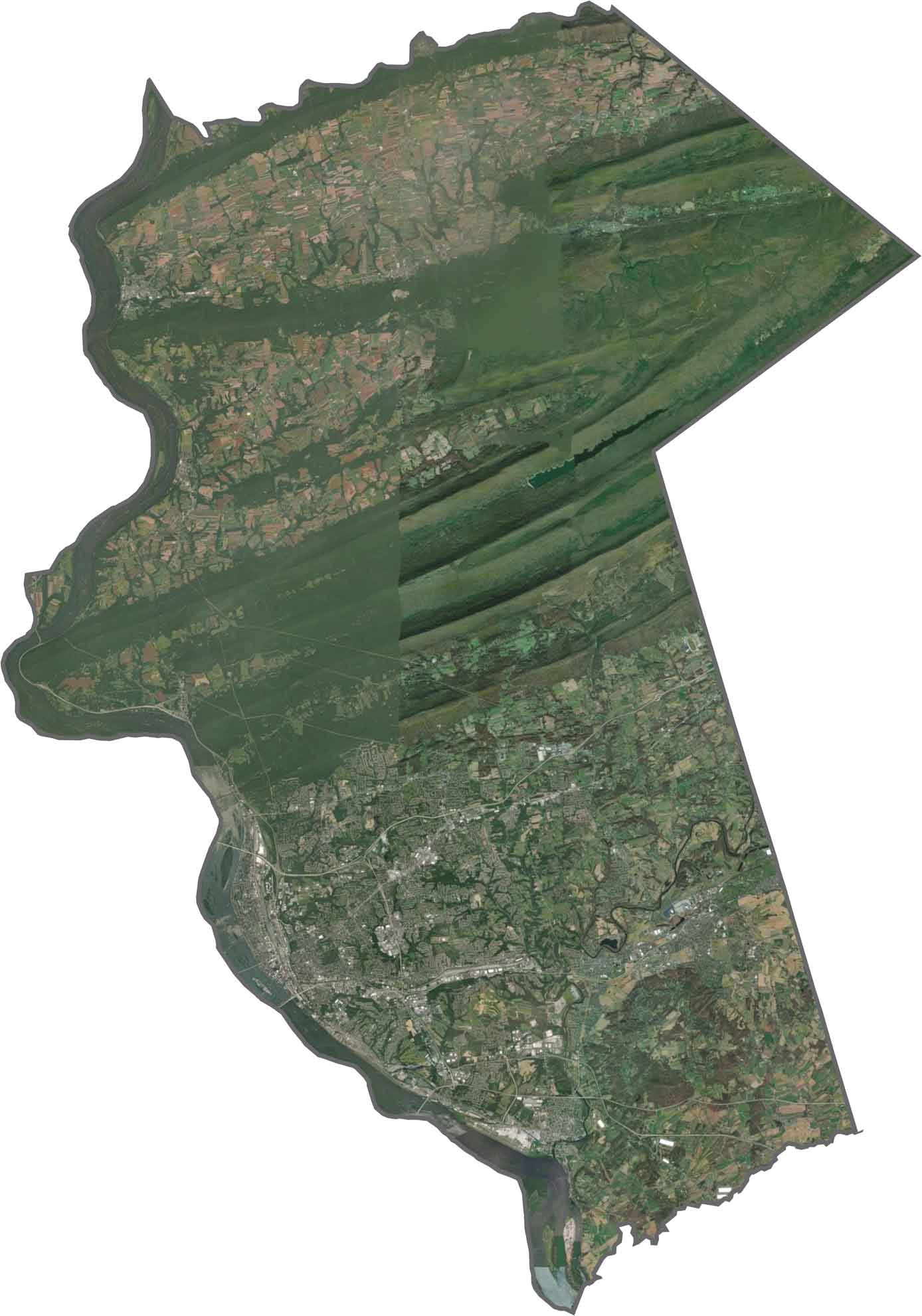
SATELLITE IMAGERY
Dauphin County Satellite Map
You’ll see contrast right away. Harrisburg and its suburbs form bright clusters along the river. Northward, ridges turn the map dark green. Rail yards, highways, and farmland all compete for space.
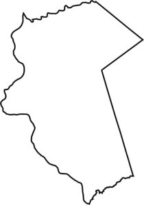
OUTLINE MAP
Dauphin County Blank Map
Dauphin’s shape is unusual. because it’s tall and narrow. The western border follows the Susquehanna River closely, while the eastern edge climbs into the mountains. It doesn’t touch another state, but its central river border stands out clearly.

Neighboring Counties
Here are the 8 neighboring counties of Dauphin County:


Pennsylvania County Map

Pennsylvania’s 67 counties contains steel city lights, Amish country backroads, and Pocono mountain escapes. Mileage may vary, but the stories won’t.