Lexington County Map, South Carolina

Lexington County Map Collection


We allow you to use our Lexington County map. Attribution is required.
Lexington County, South Carolina

Lexington County sits right in the middle of South Carolina, just west of the state capital Columbia. The county’s grown like crazy in recent years. Lots of new folks moving in, attracted by good schools and proximity to Columbia.
It’s a mix of suburban areas and rural charm. Lake Murray is a massive reservoir that takes up almost the entire northern half. Historians will dig the Lexington County Museum, which has a bunch of 19th-century buildings.
The area’s known for its peaches too. Nothing beats a fresh Lexington peach in the summer. While on the subject of peaches, don’t miss the Lexington County Peach Festival. It’s a local tradition going strong for over 60 years.
| Category | Details |
|---|---|
| County Name | Lexington County |
| County Seat | Lexington |
| Population | Approximately 325,000 |
| Cities, Towns, and Communities | Lexington, West Columbia, Cayce, Irmo, Chapin, Batesburg-Leesville |
| Interstates and Highways | Interstate 20, Interstate 26, Interstate 77, U.S. Highway 1, U.S. Highway 378 |
| FIPS Code | 45-063 |
| Total Area (Land and Water) | 758 square miles (699 sq mi land, 59 sq mi water) |
| Adjacent Counties (and Direction) | Richland County (East), Orangeburg County (Southeast), Calhoun County (Southeast), Aiken County (Southwest), Saluda County (West), Newberry County (Northwest) |
| Time Zone | Eastern Time Zone (EST) |
| State | South Carolina |
| Coordinates | 33°55’N, 81°14’W |
| Etymology | Named after the Battle of Lexington |
| Major Landmarks | Lake Murray, Riverbanks Zoo and Garden, Lexington County Museum |
| Website | Lexington County Website |
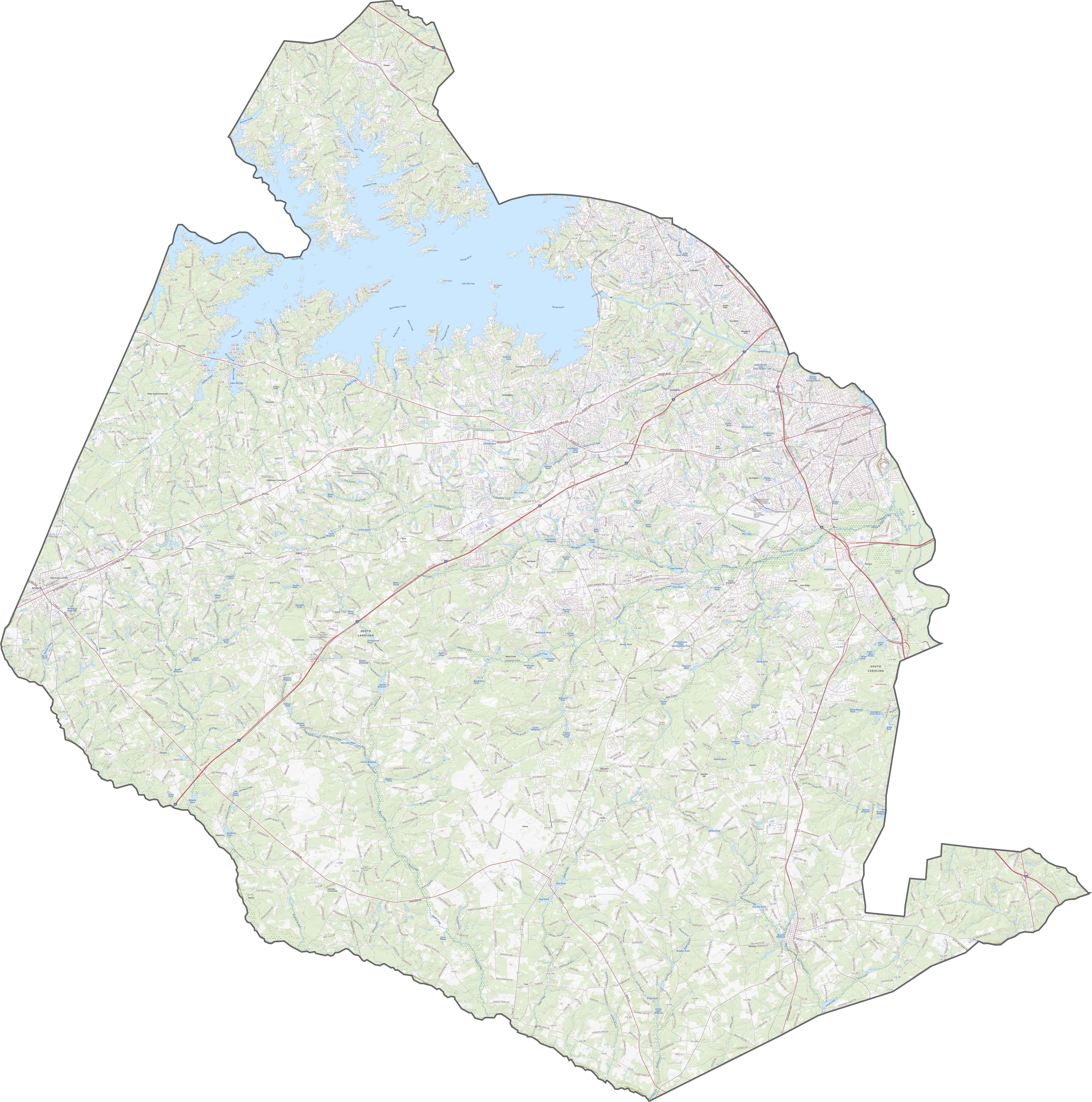
TRANSPORTATION MAP
Lexington County Road Map
The road network here in Lexington County is dense and lively. Major routes like I-20, I-26, and I-77 cut through in multiple directions, especially around the Columbia suburbs. Although some parts get congested, the highways keep traffic flowing across the region. Zoom in to get a full sense of the road network in Lexington County.
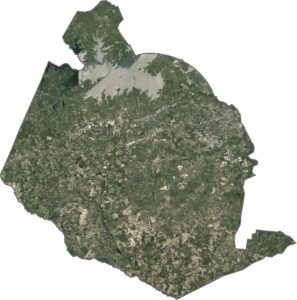
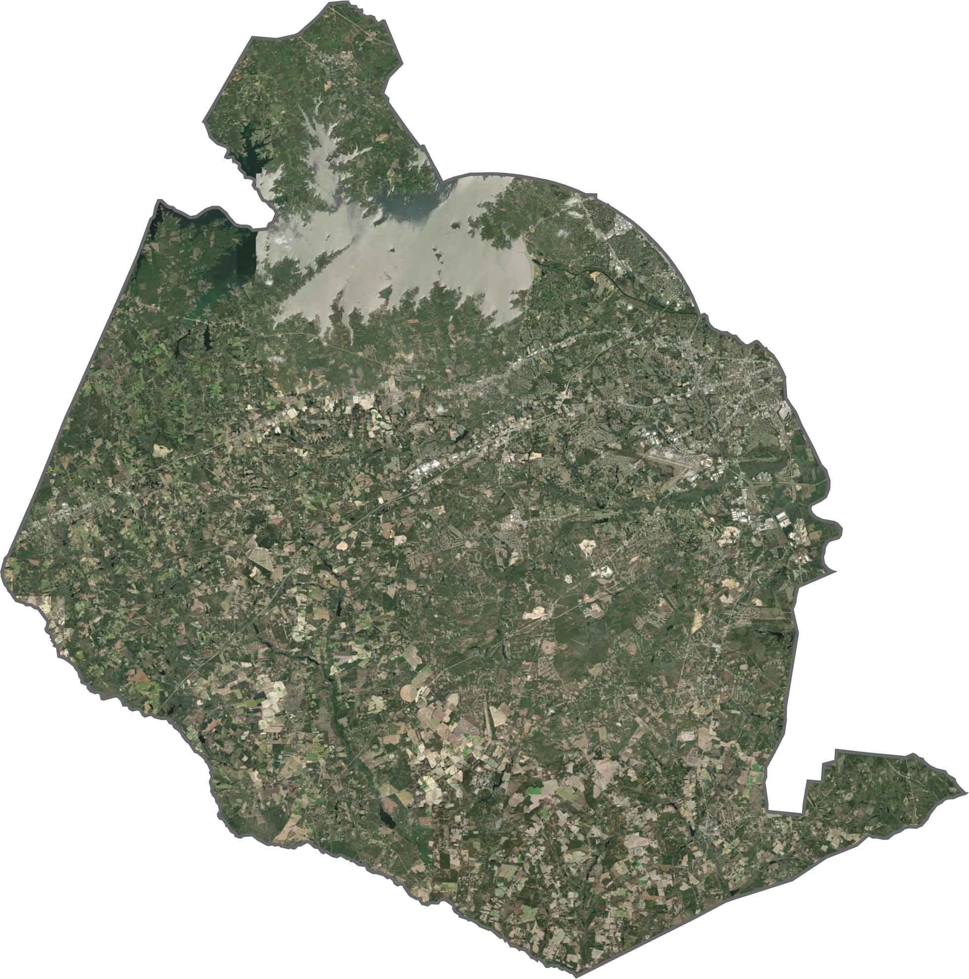
SATELLITE IMAGERY
Lexington County Satellite Map
The first thing you’re going to notice is how Lake Murray occupies such a large area in the northern region. Around it, neighborhoods pack in tight. Elsewhere, you’ll see mostly forests and farmland. But the highlight here is all the development you’ll find in the eastern region.
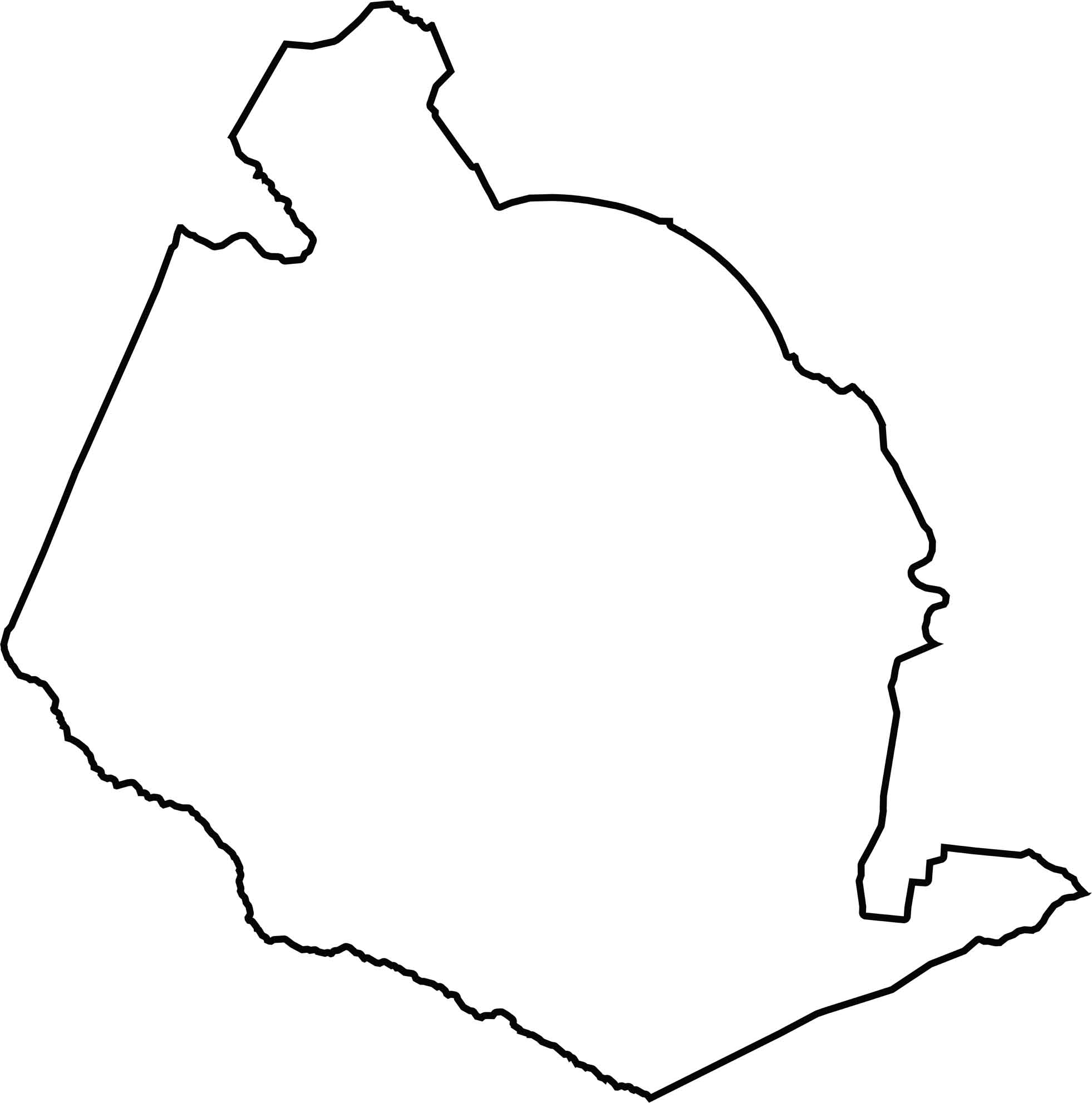
OUTLINE MAP
Lexington County Blank Map
Lexington County is a wide and oddly shaped county with a tail on the southeastern side. The eastern side wraps around Columbia. The Edisto River helps define the southern border. While it doesn’t touch another state, it borders several other populous counties.
Neighboring Counties
Here are the 6 neighboring counties of Lexington County:


South Carolina County Map

South Carolina’s 46 counties keep things interesting. Some swing to beach tunes, others hum with history. You’ll find gators, grits, and gospel… sometimes all in the same afternoon.