Mercer County Map, Pennsylvania

Mercer County Map Collection
We allow you to use our Mercer County map. Attribution is required.
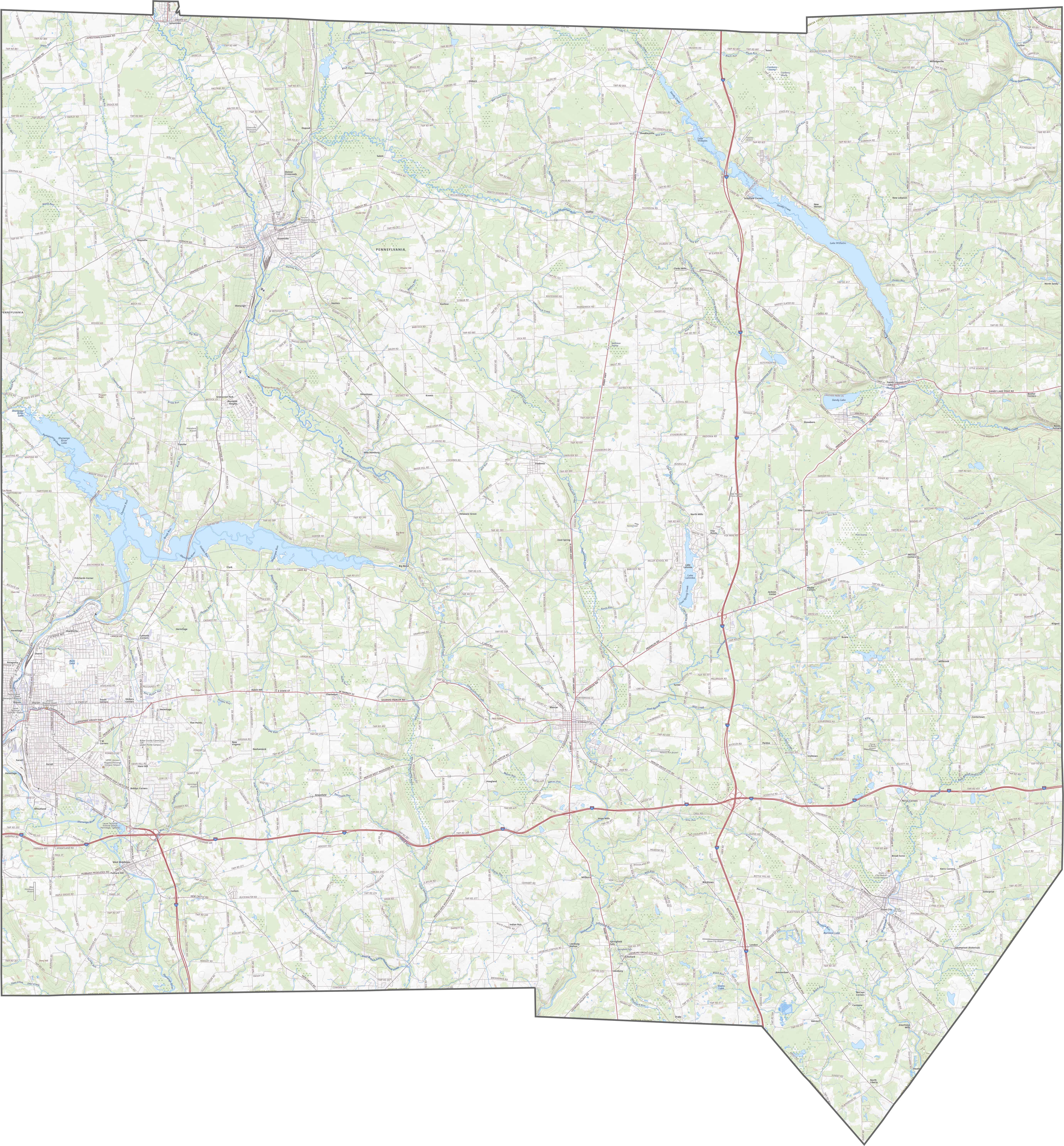
Mercer County, Pennsylvania

Mercer County is right on the Ohio border in West Pennsylvania. It has a bit of everything. Rolling hills, farmland, and some decent-sized towns.
The Shenango and Neshannock rivers run through it. They’re great for canoeing when the weather’s nice. Grove City’s outlet mall draws shoppers from all over.
But there’s more to the county than just shopping. Buhl Farm Park in Sharon is a local favorite. It has the only free golf course in the U.S.
| Category | Details |
|---|---|
| County Name | Mercer County |
| County Seat | Mercer |
| Population | Approximately 109,000 |
| Cities, Towns, and Communities | Hermitage, Sharon, Grove City, Greenville, Farrell, Mercer |
| Interstates and Highways | Interstate 79, Interstate 80, U.S. Highway 19, U.S. Highway 62 |
| FIPS Code | 42-085 |
| Total Area (Land and Water) | 683 square miles (672 sq mi land, 11 sq mi water) |
| Adjacent Counties (and Direction) | Crawford County (North), Venango County (East), Butler County (Southeast), Lawrence County (South), Mahoning County, Ohio (Southwest), Trumbull County, Ohio (West) |
| Time Zone | Eastern Time Zone (EST) |
| State | Pennsylvania |
| Coordinates | 41°17’N, 80°15’W |
| Etymology | Named after Hugh Mercer, a general in the American Revolutionary War |
| Major Landmarks | Buhl Farm Park, Shenango River Lake, Wendell August Forge, Grove City Premium Outlets |
| Website | Mercer County Website |
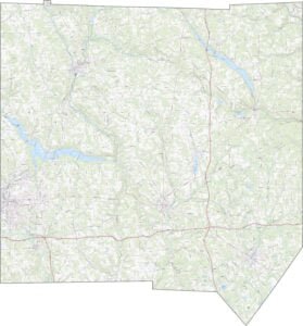
TRANSPORTATION MAP
Mercer County Road Map
Mercer’s highway system is well-balanced. This includes both I-79 and I-80 that cross each other in the northeastern region. If you want to see how it all fits together, our zoom tool can show every mile of our road map.
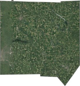
SATELLITE IMAGERY
Mercer County Satellite Map
In our satellite map of Mercer County, you’ll spot farmland first as neat rectangles. Small towns show up as gray centers between the fields. Forests aren’t dominant, but patches of green are scattered throughout. Lakes and ponds cover the map too.

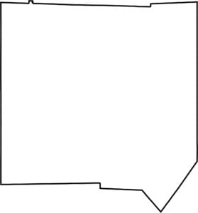
OUTLINE MAP
Mercer County Blank Map
Mercer has a tidy rectangular shape with some irregularities on the southeastern side. It borders Ohio on the west. No major rivers form the boundary, but several creeks flow through it. The outline is clean but not quite geometric.

Neighboring Counties
Here are the 6 neighboring counties of Mercer County:


Pennsylvania County Map

Pennsylvania’s 67 counties contains steel city lights, Amish country backroads, and Pocono mountain escapes. Mileage may vary, but the stories won’t.