Portage County Map, Ohio

Portage County Map Collection


We allow you to use our Portage County map. Attribution is required.
Portage County, Ohio

Northeast Ohio is home to Portage County. Kent State University is here, which is a big part of the local culture and economy. Ravenna is the county seat with lots of surrounding lakes.
The county’s name comes from an old Native American path between the Cuyahoga and Tuscarawas rivers. You’ll find a mix of rural and suburban areas.
Portage County has seen steady growth over the years. Many residents commute to Akron or Cleveland for work. The Cuyahoga River winds through the county. It’s popular for canoeing and kayaking.
| Category | Details |
|---|---|
| County Name | Portage County |
| County Seat | Ravenna |
| Population | Approximately 160,000 |
| Cities, Towns, and Communities | Ravenna, Kent, Streetsboro, Aurora |
| Interstates and Highways | Interstate 76, U.S. Highway 224, State Route 14 |
| FIPS Code | 39-133 |
| Total Area | 504 square miles (land and water) |
| Adjacent Counties | Geauga County (North), Trumbull County (East), Mahoning County (Southeast), Stark County (South), Summit County (West), Cuyahoga County (Northwest) |
| Time Zone | Eastern Time Zone |
| State | Ohio |
| Coordinates | 41.1633° N, 81.2423° W |
| Etymology | Named after the Portage Trail, a historic route used by Native Americans |
| Major Landmarks | Kent State University, Blossom Music Center |
| Website | Portage County Website |
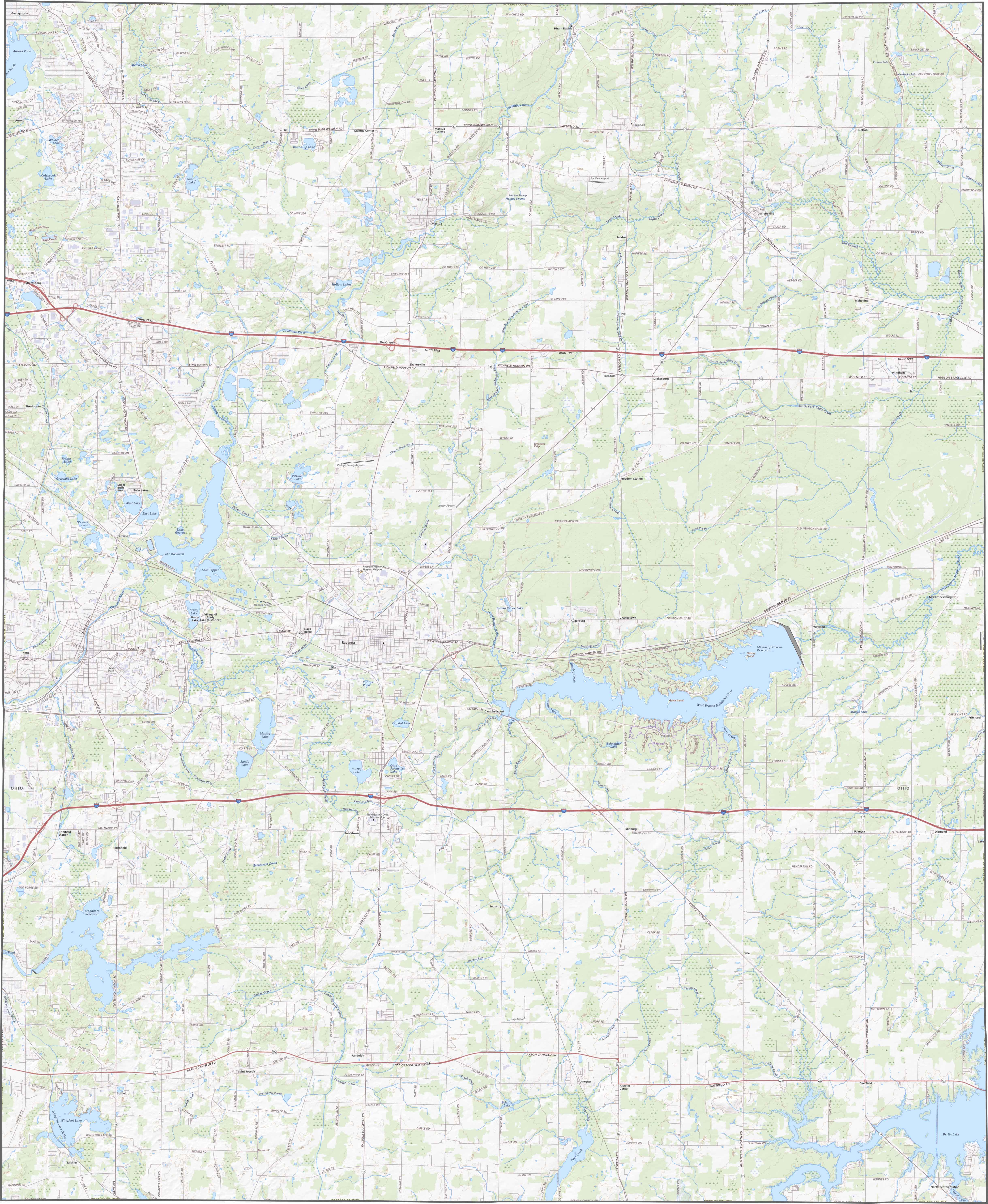
TRANSPORTATION MAP
Portage County Road Map
Portage County stays connected with I-76 which runs across the south and I-90, which runs in the south. While rural routes wind through farmland, main roads get you across quickly. Zoom in on our map below to see how they all connect.
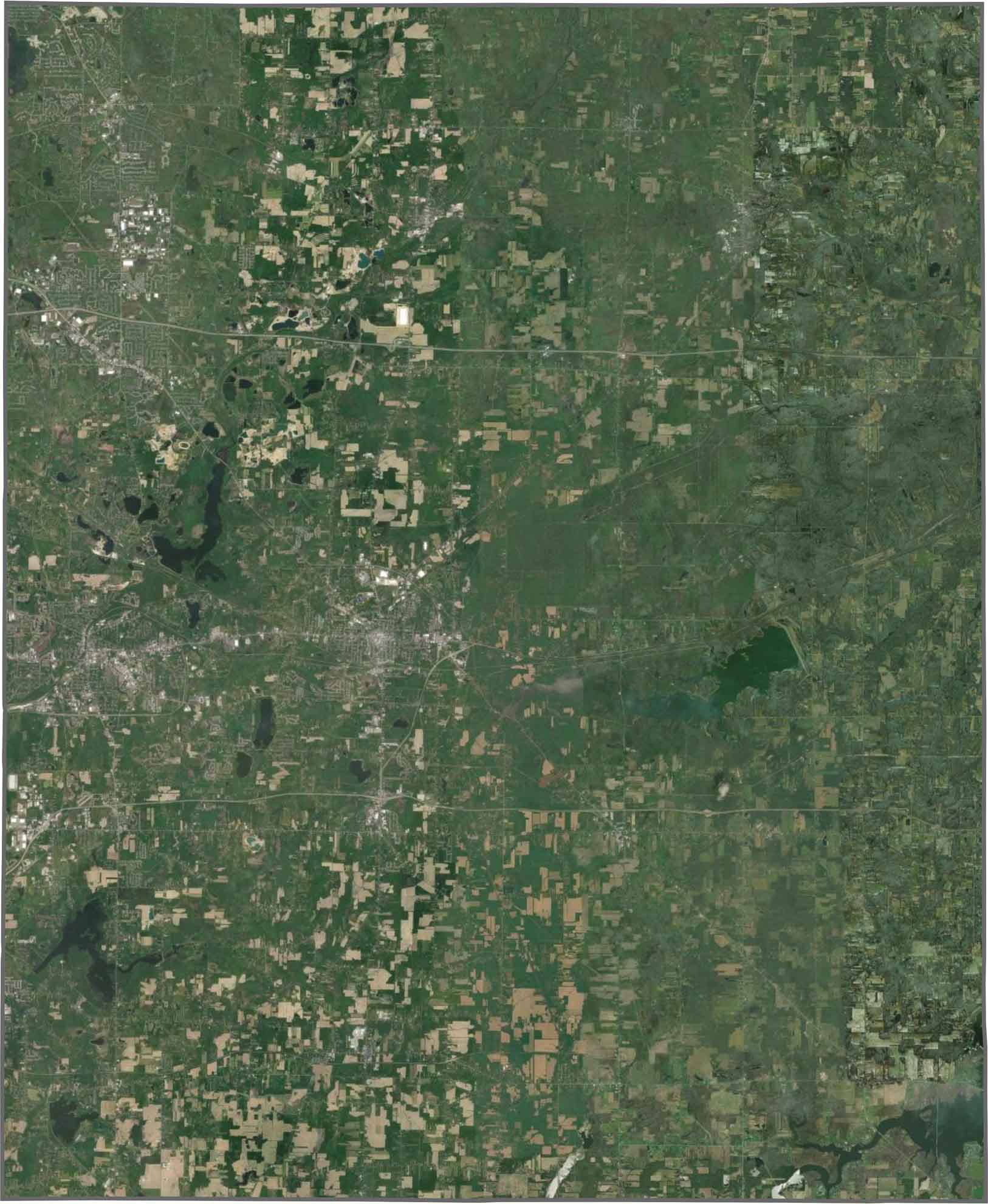
SATELLITE IMAGERY
Portage County Satellite Map
You’ll spot a balanced blend of land uses from the sky. Kent pops out as the urban core, but forest, field, and water all share space. Pippen Lake and West Branch Reservoir give the image a watery look. Though scattered development exists, it’s never overwhelming.
OUTLINE MAP
Portage County Blank Map
Portage County is a perfect square, longer in the top-down direction. Although it stays fully within Ohio, the boundaries cut clean and sharp. It’s a county of right-angles, not curves.

Neighboring Counties
Here are the 6 neighboring counties of Portage County:


Ohio County Map

Forget the coast. Ohio’s 88 counties are where real America hums. No pretense, no postcard perfection, just hard-working towns and quiet backroads that get under your skin. This is the Midwest without the filter.