Sandoval County Map, New Mexico

Sandoval County Map Collection

We allow you to use our Sandoval County map. Attribution is required.
Sandoval County, New Mexico

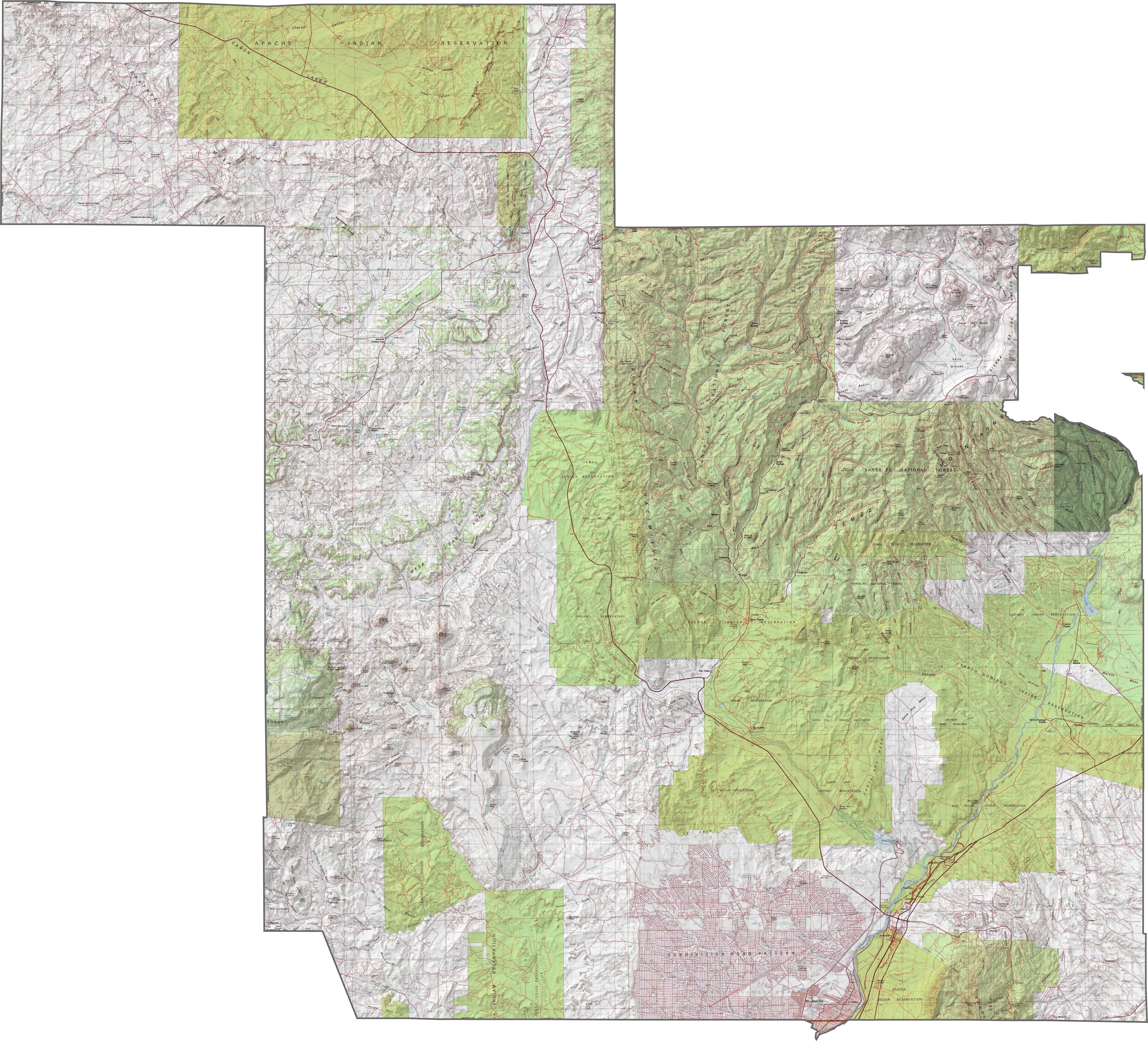
Sandoval County stretches from Albuquerque’s northern suburbs all the way to Cuba. It’s an example of urban sprawl with wide-open spaces. The Rio Grande cuts through the middle.
Jemez Springs is tucked in the mountains. People come from all over to soak in the hot springs. Coronado Historic Site is here and is where the conquistador camped in 1540. Talk about history.
The county has strong ties to Native American culture. Several pueblos call it home. Los Alamos National Lab is just next door. Outdoor recreation is common here. From hiking in the Jemez Mountains to boating on Cochiti Lake. The people are a diverse bunch.
| Category | Details |
|---|---|
| County Name | Sandoval County |
| County Seat | Bernalillo |
| Population | Approximately 160,000 |
| Cities, Towns, and Communities | Rio Rancho, Bernalillo, Corrales, Cuba, Jemez Pueblo, Placitas |
| Interstates and Highways | Interstate 25, U.S. Route 550, New Mexico State Road 4 |
| FIPS Code | 35-043 |
| Total Area (Land and Water) | 3,716 square miles (3,711 sq mi land, 5 sq mi water) |
| Adjacent Counties (and Direction) | Rio Arriba County (North), Los Alamos County (Northeast), Santa Fe County (East), Bernalillo County (South), Cibola County (Southwest), McKinley County (West), San Juan County (Northwest) |
| Time Zone | Mountain Time Zone (MT) |
| State | New Mexico |
| Coordinates | 35.6196° N, 106.7235° W |
| Etymology | Named after the Sandoval family, prominent seventeenth-century Spanish landowners |
| Major Landmarks | Kasha-Katuwe Tent Rocks National Monument, Jemez Springs, Valles Caldera National Preserve (nearby) |
| Website | Sandoval County Website |
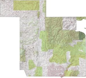
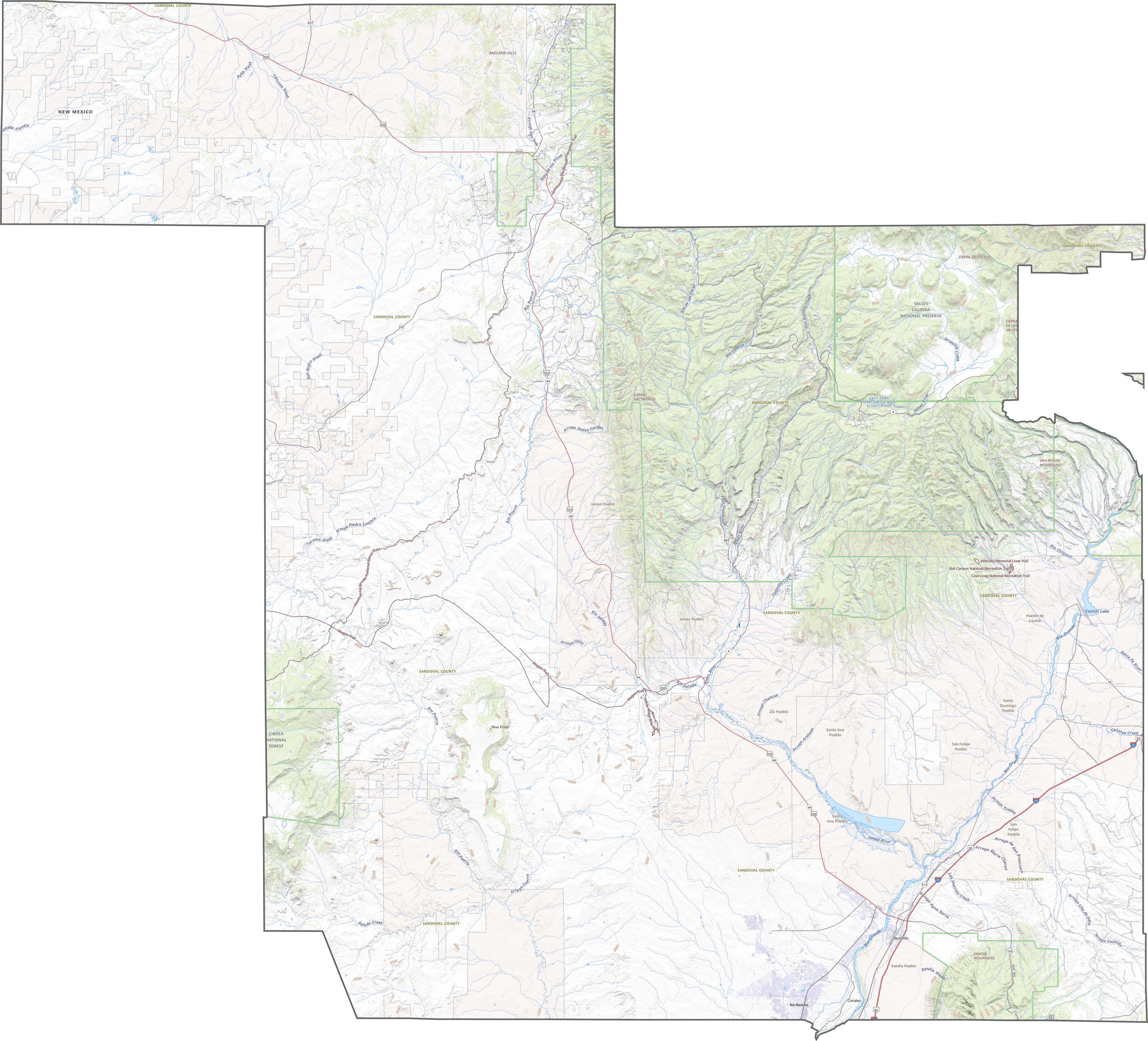
PHYSICAL MAP
Sandoval County Topographic Map
Sandoval County feels like someone took all of New Mexico’s terrain types and smashed them into one spot. Volcano cones rise in the west. The Jemez Mountains tower in the north. Canyons split the landscape. Though there’s flat land near Rio Rancho, it doesn’t stay flat for long. Plateaus, valleys, and cliffs come one after another.
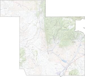
TRANSPORTATION MAP
Sandoval County Road Map
Highways in Sandoval are few and far between. U.S. 550 cuts diagonally, fast and direct… until it hits the mountains. Then the road slows and curves. I-25 grazes the southeast edge. Though the terrain makes things tricky, roads like NM 4 and 528 take you through pueblos, canyons, and mesas.
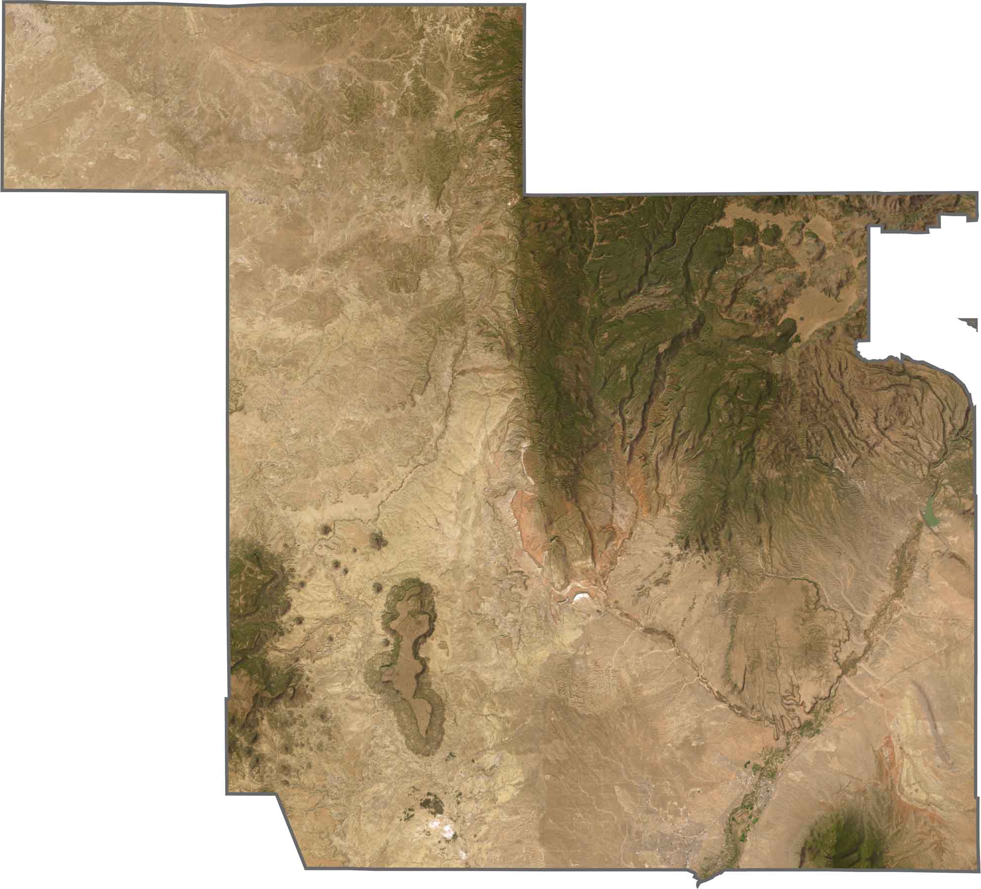
SATELLITE IMAGERY
Sandoval County Satellite Map
This one is a geologists dream. You’ll see volcanic fields. Then, suddenly, it’s green where the Jemez Mountains take over. The Rio Grande cuts through. Though development stretches from Albuquerque into Rio Rancho, it stops abruptly where the mesas begin.
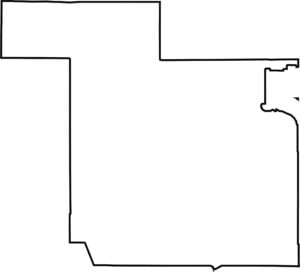
OUTLINE MAP
Sandoval County Blank Map
Forget symmetry. Sandoval looks like a jigsaw puzzle piece. It climbs northwest, and is relatively square in the south. It doesn’t touch another state and is completely contained in New Mexico.

Neighboring Counties
Here are the 7 neighboring counties of Sandoval County:


New Mexico County Map

New Mexico’s 33 counties stretch from high desert to snow-capped peaks. Each one has its own mix of cultures, landscapes, and legends. One minute you’re hiking among ancient ruins in McKinley County, the next you’re stargazing in the wide-open stillness of Hidalgo.