Santa Fe County Map, New Mexico

Santa Fe County Map Collection


We allow you to use our Santa Fe County map. Attribution is required.
Santa Fe County, New Mexico

Santa Fe County is right in the heart of northern New Mexico. It’s home to the oldest capital city in the United States. Santa Fe is an art lover’s paradise. Galleries line Canyon Road. The Georgia O’Keeffe Museum is a big draw.
But there’s more to the county than just the city. The Sangre de Cristo Mountains loom to the east. They’re a playground for hikers and skiers. Cerrillos Hills State Park is perfect for hiking and horseback riding.
Turquoise Trail National Scenic Byway winds through the southern part of the county. It’s a journey through old mining towns. The county has a rich mix of cultures. You can see it in the architecture, taste it in the food.
| Category | Details |
|---|---|
| County Name | Santa Fe County |
| County Seat | Santa Fe |
| Population | Approximately 160,000 |
| Cities, Towns, and Communities | Santa Fe, Eldorado at Santa Fe, Edgewood, Tesuque, Pojoaque |
| Interstates and Highways | Interstate 25, U.S. Route 84, U.S. Route 285 |
| FIPS Code | 35-049 |
| Total Area (Land and Water) | 1,911 square miles (1,909 sq mi land, 2 sq mi water) |
| Adjacent Counties (and Direction) | Rio Arriba County (North), Mora County (Northeast), San Miguel County (East), Torrance County (South), Bernalillo County (Southwest), Sandoval County (West), Los Alamos County (Northwest) |
| Time Zone | Mountain Time Zone (MT) |
| State | New Mexico |
| Coordinates | 35.6866° N, 105.9378° W |
| Etymology | Named after the capital city, Santa Fe, which means “Holy Faith” in Spanish |
| Major Landmarks | Santa Fe Plaza, Loretto Chapel, Meow Wolf, Georgia O’Keeffe Museum, Santa Fe Opera |
| Website | Santa Fe County Website |
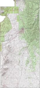
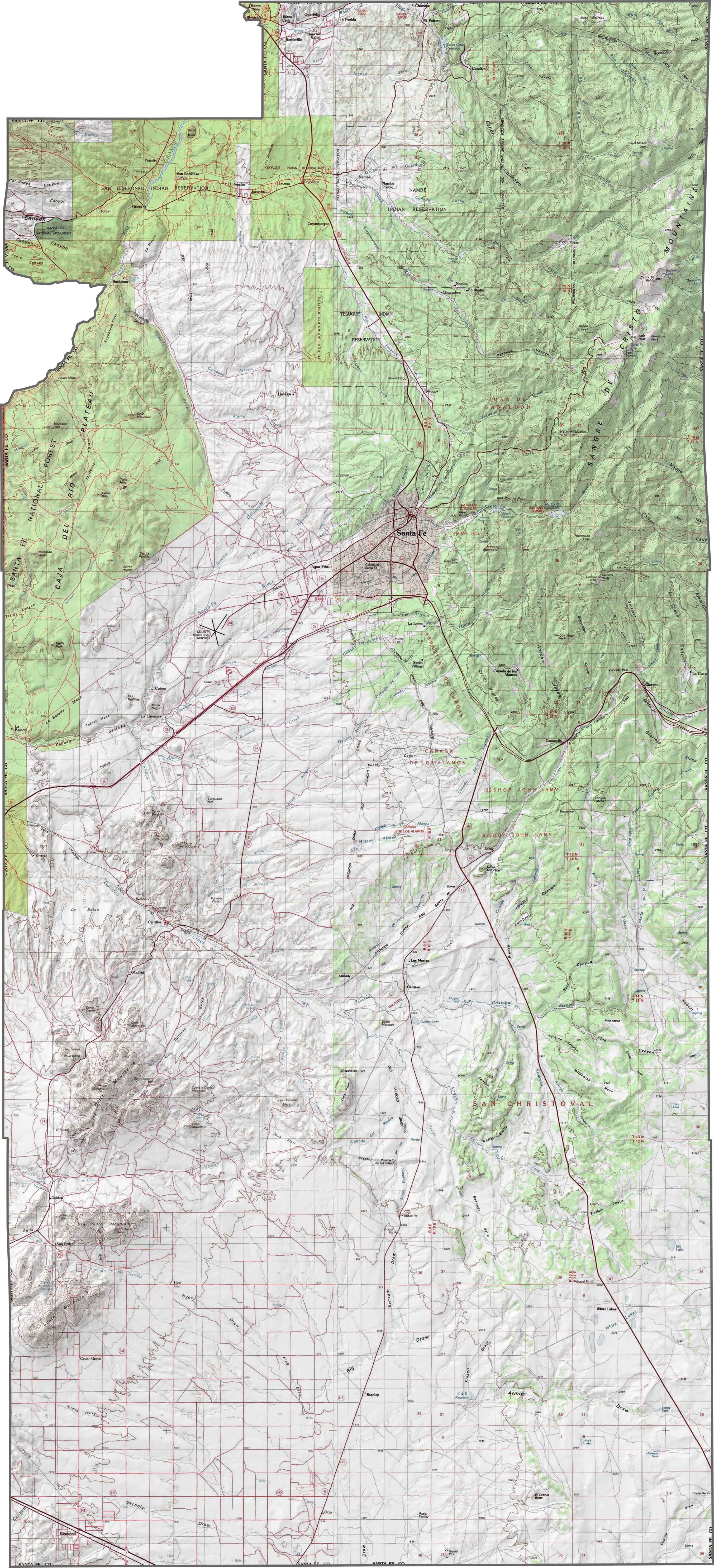
PHYSICAL MAP
Santa Fe County Topographic Map
Santa Fe County lives on the edge. Literally. The southern Rockies crash into the high desert here, and it shows. The Sangre de Cristo Mountains dominate the northeast. Meanwhile, the southwest side sinks into open plains. You can go from pine trees to cactus in less than an hour. It’s high desert with altitude issues.
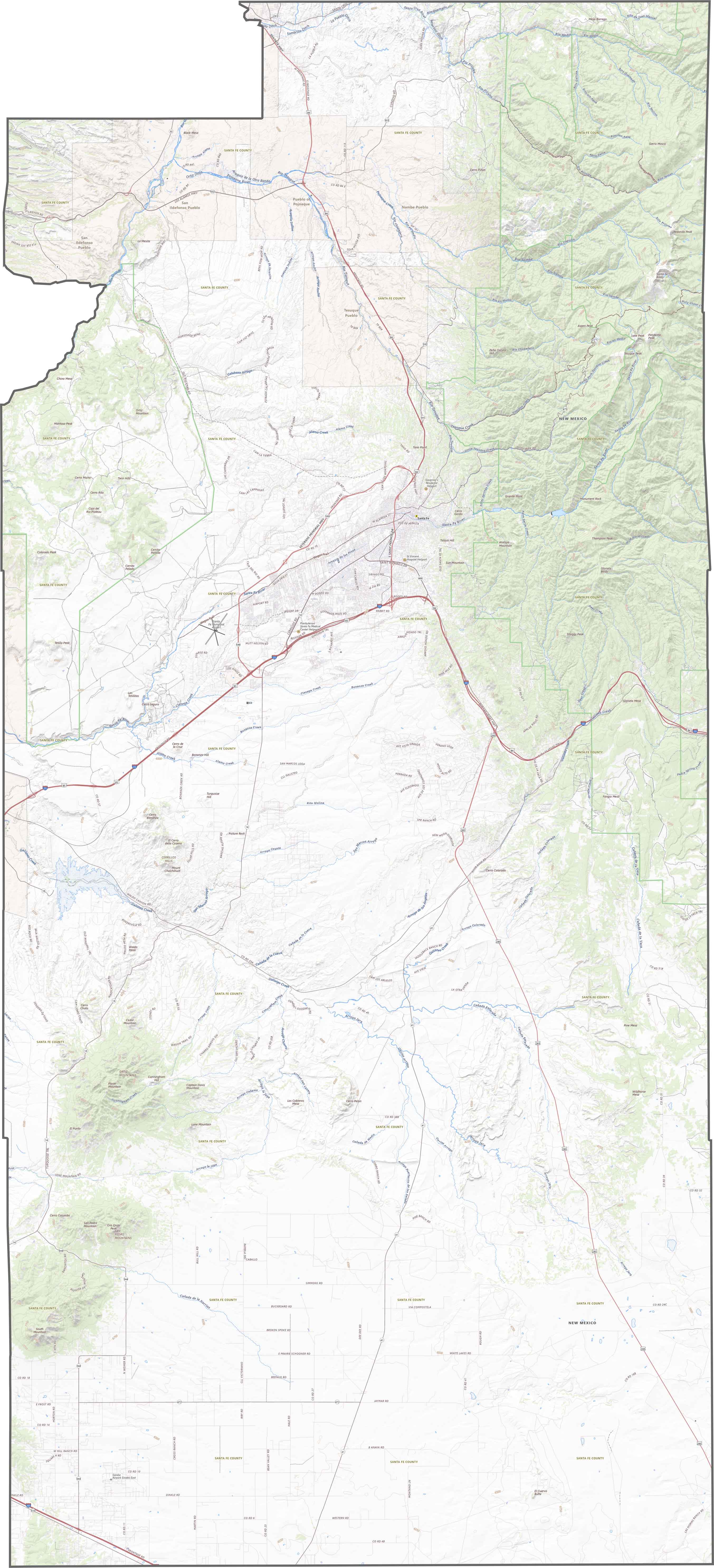
TRANSPORTATION MAP
Santa Fe County Road Map
Our Santa Fe County road map shows its main highways like I-25, U.S. Route 84, and U.S. Route 285. Roads here don’t believe in straight lines. They twist, dip, and randomly become scenic routes without warning. Our zoom tool will help you make sense of the transportation system of the state capital and beyond.
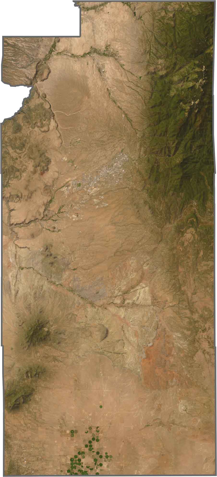
SATELLITE IMAGERY
Santa Fe County Satellite Map
At first glance, the city of Santa Fe seems swallowed by hills. Look east, and the mountains block everything with deep greens and blue shadows. Westward, it all flattens fast, turning tan, then almost white. Right in the very south, you can see irrigation circles that really stand out.
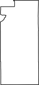
OUTLINE MAP
Santa Fe County Blank Map
Santa Fe County isn’t symmetrical but it’s close to a near perfect rectangle. It’s especially long from top-down. It doesn’t touch another state. No major river outlines it, except for a small part of the Rio Grande in the northwest corner.

Neighboring Counties
Here are the 7 neighboring counties of Santa Fe County:


New Mexico County Map

New Mexico’s 33 counties stretch from high desert to snow-capped peaks. Each one has its own mix of cultures, landscapes, and legends. One minute you’re hiking among ancient ruins in McKinley County, the next you’re stargazing in the wide-open stillness of Hidalgo.