Sevier County Map, Tennessee

Sevier County Map Collection


We allow you to use our Sevier County map. Attribution is required.
Sevier County, Tennessee

Sevier County is a tourist’s dream in eastern Tennessee. It’s home to a big chunk of the Great Smoky Mountains National Park. The county has some beautiful scenery.
Sevierville, the county seat, is Dolly Parton’s hometown. You can’t miss her statue on the courthouse lawn. Gatlinburg and Pigeon Forge are the main draws. These towns are packed with attractions, from Dollywood to mountain coasters. But there’s more to Sevier than just tourist spots.
Fall here is something special, with the mountains ablaze in color. Despite all the visitors, Sevier’s still got plenty of quiet spots. There are great hiking trails and scenic drives. The people are friendly, with that classic East Tennessee hospitality.
| Category | Details |
|---|---|
| County Name | Sevier County |
| County Seat | Sevierville |
| Population | Approximately 105,000 |
| Cities, Towns, and Communities | Sevierville, Gatlinburg, Pigeon Forge, Pittman Center, Seymour |
| Interstates and Highways | Interstate 40, U.S. Highway 321, U.S. Highway 411, U.S. Highway 441, State Highway 66 |
| FIPS Code | 47-155 |
| Total Area (Land and Water) | 598 square miles (593 sq mi land, 5 sq mi water) |
| Adjacent Counties (and Direction) | Jefferson County (North), Cocke County (East), Haywood County, North Carolina (Southeast), Swain County, North Carolina (South), Blount County (West), Knox County (Northwest) |
| Time Zone | Eastern Time Zone (EST) |
| State | Tennessee |
| Coordinates | 35°47’N, 83°30’W |
| Etymology | Named after John Sevier, the first Governor of Tennessee |
| Major Landmarks | Great Smoky Mountains National Park, Dollywood, Ober Gatlinburg |
| Website | Sevier County Website |
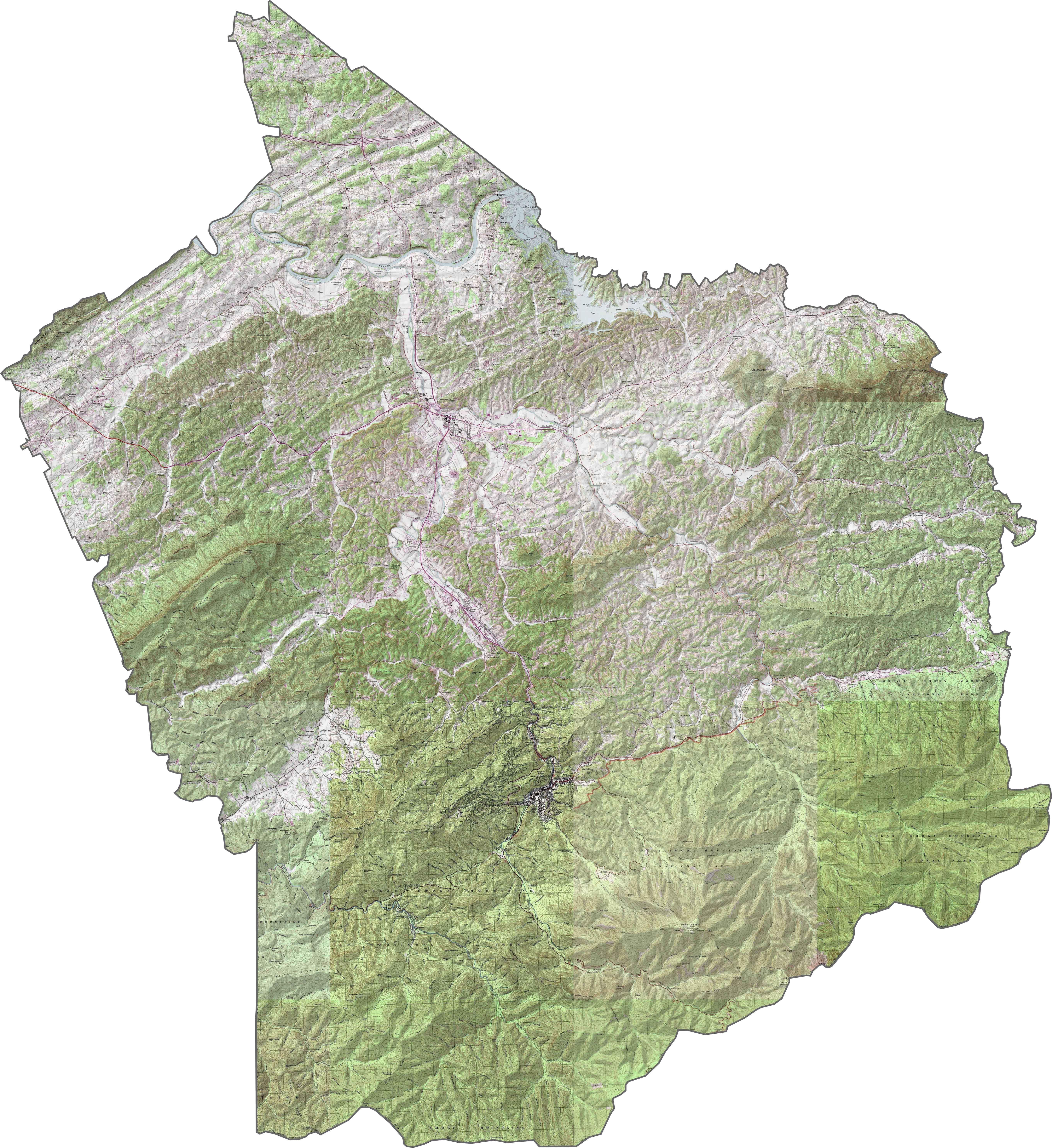
PHYSICAL MAP
Sevier County Topographic Map
Sevier County is where the mountains begin. The Great Smoky Mountains loom across the southern half, forested and steep. Elevation changes fast as flat lowlands become ridges. Mount Le Conte stands out as a defining landmark here in Sevier County.
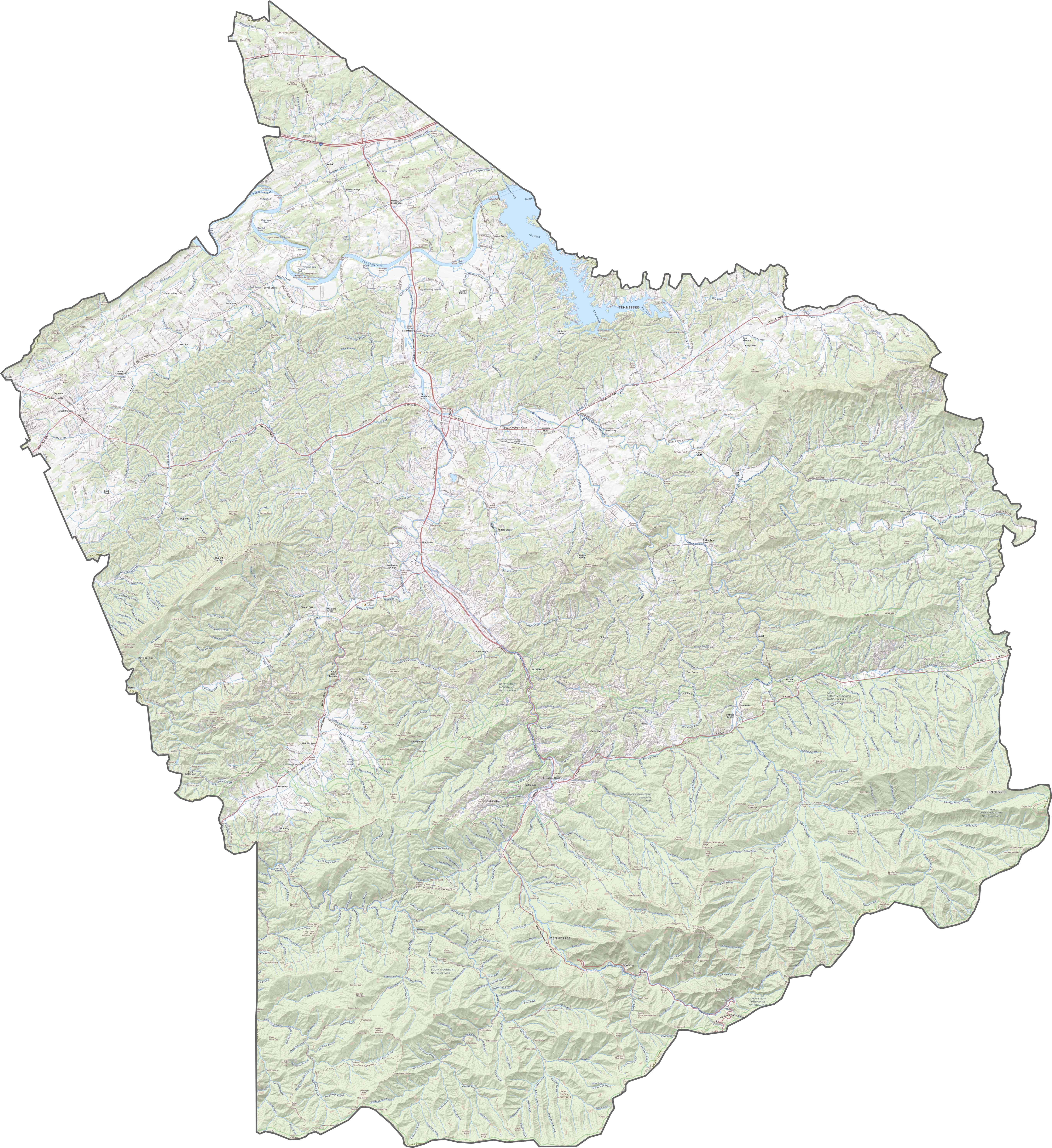
TRANSPORTATION MAP
Sevier County Road Map
Tourism drives the roads here. Routes like U.S. Highway 441 surge toward the Smokies, packed with visitors during peak seasons. I-40 skirts the northwest corner, giving quick access from Knoxville. But once you’re off the interstate, expect curves and crowds. Zoom in on our map and take a closer look.
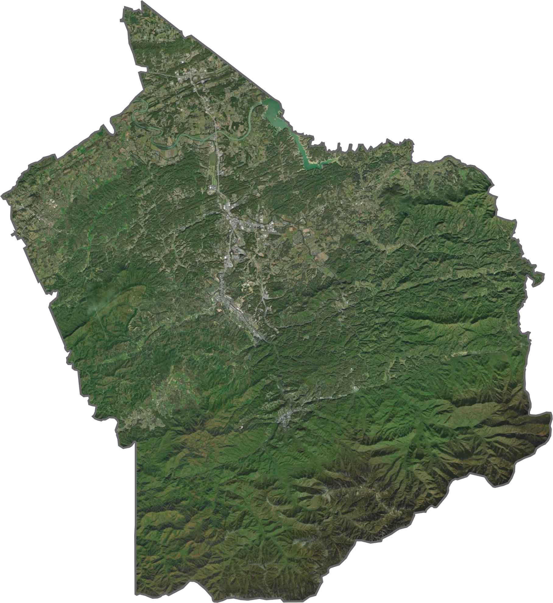
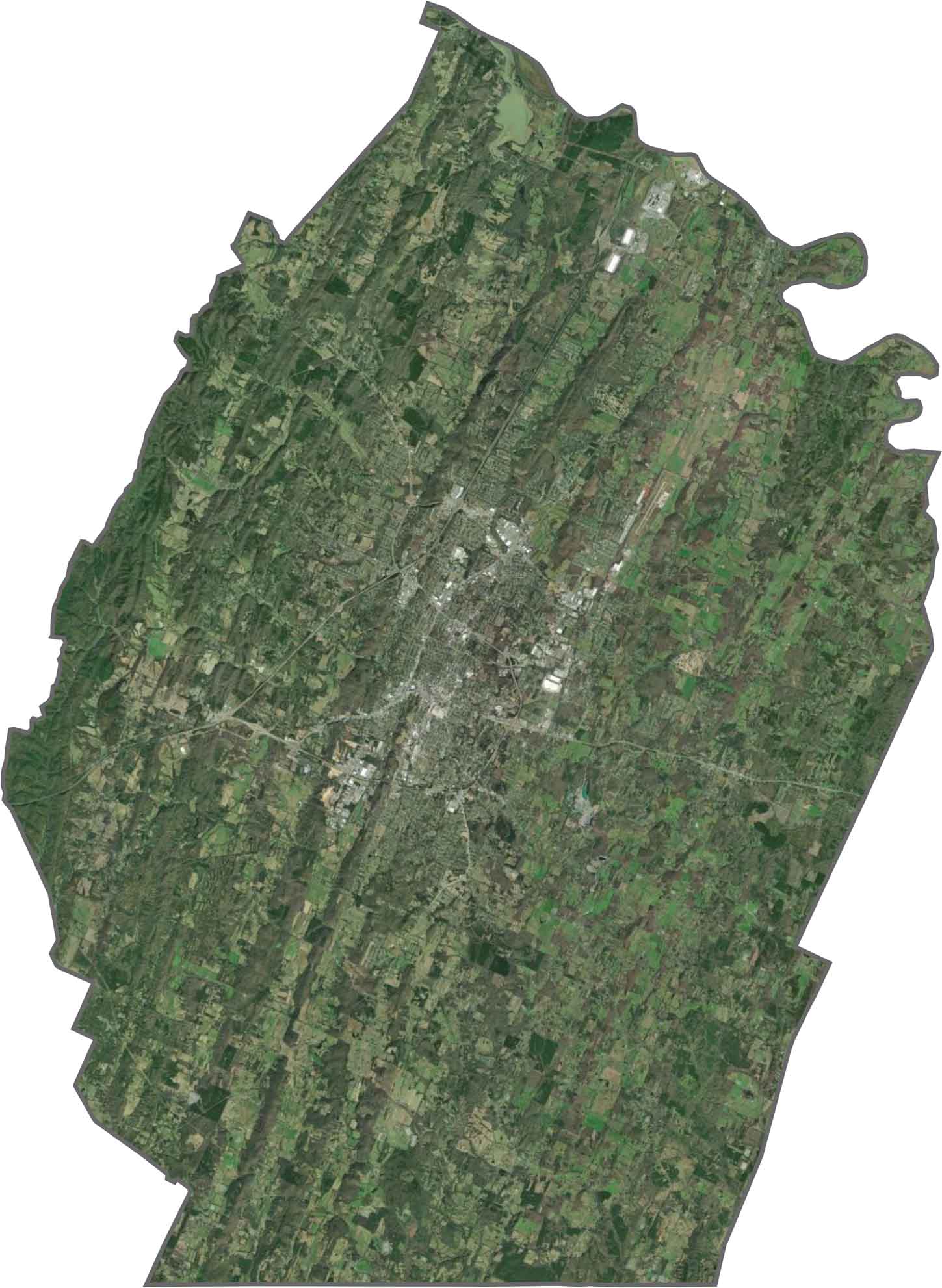
SATELLITE IMAGERY
Sevier County Satellite Map
Dark green dominates the bottom half of the image within Great Smoky Mountains National Park. But north of the park? A very different scene. Pavement and neighborhoods from Sevierville appear in grey.
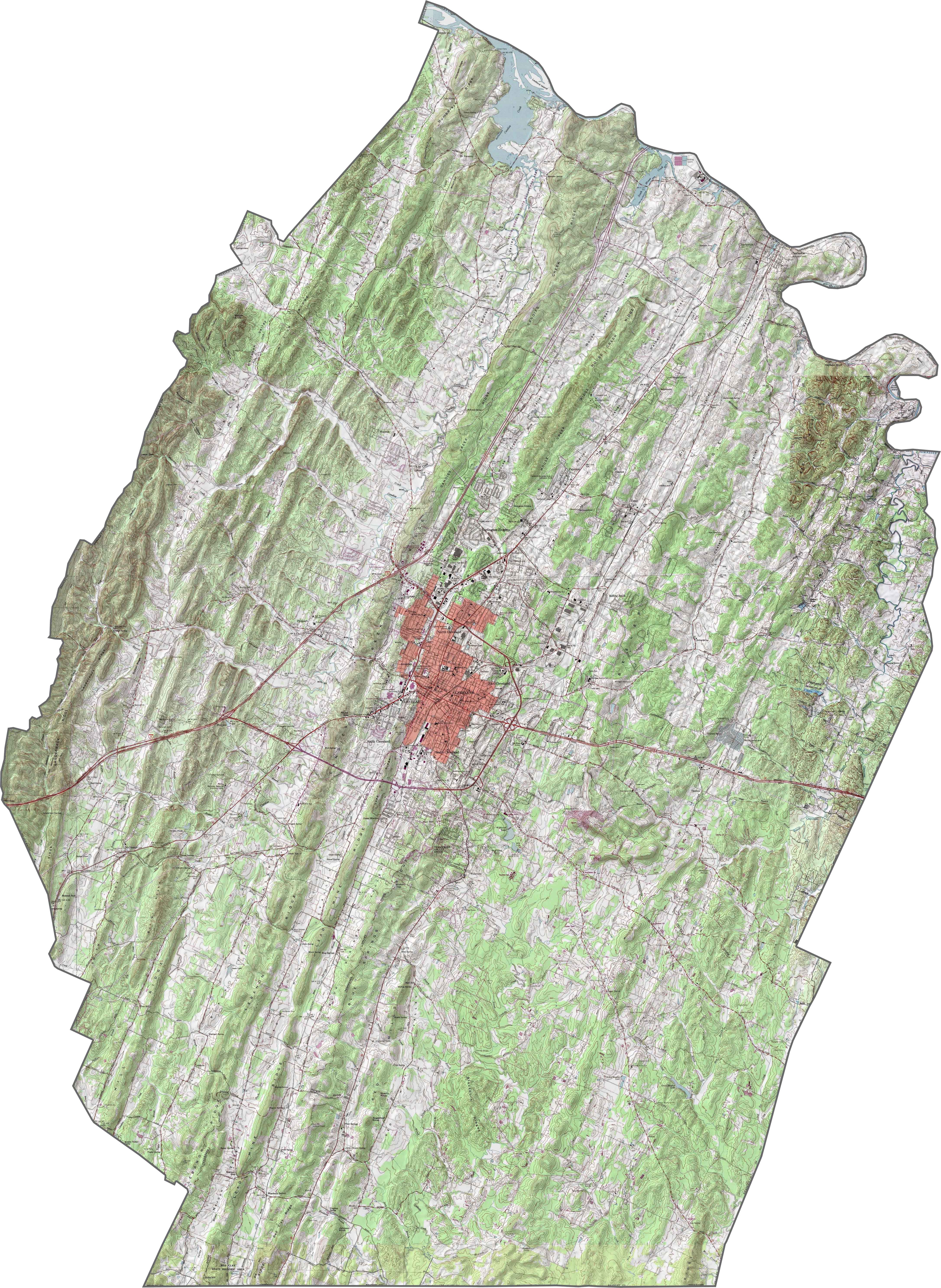
OUTLINE MAP
Sevier County Blank Map
Sevier County’s shape looks stretched and tilted, like it’s reaching southeast toward the mountains. The southern border hugs the national park boundary. It borders North Carolina to the southeast.

Neighboring Counties
Here are the 6 neighboring counties of Sevier County:


Tennessee County Map

There’s no such thing as a boring county in Tennessee. Some stretch through the Smokies, others roll out into Delta flatlands. Every county’s shaped by the land and it shows.