Sheboygan County Map, Wisconsin

Sheboygan County Map Collection

We allow you to use our Sheboygan County map. Attribution is required.
Sheboygan County, Wisconsin

Sheboygan County sits on the western shore of Lake Michigan. It’s known as the “Malibu of the Midwest” thanks to its excellent freshwater surfing. Yeah, you heard that right with surfing in Wisconsin.
The Sheboygan River winds through the county. Kohler-Andrae State Park is a local treasure, with sandy beaches and rolling dunes. You can’t talk about Sheboygan without mentioning bratwurst. Yes, they take their sausages seriously here.
The county is also home to world-class golf courses, including Whistling Straits. Art lovers flock to the John Michael Kohler Arts Center for its quirky exhibits. Plymouth, a small city in the county, calls itself the “Cheese Capital of the World”.
| Category | Details |
|---|---|
| County Name | Sheboygan County |
| County Seat | Sheboygan |
| Population | Approximately 117,000 |
| Cities, Towns, and Communities | Sheboygan, Plymouth, Sheboygan Falls, Kohler, Cedar Grove |
| Interstates and Highways | I-43, WI-23, WI-28, WI-32 |
| FIPS Code | 55-117 |
| Total Area (Land and Water) | 1,271 sq mi (Land: 511 sq mi; Water: 760 sq mi) |
| Adjacent Counties (and Direction) | Manitowoc County (North), Ozaukee County (South), Washington County (Southwest), Fond du Lac County (West), Calumet County (Northwest) |
| Time Zone | Central Time Zone (CT) |
| State | Wisconsin |
| Coordinates | 43.7508° N, 87.7145° W |
| Etymology | Named after Shawb-wa-way-kun, an Indian word meaning “great noise underground” |
| Major Landmarks | Kohler-Andrae State Park, John Michael Kohler Arts Center, Blue Harbor Resort |
| Website | Sheboygan County Website |
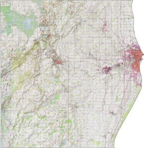
PHYSICAL MAP
Sheboygan County Topographic Map
Sheboygan County features a mix of lakefront flats and inland ridges. The Kettle Moraine in the west adds some hills and glacial landforms. Meanwhile, the Sheboygan River flows gently through the central part of the county toward Lake Michigan.
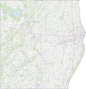
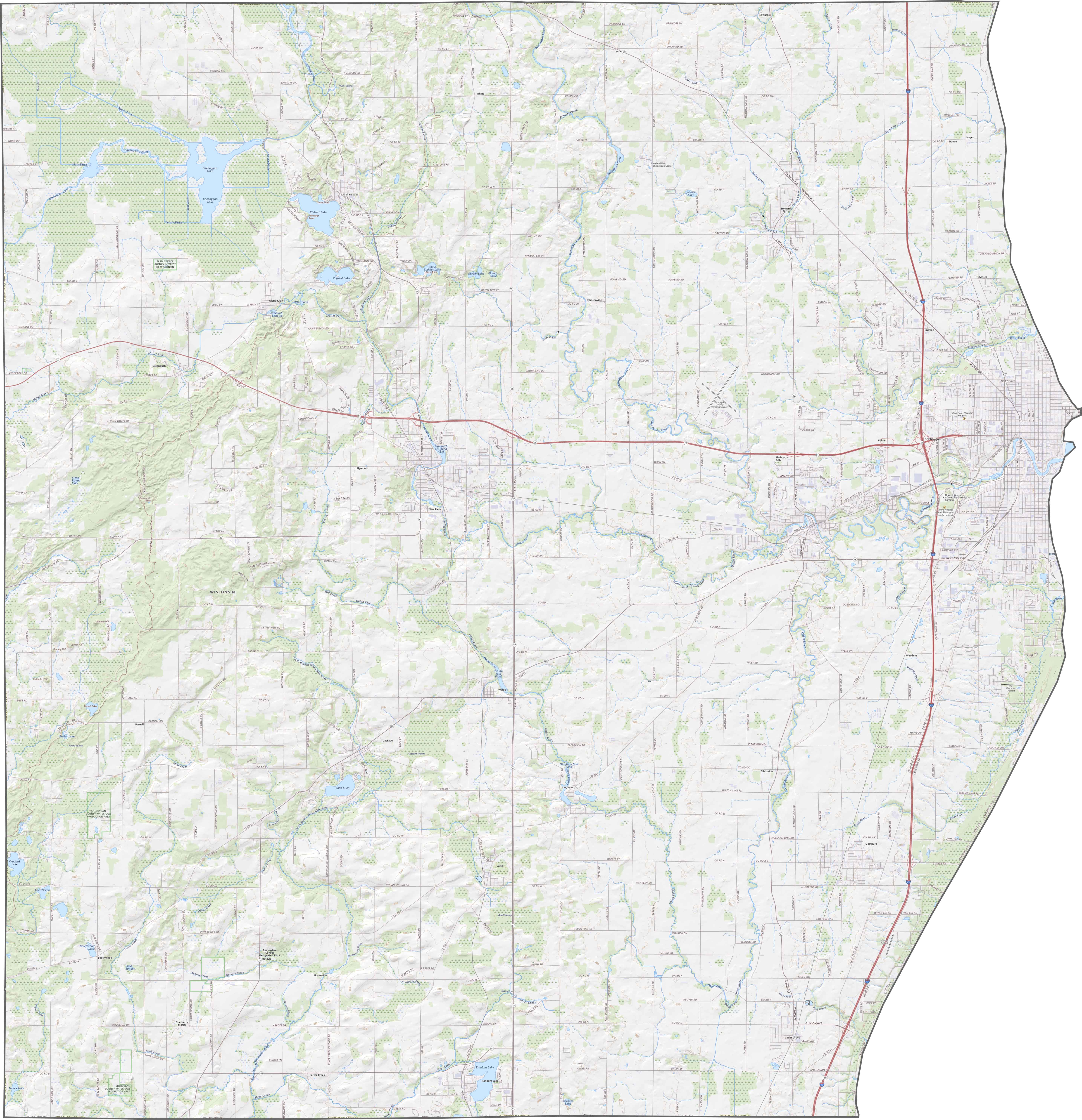
TRANSPORTATION MAP
Sheboygan County Road Map
Plenty of other roads cross through Sheboygan County. For instance, Interstate 43 runs right through, following near the Lake Michigan shoreline. Traffic outside the city stays light. You can follow each highway using our interactive zoom tool below.
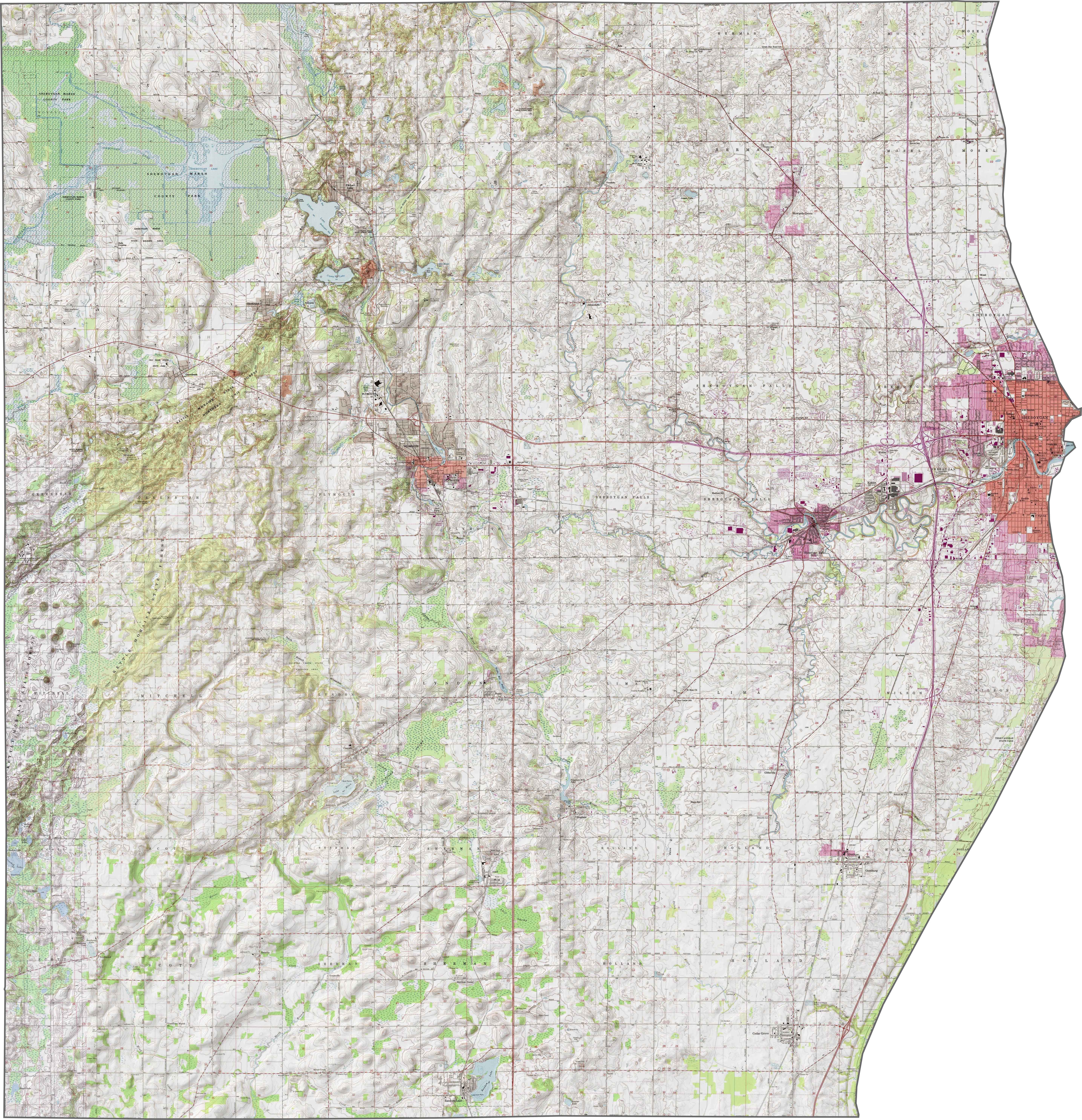
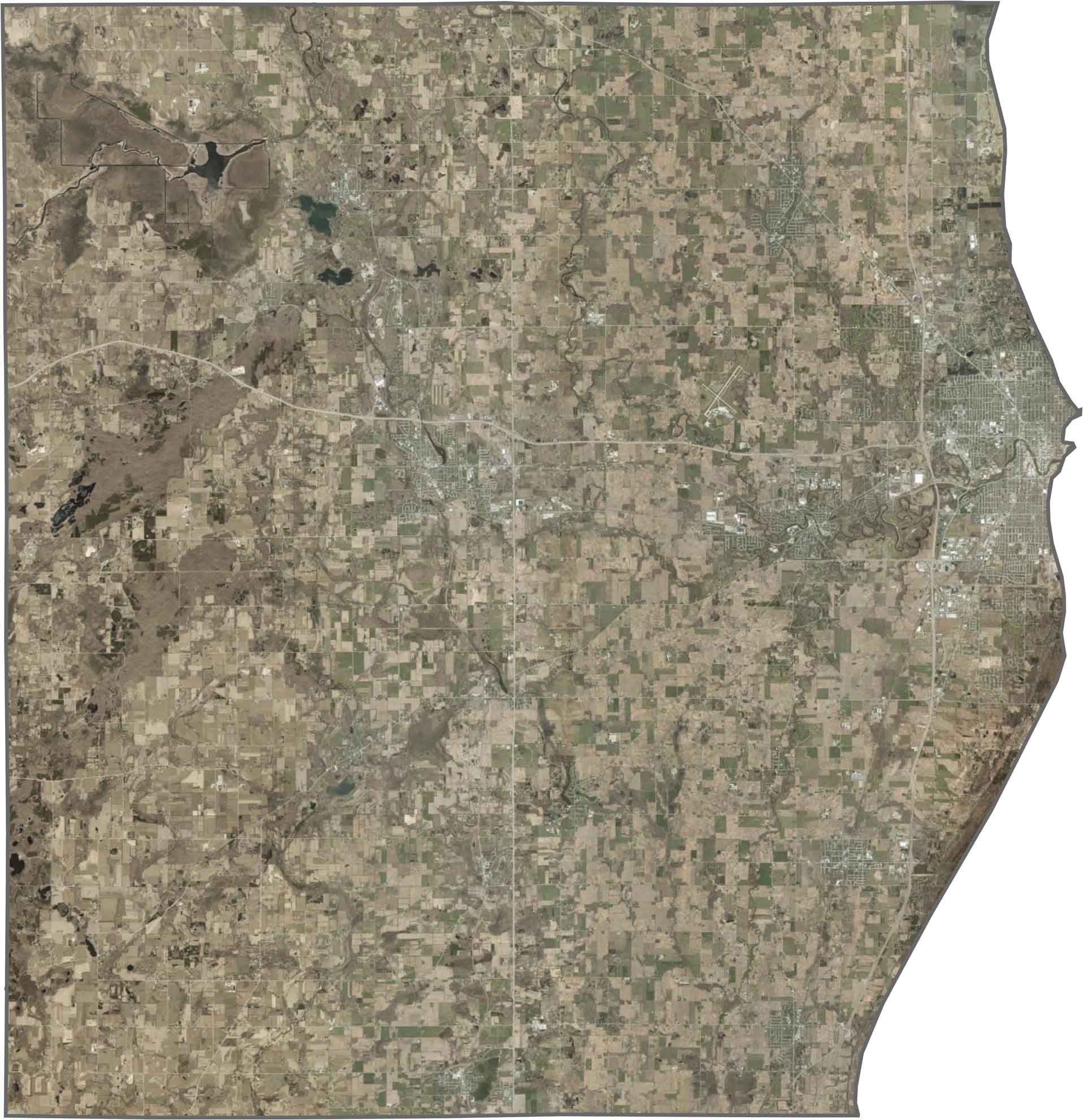
SATELLITE IMAGERY
Sheboygan County Satellite Map
Lake Michigan frames the east side. It’s cut off in our image, but believe you me that it’s there. The city of Sheboygan hugs the shoreline, standing out with dense development. Forest patches and farmland fill the remaining inland areas, especially near the wooded Kettle Moraine.
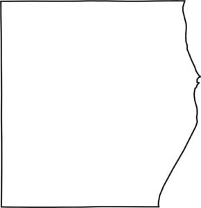
OUTLINE MAP
Sheboygan County Blank Map
Sheboygan County’s eastern border is carved clean by the lake. It doesn’t touch another state, but it does border several other counties.

Neighboring Counties
Here are the 5 neighboring counties of Sheboygan County:


Wisconsin County Map

Forget the beer and cheese stereotypes. Wisconsin’s 72 counties have more going on than tailgates and taverns. Some hug Great Lakes shorelines, others stretch through dairy farms, forests, or rolling bluffs.