Shelby County Map, Tennessee

Shelby County Map Collection
We allow you to use our Shelby County map. Attribution is required.
Shelby County, Tennessee

Memphis. That’s what Shelby County is all about. It’s in the southwest corner of Tennessee, right on the Mississippi River. This place is steeped in history and culture.
Beale Street is the heart of the blues scene. You can’t talk about Shelby without mentioning Elvis. Graceland draws visitors from all over the world. But there’s more to the county than just Memphis.
Shelby has some nice suburbs like Germantown and Collierville. The food here is legendary. We’re talking world-class barbecue and soul food. Shelby’s also an economic powerhouse. It’s home to FedEx and other big companies. The people here are diverse and friendly.
| Category | Details |
|---|---|
| County Name | Shelby County |
| County Seat | Memphis |
| Population | Approximately 930,000 |
| Cities, Towns, and Communities | Memphis, Germantown, Collierville, Bartlett, Millington, Arlington |
| Interstates and Highways | Interstate 40, Interstate 55, Interstate 240, U.S. Highway 51 |
| FIPS Code | 47-157 |
| Total Area (Land and Water) | 785 square miles (763 sq mi land, 22 sq mi water) |
| Adjacent Counties (and Direction) | Tipton County (North), Fayette County (East), Marshall County, Mississippi (Southeast), DeSoto County, Mississippi (South), Crittenden County, Arkansas (West) |
| Time Zone | Central Time Zone (CST) |
| State | Tennessee |
| Coordinates | 35°12’N, 89°53’W |
| Etymology | Named after Isaac Shelby, the first Governor of Kentucky |
| Major Landmarks | Graceland, Beale Street, National Civil Rights Museum, Shelby Farms Park |
| Website | Shelby County Website |
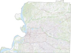
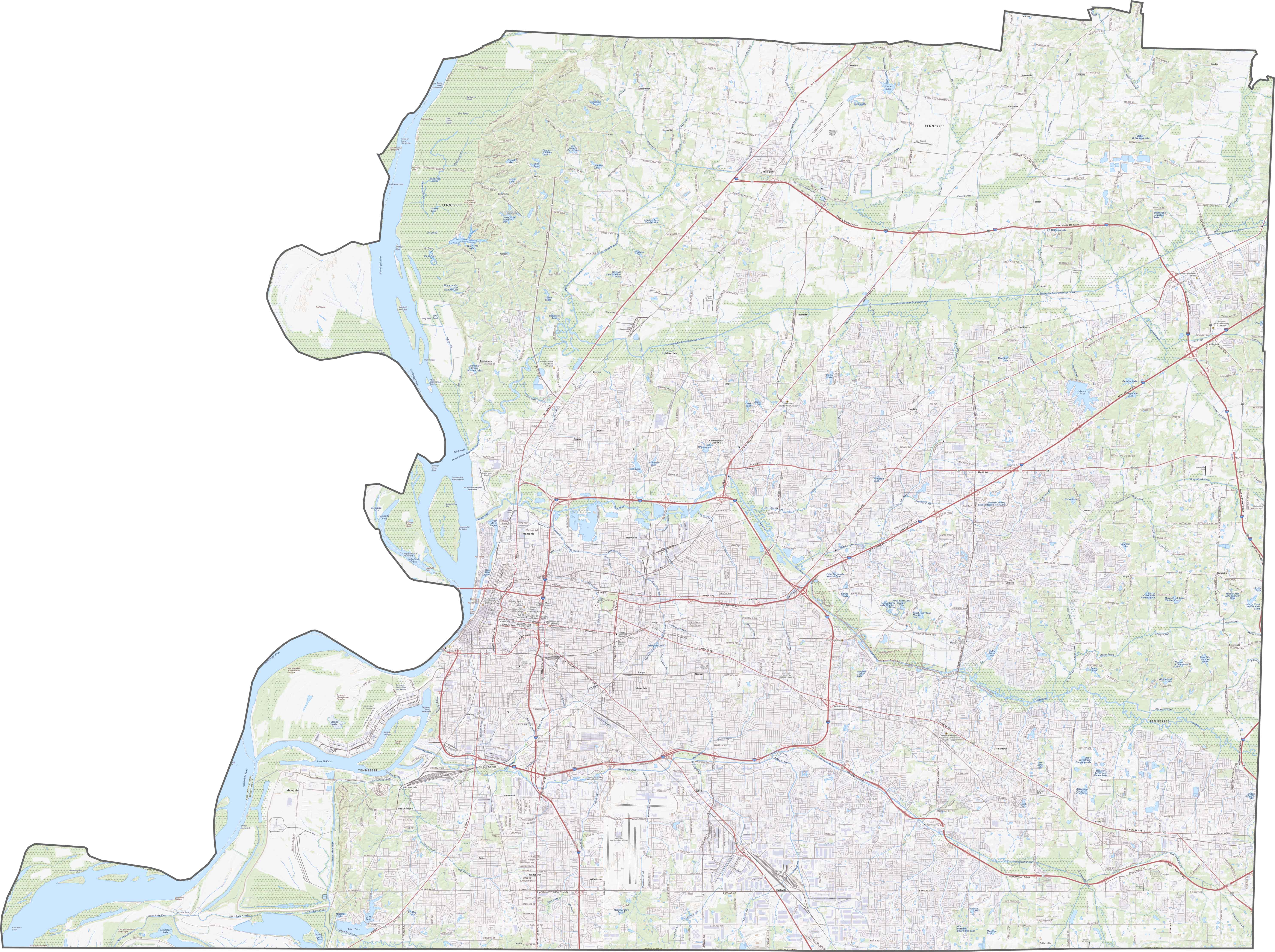
TRANSPORTATION MAP
Shelby County Road Map
Both I-40 and I-55 both cut through the county, giving Memphis a direct line to Little Rock, Nashville, and points beyond. Despite the massive network, traffic still clogs. Suburban growth adds pressure, especially in the east. If you want to see the full picture, our zoom tool shows it all.
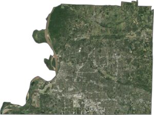
SATELLITE IMAGERY
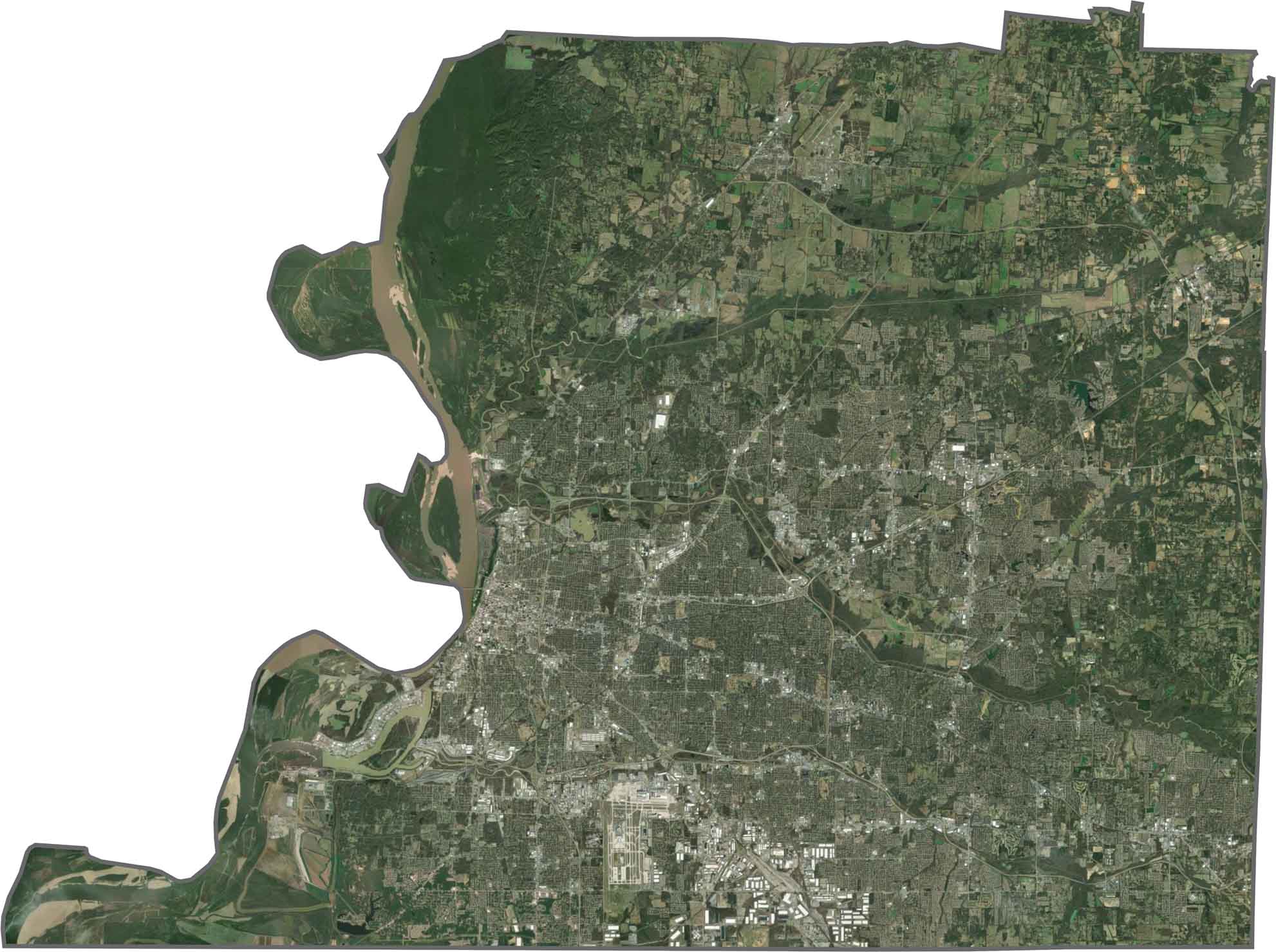
Shelby County Satellite Map
Memphis lights up the satellite map in the southern section. Dense development fills here, tapering into suburban areas. Forest patches remain, mostly in parks or along waterways. The Mississippi River shows up along the west side of Shelby County.
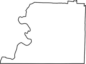
OUTLINE MAP
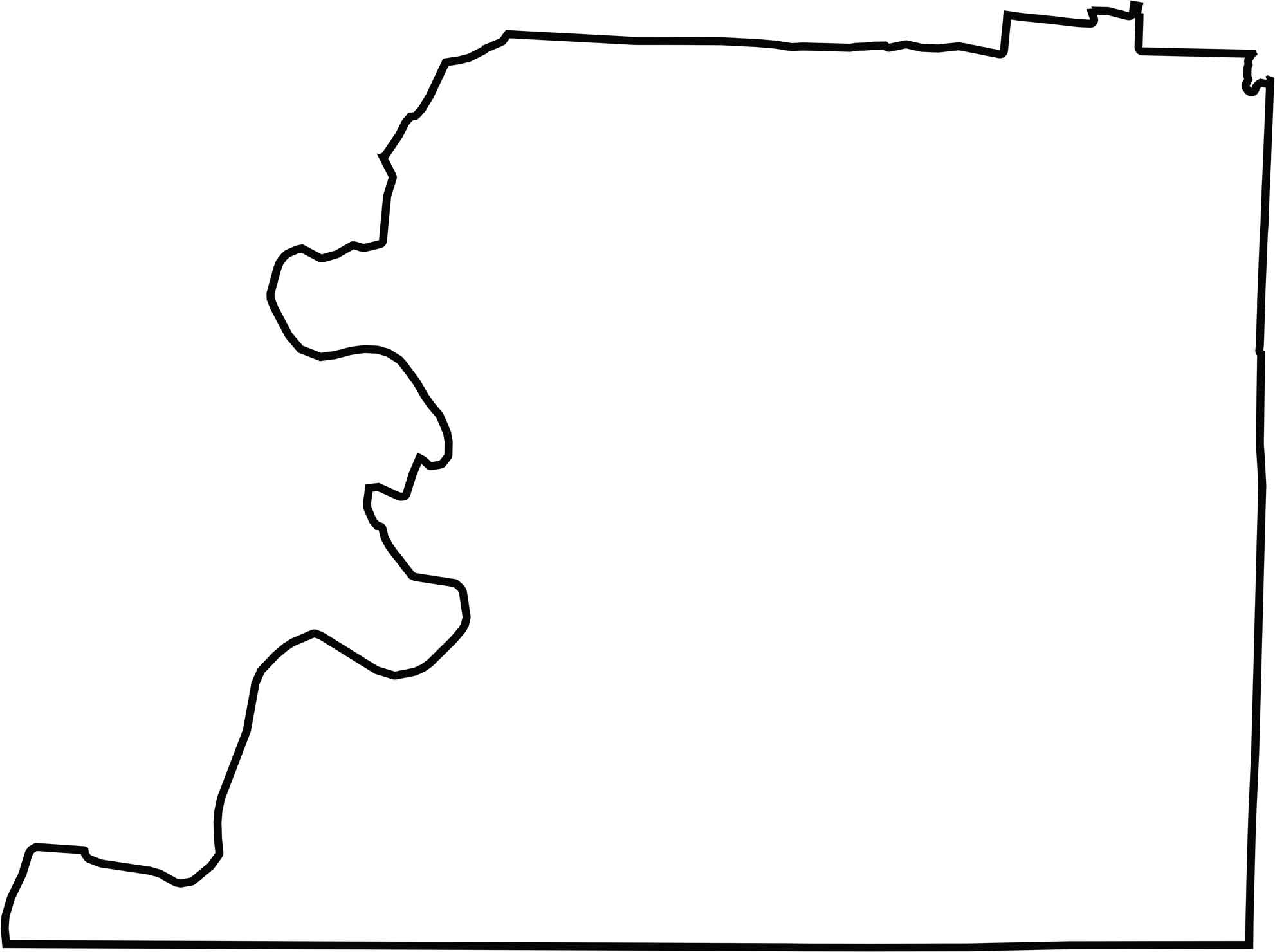
Shelby County Blank Map
Shelby County hugs the Mississippi along its western edge, marking the border with Arkansas. But it also borders the state of Mississippi to the south. The rest of the shape is more blocky, with straight lines and right angles in places. It’s wide, stretched east to west, and easy to spot on a state map.
Neighboring Counties
Here are the 5 neighboring counties of Shelby County:


Tennessee County Map

There’s no such thing as a boring county in Tennessee. Some stretch through the Smokies, others roll out into Delta flatlands. Every county’s shaped by the land and it shows.