Somerset County Map, New Jersey

Somerset County Map Collection
We allow you to use our Somerset County map. Attribution is required.
Somerset County, New Jersey

Somerset County sits in central New Jersey, bridging the gap between the New York and Philadelphia metro areas. It’s a place of rolling hills and historic towns. Somerville is the county seat, which has an exciting Main Street.
Far Hills is known for its horse farms and steeplechase races. Bridgewater is home to major pharmaceutical companies. You have plenty to explore here in the Sourland Mountain Preserve. It’s a great spot for hiking and bird watching.
You’ll find a mix of old money and new tech here. Somerset County balances industry with nature, blending history and growth. It’s a place that keeps people coming back.
| Category | Details |
|---|---|
| County Name | Somerset County |
| County Seat | Somerville |
| Population | Approximately 345,000 |
| Cities, Towns, and Communities | Bridgewater, Franklin Township, Hillsborough, Bernards Township, Warren, Montgomery, North Plainfield |
| Interstates and Highways | Interstate 78, Interstate 287, U.S. Route 22, U.S. Route 202, New Jersey Route 28 |
| FIPS Code | 34-035 |
| Total Area (Land and Water) | 305 square miles (301 sq mi land, 4 sq mi water) |
| Adjacent Counties (and Direction) | Morris County (North), Hunterdon County (West), Union County (East), Mercer County (South), Middlesex County (Southeast) |
| Time Zone | Eastern Time Zone (ET) |
| State | New Jersey |
| Coordinates | 40.5640° N, 74.6161° W |
| Etymology | Named after Somerset, a county in England |
| Major Landmarks | Duke Farms, Washington Rock State Park, Delaware and Raritan Canal State Park |
| Website | Somerset County Website |
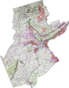
PHYSICAL MAP
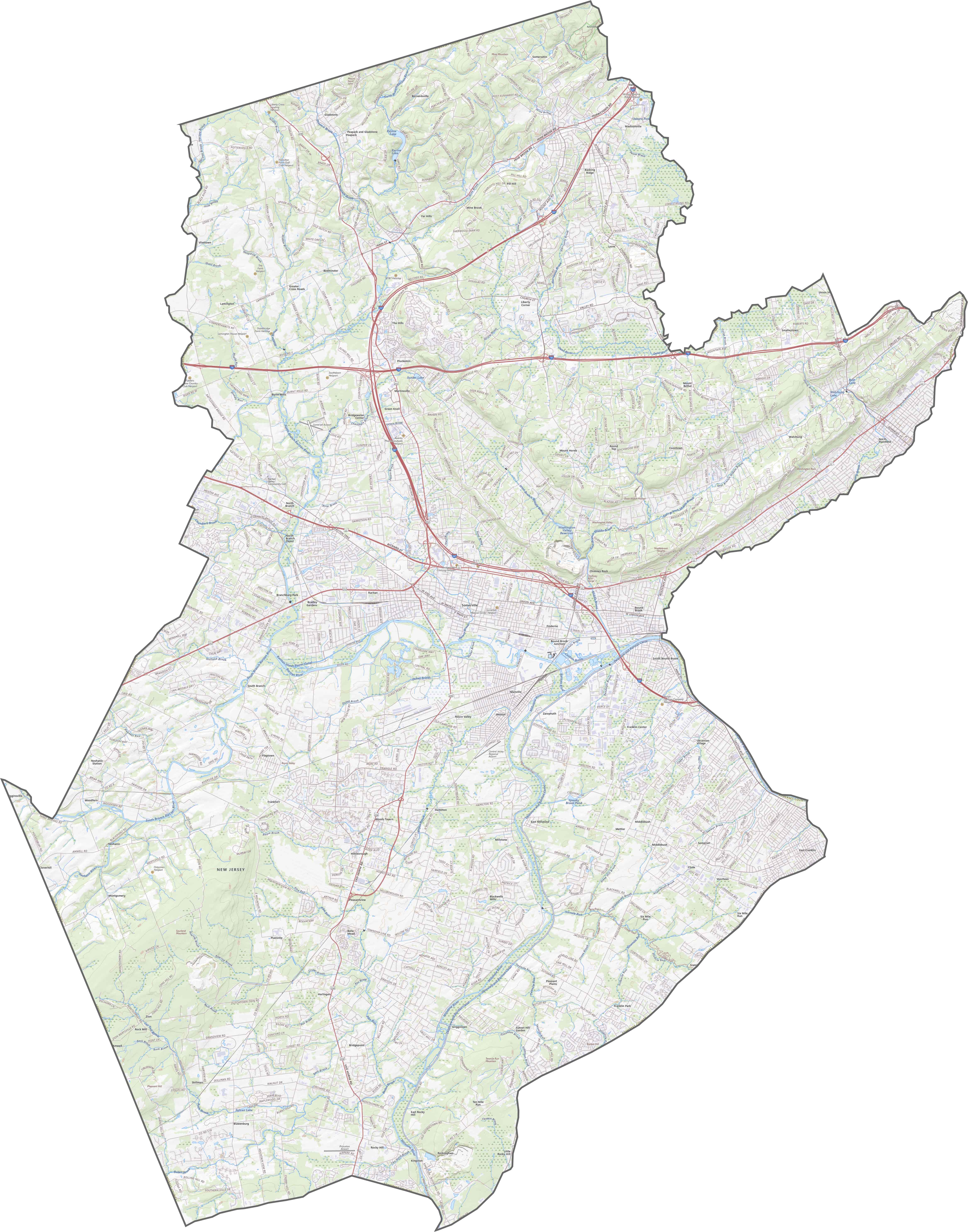
Somerset County Topographic Map
Somerset County has a quiet kind of drama. Ridges roll across the north, while the south settles into flatter farmland. Sourland Mountain makes a bold appearance in the southwest, then fades as you move outward. It’s a county with plenty of corners worth exploring.

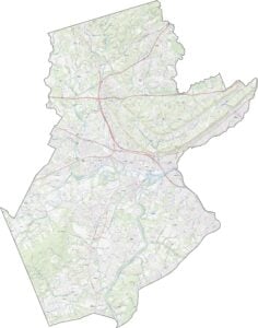
TRANSPORTATION MAP
Somerset County Road Map
Want to see which road takes you where in Somerset County? Zoom in and follow our road map below. You’ll see I-287 which arcs through the middle, looping past big towns like Bridgewater. Finally, I-78 cuts a clean line east to west across the north side.
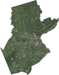
SATELLITE IMAGERY
Somerset County Satellite Map
From the sky, you’ll notice that Somerset County has a little bit of everything. Dense suburbs are near Somerville and Bound Brook. Open fields are near Hillsborough. Wooded ridges are to the north. The Raritan River makes its way across the eastern side.

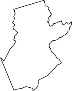
OUTLINE MAP
Somerset County Blank Map
Somerset’s shape is chunky but not clumsy. It’s sort of a tilted rectangle with a few messy edges. There are no out-of-state neighbors here, just New Jersey all around.

Neighboring Counties
Here are the 5 neighboring counties of Somerset County:


New Jersey County Map

New Jersey packs a lot into 21 counties – beach towns, pine forests and farmland. Trace the colonial history in Hunterdon or walk the boardwalk in Ocean County. There’s more here than meets the Turnpike.