Wakulla County Map, Florida
We allow you to use our Wakulla County map. Attribution is required.
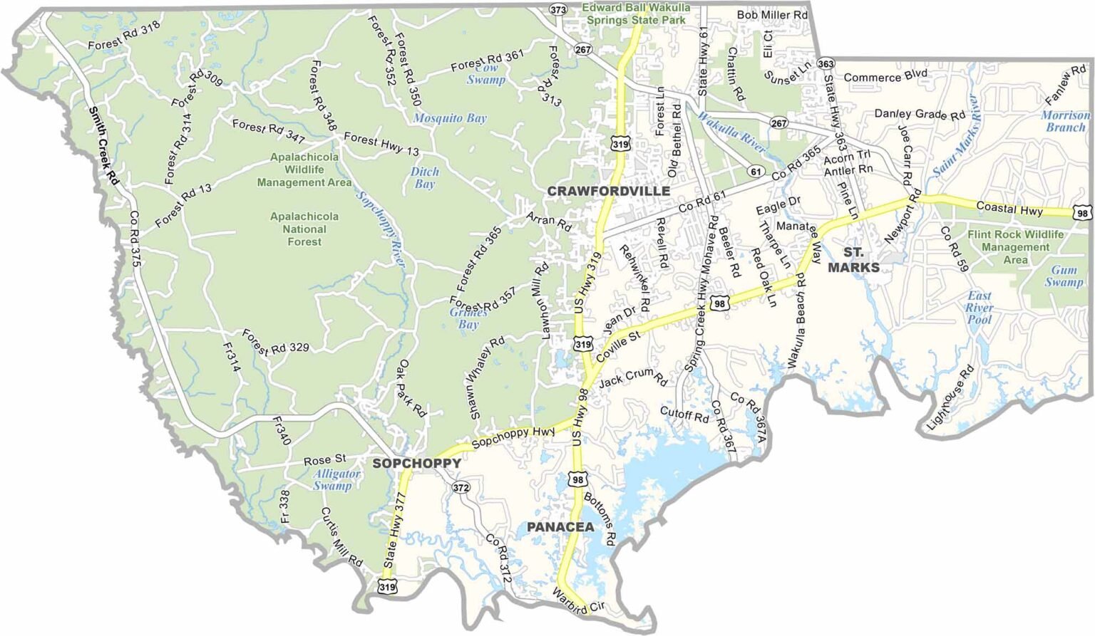
Wakulla County, Florida

Wakulla County is located in Florida’s Panhandle. It’s just south of Tallahassee, but feels worlds away. The coast here is wild and undeveloped.
Wakulla Springs is the star attraction as it’s one of the world’s largest and deepest freshwater springs. You can take a glass-bottom boat tour and spot manatees, gators, and all sorts of birds.
St. Marks National Wildlife Refuge is great for hiking and watching sunsets. Locals love to fish and hunt. The seafood is fresh and delicious. Oysters are important here. It’s a place where you can really get away from it all.
| Category | Details |
|---|---|
| County Name | Wakulla County |
| County Seat | Crawfordville |
| Population | Approximately 35,000 |
| Cities, Towns, and Communities | Crawfordville, Sopchoppy, St. Marks, Panacea |
| Interstates and Highways | US 98, SR 267, SR 363 |
| FIPS Code | 12-129 |
| Total Area (Land and Water) | 736 square miles (land: 606 sq mi, water: 130 sq mi) |
| Adjacent Counties (and Direction) | Leon County (North), Liberty County (West), Franklin County (Southwest), Jefferson County (East) |
| Time Zone | Eastern Time Zone (ET) |
| State | Florida |
| Coordinates | 30.2167° N, 84.3583° W |
| Etymology | Named after the Wakulla River, which means “mysterious water” in the Apalachee language |
| Major Landmarks | Wakulla Springs State Park, St. Marks National Wildlife Refuge, Torreya State Park |
| Website | Wakulla County Website |
Florida County Maps
Get to know all the counties in Florida with our map collection.


