Walton County Map, Georgia

Walton County Map Collection


We allow you to use our Walton County map. Attribution is required.
Walton County, Georgia

Walton County straddles the line between Atlanta’s sprawl and Georgia’s rural heartland. It’s about an hour east of the city. It’s close enough for commuters but far enough to keep its country charm.
You can’t talk about Walton without mentioning “In the Heat of the Night”. That’s because parts of the TV show were filmed here. The Social Circle Theater keeps the arts alive with local productions.
Monroe is the county seat. It has a historic downtown that’s come back to life in recent years. You’ll see plenty of farms and pastures. But there’s also a growing tech sector. Walton County is changing, sure, but it’s holding onto its roots.
| Category | Details |
|---|---|
| County Name | Walton County |
| County Seat | Monroe |
| Population | Approximately 130,000 |
| Cities, Towns, and Communities | Monroe (county seat), Loganville, Social Circle, Walnut Grove, and other smaller communities |
| Interstates and Highways | Interstate 85, U.S. Route 78, U.S. Route 29, State Route 11, State Route 20 |
| FIPS Code | 13-297 |
| Total Area (Land and Water) | 330 square miles (land: 329 sq mi, water: 1 sq mi) |
| Adjacent Counties (and Direction) | Barrow County (North), Oconee County (Northeast), Morgan County (Southeast), Newton County (South), Rockdale County (Southwest), Gwinnett County (Northwest) |
| Time Zone | Eastern Time Zone (ET) |
| State | Georgia |
| Coordinates | 33.7715° N, 83.7211° W |
| Etymology | Named after George Walton, a signer of the Declaration of Independence |
| Major Landmarks | Walton County Historic Courthouse, Georgia International Horse Park, Broadnax Park |
| Website | Walton County Website |
PHYSICAL MAP
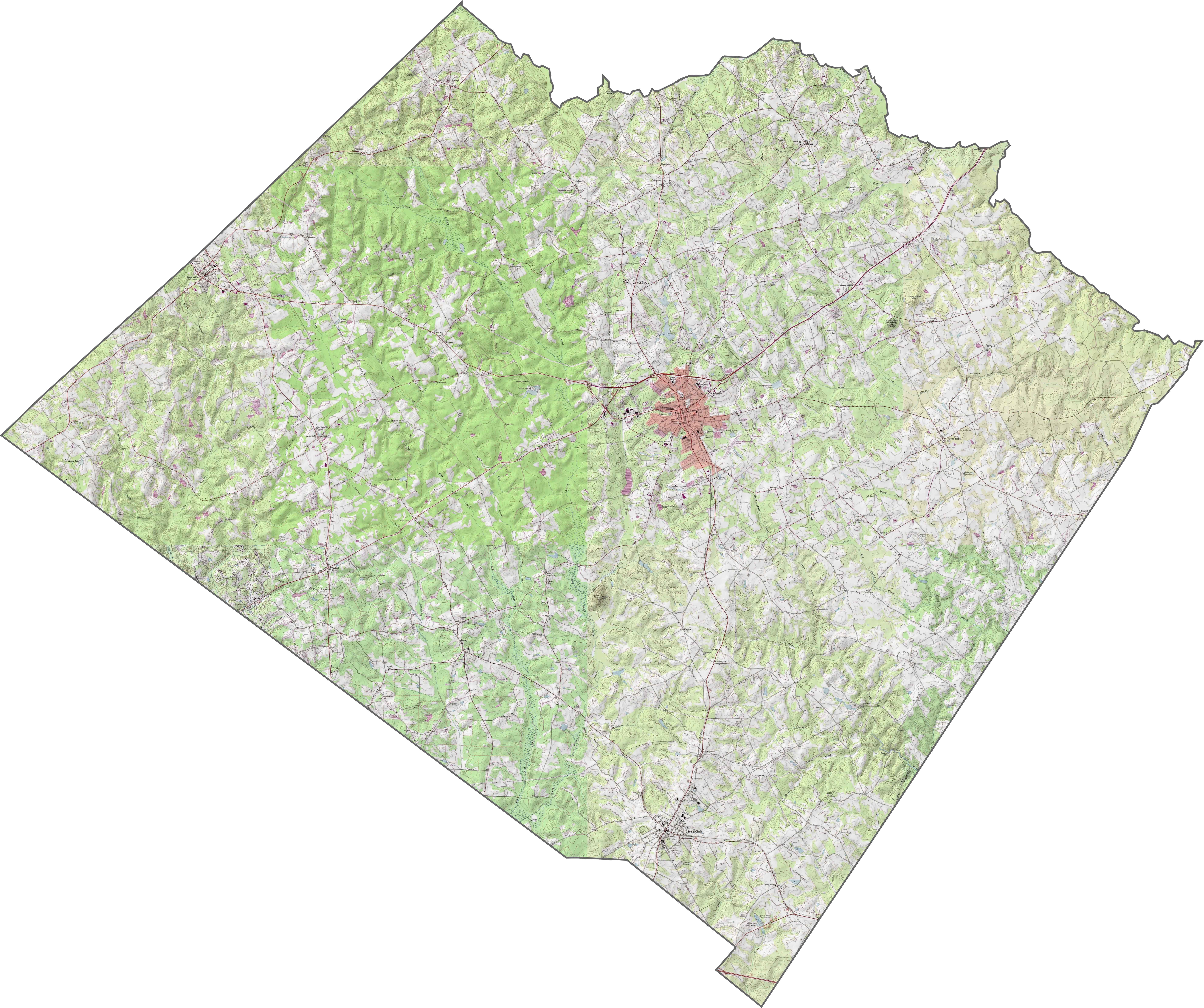
Walton County Topographic Map
Our Walton County topographic map displays everything from elevation contours to highways and roads. Monroe sits in the center of the county. Walnut Grove and Social Circle are other major communities. The Alcovy River runs through the county, along with creeks and small lakes.
SATELLITE IMAGERY
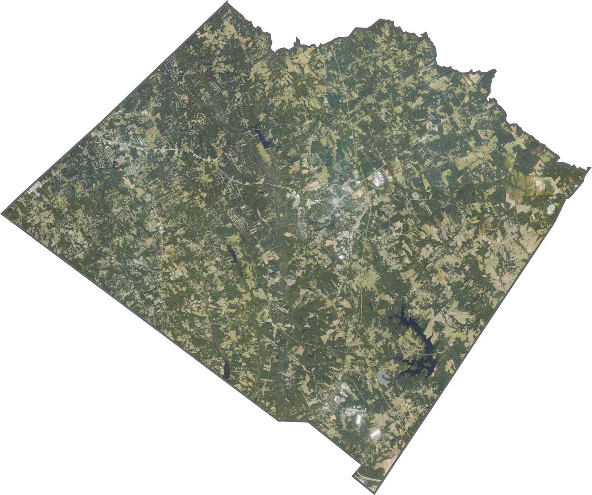
Walton County Satellite Map
This satellite map of Walton County shows its suburban growth and rural areas. There is a lot of rolling hills, forests, and farmland here. The eastern region has pastures, row crops, and agriculture use.
OUTLINE MAP
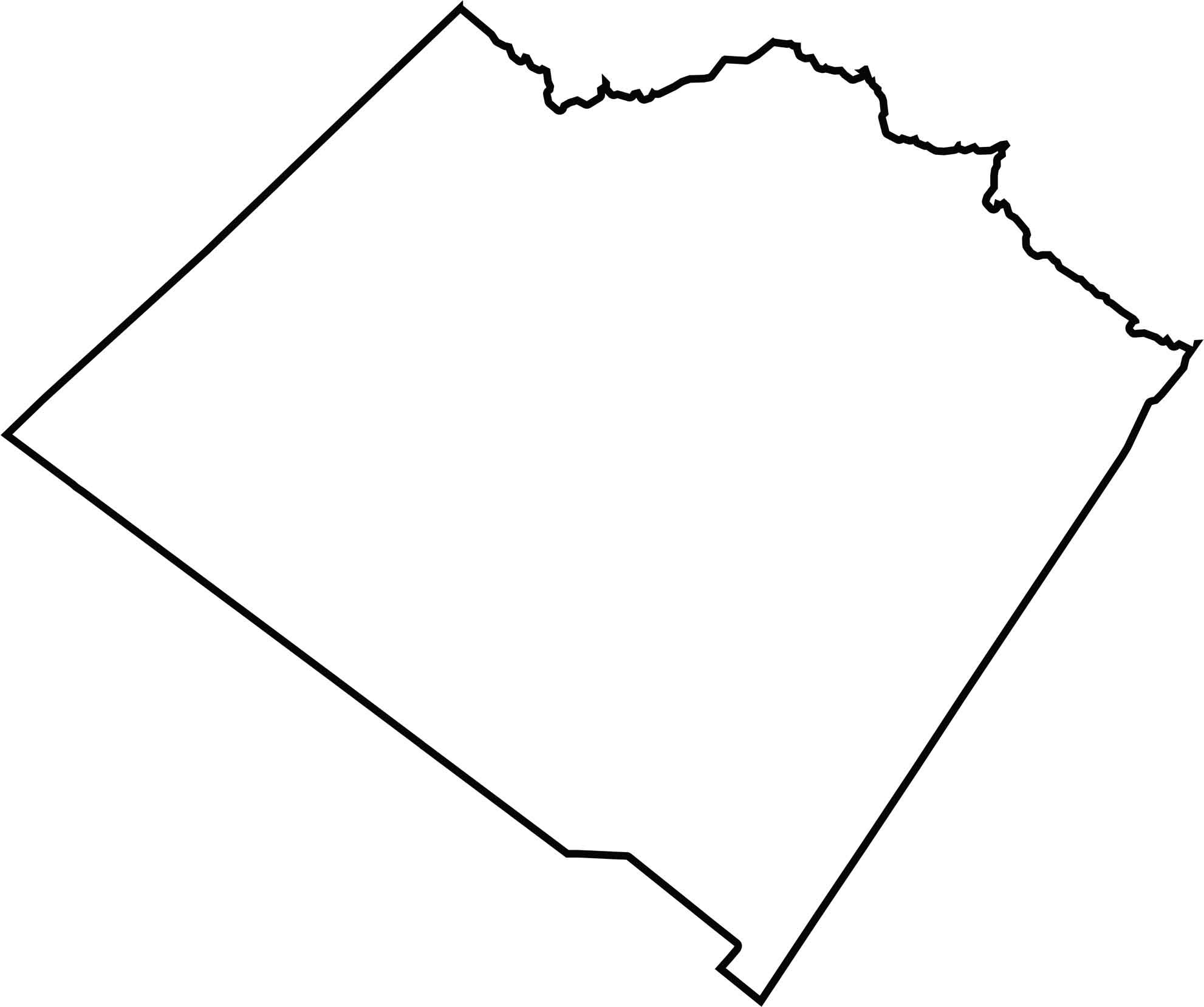
Walton County Blank Map
Walton County is in north-central Georgia, between Atlanta and Athens. It has a somewhat irregular pentagonal shape with the Apalachee River forming its northeastern boundary.
Neighboring Counties
Here are the 6 neighboring counties of Walton County:


Georgia County Map

Just launched! Our Georgia county map shows all 159 counties in stunning detail. It’s the perfect resource you’ve been waiting for. Don’t miss out on the Peach State.