York County Map, Pennsylvania

York County Map Collection

We allow you to use our York County map. Attribution is required.
York County, Pennsylvania

York County is in south-central Pennsylvania, right on the Maryland border. Historians love this place. The Continental Congress met here during the Revolutionary War.
These days, it’s a mix of urban and rural. York is the biggest city and county seat. You’ve got your pick of things to do. It’s also home to the York Fair, which is one of the oldest in the country.
Gettysburg isn’t far if you want even more history. The Susquehanna River forms the eastern border. It’s great for outdoor activities. Manufacturing’s still big here. Harley-Davidson has a plant in York. The county has good farmland too. It’s a place with deep roots and a bright future.
| Category | Details |
|---|---|
| County Name | York County |
| County Seat | York |
| Population | Approximately 461,000 |
| Cities, Towns, and Communities | York, Hanover, Red Lion, Dallastown, Spring Grove, Shrewsbury |
| Interstates and Highways | Interstate 83, U.S. Highway 30, U.S. Highway 15, State Highway 74 |
| FIPS Code | 42-133 |
| Total Area (Land and Water) | 910 square miles (904 sq mi land, 6 sq mi water) |
| Adjacent Counties (and Direction) | Cumberland County (North), Dauphin County (Northeast), Lancaster County (East), Harford County, Maryland (Southeast), Baltimore County, Maryland (South), Carroll County, Maryland (Southwest), Adams County (West) |
| Time Zone | Eastern Time Zone (EST) |
| State | Pennsylvania |
| Coordinates | 39°55’N, 76°73’W |
| Etymology | Named after the city of York in Yorkshire, England |
| Major Landmarks | York Fairgrounds, York County History Center, Codorus State Park, Indian Steps Museum |
| Website | York County Website |
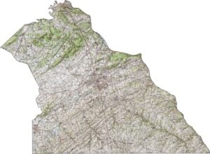
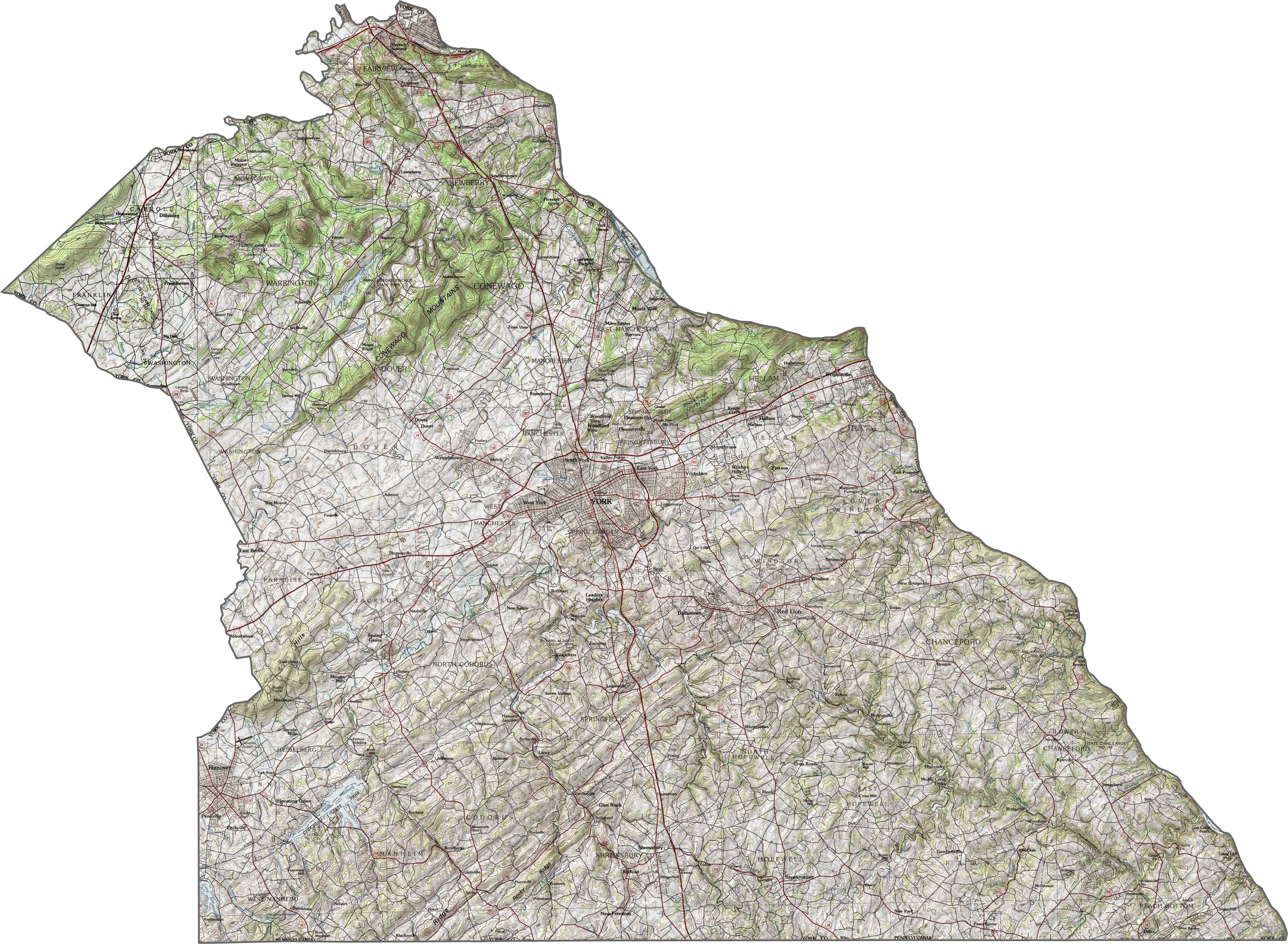
PHYSICAL MAP
York County Topographic Map
The terrain in York County is gently rolling, with no sharp elevation changes. Hills rise gradually, and wide valleys stretch across the center. The southern edge dips into the Piedmont region, adding more slope to the land.
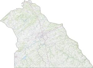
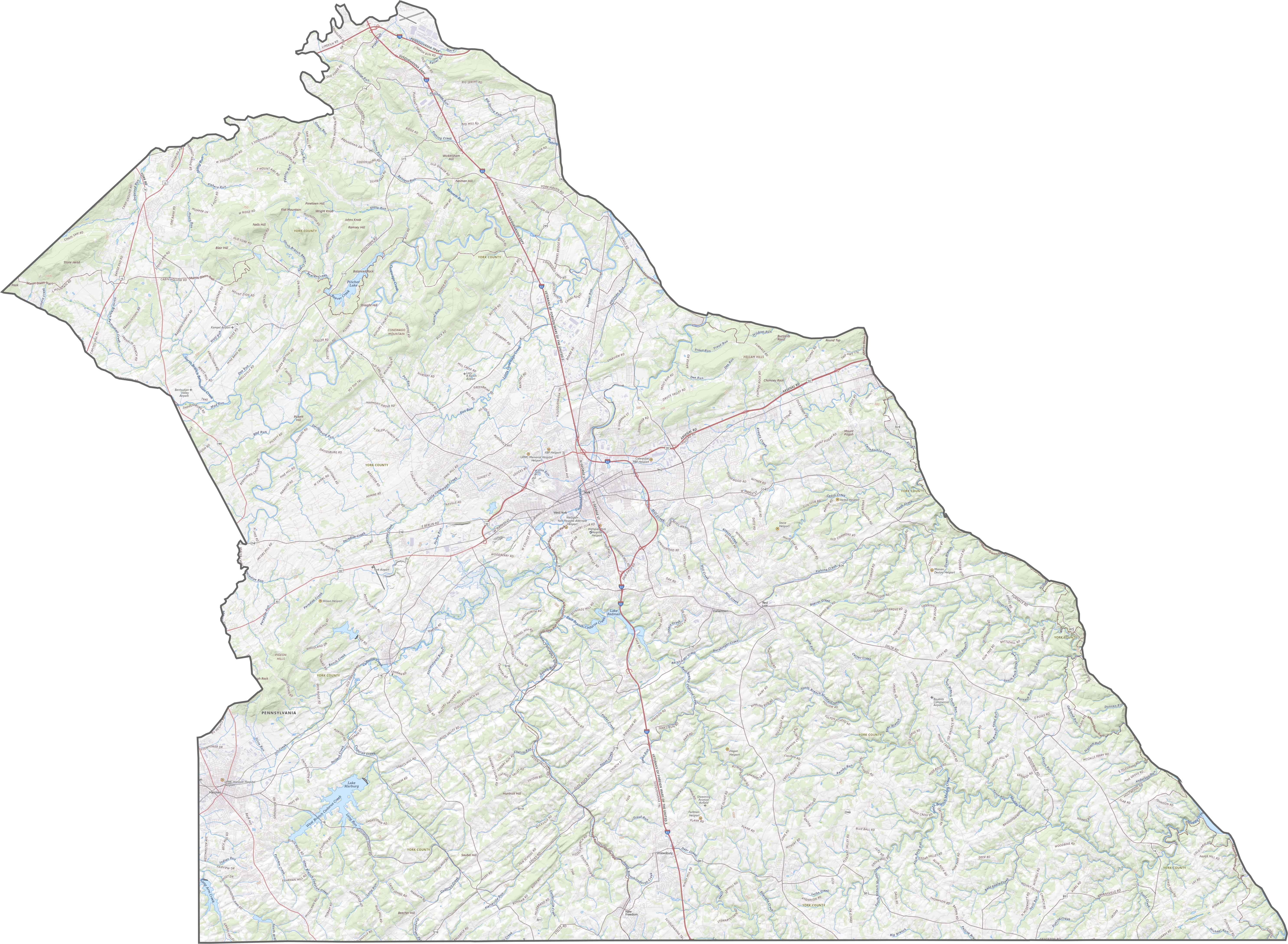
TRANSPORTATION MAP
York County Road Map
York County has a sturdy network of roads that blend rural routes with busy commuter lines. I-83 is a major highways that runs north-south. Though farmland dominates the view, road access is strong. Try our zoom tool for a detailed view.
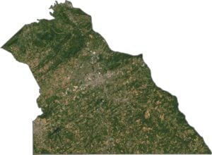
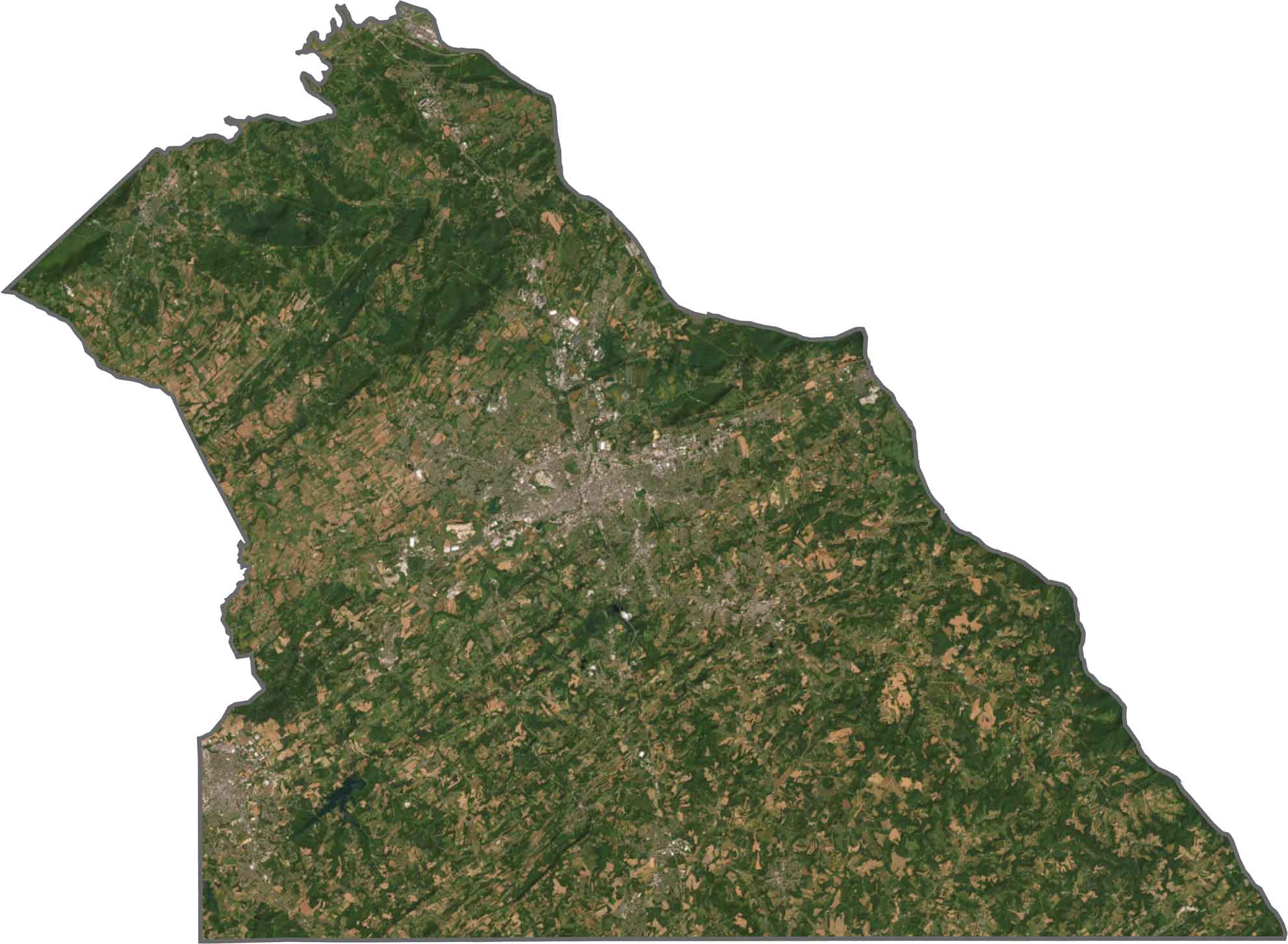
SATELLITE IMAGERY
York County Satellite Map
Fields dominate our satellite map of York County. York city appears as a dense gray core, surrounded by smaller towns and industrial zones. Forests break up the farmland, especially near creeks and hilltops.
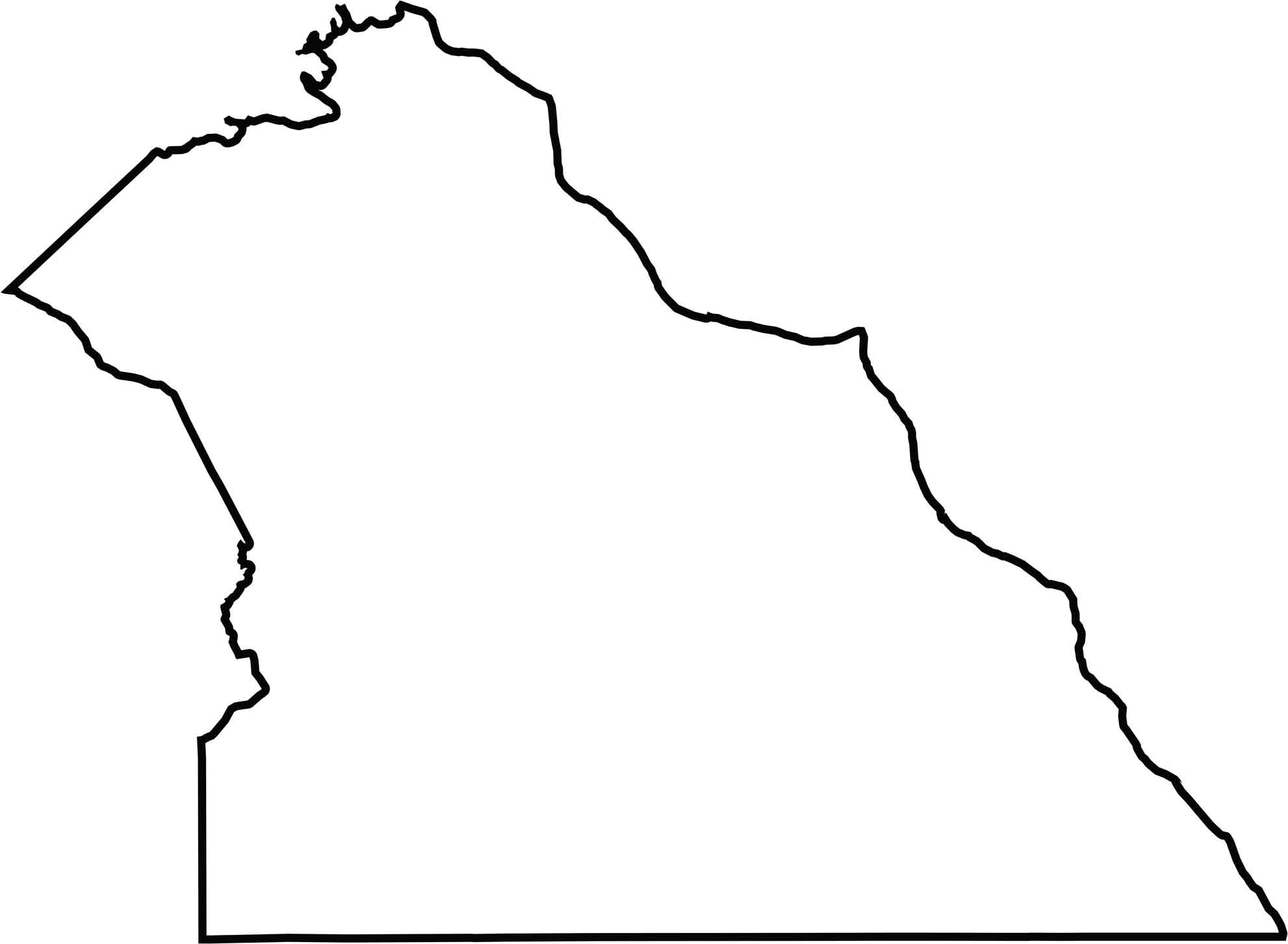
OUTLINE MAP
York County Blank Map
York has a fat-bottomed triangle shape, tilting southeast. The Susquehanna River defines its eastern border. It shares its southern edge with Maryland. The outline is smooth, with clear natural and political boundaries.
Neighboring Counties
Here are the 7 neighboring counties of York County:


Pennsylvania County Map

Pennsylvania’s 67 counties contains steel city lights, Amish country backroads, and Pocono mountain escapes. Mileage may vary, but the stories won’t.