Allegheny County Map, Pennsylvania

Allegheny County Map Collection


We allow you to use our Allegheny County map. Attribution is required.
Allegheny County, Pennsylvania

Allegheny County sits in the southwest corner of Pennsylvania. It’s home to Pittsburgh, the state’s second-largest city. The city sits at the meeting point of three rivers: the Allegheny, Monongahela, and Ohio.
This spot has been important for trade and industry for centuries. Steel used to be king here, but now healthcare and tech are big employers.
The county’s not all urban though. There are plenty of parks and green spaces to explore. Sports fans here love their teams. The NFL Steelers, MLB Pirates, and NHL Penguins all call Pittsburgh home.
| Category | Details |
|---|---|
| County Name | Allegheny County |
| County Seat | Pittsburgh |
| Population | Approximately 1,200,000 |
| Cities, Towns, and Communities | Pittsburgh, Bethel Park, McKeesport, Monroeville, Penn Hills, Mount Lebanon, West Mifflin |
| Interstates and Highways | Interstate 79, Interstate 376, Interstate 279, U.S. Highway 19, U.S. Highway 30 |
| FIPS Code | 42-003 |
| Total Area (Land and Water) | 745 square miles (730 sq mi land, 15 sq mi water) |
| Adjacent Counties (and Direction) | Butler County (North), Armstrong County (Northeast), Beaver County (Northwest), Westmoreland County (Southeast), Washington County (Southwest) |
| Time Zone | Eastern Time Zone (EST) |
| State | Pennsylvania |
| Coordinates | 40°26’N, 80°00’W |
| Etymology | Named after the Allegheny River |
| Major Landmarks | Carnegie Museum of Natural History, PNC Park, Heinz Field, Point State Park, Andy Warhol Museum |
| Website | Allegheny County Website |
TRANSPORTATION MAP
Allegheny County Road Map
Allegheny’s highway system is dense and built for volume. Though rural areas exist, the focus here is movement in and out of Pittsburgh. Backroads still linger in the outskirts for quiet alternatives. Our road map’s zoom tool shows how everything connects.

SATELLITE IMAGERY
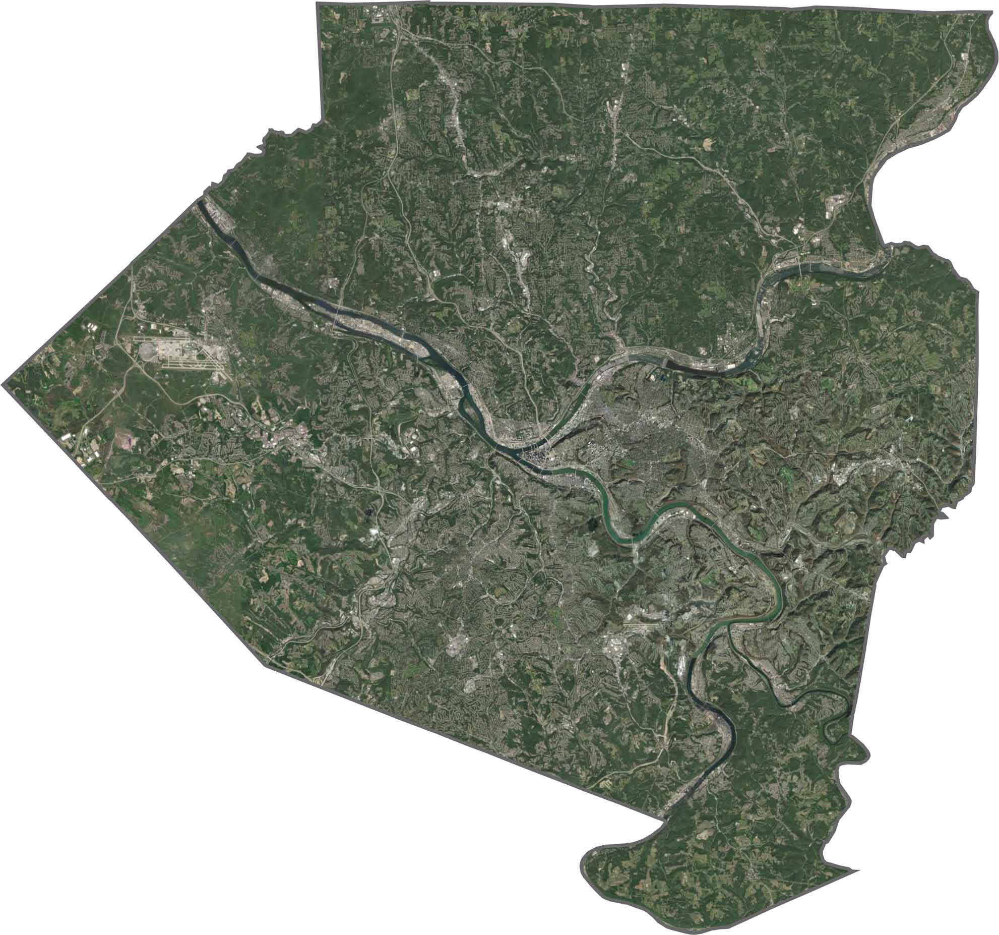
Allegheny County Satellite Map
Urban density fills the center, with sharp angles from roads and rooftops. Rivers cut deep, carving dark lines through the city. Tree cover increases toward the north and west. Though the metro area dominates, green spaces still show up in surprising places.
OUTLINE MAP
Allegheny County Blank Map
The county outline is jagged with several rivers forming borders. Allegheny doesn’t touch another state, but it does border multiple counties in nearly every direction.

Neighboring Counties
Here are the 5 neighboring counties of Allegheny County:


Pennsylvania County Map

Pennsylvania’s 67 counties contains steel city lights, Amish country backroads, and Pocono mountain escapes. Mileage may vary, but the stories won’t.