Denton County Map, Texas

Denton County Map Collection


We allow you to use our Denton County map. Attribution is required.
Denton County, Texas

Denton County is just north of Dallas-Fort Worth. The county seat, Denton, is home to two universities, University of North Texas and Texas Woman’s University.
But drive a few miles out and you’re in horse country. You can still find ranches everywhere on the landscape. The county’s grown like crazy in recent years. New subdivisions keep popping up.
Still, there’s charm in the old town squares. Music is a big deal here. Grab a beer and catch a show any night of the week. Lake Lewisville is a hot spot in summer. Boats, beaches, and barbecues. It’s Texas living at its finest.
| Category | Details |
|---|---|
| County Name | Denton County |
| County Seat | Denton |
| Population | Approximately 1,050,000 |
| Cities, Towns, and Communities | Denton, Lewisville, Flower Mound, Carrollton, The Colony, Little Elm, Highland Village, Roanoke, Argyle |
| Interstates and Highways | Interstate 35, Interstate 35E, U.S. Highway 380, State Highway 121 |
| FIPS Code | 48-121 |
| Total Area (Land and Water) | 953 square miles (880 sq mi land, 73 sq mi water) |
| Adjacent Counties (and Direction) | Cooke County (North), Grayson County (Northeast), Collin County (East), Dallas County (Southeast), Tarrant County (South), Wise County (West) |
| Time Zone | Central Time Zone (CST) |
| State | Texas |
| Coordinates | 33°13’N, 97°08’W |
| Etymology | Named after John B. Denton, a Texas pioneer and lawyer |
| Major Landmarks | University of North Texas, Texas Woman’s University, Lewisville Lake, Ray Roberts Lake State Park |
| Website | Denton County Website |
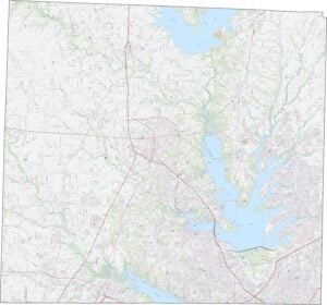
TRANSPORTATION MAP
Denton County Road Map
Multiple highways race through, offering routes to Dallas, Fort Worth, and everything in between. I-35 and U.S. Highway 380 are the main highways here. Find your way through using our road map below.

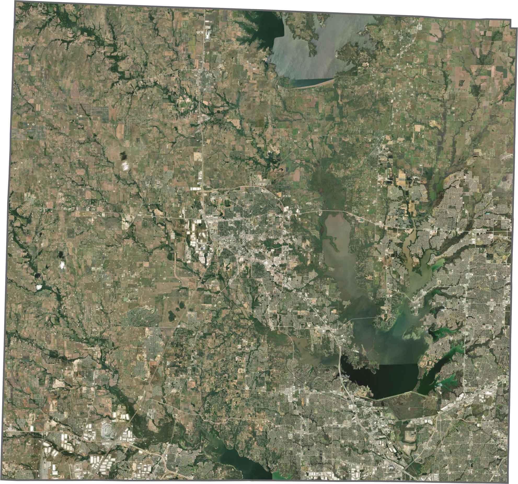
SATELLITE IMAGERY
Denton County Satellite Map
Subdivisions dominate the southern half. But look north and the scene changes. There’s fewer houses and more open land. Lewisville Lake is the most prominent feature in the east.
OUTLINE MAP
Denton County Blank Map
Denton County’s shape is nearly a perfect square. The county is mostly straight lines without any curves along its edges.

Neighboring Counties
Here are the 6 neighboring counties of Denton County:


Texas County Map

254 legendary Texas county maps. From the Panhandle to the Rio Grande, we’ve got the Lone Star State mapped. That means more rodeos, honky-tonk, and Texas BBQ.