Fort Bend County Map, Texas

Fort Bend County Map Collection


We allow you to use our Fort Bend County map. Attribution is required.
Fort Bend County, Texas

Fort Bend County is just southwest of Houston. It’s one of the fastest-growing counties in the state. U.S. Sugar Land, its largest city, used to be a company town for Imperial Sugar. Now it’s a booming suburb.
The county’s incredibly diverse. They say it’s the most ethnically diverse county in Texas. The Brazos River winds its way through, shaping the landscape. George Ranch Historical Park offers a glimpse into the county’s ranching past. It’s pretty cool.
Fort Bend was one of the original Texas counties, created when Texas was still its own country. These days, it’s a mix of suburban sprawl and rural charm. You can find world-class restaurants and working farms within a few miles of each other. It’s a place of contrasts.
| Category | Details |
|---|---|
| County Name | Fort Bend County |
| County Seat | Richmond |
| Population | Approximately 950,000 |
| Cities, Towns, and Communities | Richmond, Rosenberg, Sugar Land, Missouri City, Katy, Fulshear, Stafford, Needville |
| Interstates and Highways | Interstate 69, U.S. Highway 59, State Highway 99, State Highway 6 |
| FIPS Code | 48-157 |
| Total Area (Land and Water) | 885 square miles (861 sq mi land, 24 sq mi water) |
| Adjacent Counties (and Direction) | Waller County (North), Harris County (Northeast), Brazoria County (Southeast), Wharton County (Southwest), Austin County (Northwest) |
| Time Zone | Central Time Zone (CST) |
| State | Texas |
| Coordinates | 29°31’N, 95°47’W |
| Etymology | Named after a blockhouse at a bend of the Brazos River |
| Major Landmarks | George Ranch Historical Park, Brazos Bend State Park, Fort Bend Museum |
| Website | Fort Bend County Website |
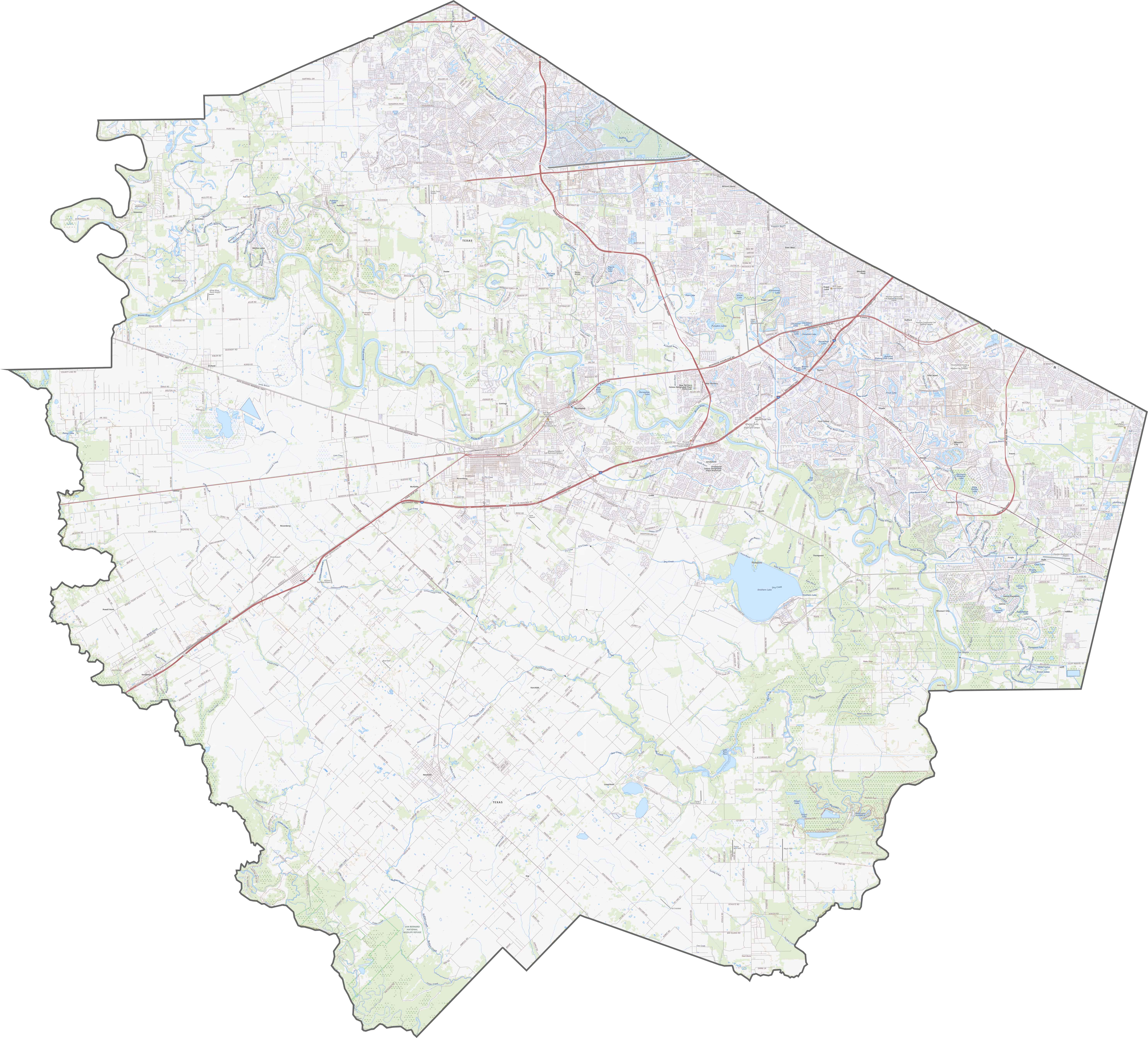
TRANSPORTATION MAP
Fort Bend County Road Map
Fort Bend County has highways built for movement, and lots of it. Though the traffic can be thick, there’s still room to spread out westward. The further you go, the less crowded it feels. Explore our road map with our zoom tool.
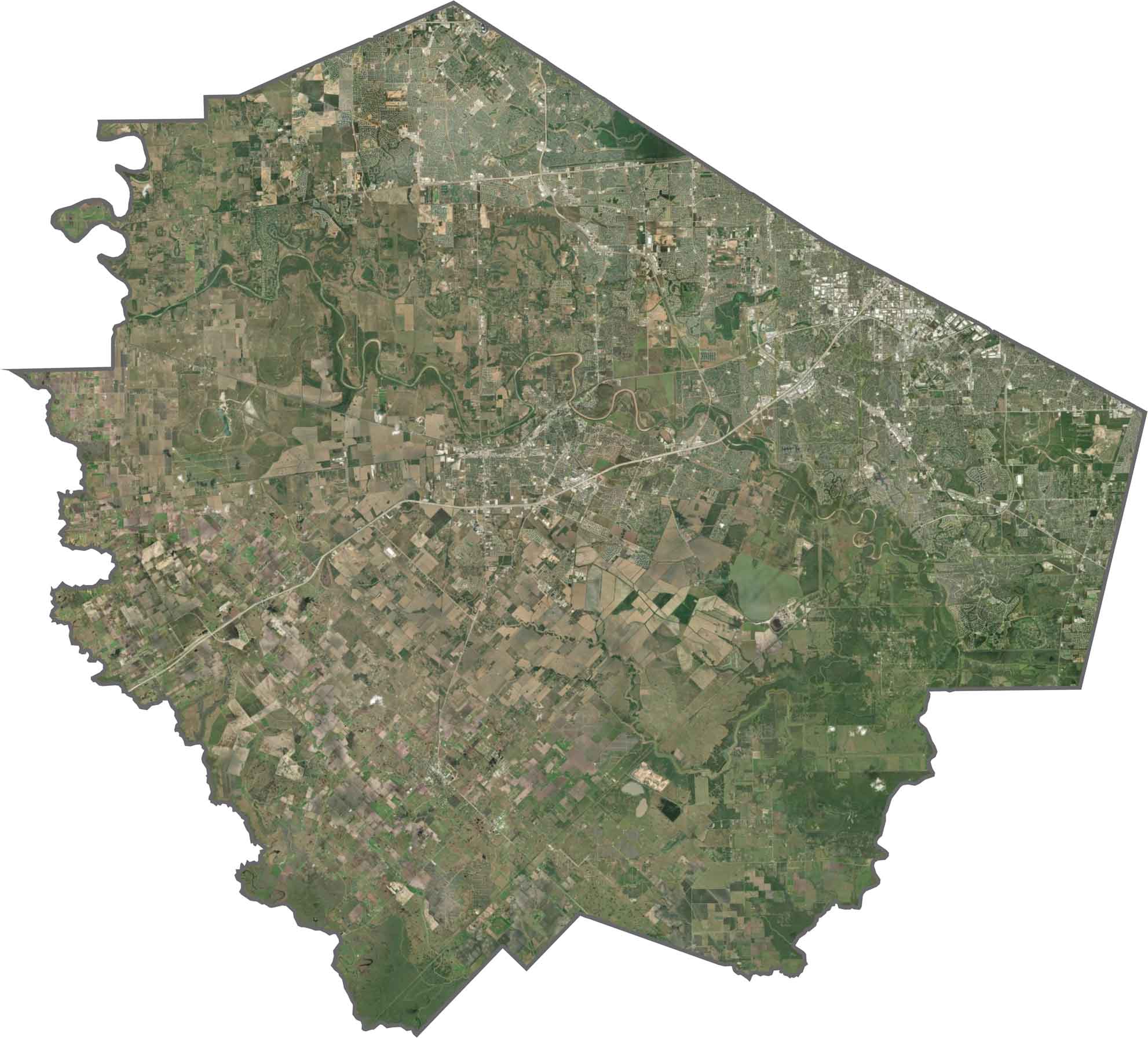
SATELLITE IMAGERY
Fort Bend County Satellite Map
From above, the difference is clear. Subdivisions dominate the east, with tight road networks. But west of the Brazos, the density fades. Farmland reappears, along with ranches and open space. The river itself carves through the county.
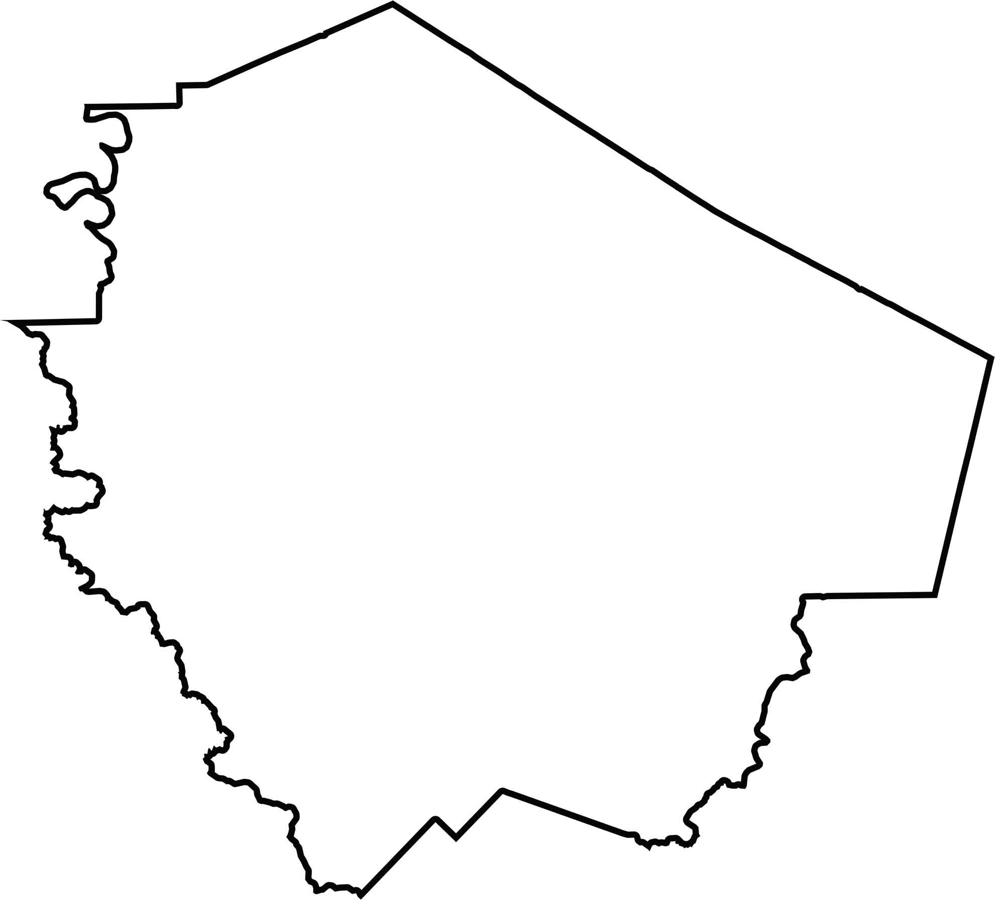
OUTLINE MAP
Fort Bend County Blank Map
Fort Bend County is a stretched, irregular shape. The Brazos and San Bernard River form the western part of the outline. It borders no other states, but it wraps around the southwest side of the Houston area.
Neighboring Counties
Here are the 5 neighboring counties of Fort Bend County:


Texas County Map

254 legendary Texas county maps. From the Panhandle to the Rio Grande, we’ve got the Lone Star State mapped. That means more rodeos, honky-tonk, and Texas BBQ.