Harris County Map, Texas

Harris County Map Collection


We allow you to use our Harris County map. Attribution is required.
Harris County, Texas

Houston, we have a county. Harris County is the most populous county in Texas, home to over 4.8 million people. It’s located in the southeastern part of the state, along the Gulf Coast.
This urban powerhouse spans 1,780 square miles. The county seat? Houston, of course. It’s a diverse place, with folks from all over the world calling it home. You’ll find world-class museums, sports teams, and the Johnson Space Center here.
The economy is booming, driven by energy, healthcare, and shipping industries. But it’s not all concrete jungle. Harris County has some beautiful parks and natural areas too. From nightlife to NASA, this county has it all.
| Category | Details |
|---|---|
| County Name | Harris County |
| County Seat | Houston |
| Population | Approximately 4,800,000 |
| Cities, Towns, and Communities | Houston, Pasadena, Baytown, Humble, Katy, Spring, Tomball, Bellaire |
| Interstates and Highways | Interstate 10, Interstate 45, Interstate 69, U.S. Highway 59, U.S. Highway 290, State Highway 6 |
| FIPS Code | 48-201 |
| Total Area (Land and Water) | 1,780 square miles (1,706 sq mi land, 74 sq mi water) |
| Adjacent Counties (and Direction) | Montgomery County (North), Liberty County (Northeast), Chambers County (East), Galveston County (Southeast), Brazoria County (South), Fort Bend County (Southwest), Waller County (Northwest) |
| Time Zone | Central Time Zone (CST) |
| State | Texas |
| Coordinates | 29°45’N, 95°21’W |
| Etymology | Named after John Richardson Harris, an early settler of the area |
| Major Landmarks | Space Center Houston, Houston Museum of Natural Science, The Galleria, Houston Zoo |
| Website | Harris County Website |
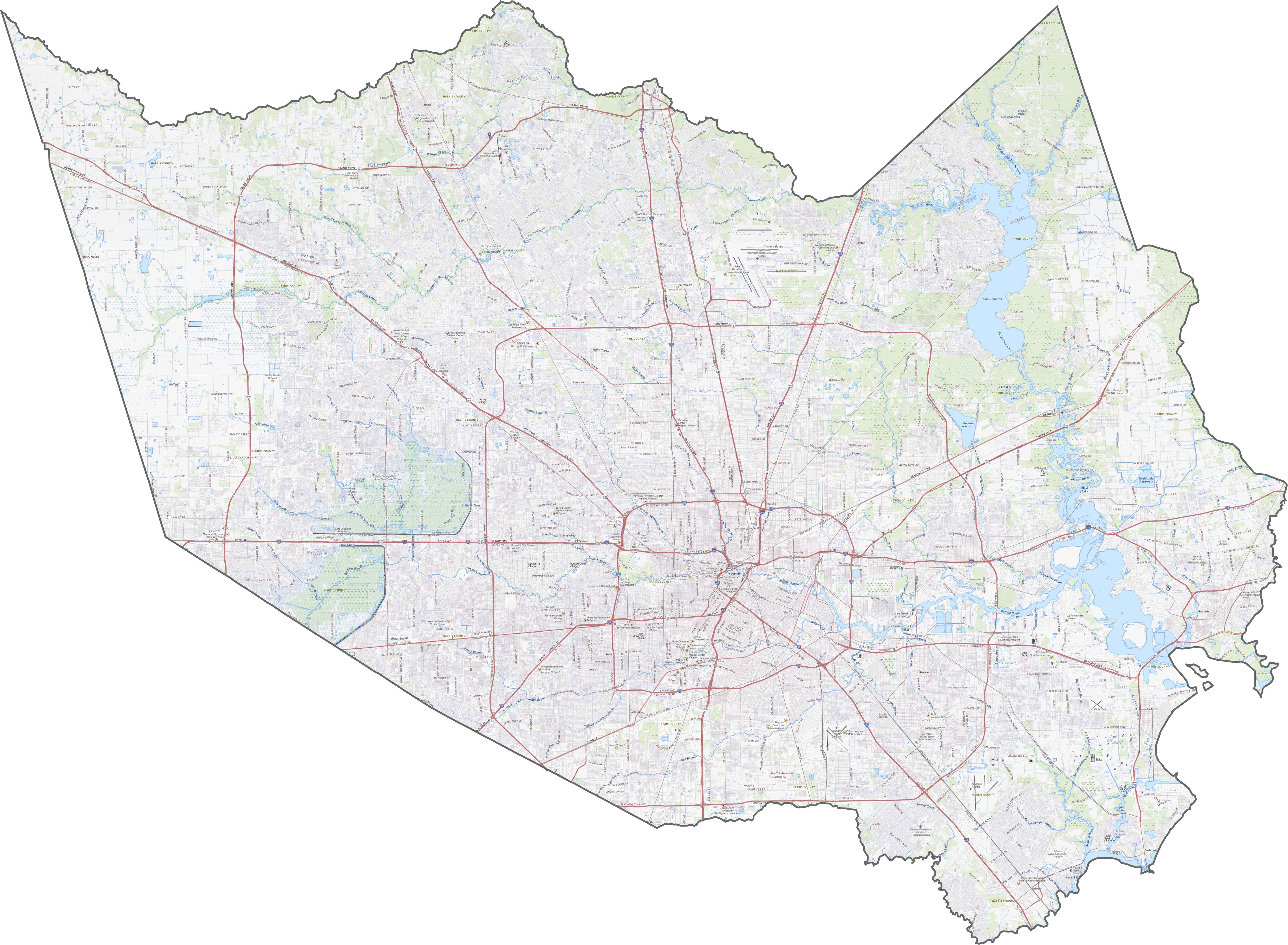
PHYSICAL MAP
Harris County Topographic Map
Harris County is mostly flat, sitting low on the coastal plain. The defining feature is the Buffalo Bayou system, which winds through the urban core. There are small elevation shifts but they’re barely noticeable in most places. See it all for yourself in our topographic map below.
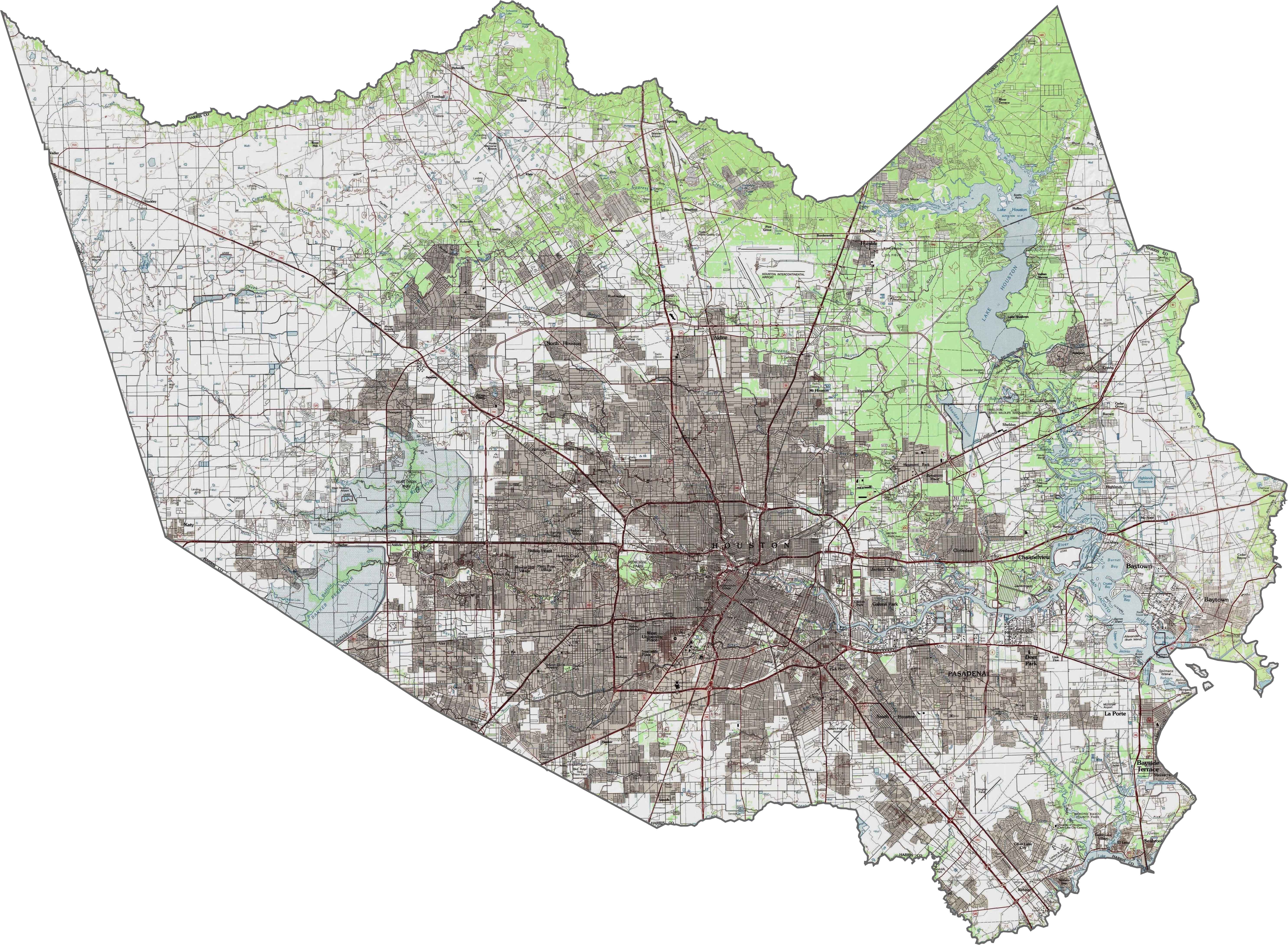
TRANSPORTATION MAP
Harris County Road Map
This is the highway capital of Texas. Roads loop, stretch, and stack across the landscape. While I-10 runs east to west through the heart of Houston, Loop 610 circles central Houston. I-45 cuts north to south, linking the county with Dallas and Galveston. Zoom in to see all these highways up close.
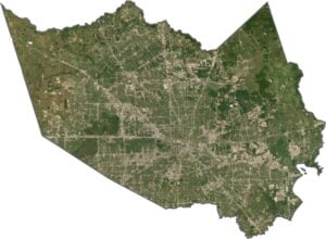
SATELLITE IMAGERY
Harris County Satellite Map
From the air, you can see that it’s clearly city almost everywhere. Houston dominates the center, with its dense buildings and streets. Suburbs spread outward in every direction. To the east, you’ll spot the Gulf’s edge creeping in. There’s very little open land left in Harris County.

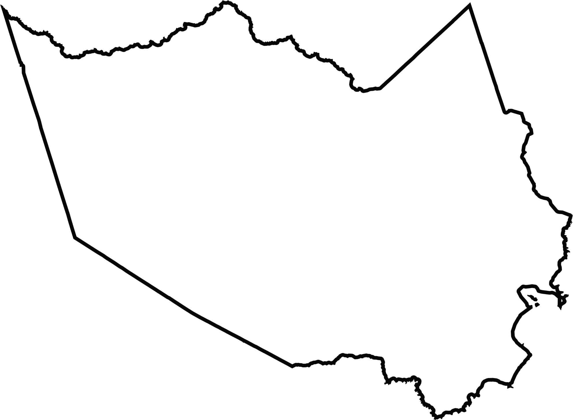
OUTLINE MAP
Harris County Blank Map
Harris County has a jagged, wheel-like shape. It doesn’t border another state, but it does touch the Gulf coastline to the southeast. Its outer edges reflect mostly bayous and streams, not just survey lines. While Cedar Bayou forms part of the eastern border, Spring Creek defines part of the northern edge.
Neighboring Counties
Here are the 7 neighboring counties of Harris County:


Texas County Map

254 legendary Texas county maps. From the Panhandle to the Rio Grande, we’ve got the Lone Star State mapped. That means more rodeos, honky-tonk, and Texas BBQ.