Humboldt County Map, California

Humboldt County Map Collection


We allow you to use our Humboldt County map. Attribution is required.
Humboldt County, California

Humboldt County is way up north on the coast. It’s redwood country, with trees taller than skyscrapers. They like to say, “Come for the trees, stay for the tranquility.”
Eureka is the biggest city, with a cool old town full of Victorian buildings. The place has a reputation for… um, certain plants. California State Polytechnic University, Humboldt keeps things lively.
Highway 101 is the main artery. It winds through ancient forests and along stunning coastlines. If you like your towns quirky and your nature wild, Humboldt’s your spot.
| Category | Details |
|---|---|
| County Name | Humboldt County |
| County Seat | Eureka |
| Population | Approximately 135,000 |
| Cities, Towns, and Communities | Eureka, Arcata, Fortuna, McKinleyville, Garberville, Rio Dell |
| Interstates and Highways | U.S. Route 101, State Route 36, State Route 299 |
| FIPS Code | 06-023 |
| Total Area (Land and Water) | 4,052 square miles (Land: 3,568 sq mi, Water: 484 sq mi) |
| Adjacent Counties (and Direction) | Del Norte County (North), Siskiyou County (Northeast), Trinity County (East), Mendocino County (South) |
| Time Zone | Pacific Standard Time (PST) |
| State | California |
| Coordinates | 40.7711° N, 124.1627° W |
| Etymology | Named after the German naturalist, Alexander von Humboldt |
| Major Landmarks | Redwoods National and State Parks, Humboldt Bay, Lost Coast |
| Website | Humboldt County Website |
PHYSICAL MAP
Humboldt County Topographic Map
Our topographic map below reveals rugged coastlines, river valleys, and northern sections of California’s Coast Ranges. Our zoom tool brings to life the diverse coastal and mountainous landscape of Humboldt County.

SATELLITE IMAGERY
Humboldt County Satellite Map
Extensive forests and an irregular coastline dominate this satellite view. Major rivers like the Eel and Klamath cut impressive paths through mountainous terrain toward the Pacific.

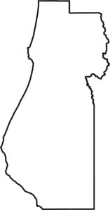
OUTLINE MAP
Humboldt County Blank Map
This blank map presents Humboldt County’s irregular outline along California’s northern coast. The western boundary follows the Pacific shoreline while the eastern edge extends into the Coast Range mountains.

Neighboring Counties
Here are the 4 neighboring counties of Humboldt County:


California County Map

Ever wonder how California’s 58 counties stack up? Our California county map lays them all out, from the coast to the deserts. Take a look and find the ones you know — and maybe a few you don’t.