Kanawha County Map, West Virginia

Kanawha County Map Collection
We allow you to use our Kanawha County map. Attribution is required.
Kanawha County, West Virginia

The capital calls Kanawha County home. Charleston is the beating heart of West Virginia, right in the south-central part of the state. The Kanawha River winds through, flanked by hills and hollers.
This place has seen its share of booms and busts. Coal made it rich. Then things got tough. Now it’s finding its footing again. Tech jobs are moving in.
The people? They’re survivors. Tough but with a soft spot for strangers. You’ll find some of the best comfort food here. And the pepperoni rolls? To die for. Remember the best part is that the mountains aren’t far if you need an escape.
| Category | Details |
|---|---|
| County Name | Kanawha County |
| County Seat | Charleston |
| Population | Approximately 176,000 |
| Cities, Towns, and Communities | Charleston, St. Albans, South Charleston, Dunbar, Nitro |
| Interstates and Highways | I-64, I-77, I-79, US-60, WV-114 |
| FIPS Code | 54-039 |
| Total Area (Land and Water) | 911 sq mi (Land: 902 sq mi; Water: 9 sq mi) |
| Adjacent Counties (and Direction) | Roane County (North), Clay County (Northeast), Nicholas County (East), Fayette County (East), Raleigh County (Southeast), Boone County (South), Lincoln County (Southwest), Putnam County (West), Jackson County (Northwest) |
| Time Zone | Eastern Time Zone (ET) |
| State | West Virginia |
| Coordinates | 38.3498° N, 81.6326° W |
| Etymology | Named after the Kanawha River, which flows through the county |
| Major Landmarks | West Virginia State Capitol, Kanawha State Forest, Haddad Riverfront Park |
| Website | Kanawha County Website |
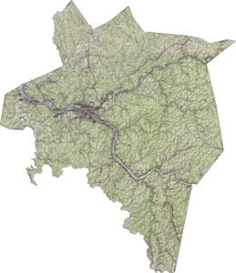
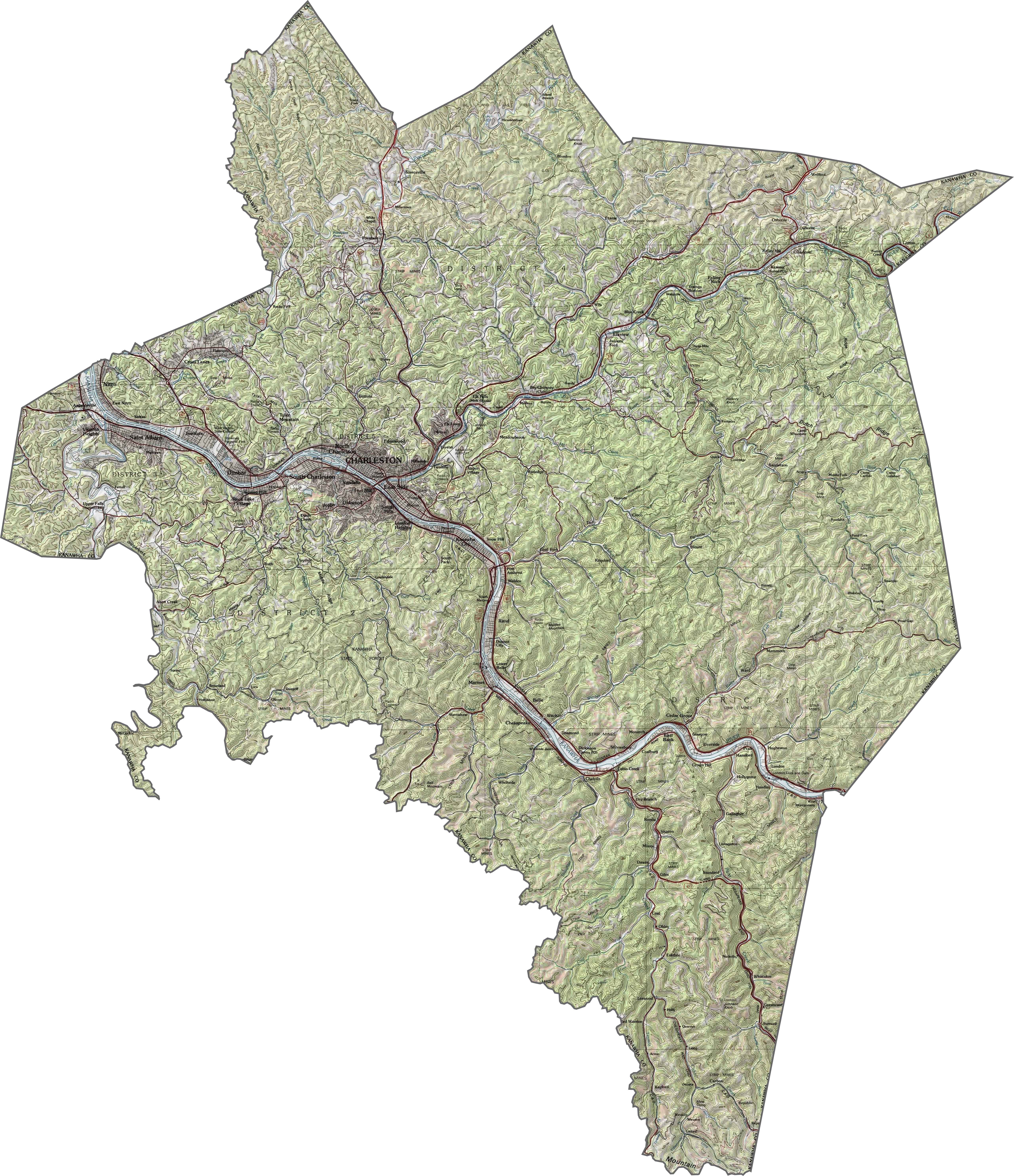
PHYSICAL MAP
Kanawha County Topographic Map
Kanawha County is carved by rivers and framed by steep hills. The Kanawha River runs through the center, cutting a broad valley into otherwise rugged land. Around Charleston, the terrain flattens slightly, but not for long. Hollows, ridges, and densely wooded slopes dominate the outer areas.
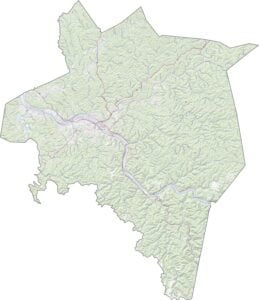
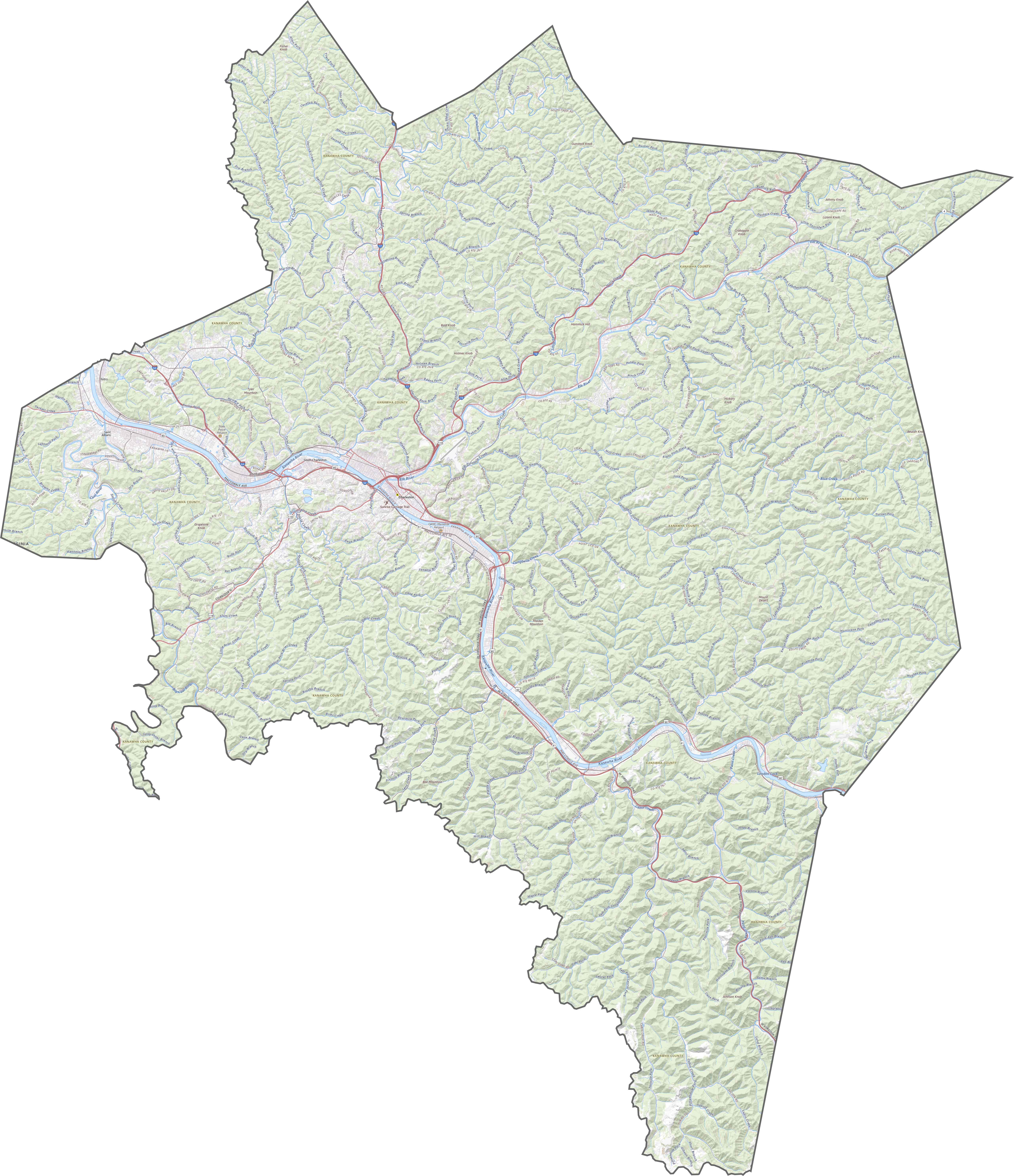
TRANSPORTATION MAP
Kanawha County Road Map
Roads follow the rivers, for the most part. Interstate 64 crosses the county east to west, meeting I-77 and I-79 near Charleston. Although the interstates are straightforward, many smaller roads twist through hills.
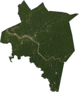
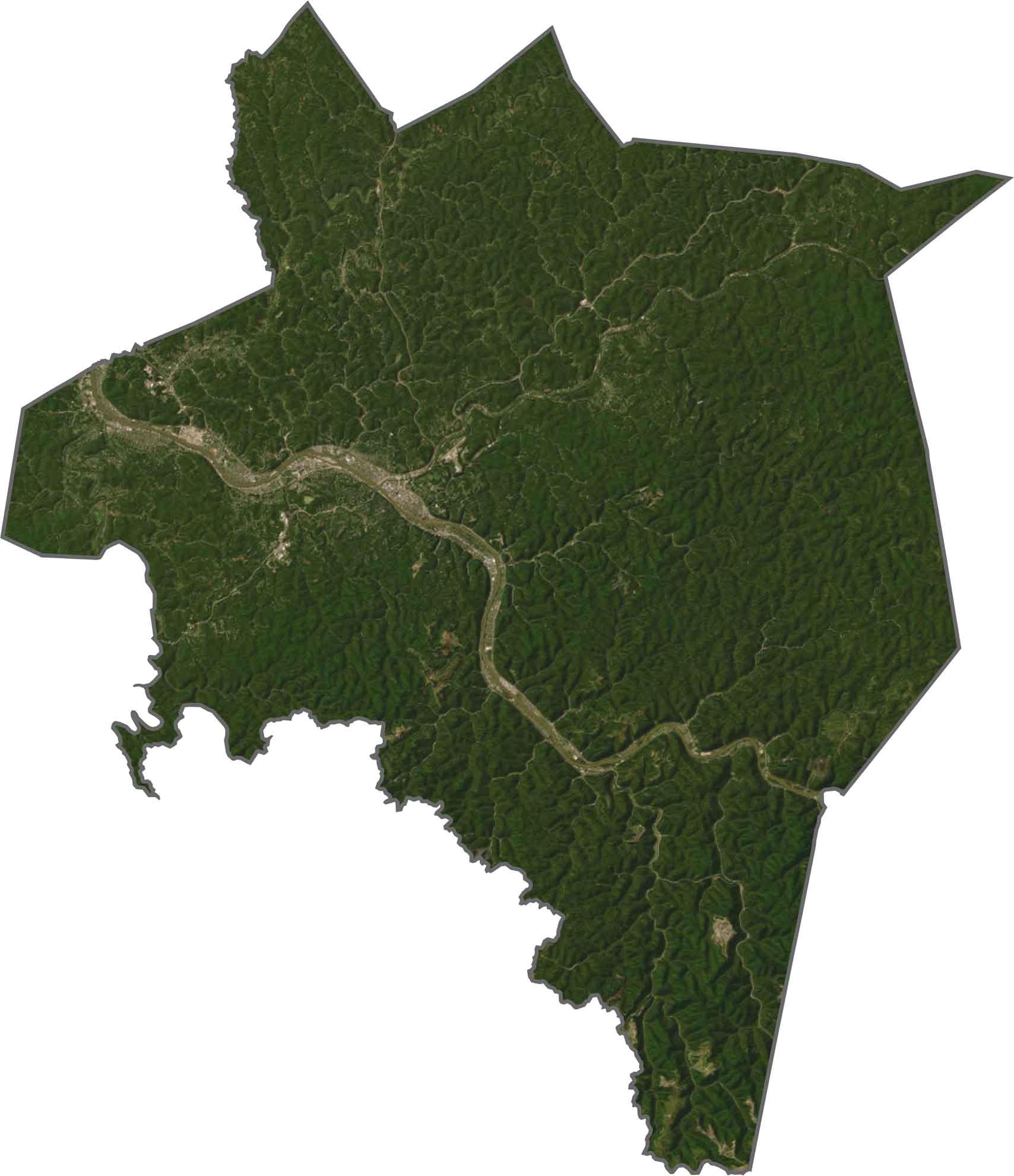
SATELLITE IMAGERY
Kanawha County Satellite Map
Charleston stands out immediately with its gray rooftops, road networks, and of course, the Kanawha River. Outside the city, you’ll spot long stretches of tree cover. A few pockets of open land break it up, but forest wins.
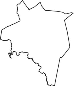
OUTLINE MAP
Kanawha County Blank Map
Kanawha has a bulky, irregular shape. It doesn’t hug any major rivers along its borders. All the borders are with other West Virginia counties. No out-of-state neighbors here.

Neighboring Counties
Here are the 9 neighboring counties of Kanawha County:


West Virginia County Map

Don’t let the size fool you. West Virginia’s 55 counties are anything but small in character. They climb, twist, and hold tight to the hills. You’ll find coal towns and roads that disappear into the trees.