Missoula County Map, Montana

Missoula County Map Collection


We allow you to use our Missoula County map. Attribution is required.
Missoula County, Montana

In western Montana, Missoula County is where the mountains meet the minds. It’s home to the University of Montana, giving the area a lively, hip vibe. Missoula is the county seat and is often called the “Garden City”. You’ll see why when spring hits.
The Clark Fork River runs right through downtown, and on hot days, you’ll spot locals surfing the man-made wave. Hike in the Rattlesnake Wilderness, ski at Snowbowl, or fish in one of the many blue-ribbon trout streams. The food scene here is surprisingly good for a small city.
Locals are a mix of old-school Montanans and new-age hippies, somehow coexisting in perfect harmony. Don’t miss out on the weekly farmer’s market. It’s as much a social event as it is a place to buy veggies. Oh, and keep an eye out for the occasional bear wandering into town. It happens more often than you’d think.
| Category | Details |
|---|---|
| County Name | Missoula County |
| County Seat | Missoula |
| Population | Approximately 125,000 |
| Cities, Towns, and Communities | Missoula, Lolo, Frenchtown, Seeley Lake, East Missoula, Bonner, Clinton |
| Interstates and Highways | I-90, US 93, MT 200 |
| FIPS Code | 30-063 |
| Total Area (Land and Water) | 2,618 square miles (Land: 2,593 sq mi, Water: 25 sq mi) |
| Adjacent Counties (and Direction) | Mineral County (West), Sanders County (Northwest), Lake County (North), Flathead County (Northeast), Powell County (East), Granite County (Southeast), Ravalli County (South), Idaho County, Idaho (Southwest), Clearwater County, Idaho (Southwest) |
| Time Zone | Mountain Time Zone (MT) |
| State | Montana |
| Coordinates | 46.8588° N, 113.9867° W |
| Etymology | Named after the Native American word “Imi-Suletiku” meaning “near the cold water” |
| Major Landmarks | University of Montana, Rattlesnake National Recreation Area, Mount Sentinel |
| Website | Missoula County Website |
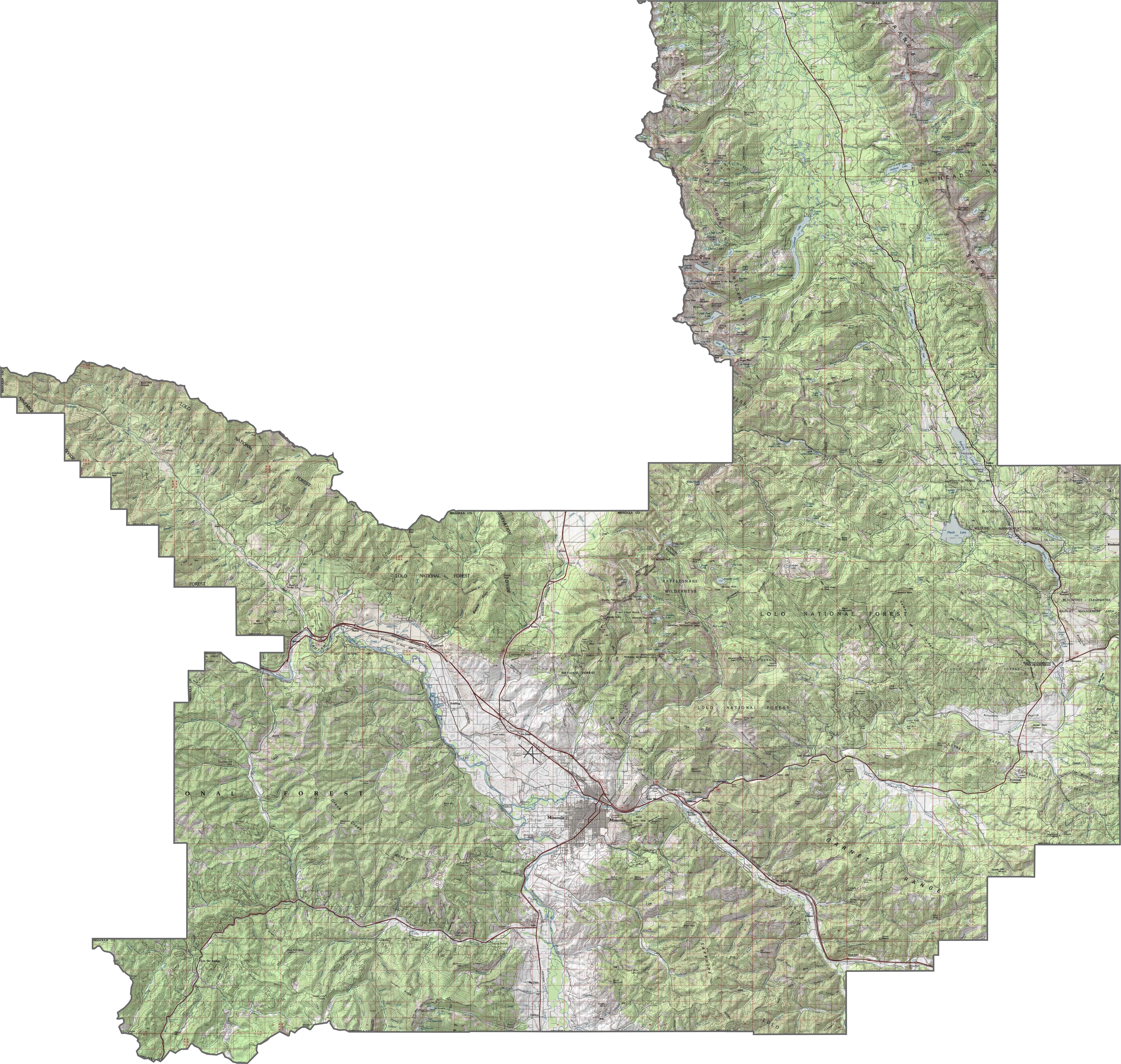
PHYSICAL MAP
Missoula County Topographic Map
Missoula County is both rugged and relaxed. The Bitterroot Mountains press against the west side, rising sharply. Meanwhile, the Clark Fork River carves a deep, winding path through the middle. Although the city of Missoula sits in a broad valley, steep hills creep close by. Elevations swing fast, especially as you head south or west.
TRANSPORTATION MAP
Missoula County Road Map
Missoula County has a tight, busy road network near the city and wide-open highways beyond. Interstate 90 slices east-west across the heart of the county. Although U.S. Highway 93 pulls heavy traffic south toward the Bitterroot Valley, roads get quieter fast outside Missoula. Zoom in below to see Missoula’s road network.

SATELLITE IMAGERY
Missoula County Satellite Map
From above, Missoula County looks like city, forest, and river. The city center shows up bright and dense, but the green rushes in quickly. Although farmland spreads along the valleys, forests dominate the hills.

OUTLINE MAP
Missoula County Blank Map
Missoula County’s shape feels rough but sprawling. It stretches west into the mountains and east into river valleys, refusing to stay neat. It borders Idaho to the southwest.

Neighboring Counties
Here are the 9 neighboring counties of Missoula County:


Montana County Map

Big skies, bigger adventures. Montana’s 56 counties are pure wild wonder. Yellowstone, Glacier and Grand Teton. Big Sky Country knows how to show off.