Pennington County Map, South Dakota

Pennington County Map Collection
We allow you to use our Pennington County map. Attribution is required.
Pennington County, South Dakota

The Black Hills dominate the western landscape of Pennington County. Bustling Rapid City serves as the county seat, while vast prairies stretch to the east.
Mount Rushmore brings in tourists by the millions each year. But there’s more to see. Badlands National Park offers otherworldly vistas.
The county’s history runs deep. Native American culture thrives here. People who love the outdoors flock to the area for hiking, camping, and rock climbing. Summers are mild and perfect for exploring. Winter? Well, let’s not talk about that.
| Category | Details |
|---|---|
| County Name | Pennington County |
| County Seat | Rapid City |
| Population | Approximately 120,000 |
| Cities, Towns, and Communities | Rapid City, Hill City, Keystone, Wall, New Underwood, Box Elder |
| Interstates and Highways | Interstate 90, U.S. Highway 16, U.S. Highway 385 |
| FIPS Code | 46-103 |
| Total Area (Land and Water) | 2,784 square miles (2,776 sq mi land, 8 sq mi water) |
| Adjacent Counties (and Direction) | Meade County (North), Ziebach County (Northeast), Haakon County (Northeast), Jackson County (Southeast), Oglala Lakota County (South), Custer County (Southwest), Weston County, Wyoming (West), Lawrence County (Northwest) |
| Time Zone | Mountain Time Zone (MST) |
| State | South Dakota |
| Coordinates | 44°01’N, 103°40’W |
| Etymology | Named after John L. Pennington, the second governor of Dakota Territory |
| Major Landmarks | Mount Rushmore National Memorial, Badlands National Park, Black Hills National Forest, Custer State Park |
| Website | Pennington County Website |
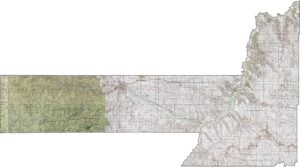
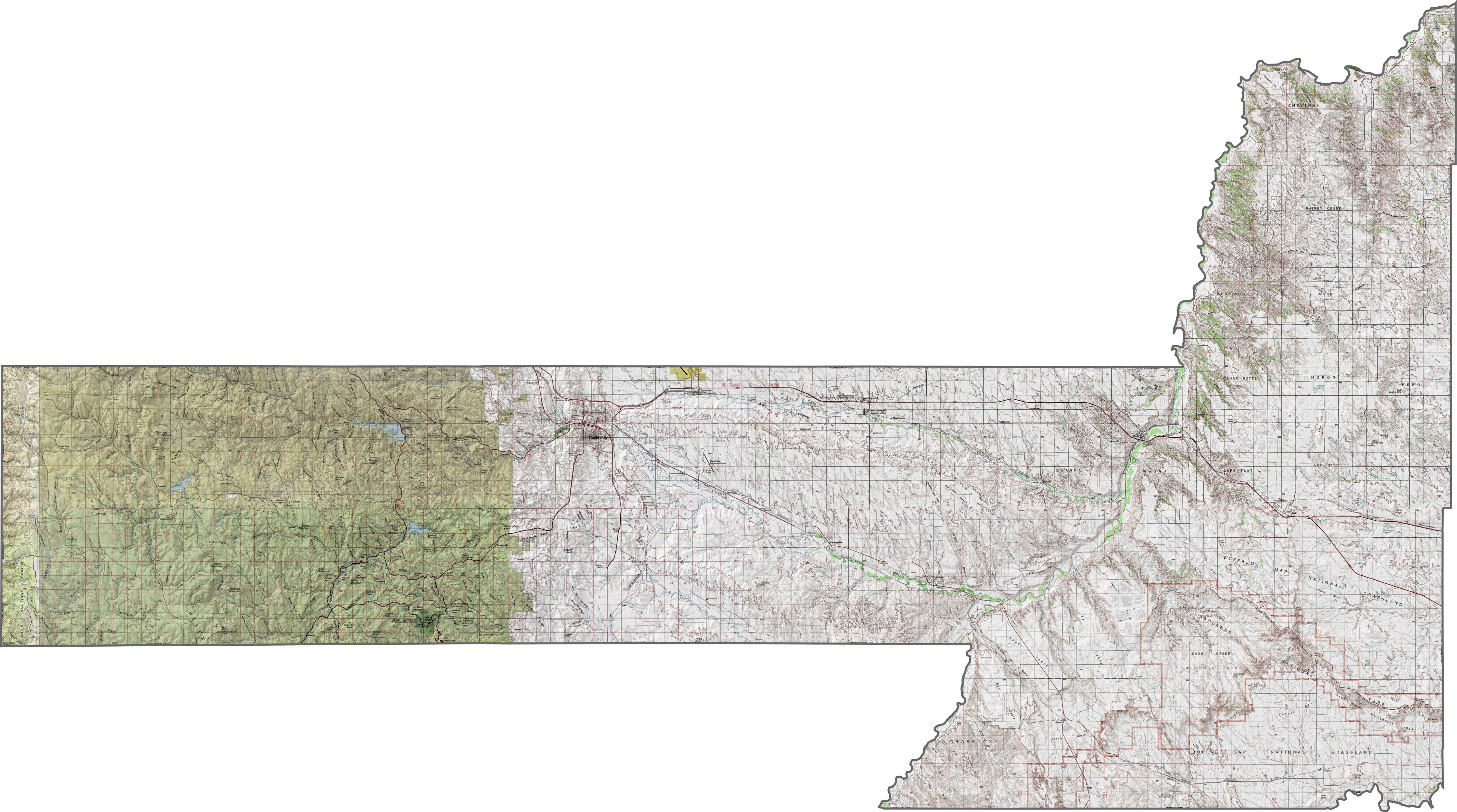
PHYSICAL MAP
Pennington County Topographic Map
Pennington County contains some of South Dakota’s wildest terrain. The Black Hills rise steeply in the west, with rugged peaks and forested slopes. It’s the most mountainous part of the state. Elevation drops quickly as you head east, flattening into prairie. Our zoom tool can help you spot every elevation contour.
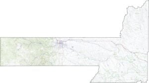
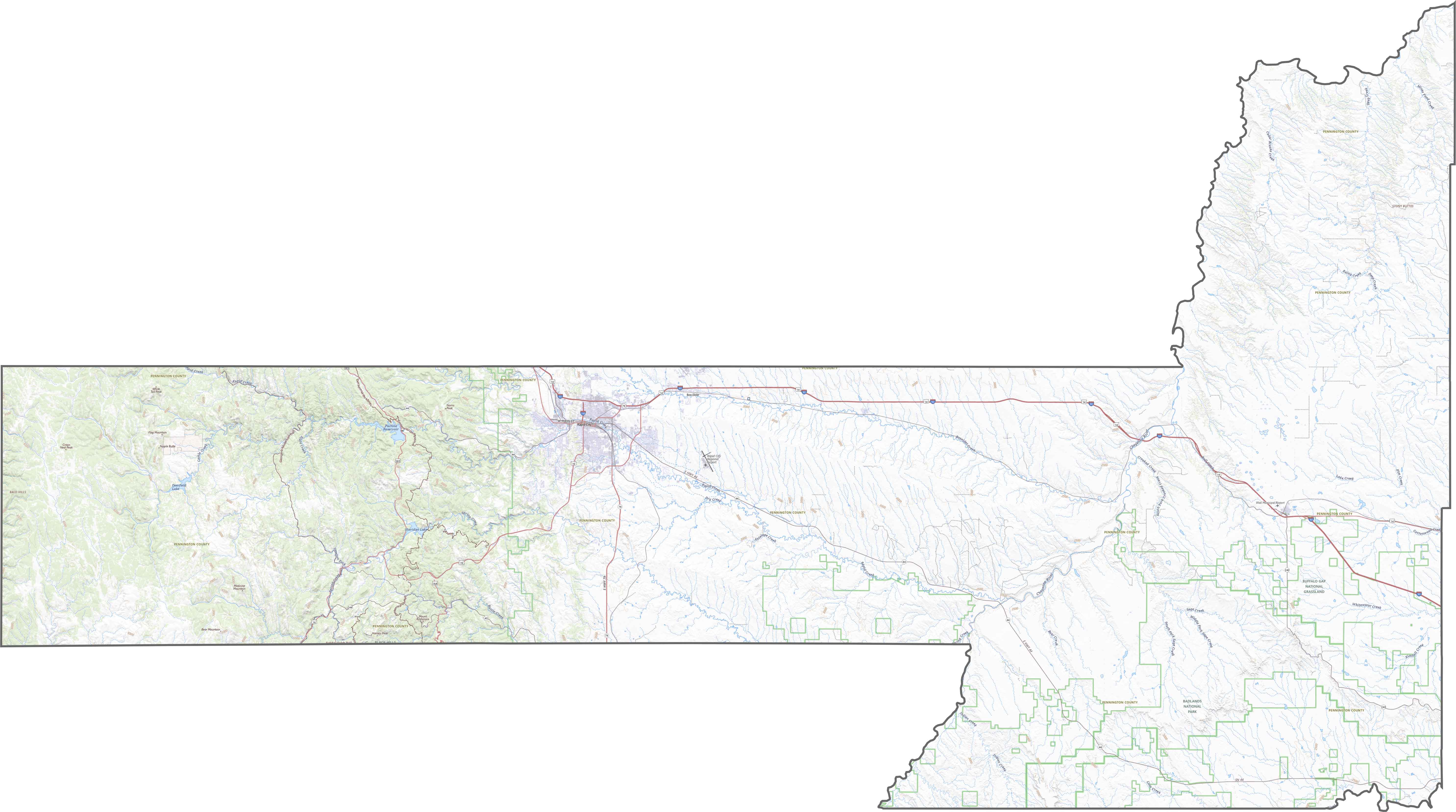
TRANSPORTATION MAP
Pennington County Road Map
Roads here do a bit more climbing. They weave between ridges and valleys in the west, then straighten out as you move east. I-90 is the major highway, which moves traffic in an east-west direction. However, not every turn leads to pavement as gravel roads are still common out here.
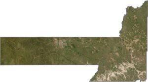
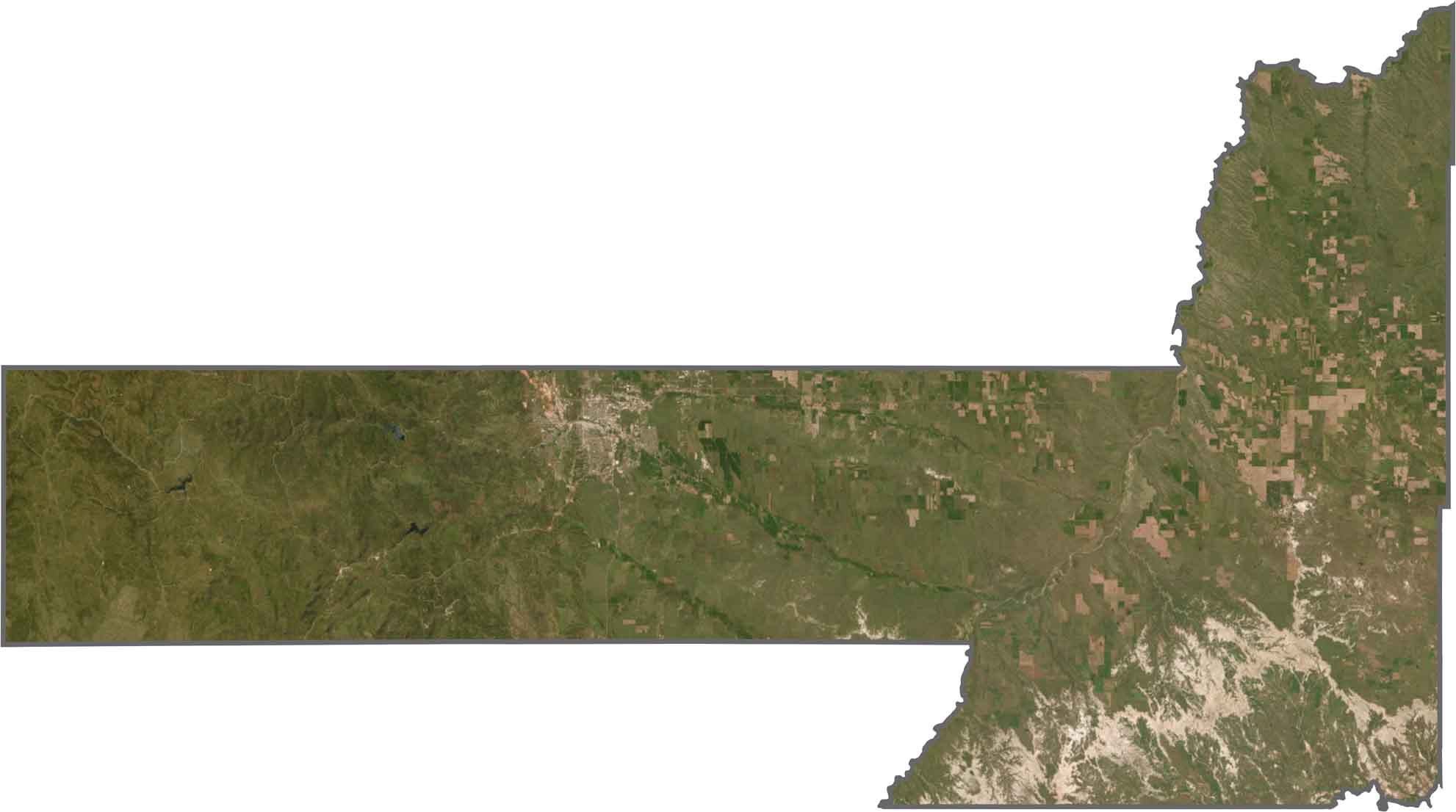
SATELLITE IMAGERY
Pennington County Satellite Map
From above, you’ll notice a dramatic contrast. The western half is dark green and rugged, thick with trees and broken ridgelines. The eastern side turns gold and tan, with lighter patches of farmland. Rapid City also stands out in grey.
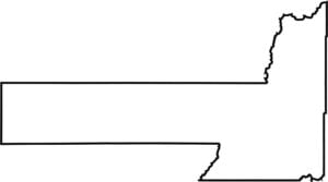
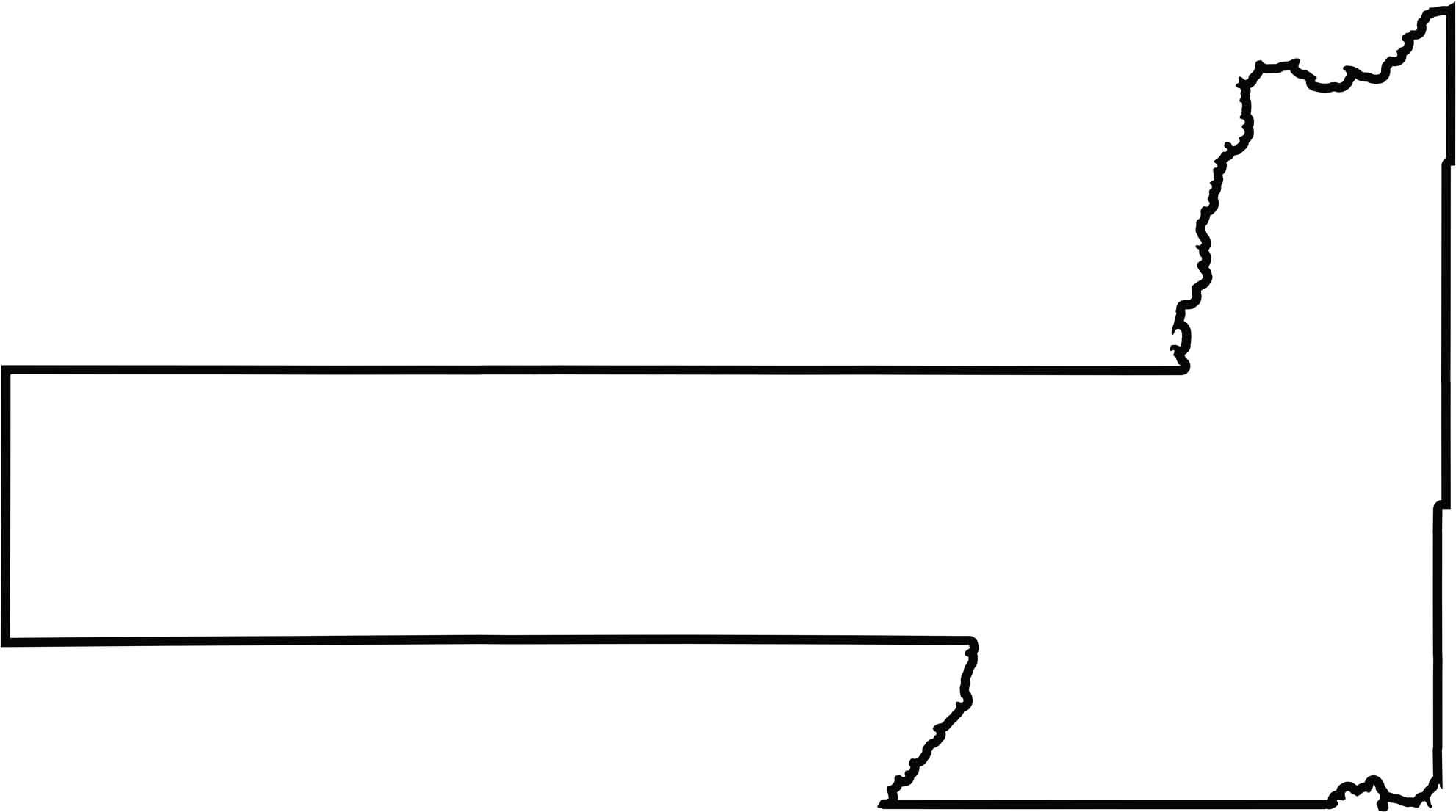
OUTLINE MAP
Pennington County Blank Map
Pennington’s shape is wide on the east side, and rectangular on the western section where the Black Hills push into the boundary. The county borders Wyoming to the west. It stretches farther west than you’d expect, giving it a broad footprint on the map. The Cheyenne River defines part of its boundary in the north and south.
Neighboring Counties
Here are the 8 neighboring counties of Pennington County:


South Dakota County Map

South Dakota’s 66 counties cover a lot of ground. Some of it is jagged and surreal, like the Badlands. Another might be all wheat and quiet roads. It’s a wild mix, in the best way.