Scott County Map, Iowa

Scott County Map Collection


We allow you to use our Scott County map. Attribution is required.
Scott County, Iowa

Scott County hugs the Mississippi River in eastern Iowa, anchored by the Quad Cities. Davenport, the county seat, is Iowa’s third-largest city.
The county’s named after General Winfield Scott, a War of 1812 hero. Interstate 80 and 74 provide easy access, making it a major transportation hub.
Scott County is also home to the annual Bix Beiderbecke Memorial Jazz Festival, celebrating the famous jazz musician who hailed from Davenport.
| Category | Details |
|---|---|
| County Name | Scott County |
| County Seat | Davenport |
| Population | 185,500 |
| Cities, Towns, and Communities | Davenport, Bettendorf, Eldridge, Panorama Park, and several smaller communities |
| Interstates and Highways | Interstate 80, Interstate 74, U.S. Highway 61, U.S. Highway 67 |
| FIPS Code | 19-163 |
| Total Area (Land and Water) | 468 square miles (land: 459 sq mi, water: 9 sq mi) |
| Adjacent Counties (and Direction) | Clinton County (North), Rock Island County, Illinois (East), Muscatine County (Southwest), Cedar County (Northwest) |
| Time Zone | Central Time Zone (CST) |
| State | Iowa |
| Coordinates | 41.55°N, 90.58°W |
| Etymology | Named after Winfield Scott, War of 1812 General |
| Major Landmarks | The Figge Art Museum, the Davenport Skybridge, and the Scott County Courthouse |
| Website | Scott County Website |
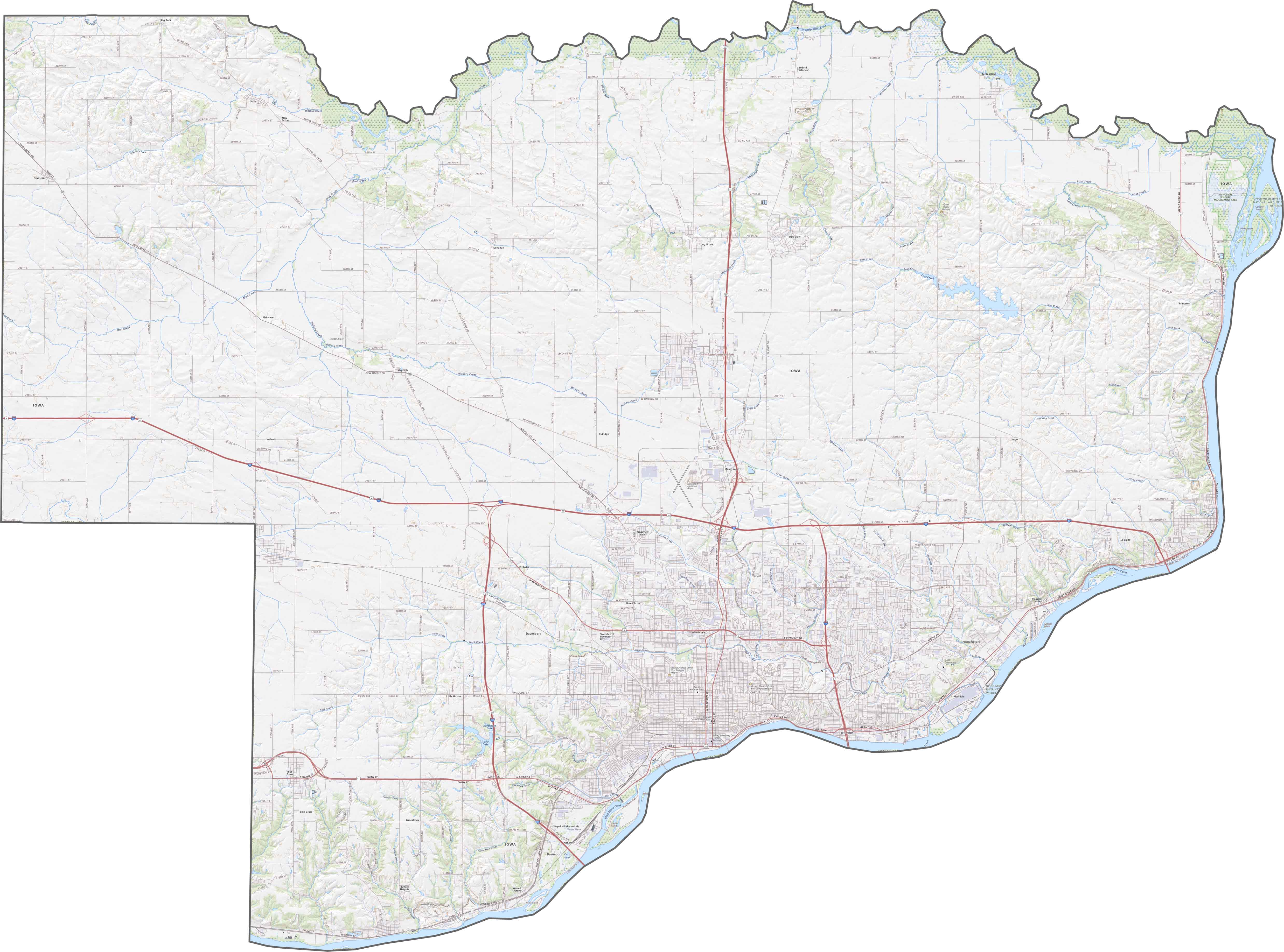
TRANSPORTATION MAP
Scott County Road Map
Interstate 80 speeds past Davenport, while I-280 loops around it. The Mississippi River shapes the east, and US 61 follows the shore. Explore more on our road map below.
SATELLITE IMAGERY
Scott County Satellite Map
Davenport and Bettendorf stand out along the Mississippi, with dense development near the river. The Mississippi’s wide, winding path is the most prominent feature here. Farmland covers the western half, though subdivisions are expanding.

OUTLINE MAP
Scott County Blank Map
Scott County is an irregular shape, with the Mississippi River forming its entire eastern border. It directly borders Illinois (Rock Island County) across the river.

Neighboring Counties
Here are the 4 neighboring counties of Scott County:


Iowa County Map

Where the sky stretches wide and the backroads lead to something real. Come find the grace in wide-open spaces in one of Iowa’s 99 counties.