Travis County Map, Texas

Travis County Map Collection


We allow you to use our Travis County map. Attribution is required.
Travis County, Texas

The heart of Texas beats in Travis County. Austin, the state capital, dominates the scene here. It’s weird. It’s wonderful. It’s growing like crazy.
The county stretches from the Edwards Plateau to the Blackland Prairie. You’ve got hills to the west, flatlands to the east. Lake Travis is a popular spot for boating and swimming. Travis County is a melting pot of politics, music, and innovation.
The tech industry is booming, but you’ll still find plenty of old-school Texas charm. Traffic can be a nightmare. But the food scene? Out of this world. It’s not your typical Texas county, that’s for sure.
| Category | Details |
|---|---|
| County Name | Travis County |
| County Seat | Austin |
| Population | Approximately 1,300,000 |
| Cities, Towns, and Communities | Austin, Pflugerville, Manor, Lago Vista |
| Interstates and Highways | Interstate 35, U.S. Highway 183, U.S. Highway 290 |
| FIPS Code | 48-453 |
| Total Area (Land and Water) | 1,022 square miles (1,016 sq mi land, 6 sq mi water) |
| Adjacent Counties (and Direction) | Williamson County (North), Bastrop County (East), Caldwell County (Southeast), Hays County (South), Blanco County (Southwest), Burnet County (Northwest) |
| Time Zone | Central Time Zone (CST) |
| State | Texas |
| Coordinates | 30°16’N, 97°45’W |
| Etymology | Named after William B. Travis, a hero of the Alamo |
| Major Landmarks | Texas State Capitol, Barton Springs, Lady Bird Lake |
| Website | Travis County Website |
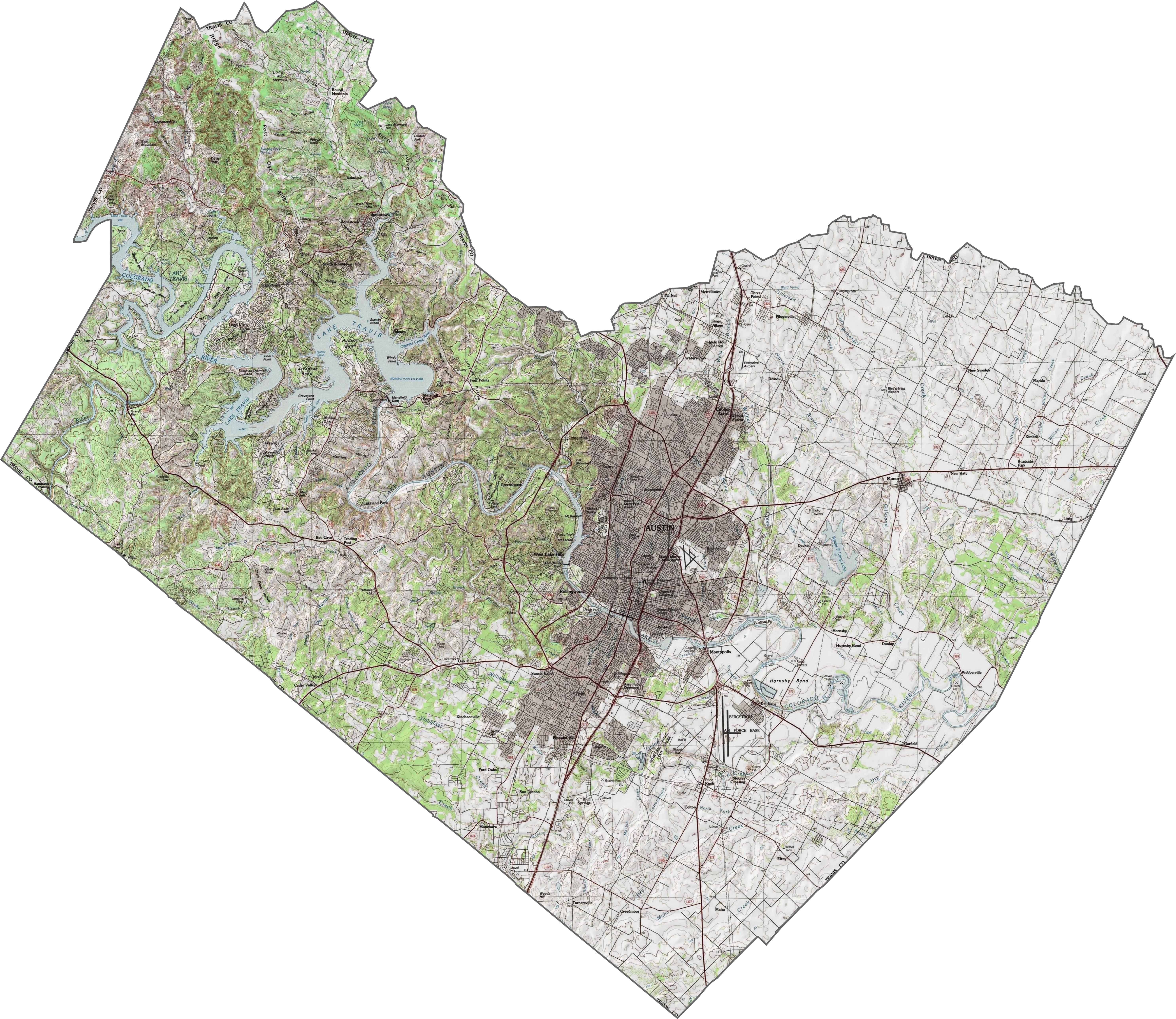
PHYSICAL MAP
Travis County Topographic Map
Travis County is where the Hill Country begins. Elevation rises sharply west of Austin, forming steep slopes and limestone cliffs. The standout? Lake Travis, a long reservoir that snakes through the canyon-like terrain.
TRANSPORTATION MAP
Travis County Road Map
Travis County is a system of roads, ramps, and loops, all leading in and out of Austin. East-west corridors slice across hills, while north-south highways like I-35 push through suburbs. It’s busy, built-up, and fast-moving. Use our zoom tool below to find the best route.

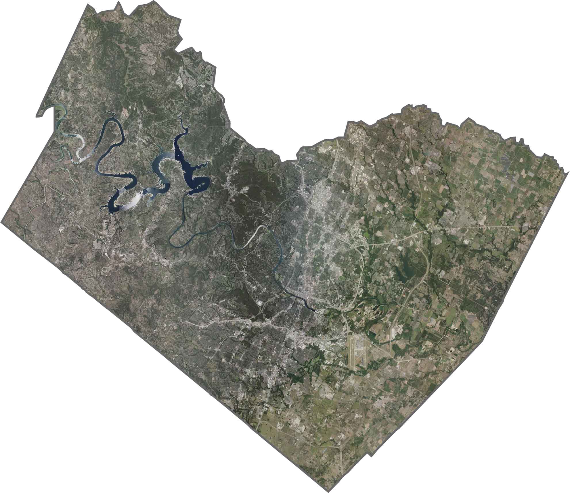
SATELLITE IMAGERY
Travis County Satellite Map
The western side of Travis County is rugged. It’s patchy with vegetation and crisscrossed by winding roads. Austin dominates the center. In between, Lake Travis and the Colorado River twists through across the hills.
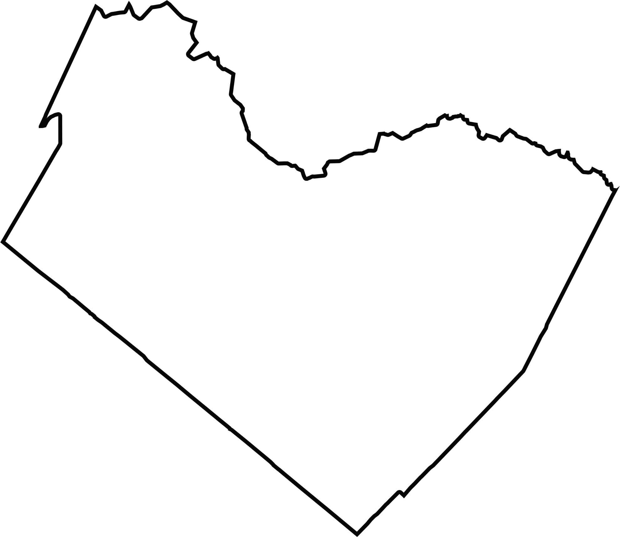
OUTLINE MAP
Travis County Blank Map
The county’s shape is long and stretched, almost diagonal. It doesn’t follow a river on the edge, but waterways like the Colorado River run right through it. Surrounded by fellow Texas counties, it’s wedged into Central Texas with no state border nearby.
Neighboring Counties
Here are the 6 neighboring counties of Travis County:


Texas County Map

254 legendary Texas county maps. From the Panhandle to the Rio Grande, we’ve got the Lone Star State mapped. That means more rodeos, honky-tonk, and Texas BBQ.