Warren County Map, New Jersey

Warren County Map Collection


We allow you to use our Warren County map. Attribution is required.
Warren County, New Jersey

Warren County is in the northwestern corner of New Jersey, bordering Pennsylvania. It’s a place where the Delaware River meets rolling hills and farmland. Belvidere is the county seat. It feels like a step back in time with its Victorian architecture.
The county is a paradise for its outdoors. You can hike part of the Appalachian Trail or kayak down the Delaware (the western border). The county has deep agricultural roots. You’ll find plenty of farm stands selling fresh produce and homemade goods.
Try exploring the Oxford Furnace. It’s a reminder of the area’s iron-making past. Warren County is quieter than other counties in New Jersey. Come here to escape the noise and rediscover the simple life.
| Category | Details |
|---|---|
| County Name | Warren County |
| County Seat | Belvidere |
| Population | Approximately 110,000 |
| Cities, Towns, and Communities | Phillipsburg, Hackettstown, Washington, Blairstown, Belvidere, Alpha, Allamuchy, Hope |
| Interstates and Highways | Interstate 80, U.S. Route 46, U.S. Route 22, New Jersey Route 31, New Jersey Route 57 |
| FIPS Code | 34-041 |
| Total Area (Land and Water) | 364 square miles (356 sq mi land, 8 sq mi water) |
| Adjacent Counties (and Direction) | Monroe County, Pennsylvania (Northwest), Sussex County (Northeast), Northampton County, Pennsylvania (West), Morris County (East), Bucks County, Pennsylvania (Northwest), Hunterdon County (South) |
| Time Zone | Eastern Time Zone (ET) |
| State | New Jersey |
| Coordinates | 40.8298° N, 75.0745° W |
| Etymology | Named after Joseph Warren, an American Revolutionary War hero |
| Major Landmarks | Delaware Water Gap National Recreation Area, Merrill Creek Reservoir, Shippen Manor |
| Website | Warren County Website |
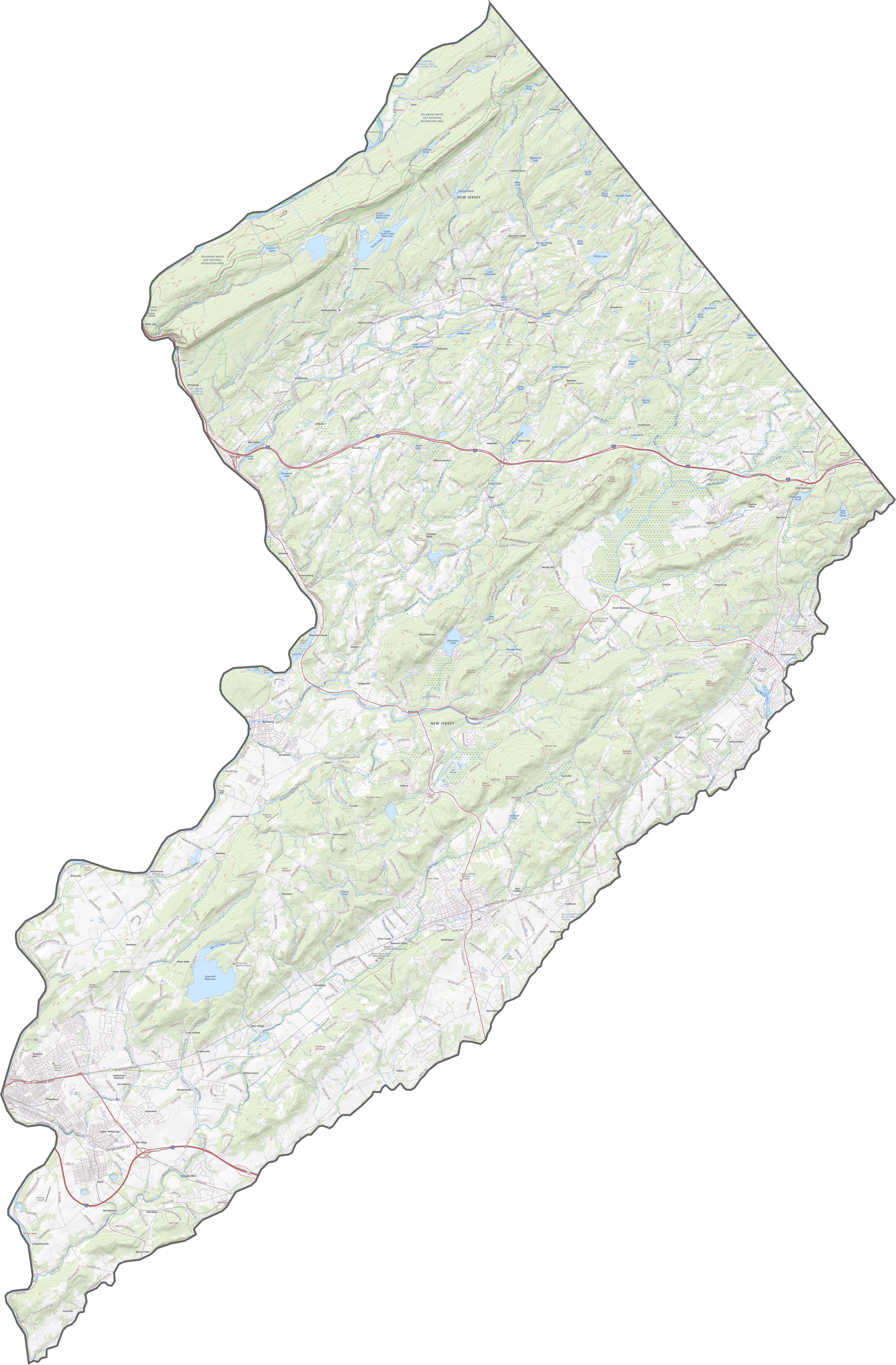
PHYSICAL MAP
Warren County Topographic Map
Hills, ridges, and river valleys make Warren feel like the edge of the Appalachians. The terrain changes often. Some areas are open farmland, others are wooded and steep. It’s not flat, and it doesn’t pretend to be.

TRANSPORTATION MAP
Warren County Road Map
I-78 and I-80 both run through Warren, which is rare for a rural county. Route 46 parallels I-80, hopping from town to town. Though Route 31 dips in briefly, most of the roads here are local, winding, and scenic. Highways may cross it, but backroads define it. Try out our zoom tool in our road map below to see it all.
SATELLITE IMAGERY
Warren County Satellite Map
Green covers most of Warren County. Trees, farms, and long stretches of nothing much. The Delaware River outlines the west, right on the border. Towns like Phillipsburg and Hackettstown are visible but small in the big picture.

OUTLINE MAP
Warren County Blank Map
The Delaware River draws the entire western border, separating it from Pennsylvania. Its shape is long and slanted, tapering as it goes north. The eastern edge is also jagged. The only straight lines that can be found are in the northeast.

Neighboring Counties
Here are the 6 neighboring counties of Warren County:


New Jersey County Map

New Jersey packs a lot into 21 counties – beach towns, pine forests and farmland. Trace the colonial history in Hunterdon or walk the boardwalk in Ocean County. There’s more here than meets the Turnpike.