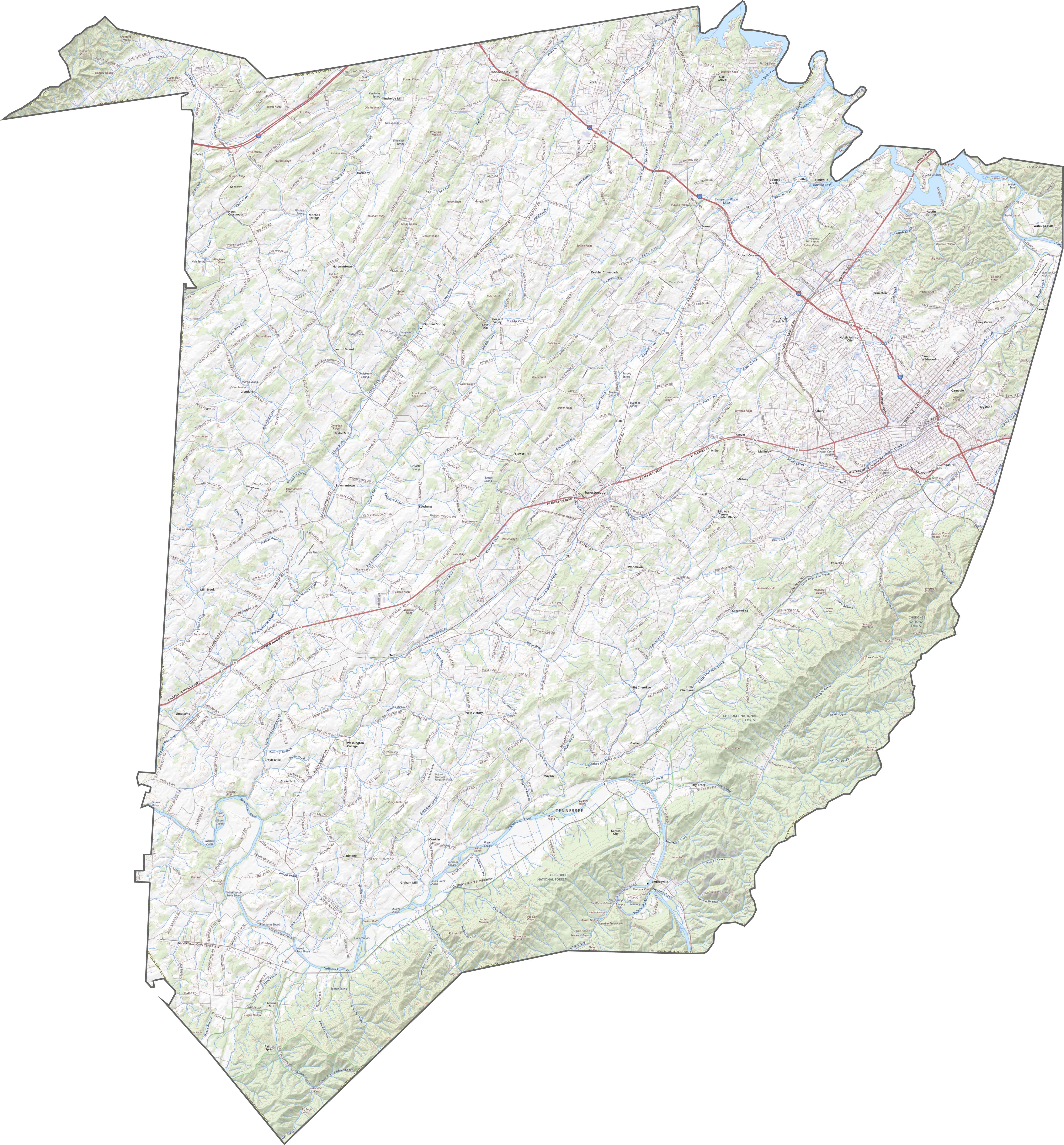
Washington County Map, Tennessee

Washington County Map Collection

We allow you to use our Washington County map. Attribution is required.
Washington County, Tennessee

Washington County sits in the northeastern corner of Tennessee, part of the Tri-Cities region. Jonesborough, the county seat, is the oldest town in the state.
Visitors love it here. The storytelling festival draws folks from all over. Johnson City, the largest city, is home to East Tennessee State University. It has a cool mix of college town vibes and Appalachian charm.
The county has some beautiful scenery. Check out the view from Buffalo Mountain. Agriculture is still important here so you’ll see plenty of farms. The people are friendly and proud of their mountain heritage.
| Category | Details |
|---|---|
| County Name | Washington County |
| County Seat | Jonesborough |
| Population | Approximately 140,000 |
| Cities, Towns, and Communities | Johnson City, Jonesborough, Telford, Limestone |
| Interstates and Highways | Interstate 26, U.S. Highway 11E, U.S. Highway 321 |
| FIPS Code | 47-179 |
| Total Area (Land and Water) | 330 square miles (326 sq mi land, 4 sq mi water) |
| Adjacent Counties (and Direction) | Sullivan County (North), Carter County (East), Unicoi County (South), Greene County (West), Hawkins County (Northwest) |
| Time Zone | Eastern Time Zone (EST) |
| State | Tennessee |
| Coordinates | 36°20’N, 82°30’W |
| Etymology | Named after George Washington, the first President of the United States |
| Major Landmarks | International Storytelling Center, Jonesborough Historic District, Tipton-Haynes Historic Site |
| Website | Washington County Website |
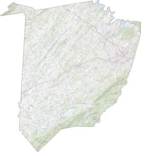
TRANSPORTATION MAP
Washington County Road Map
Washington County has routes that twist with the mountains. I-26 slices diagonally across the county, linking Johnson City with the outside world. Smaller roads fan out in all directions. The mix can feel chaotic at first, but it’s functional. You can always zoom in below to see how the whole road network connects.
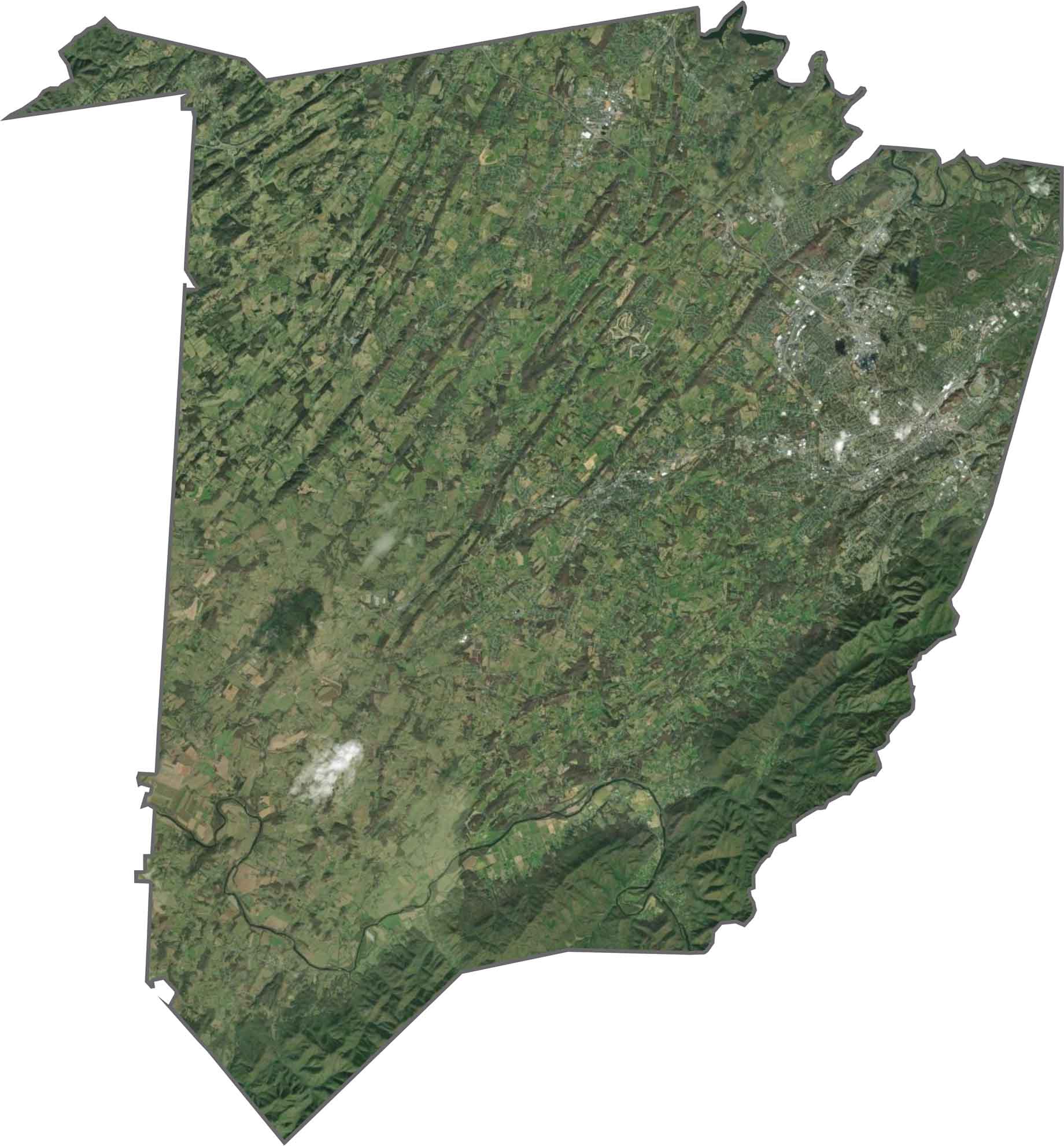
SATELLITE IMAGERY
Washington County Satellite Map
From above, Johnson City stretches across the eastern section. But beyond that, the land gets green fast. Ridges throw shadows in long lines, while farms and neighborhoods fill the valleys. Forests climb the southeastern hills. A few lakes and reservoirs appear in our satellite map.
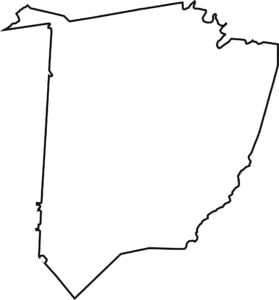
OUTLINE MAP
Washington County Blank Map
The shape of Washington County is jagged with a tail out in the northwest. It’s extremely close to North Carolina and Virginia, but it doesn’t technically border any of them.

Neighboring Counties
Here are the 5 neighboring counties of Washington County:


Tennessee County Map

There’s no such thing as a boring county in Tennessee. Some stretch through the Smokies, others roll out into Delta flatlands. Every county’s shaped by the land and it shows.