Yolo County Map, California

Yolo County Map Collection
We allow you to use our Yolo County map. Attribution is required.
Yolo County, California

You Only Live Once. No, not that YOLO. Yolo County, California is just west of Sacramento. Davis is the biggest city, home to UC Davis. It is a serious bike town.
Woodland is the county seat, with a cute downtown. There is a lot of farming here, including tomatoes, rice, and almonds. The Cache Creek Casino is in the rural part of the county.
The Yolo Bypass Wildlife Area is great for birding. Sacramento International Airport is actually just outside Yolo County. This county is more affordable than the Bay Area, but it has horrifically hot summers.
| Category | Details |
|---|---|
| County Name | Yolo County |
| County Seat | Woodland |
| Population | Approximately 240,000 |
| Cities, Towns, and Communities | Davis, Woodland, West Sacramento, Winters, Esparto |
| Interstates and Highways | I-5, SR 113, SR 16 |
| FIPS Code | 06-113 |
| Total Area (Land and Water) | 1,024 square miles (Land: 1,014 sq mi, Water: 10 sq mi) |
| Adjacent Counties (and Direction) | Colusa County (North), Sutter County (Northeast), Sacramento County (East), Solano County (South), Napa County (West), Lake County (Northwest) |
| Time Zone | Pacific Standard Time (PST) |
| State | California |
| Coordinates | 38.6785° N, 121.7382° W |
| Etymology | Named after the Yolo people, a Native American tribe from the area |
| Major Landmarks | UC Davis Arboretum, Cache Creek, Sacramento River, Yolo Bypass Wildlife Area |
| Website | Yolo County Website |
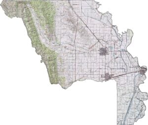
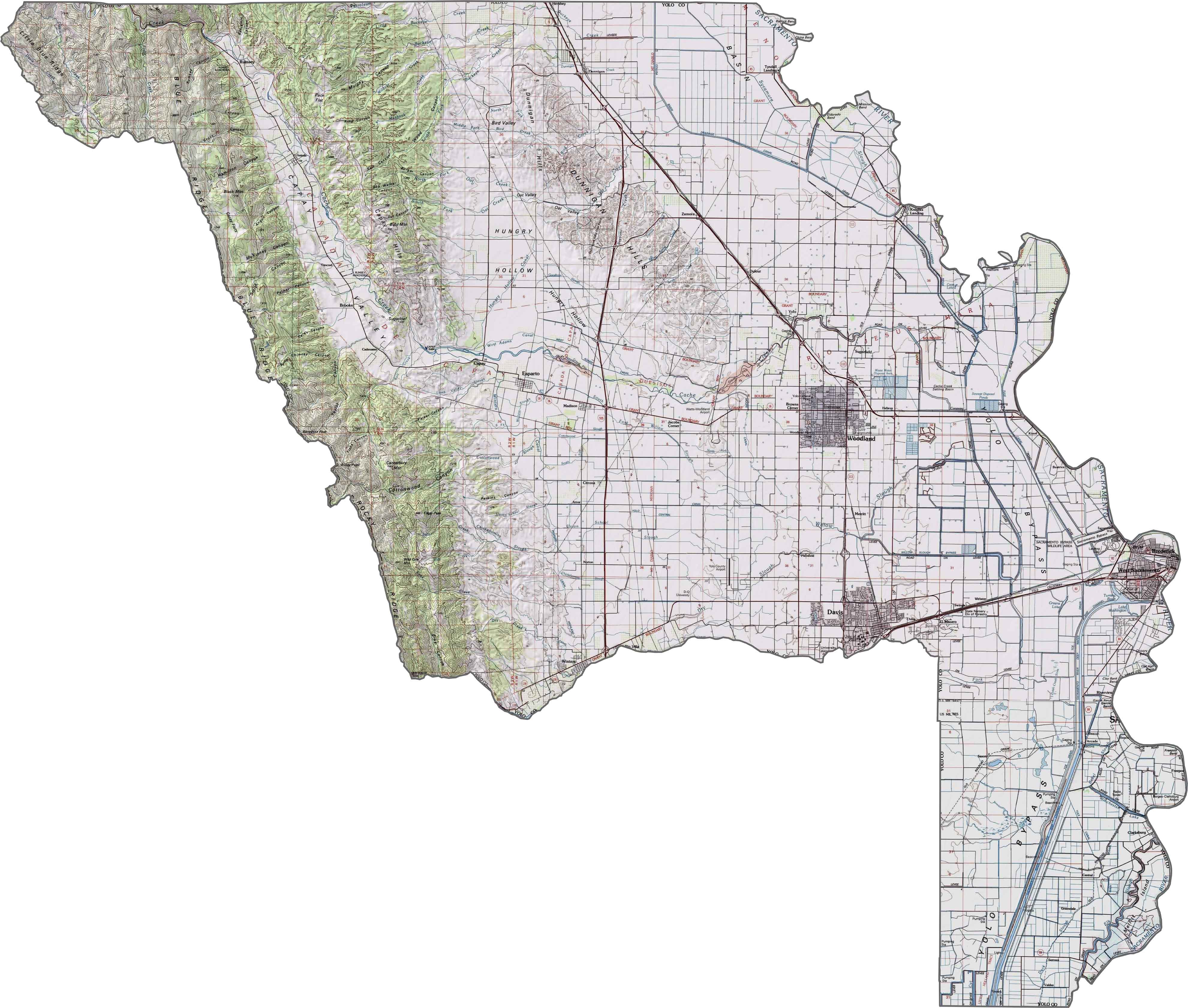
PHYSICAL MAP
Yolo County Topographic Map
Zoom in on our topographic map to study Yolo County’s predominantly flat agricultural landscape. The terrain features level farmland with gradual elevation increases toward the coastal mountains in the west.
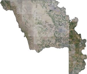
SATELLITE IMAGERY
Yolo County Satellite Map
Agricultural development dominates this Sacramento Valley county. Davis and Woodland appear as urban centers amid the predominantly rural landscape.

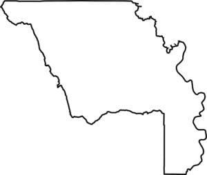
OUTLINE MAP
Yolo County Blank Map
This blank map features Yolo County’s rectangular outline in the Sacramento Valley. The eastern boundary follows the Sacramento River while the western edge extends into the Coast Range foothills.

Neighboring Counties
Here are the 6 neighboring counties of Yolo County:


California County Map

Ever wonder how California’s 58 counties stack up? Our California county map lays them all out, from the coast to the deserts. Take a look and find the ones you know — and maybe a few you don’t.