Madison County Map, Illinois

Madison County Map Collection
We allow you to use our Madison County map. Attribution is required.
Madison County, Illinois

Madison County sits in southwestern Illinois, right across the Mississippi River from St. Louis. Alton, the largest city, is known for its limestone bluffs and riverfront views. Manufacturing and healthcare drive the economy these days.
You’ll find a mix of farmland, forests, and communities here. Outdoor people love exploring the miles of bike trails that crisscross the area. Local festivals celebrate everything from apple orchards to barbecue.
Madison County has a little bit of everything, from lively towns like Edwardsville to miles of peaceful farmland. With the Mississippi River running along its edge, it’s a great spot for everyone to enjoy.
| Category | Details |
|---|---|
| County Name | Madison County |
| County Seat | Edwardsville |
| Population | Approximately 270,000 |
| Cities, Towns, and Communities | Alton, Granite City, Collinsville, Troy, and several unincorporated communities |
| Interstates and Highways | Interstate 55, Interstate 64, Interstate 270, U.S. Highway 40, U.S. Highway 67, Illinois Route 3 |
| FIPS Code | 17-119 |
| Total Area (Land and Water) | 738 square miles (land: 715 sq mi, water: 23 sq mi) |
| Adjacent Counties (and Direction) | Bond County (East), Clinton County (Southeast), Jersey County (Northwest), Macoupin County (North), Montgomery County (Northeast), St. Charles County, Missouri (Northwest), St. Clair County (South), St. Louis, Missouri (West), St. Louis County, Missouri (West) |
| Time Zone | Central Time Zone (CT) |
| State | Illinois |
| Coordinates | 38.7680° N, 89.9786° W |
| Etymology | Named in honor of James Madison, the fourth President of the United States |
| Major Landmarks | The Gateway Arch (visible from parts of the county), Alton Historic District, and Cahokia Mounds |
| Website | Madison County Website |
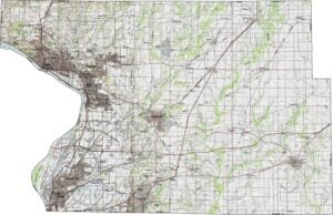
PHYSICAL MAP
Madison County Topographic Map
Rolling hills in the west give way to floodplains near the Mississippi River. This gives Madison County’s topography a mix of bluffs and flatlands. The river itself shapes much of the western scenery. Zoom in to see the elevation shifts.
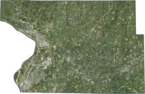
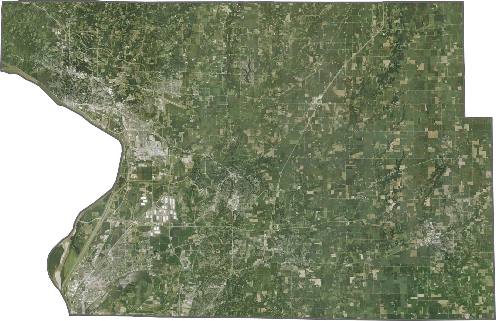
SATELLITE IMAGERY
Madison County Satellite Map
The Mississippi River flows along the western edge, with industrial areas and wetlands hugging its banks. Urban sprawl from St. Louis bleeds into the east, while the central areas show a mix of farmland and small towns. Highways like I-55 and I-270 form clear, bold lines in the landscape.
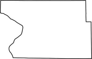
OUTLINE MAP
Madison County Blank Map
Madison County has a western border shaped by the Mississippi River, while the rest follows straight survey lines. It borders Missouri across the river but remains entirely within Illinois.

Neighboring Counties
Here are the 9 neighboring counties of Madison County:


Illinois County Map

Ready to explore Illinois? Counties full of surprises. Chicago’s buzz in Cook. Shawnee’s quiet beauty. History, farms, and charm. Grab an Illinois county map. Find your adventure. Illinois awaits.