Alpine County Map, California

Alpine County Map Collection
We allow you to use our Alpine County map. Attribution is required.
Alpine County, California

Alpine County is where California’s Sierra Nevada really shines. As the smallest county in the state by population, it’s more of a wilderness retreat than a busy hub.
Markleeville, the county seat, is about as laid-back as it gets. You won’t find any traffic lights here, just wide-open spaces and clear mountain air.
Drive along Highway 4 or 89 and you’ll pass through its rugged terrain. They joke that there are more bears than people in Alpine County. So if you visit, bring your bear spray and a good book. The cell service is spotty at best.
| Category | Details |
|---|---|
| County Name | Alpine County |
| County Seat | Markleeville |
| Population | Approximately 1,200 |
| Cities, Towns, and Communities | Markleeville, Bear Valley Village, Woodfords, Alpine Village, Kirkwood |
| Interstates and Highways | State Route 4, State Route 89 |
| FIPS Code | 06-003 |
| Total Area (Land and Water) | 743 square miles (Land: 741 sq mi, Water: 2 sq mi) |
| Adjacent Counties (and Direction) | El Dorado County (Northwest), Douglas County, Nevada (Northeast), Mono County (Southeast), Tuolumne County (South), Calaveras County (Southwest), Amador County (West) |
| Time Zone | Pacific Standard Time (PST) |
| State | California |
| Coordinates | 38.6000° N, 119.5833° W |
| Etymology | Named for the Alpine region, high in the Sierra Nevada |
| Major Landmarks | Lake Tahoe, Kirkwood Mountain Resort, Mokelumne Wilderness |
| Website | Alpine County Website |
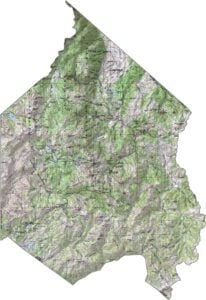
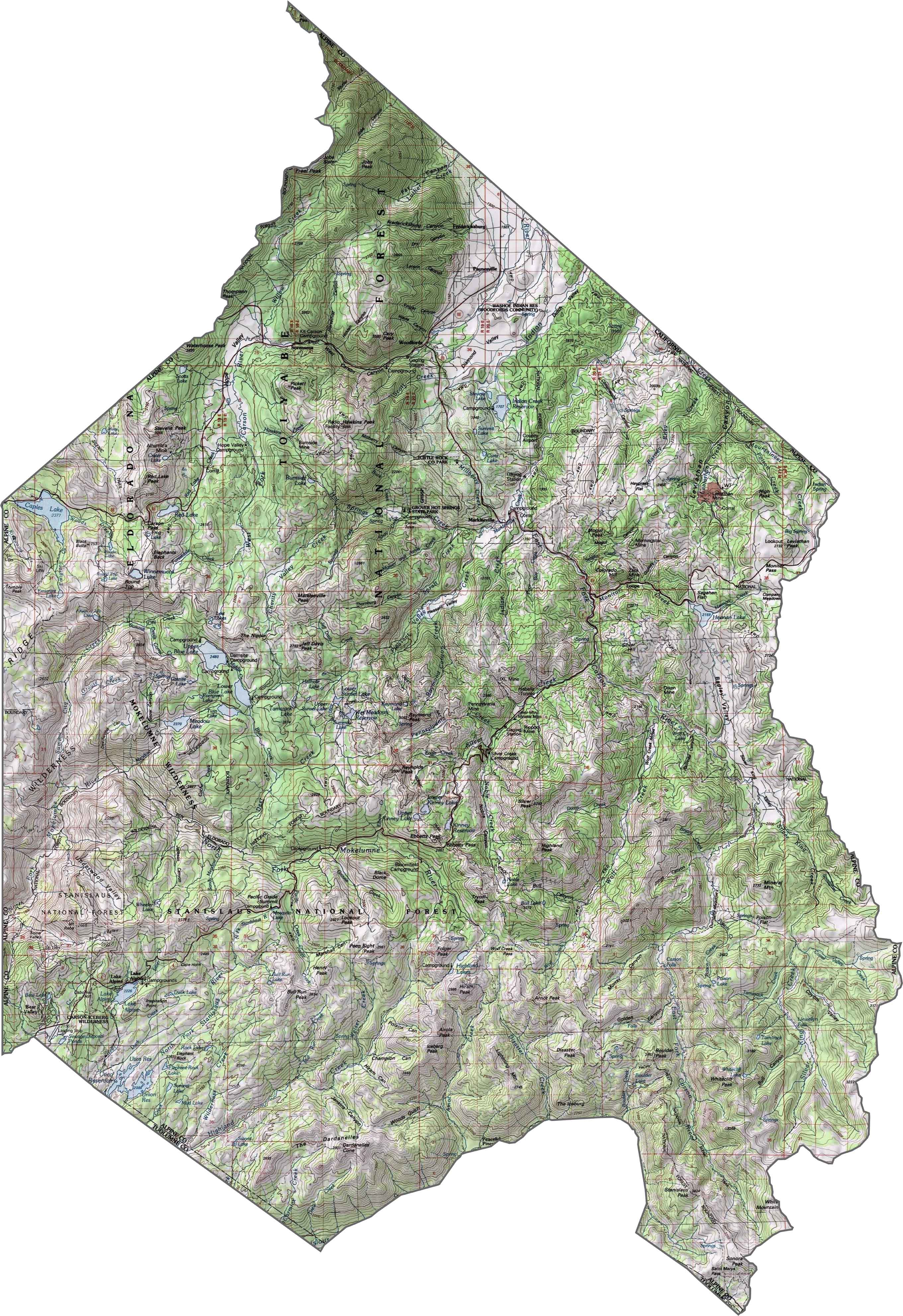
PHYSICAL MAP
Alpine County Topographic Map
The terrain of Alpine County features high peaks, deep valleys, and numerous alpine lakes. Use our zoom tool to check out the mountainous landscape and contours of the Sierra Nevada range.
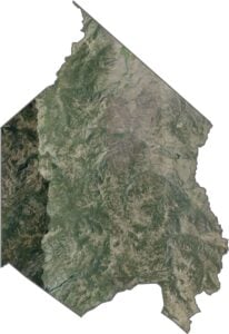
SATELLITE IMAGERY
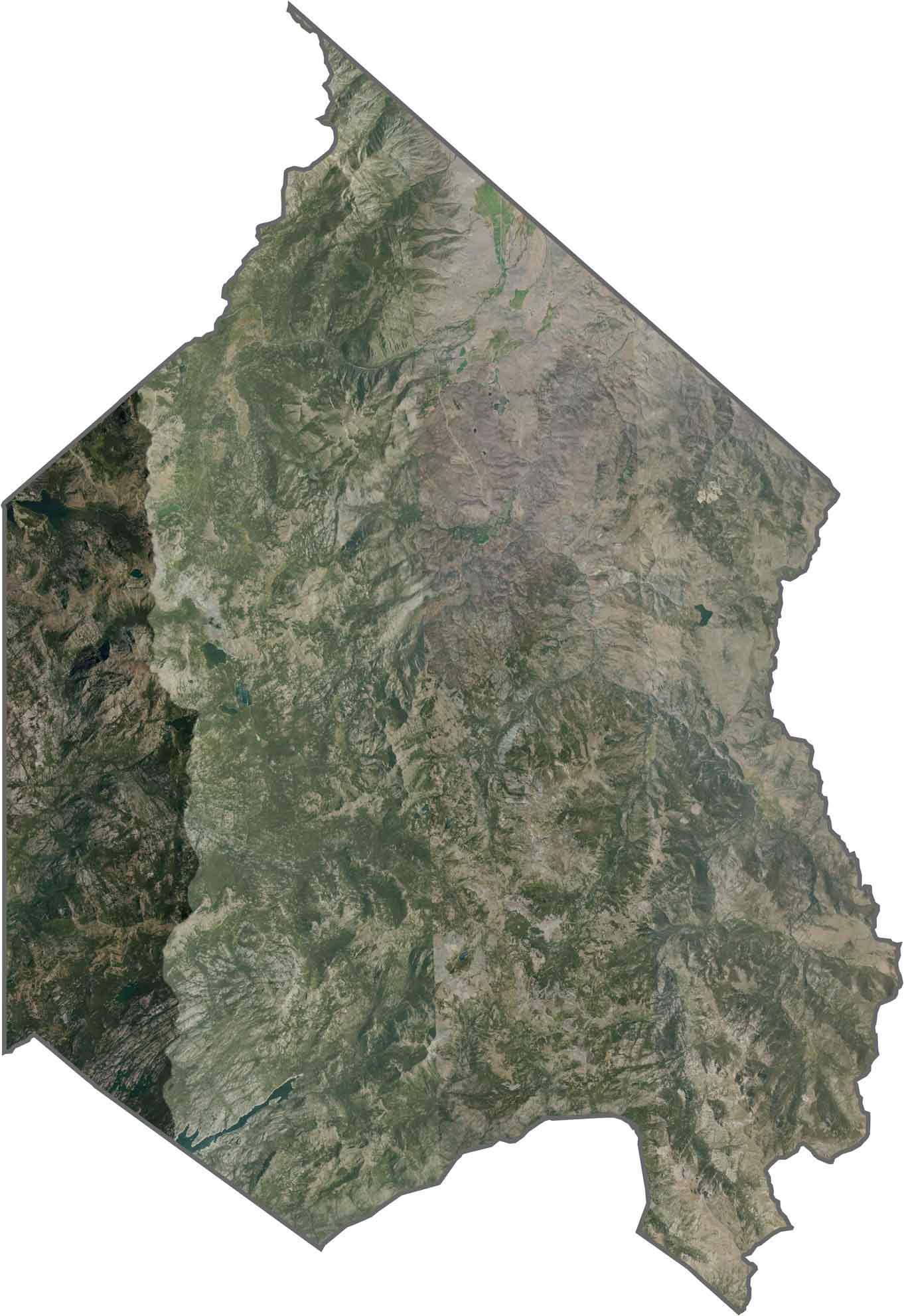
Alpine County Satellite Map
Wilderness landscape of the Sierra Nevada fills this satellite image. Few roads cut through the forested mountains and alpine lakes of this sparsely populated region.
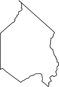
OUTLINE MAP
Alpine County Blank Map
This blank map displays Alpine County’s compact outline along the California-Nevada border. The simple boundary shape highlights this small mountain county in the Sierra Nevada range.

Neighboring Counties
Here are the 6 neighboring counties of Alpine County:


California County Map

Ever wonder how California’s 58 counties stack up? Our California county map lays them all out, from the coast to the deserts. Take a look and find the ones you know — and maybe a few you don’t.
I don’t see a map of the 5 districts within Alpine County
Hi Carol. Unfortunately, we haven’t created that one at this point. It’s something we’ll consider doing in the future. Thanks for the suggestion!