Bradley County Map, Tennessee
Bradley County Map Collection


We allow you to use our Bradley County map. Attribution is required.
Bradley County, Tennessee
Bradley County sits in the southeastern corner of Tennessee. It’s where the mountains meet the valley. Cleveland, the county seat, is a mix of small-town friendliness and city amenities.
The Cherokee National Forest is right on the doorstep, perfect for hiking and camping. The Museum Center at 5ive Points tells the story of the Ocoee Region. It’s fascinating stuff. The Ocoee River, famous for its whitewater rafting, is nearby.
Lee University in Cleveland was founded in 1918. The Cleveland Apple Festival is a fall favorite. You’ll find a strong sense of community here. And the views of the Appalachian foothills? They’re pretty spectacular.
| Category | Details |
|---|---|
| County Name | Bradley County |
| County Seat | Cleveland |
| Population | Approximately 112,000 |
| Cities, Towns, and Communities | Cleveland, Charleston, Hopewell, East Cleveland |
| Interstates and Highways | Interstate 75, U.S. Highway 11, U.S. Highway 64, State Highway 60 |
| FIPS Code | 47-011 |
| Total Area (Land and Water) | 331 square miles (329 sq mi land, 2 sq mi water) |
| Adjacent Counties (and Direction) | Meigs County (Northwest), McMinn County (North), Polk County (East), Murray County, Georgia (Southeast), Whitfield County, Georgia (South), Hamilton County (West) |
| Time Zone | Eastern Time Zone (EST) |
| State | Tennessee |
| Coordinates | 35°10’N, 84°52’W |
| Etymology | Named after Edward Bradley, a State Representative |
| Major Landmarks | Red Clay State Historic Park, Cherokee National Forest, Cleveland Bradley County Greenway |
| Website | Bradley County Website |
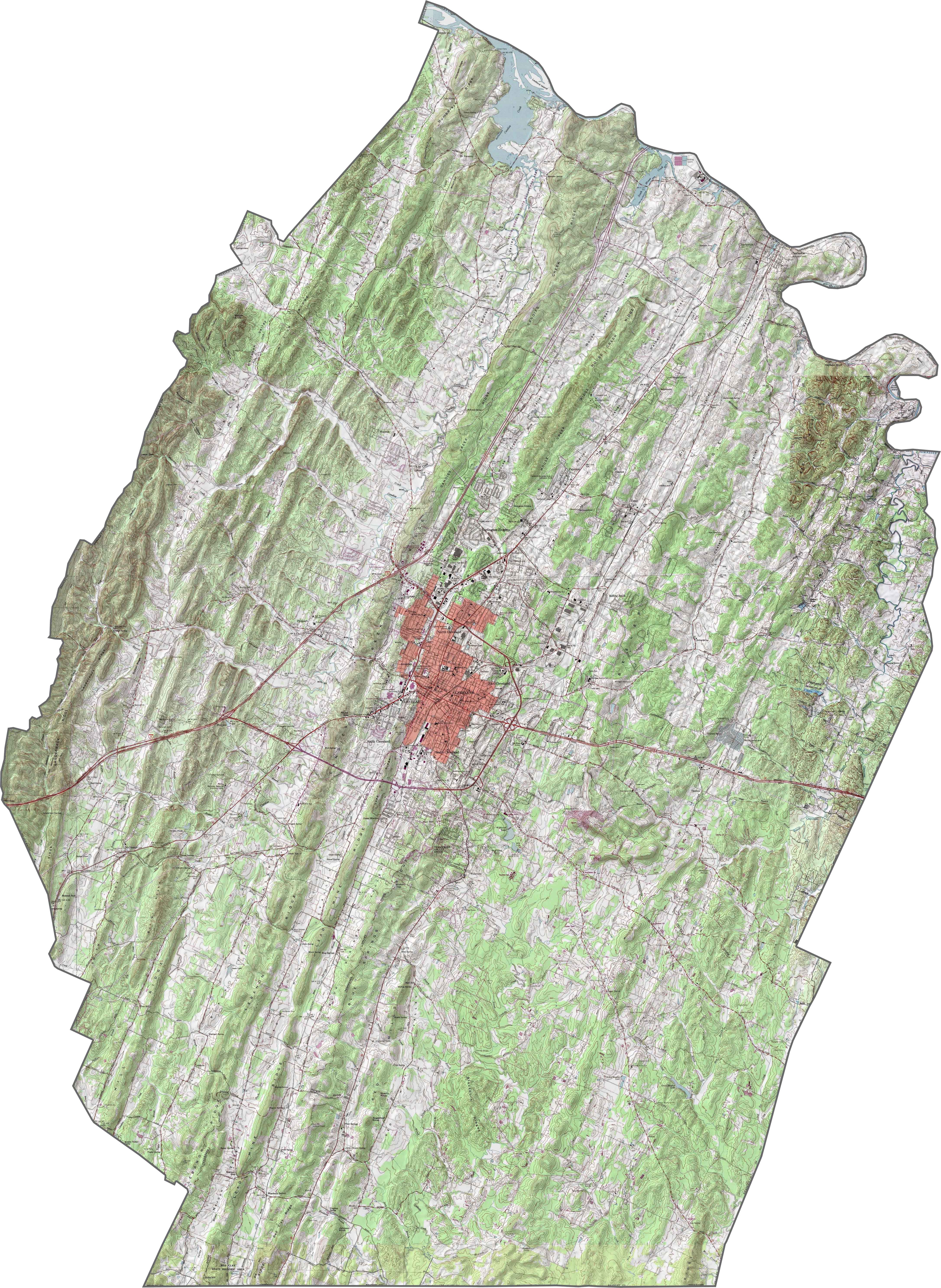
PHYSICAL MAP
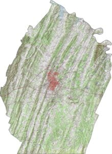
Bradley County Topographic Map
Ridges, valleys, and gentle hills make Bradley County an easy one to map. The defining feature is Candies Creek Ridge, a long, low spine that slices through the county. Most of the land dips gradually from there, shaping a soft, wave-like surface. If you want to see more, try out our zoom tool below.
TRANSPORTATION MAP
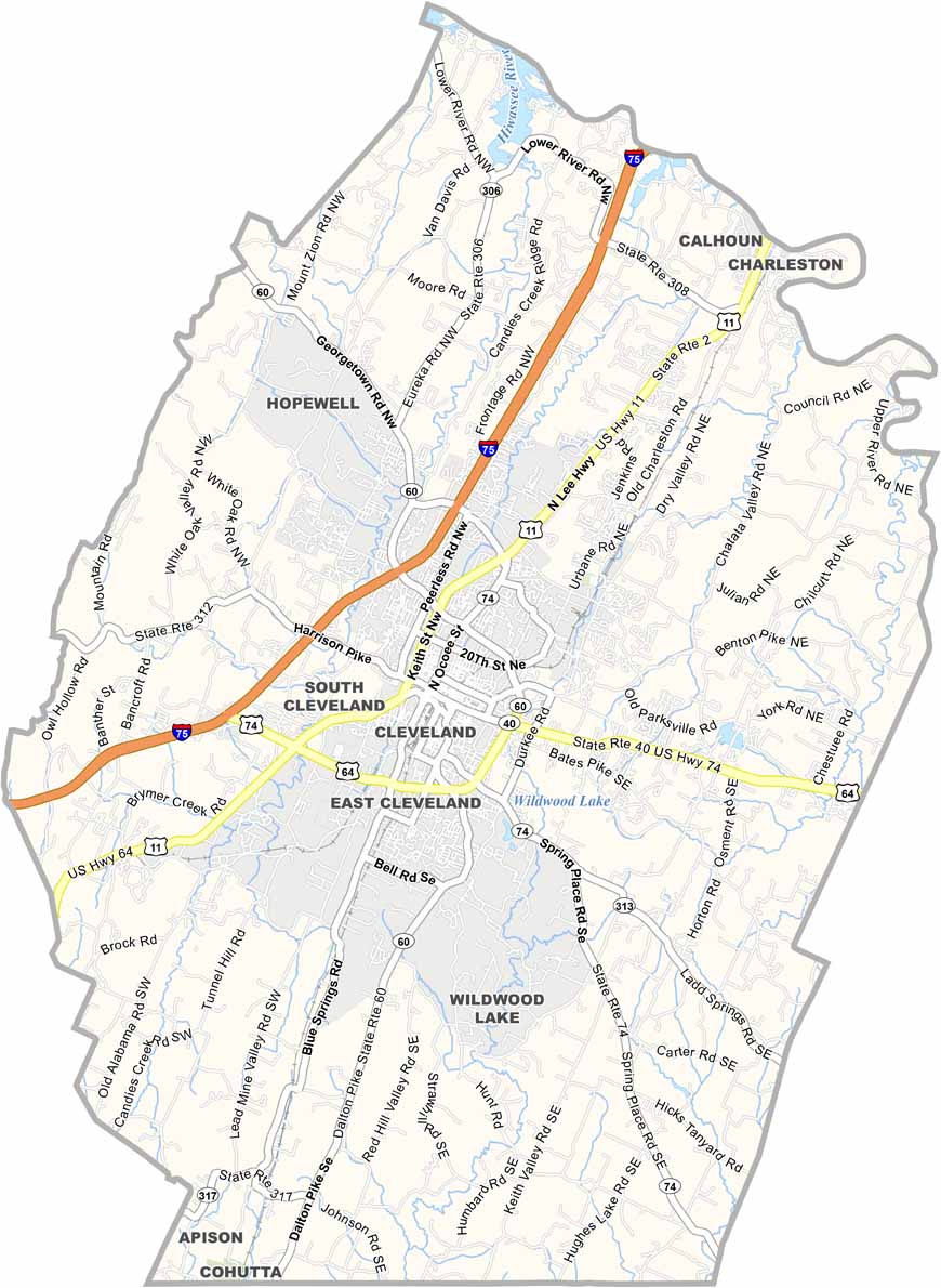
Bradley County Road Map
Bradley County’s road network weaves through valleys and hills. I-74 and U.S. Highway 64 are the two primary routes here. Despite the curvy terrain, travel here stays pretty smooth.

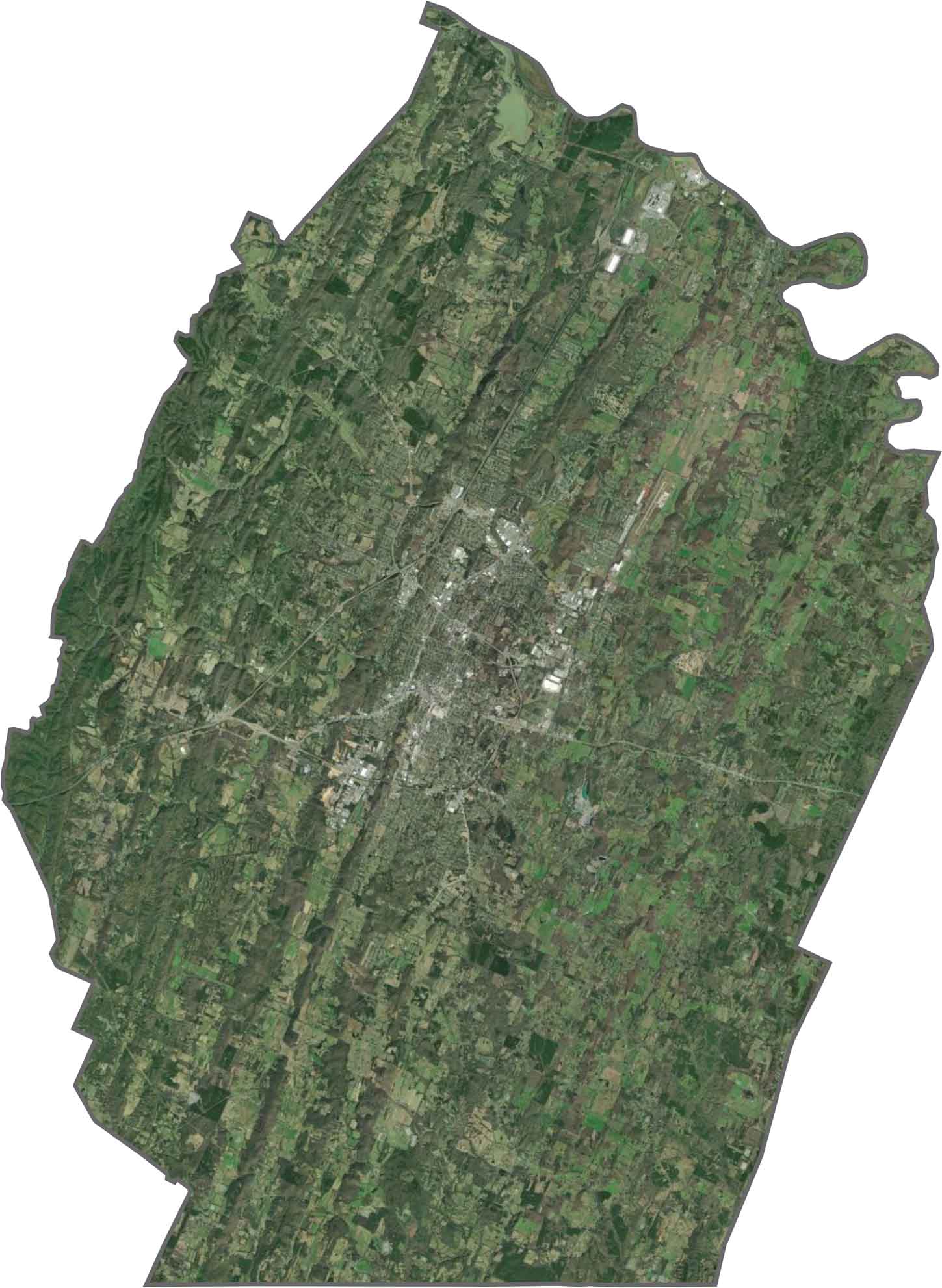
SATELLITE IMAGERY
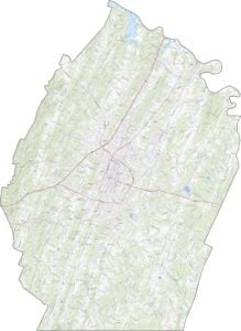
Bradley County Satellite Map
The city of Cleveland sits bright in the middle, its grid easy to spot. But beyond that, green dominates. This includes trees, farms, and wooded hills that covers most of the view. A few long ridges cut diagonally across the image. Here and there, you’ll notice scattered ponds and winding streams.
OUTLINE MAP
Bradley County Blank Map
Bradley has a slightly bent triangular shape, with mostly smooth edges. While the northeast border follows the Hiwassee River, the southern border touches the state of Georgia.

Neighboring Counties
Here are the 6 neighboring counties of Bradley County:


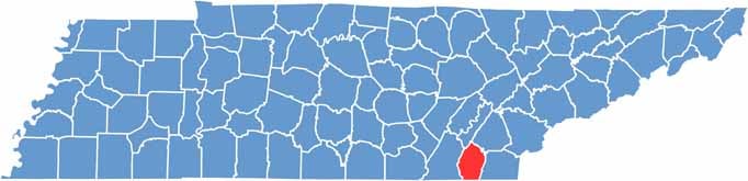
Tennessee County Map

There’s no such thing as a boring county in Tennessee. Some stretch through the Smokies, others roll out into Delta flatlands. Every county’s shaped by the land and it shows.