Calvert County Map, Maryland

Calvert County Map Collection

We allow you to use our Calvert County map. Attribution is required.
Calvert County, Maryland

Calvert County lies on the western shore of the Chesapeake Bay. It’s the smallest county in the state by land area, but don’t let that fool you.
The peninsula is home to some of the most stunning beaches in the state of Maryland. You’ll also find fossil-filled cliffs on the East Coast.
Solomons Island, at the southern tip, is a waterfront town that’s perfect for a weekend getaway. Fishing, boating, and crabbing are big here. Calvert County is a slice of Maryland that’s rich in history and natural beauty.
| Category | Details |
|---|---|
| County Name | Calvert County |
| County Seat | Prince Frederick |
| Population | 100,000 |
| Cities, Towns, and Communities | Prince Frederick, North Beach, Chesapeake Beach, Dunkirk, Huntingtown, Owings, St. Leonard |
| Interstates and Highways | MD Route 2, MD Route 4, MD Route 231, MD Route 260 |
| FIPS Code | 24-009 |
| Total Area (Land and Water) | 345.3 square miles (land: 213.3 sq mi, water: 132.0 sq mi) |
| Adjacent Counties (and Direction) | Anne Arundel County (North), Prince George’s County (Northwest), Charles County (West), Dorchester County (East), Talbot County (Northeast), St. Mary’s County (South) |
| Time Zone | Eastern Time Zone (EST) |
| State | Maryland |
| Coordinates | 38.56°N, 76.63°W |
| Etymology | Named after the Calvert family, the original proprietors of the Maryland Colony. |
| Major Landmarks | Calvert Marine Museum, Jefferson Patterson Park and Museum, Solomons Island, Cove Point Lighthouse |
| Website | Calvert County Website |
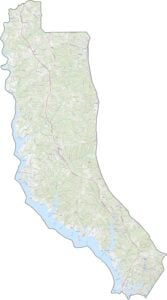
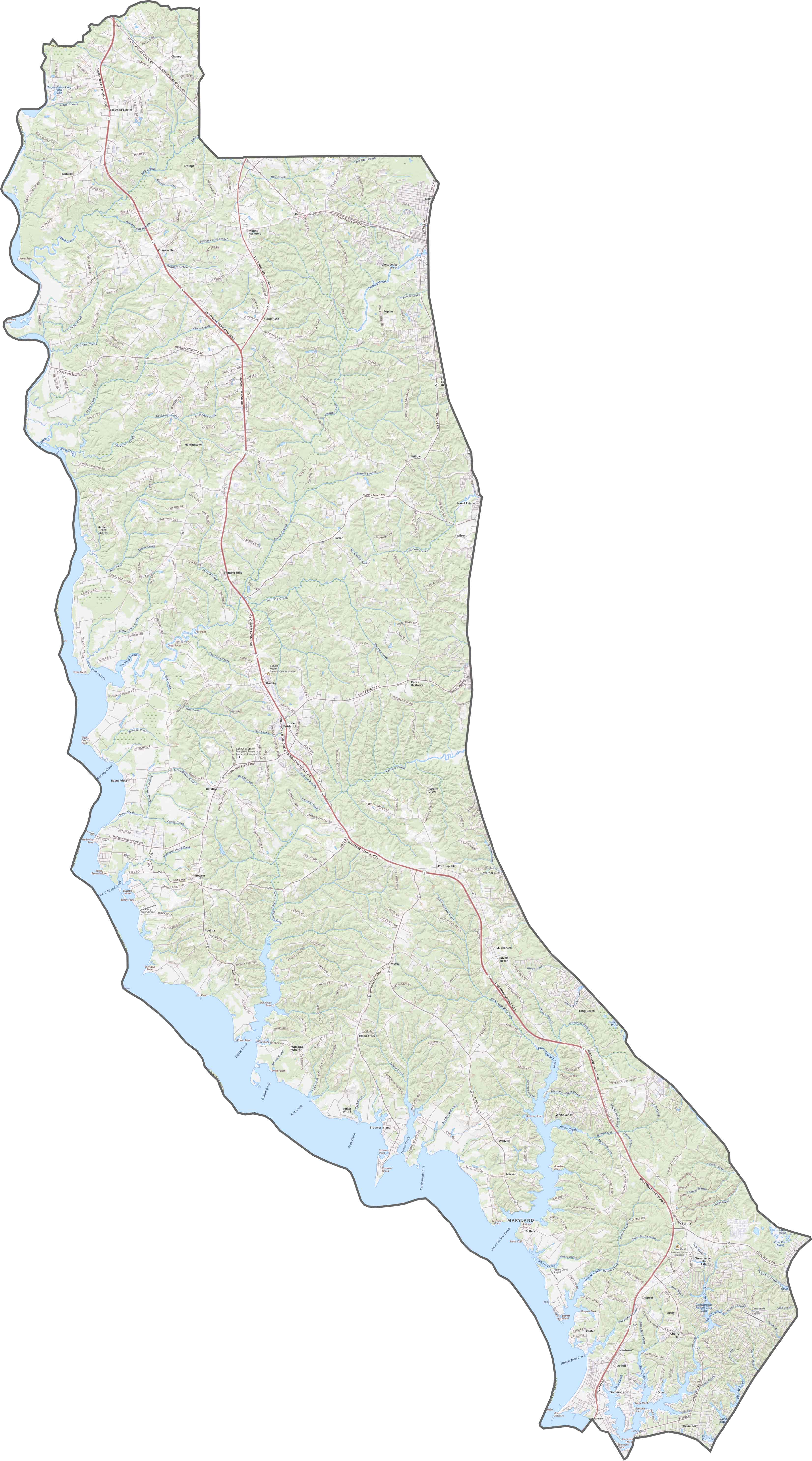
TRANSPORTATION MAP
Calvert County Road Map
The main highway in Calvert County is Route 4, which slices straight down the peninsula. Although backroads twist trough this county, there are no interstate here. Explore detailed features up close with our interactive zoom tool.
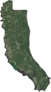
SATELLITE IMAGERY
Calvert County Satellite Map
In our satellite map, Calvert County looks like a green thumb dipped in blue paint. That’s right. It’s mostly dense forests suddenly cut off by jagged shorelines. It has a couple of small towns scattered throughout, but it mostly remains wilderness from what I can tell.

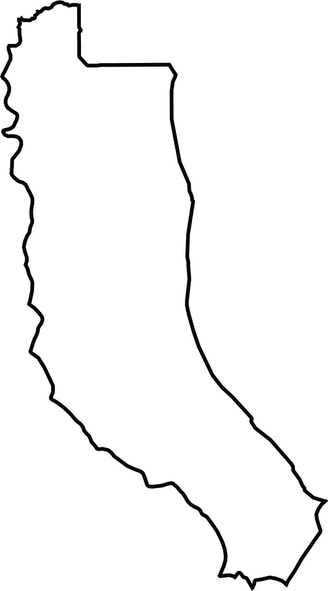
OUTLINE MAP
Calvert County Blank Map
Calvert County is a skinny peninsula with a dented spine. It’s hugged by water on three sides. The Patuxent River chews at its western edge, while the Chesapeake Bay gnaws the east. Only Anne Arundel County touches it by land to the north.
Neighboring Counties
Here are the 6 neighboring counties of Calvert County:


Maryland County Map

With 23 counties and Baltimore City, Maryland gives you a distinct experience in every corner. City life, small towns, and outdoor adventures all come together. Learn more in our Maryland county maps.
Very poor
Generally 1980 quality