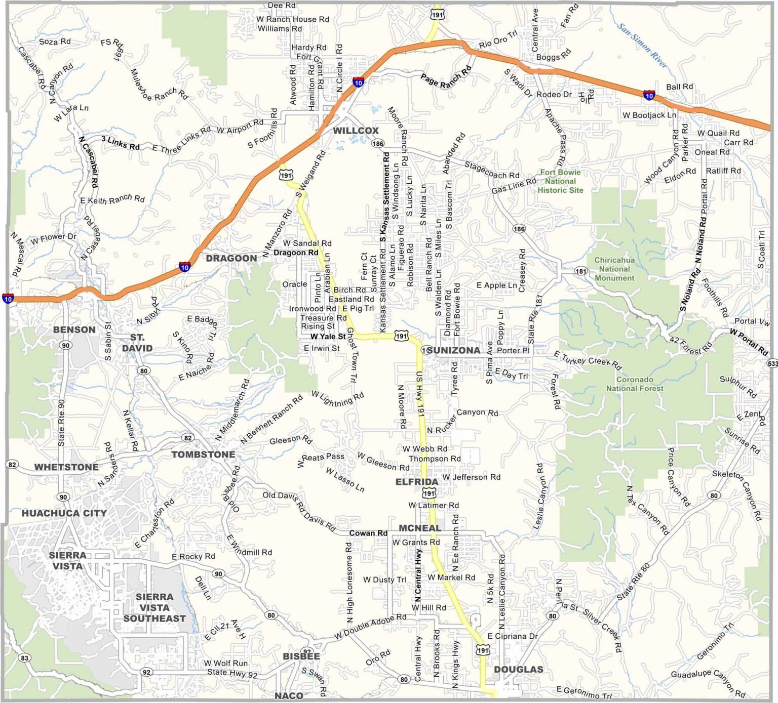
Cochise County Map, Arizona
Cochise County Map Collection

We allow you to use our Cochise County map. Attribution is required.
Cochise County, Arizona

Cochise County is in southeast Arizona, bordering Mexico. It’s known for its Wild West history, including the town of Tombstone. This is where the famous gunfight at the O.K. Corral happened.
About 125,000 people live here. The county seat is Bisbee, an old mining town turned artsy community. Sierra Vista is the largest city and home to Fort Huachuca, an Army base.
The landscape is diverse, with desert lowlands and forested mountains called “sky islands.” Birdwatching is popular, especially in places like Ramsey Canyon. The area has a rich Native American and Spanish colonial history.
| Category | Details |
|---|---|
| County Name | Cochise County |
| County Seat | Bisbee |
| Population | Approximately 125,000 |
| Cities, Towns, and Communities | Sierra Vista, Bisbee, Douglas, Benson, Willcox, Tombstone, Huachuca City, Bisbee Junction, Bowie, Portal, Dragoon, Sunsites, McNeal, Elfrida, Whetstone |
| Interstates and Highways | Interstate 10, U.S. Route 191, U.S. Route 80, State Route 90, State Route 80, State Route 92, State Route 181 |
| FIPS Code | 04-003 |
| Total Area (Land and Water) | 6,219 square miles (Land: 6,166 sq mi, Water: 53 sq mi) |
| Adjacent Counties (and Direction) | Santa Cruz County (Southwest), Pima County (West), Graham County (North), Greenlee County (North), Hidalgo County, New Mexico (East) |
| Time Zone | Mountain Standard Time (MST), no daylight saving time |
| State | Arizona |
| Coordinates | 31.8780° N, 109.7513° W |
| Etymology | Named after Cochise, a famous leader of the Chiricahua Apache tribe |
| Major Landmarks | Chiricahua National Monument, Coronado National Memorial, Tombstone Historic District, Fort Huachuca, Cochise Stronghold, Kartchner Caverns State Park |
| Website | Cochise County Website |
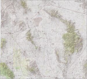
PHYSICAL MAP
Cochise County Topographic Map
The topographic map of Cochise County reveals its basin and range terrain with mountain chains separated by desert valleys. The contour lines mostly highlight the peaks of the Dragoon and Chiricahua Mountains. Download it for a higher resolution.

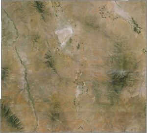
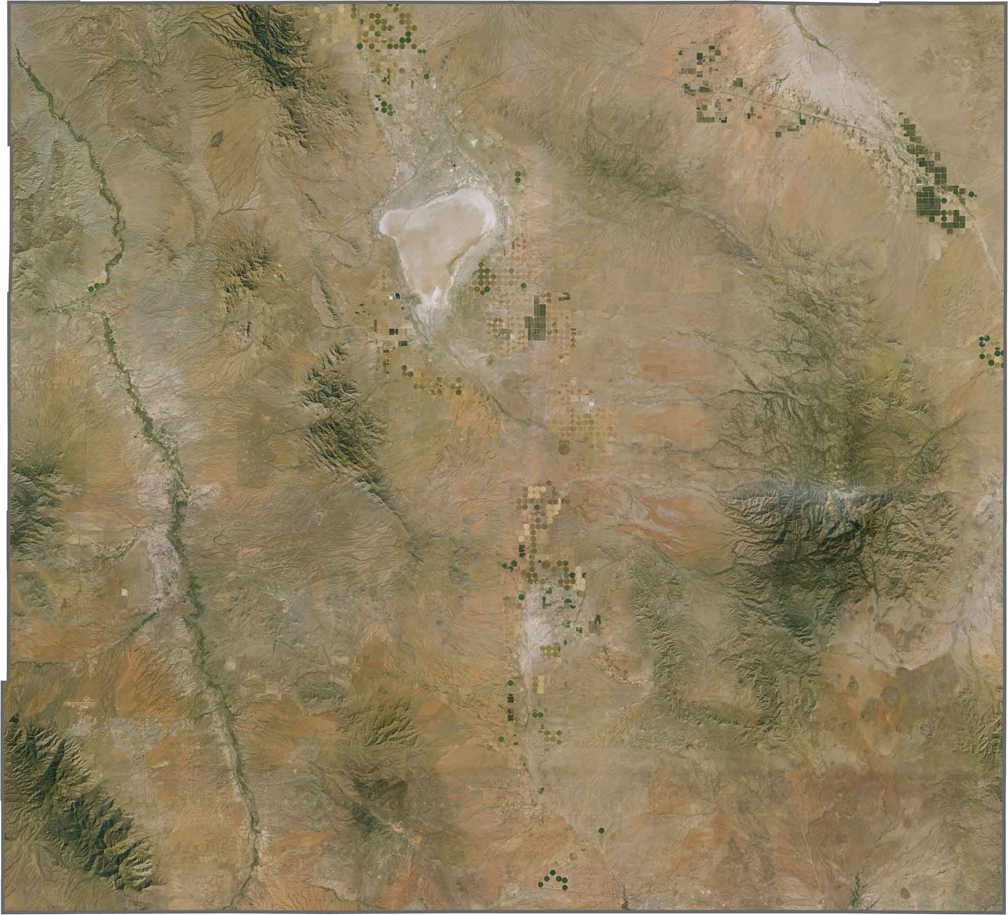
SATELLITE IMAGERY
Cochise County Satellite Map
From above, you can see Cochise County’s dramatic basin and range landscape with dark mountain chains separated by pale desert valleys. The satellite imagery reveals pockets of green in this otherwise arid southeastern corner of Arizona.
OUTLINE MAP
Cochise County Blank Map
Take a look at this blank Cochise County map showing its nearly square shape in Arizona’s southeast corner. The outline reveals its position bordering Mexico along the southern edge.

Neighboring Counties
Here are the 5 neighboring counties of Cochise County:


Arizona County Map

Explore all fifteen Arizona counties with our clear, colorful map. Find major cities, highways, and landmarks across the Grand Canyon State. Our Arizona county map is perfect for road trips or learning more about Arizona’s diverse landscapes.
WRONG LINK
OUTLINE MAP
Cochise County Blank Map
Take a look at this blank Cochise County map showing its nearly square shape in Arizona’s southeast corner. The outline reveals its position bordering Mexico along the southern edge.
Nice catch. I updated the link so it’s pointing to the Cochise blank map.