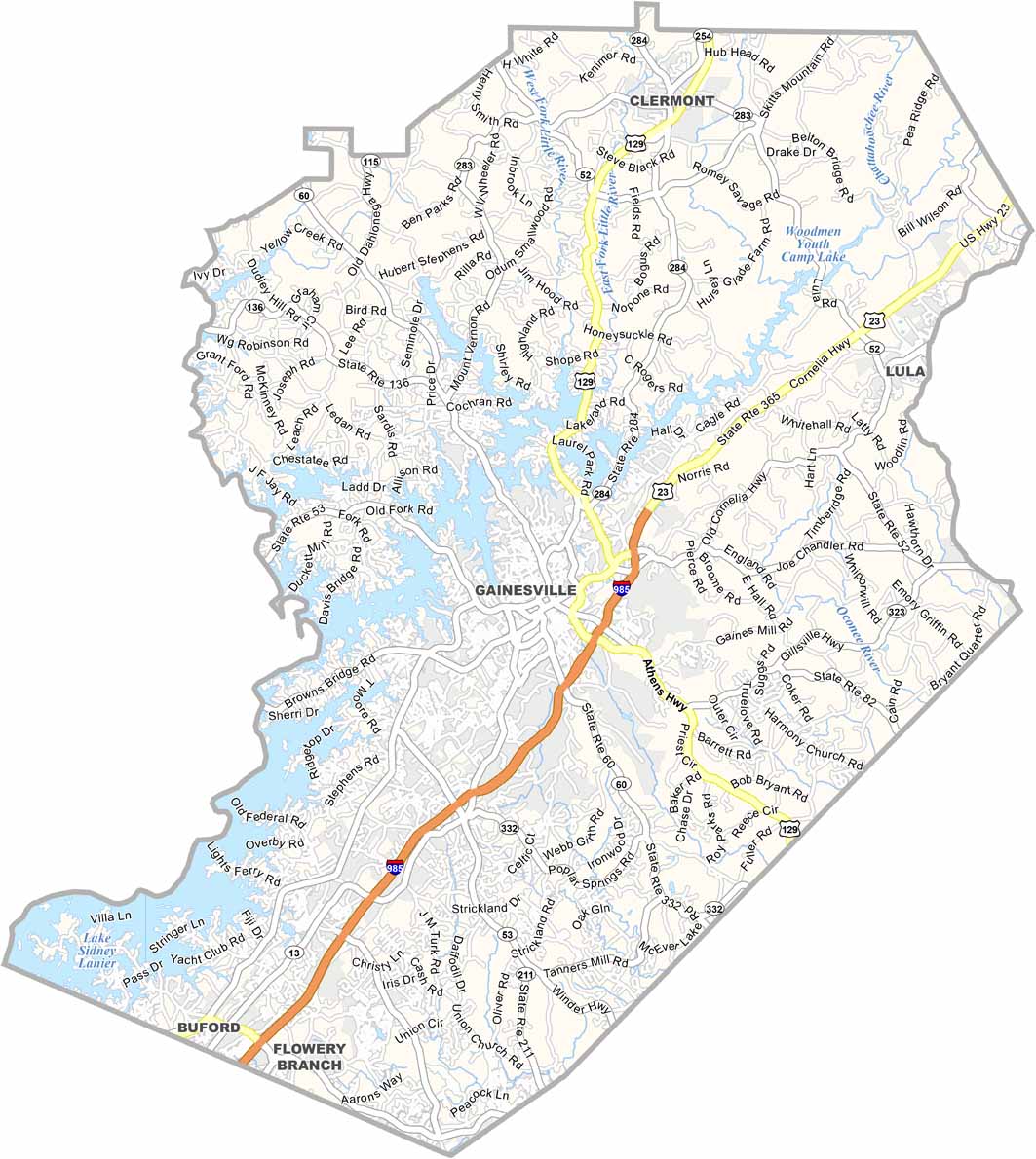
Hall County Map, Georgia
Hall County Map Collection


We allow you to use our Hall County map. Attribution is required.
Hall County, Georgia

When you think of North Georgia, Hall County should come to mind. It’s home to Gainesville, known as the “Poultry Capital of the World”. But it also has natural beauty like the Atlanta Botanical Gardens in Gainesville.
Lake Lanier takes up a piece of the county. It was created by damming the Chattahoochee River. Visitors come here for boating, fishing, and water sports. Hall County played host to the 1996 Olympic rowing events, leaving behind a world-class venue.
The economy here is diverse, mixing poultry processing, manufacturing, and healthcare. The area’s Hispanic community has grown significantly, adding to its cultural diversity. Gainesville’s historic downtown offers shops, restaurants, and regular events.
| Category | Details |
|---|---|
| County Name | Hall County |
| County Seat | Gainesville |
| Population | Approximately 250,000 |
| Cities, Towns, and Communities | Gainesville (county seat), Flowery Branch, Oakwood, Braselton, Lula |
| Interstates and Highways | Interstate 985, U.S. Route 129, U.S. Route 23, State Route 60, State Route 365 |
| FIPS Code | 13-139 |
| Total Area (Land and Water) | 429 square miles (land: 399 sq mi, water: 30 sq mi) |
| Adjacent Counties (and Direction) | White County (North), Habersham County (Northeast), Banks County (East), Jackson County (Southeast), Barrow County (South), Gwinnett County (Southwest), Forsyth County (West), Dawson County (Northwest), Lumpkin County (Northwest) |
| Time Zone | Eastern Time Zone (ET) |
| State | Georgia |
| Coordinates | 34.3036° N, 83.8086° W |
| Etymology | Named in honor of Dr. Lyman Hall, a signer of the Declaration of Independence |
| Major Landmarks | Lake Lanier, Don Carter State Park, Elachee Nature Science Center |
| Website | Hall County Website |
PHYSICAL MAP
Hall County Topographic Map
Our topographic map of Hall County highlights its rolling hills, ridges, and the vast shoreline of Lake Lanier. The terrain slopes toward the lake with lots of inlets and peninsulas. Use our zoom to see the elevation changes around Gainesville and the surrounding countryside.

SATELLITE IMAGERY
Hall County Satellite Map
Our satellite map provides a clear overhead view of Hall County. You’ll see Gainesville’s cityscape, major highways like I-985, and the deep blue waters of Lake Lanier. Forests, farmland, and suburban neighborhoods stand out. Try out the zoom tool for a full picture of how the county is laid out.

OUTLINE MAP
Hall County Blank Map
Our outline map keeps it simple, showing only the county’s borders. Its irregular shape shows the numerous inlets along Lake Lanier.

Neighboring Counties
Here are the 9 neighboring counties of Hall County:


Georgia County Map

Just launched! Our Georgia county map shows all 159 counties in stunning detail. It’s the perfect resource you’ve been waiting for. Don’t miss out on the Peach State.