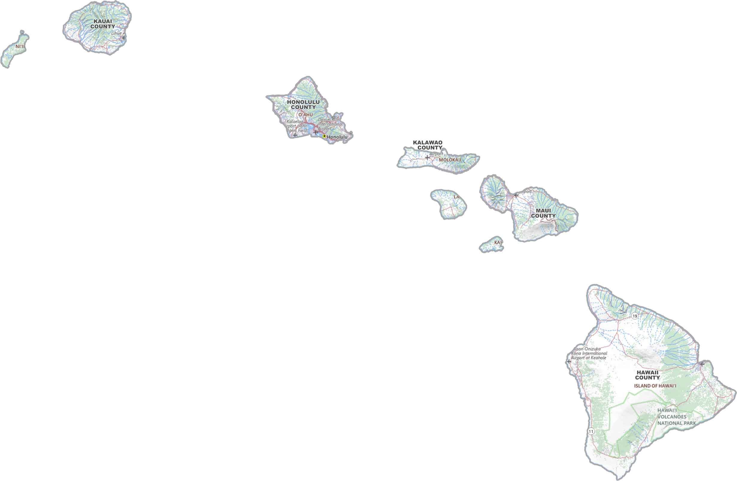
Hawaii County Map

Hawaii County Map Collection
We allow you to use our Hawaii County map. Attribution is required.
Hawaii County Maps
Hawaii’s county situation is about as laid-back as the state itself. They’ve got 5 counties. Yep, you can count them all on one hand. It’s more like they threw some lines on a map and called it a day.


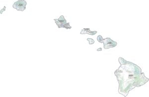
PHYSICAL MAP
Hawaii Topographic County Map
Hawaii’s topography is all about elevation with its volcanoes, ridges, and steep slopes rising from the ocean. Our map below highlights how each island’s terrain changes, even within a single county.
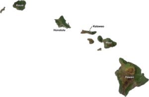
SATELLITE IMAGERY
Hawaii Satellite County Map
Our satellite map shows Hawaii’s lush green valleys, dark lava fields, and bright coastal areas. We also display each county name cut out to each of its islands.

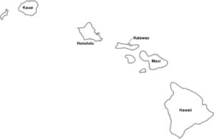
OUTLINE MAP
Hawaii Simple County Map
Our simple map outlines Hawaii’s counties, spread across the islands with clear labels. It just shows the basics for a quick way to understand how the state is divided.

Hawaii Counties
Honolulu County, home to the state capital and nearly a million residents, takes the crown as the most populous. It’s no wonder, with Honolulu’s urban center, world-famous Waikiki Beach, and massive tourism industry.

On the flip side, Kalawao County is a tiny speck on the map, with fewer than 100 inhabitants. This remote county on Molokai’s northern shore was once a quarantine zone. After Loving County, Texas, it’s second least populated… at least at the time of me writing this.
Most Populous: Honolulu County
Least Populous: Kalawao County
When it comes to size, Hawaii County (also known as the Big Island) lives up to its nickname. According to the US Census Bureau, it’s a whopping 5,086.1 square miles. Yep, that’s larger than all the other Hawaiian islands combined. Meanwhile, tiny Kalawao County measures just 52.8 square miles.
Largest Area: Hawaii County
Smallest Area: Kalawao County
But size isn’t everything. The story behind Hawaii’s counties is as fascinating as the islands themselves. The word “county” comes from the Hawaiian “kalana,” meaning a land division. Interestingly, the first county government wasn’t established until 1905, long after Hawaii became a U.S. territory.
Hawaii County List
Here’s a list of Hawaii’s 5 counties, with information details about each one:
| FIPS Code | Name | Land % | Water % | Total Area (sq mi) |
|---|---|---|---|---|
| 15-001 | Hawaii County | 79.2 | 20.8 | 5,086.1 |
| 15-003 | Honolulu County | 27.7 | 72.3 | 2,166.2 |
| 15-005 | Kalawao County | 22.7 | 77.3 | 52.8 |
| 15-007 | Kauai County | 49.0 | 51.0 | 1,266.3 |
| 15-009 | Maui County | 48.4 | 51.6 | 2,398.3 |
Source: United States Census Bureau