Hawaii County Map, Hawaii

Hawaii County Map Collection


We allow you to use our Hawaii County map. Attribution is required.
Hawaii County, Hawaii

Hawaii County covers the entire Big Island of Hawaii, the largest and youngest island in the Hawaiian archipelago. It’s a place of black sand beaches and lush rainforests. Snow-capped mountains rise above barren lava fields.
The county seat, Hilo, sits on the rainy east side, while Kailua-Kona basks in the sunny west. Volcanoes shape the landscape here. Mauna Kea, the world’s tallest mountain from base to peak, offers world-class stargazing. Kilauea, one of the most active volcanoes on Earth, has been erupting on and off for centuries.
Locals embrace a laid-back lifestyle, savoring fresh seafood and tropical fruits. Tourists come to the island for its natural wonders and outdoor adventures. From snorkeling with manta rays to hiking through volcanic craters, Hawaii County never fails to amaze.
| Category | Details |
|---|---|
| County Name | Hawaii County |
| County Seat | Hilo |
| Population | 221,000 |
| Cities, Towns, and Communities | Hilo, Kailua-Kona, Waimea, Pahoa, Volcano, Honokaa, and more |
| Interstates and Highways | Hawaii Route 19 (Daniel K. Inouye Highway), Hawaii Route 11 (Mamalahoa Highway) |
| FIPS Code | 15-001 |
| Total Area | 4,028 square miles (land: 3,880 sq mi; water: 148 sq mi) |
| Adjacent Counties | Maui County (Northwest) |
| Time Zone | Hawaii-Aleutian Time Zone |
| State | Hawaii |
| Coordinates | 19.7° N, 155.1° W |
| Etymology | Named after the Big Island of Hawaii, which is the largest island in the Hawaiian archipelago. The name “Hawaii” itself is derived from the native Hawaiian word “Hawaiʻiloa” |
| Major Landmarks | Mauna Loa, Mauna Kea, Kilauea, Volcanoes National Park, Akaka Falls, Waipio Valley |
| Website | Hawaii County Website |
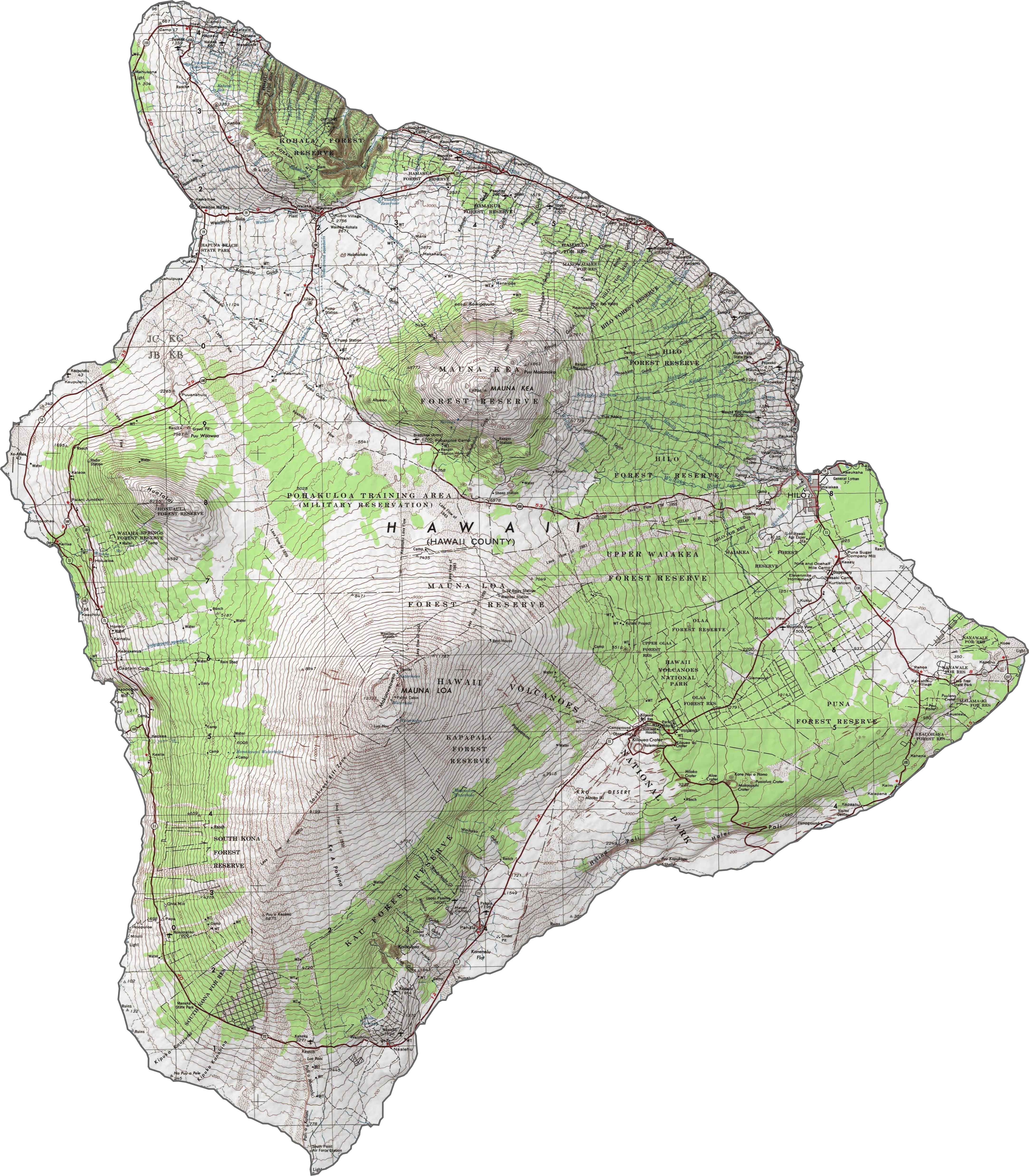
PHYSICAL MAP
Hawaii County Topographic Map
The Big Island’s map is all about contrasts. Think massive volcanoes like Mauna Kea and Mauna Loa, lava fields, and lush green valleys. Hilo, the island’s biggest town, is on the rainy east side. Down south, you’ve got Hawaii Volcanoes National Park, with its thick rainforests.
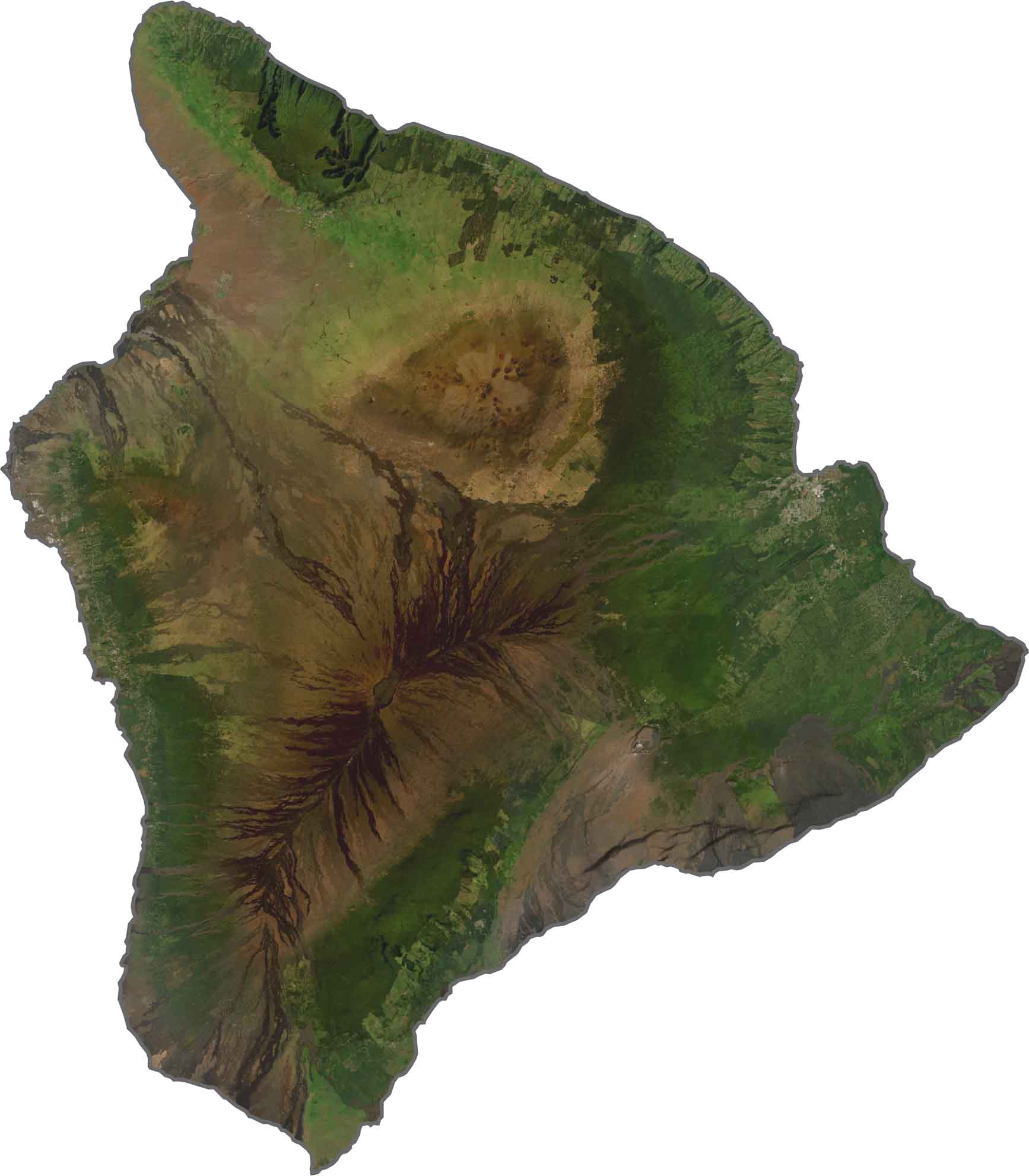
SATELLITE IMAGERY
Hawaii County Satellite Map
From above, the Big Island looks like two huge volcanoes (but there’s actually 6) and patches of bright green forest. Over on the west side, the Kona Coast shines with its sunny beaches and rows of resorts. Try our new zoom tool to see Mauna Kea and Mauna Loa.
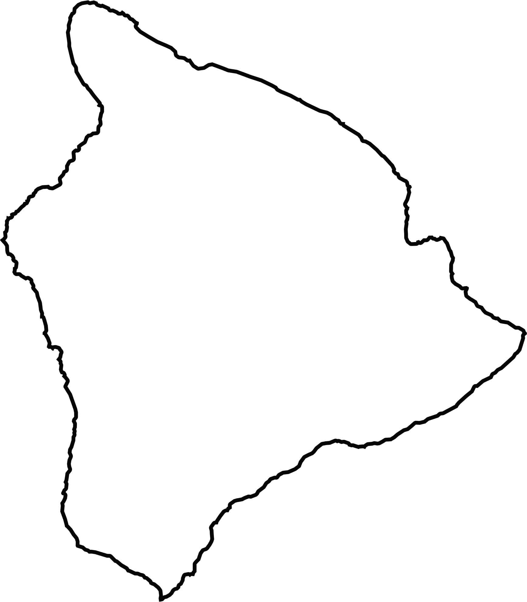
OUTLINE MAP
Hawaii County Blank Map
The outline of Hawaii County is huge. They don’t call it the Big Island for nothing! The island is circular with a bumpy coastline that curves in and out. On a blank map, it’s easy to spot because it’s the biggest island in the chain.
Counties of Hawaii
Here are the 5 counties of Hawaii:


Hawaii County Map

Embrace island life. From Big Island’s rugged landscapes to Maui’s lush valleys, each county tells a story. Your island exploration starts here with our Hawaii county map.