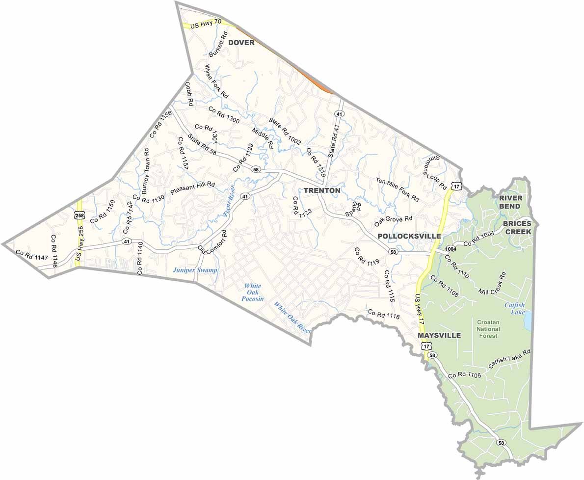
Jones County Map, North Carolina
We allow you to use our Jones County map. Attribution is required.
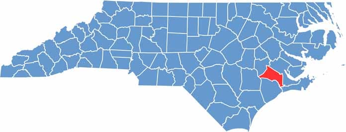
Jones County, North Carolina
The eastern part of North Carolina is home to Jones County. It’s small but full of character. Trenton serves as the county seat. You’ll find more trees than people here. But that’s pretty common everywhere.
The Trent River winds through the county, perfect for a lazy day of fishing. Historians will love the Foscue Plantation House, built way back in 1824. You can find it in Pollocksville.
Maysville is on the county’s eastern edge, next to the Croatan National Forest. Jones County isn’t flashy, but it’s genuine. If you’re looking to slow down and enjoy life, Jones County might be just the ticket.
| Category | Details |
|---|---|
| County Name | Jones County |
| County Seat | Trenton |
| Population | Approximately 10,000 |
| Cities, Towns, and Communities | Trenton, Maysville, Pollocksville |
| Interstates and Highways | U.S. Route 17, U.S. Route 58 |
| FIPS Code | 37-103 |
| Total Area | 480 square miles (land and water) |
| Adjacent Counties | Craven County (Northeast), Carteret County (Southeast), Onslow County (South), Duplin County (West), Lenoir County (Northwest) |
| Time Zone | Eastern Time Zone |
| State | North Carolina |
| Coordinates | 35.0156° N, 77.3420° W |
| Etymology | Named after Willie Jones |
| Major Landmarks | Croatan National Forest, Jones County Courthouse |
| Website | Jones County Website |
North Carolina County Maps
Get to know all the counties in North Carolina with our map collection.


