Laramie County Map, Wyoming

Laramie County Map Collection
We allow you to use our Laramie County map. Attribution is required.
Laramie County, Wyoming

Laramie County is Wyoming’s most populous county. It sits in the southeastern corner of the state. Cheyenne, the state capital, calls this place home. It’s where the high plains meet the Rocky Mountains.
You’ll feel the cowboy spirit here, especially during Cheyenne Frontier Days. It’s the world’s largest outdoor rodeo. But there’s more to Laramie County than just cowboys.
The air force base brings in folks from all over. Agriculture is still big here. Cattle ranches and wheat fields fill the landscape. The Transcontinental Railroad came right through here. From wide-open spaces to city amenities, Laramie County has a little bit of everything.
| Category | Details |
|---|---|
| County Name | Laramie County |
| County Seat | Cheyenne |
| Population | Approximately 106,000 |
| Cities, Towns, and Communities | Cheyenne, Pine Bluffs, Burns, Albin, Carpenter |
| Interstates and Highways | I-25, I-80, US-30, US-85 |
| FIPS Code | 56-021 |
| Total Area (Land and Water) | 2,688 sq mi (Land: 2,686 sq mi; Water: 2 sq mi) |
| Adjacent Counties (and Direction) | Goshen County (North), Banner County, Nebraska (Northeast), Kimball County, Nebraska (East), Weld County, Colorado (South), Larimer County, Colorado (Southwest), Albany County (West), Platte County (Northwest) |
| Time Zone | Mountain Time Zone (MT) |
| State | Wyoming |
| Coordinates | 41.3114° N, 104.7570° W |
| Etymology | Named after Jacques La Ramee, a French-Canadian trapper |
| Major Landmarks | Wyoming State Capitol, Cheyenne Frontier Days, Curt Gowdy State Park |
| Website | Laramie County Website |
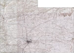
PHYSICAL MAP
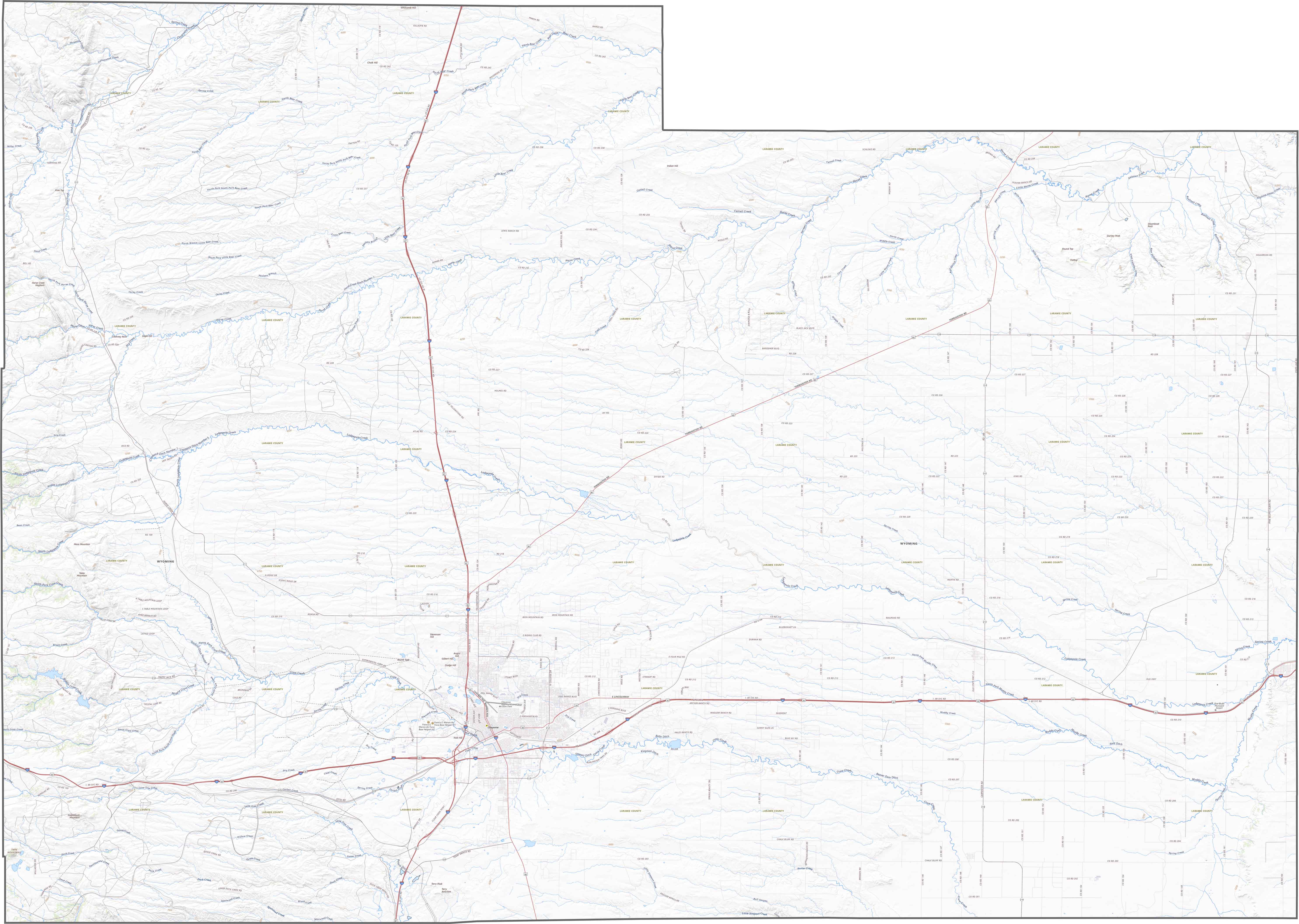
Laramie County Topographic Map
Laramie County lies on the High Plains, where elevation changes come slowly but steadily. One defining feature is the gradual rise toward the west, hinting at the distant Rockies. The land here is mostly open prairie with some ridgelines.

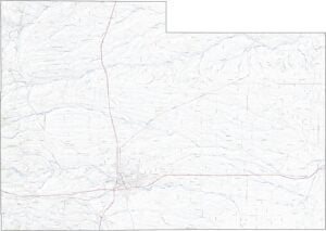
TRANSPORTATION MAP
Laramie County Road Map
Several highways cross Laramie County in all directions. Interstate 25 runs north to south, while I-80 cuts across the southern half. The county seat of Cheyenne is well-connected. But there are some outer areas that make you feel like you’re miles away.
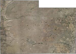
SATELLITE IMAGERY
Laramie County Satellite Map
Our satellite map shows the land use of Laramie County, which includes farmland, prairie, and cityscape. Cheyenne stands out clearly in the southern region. But even close to town, dry open fields dominate the landscape. You can even see some pivot irrigation fields.

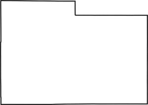
OUTLINE MAP
Laramie County Blank Map
The county has a broad, somewhat rectangular shape. It borders Colorado to the south and Nebraska to the east. All boundary lines are straight in Laramie County.

Neighboring Counties
Here are the 7 neighboring counties of Laramie County:


Wyoming County Map

Get ready for wide skies and long drives. Wyoming’s 23 counties don’t do crowded. But what I do know is that it’s big, it’s bold, and it doesn’t try to impress you. It comes naturally.