Livingston County Map, New York
We allow you to use our Livingston County map. Attribution is required.
Livingston County, New York
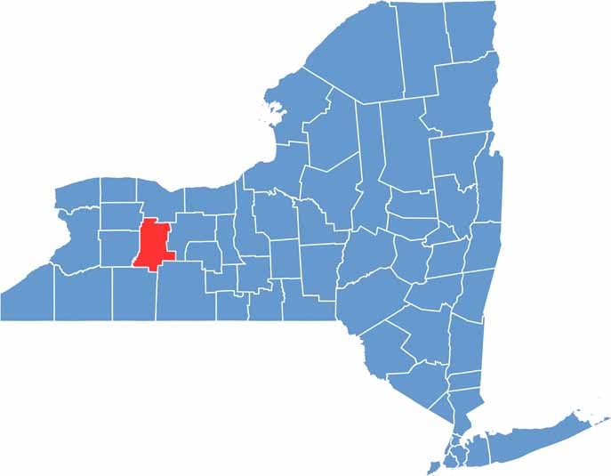
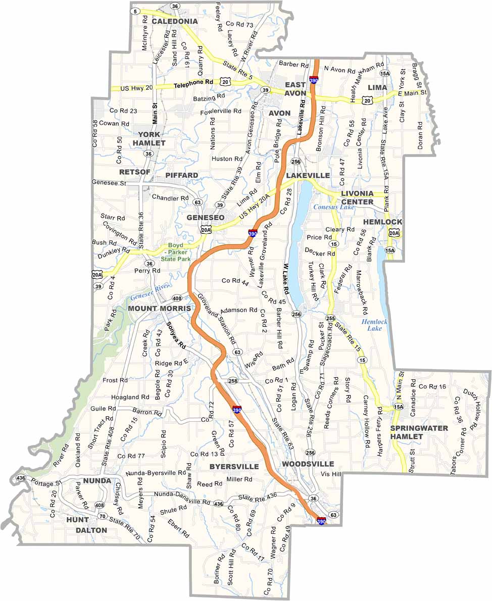
Livingston County sits in the Finger Lakes region of western New York, just south of Rochester. It’s a place where history and natural beauty intertwine. The county is named after Chancellor Robert R. Livingston, one of the Founding Fathers.
Geneseo is the county seat and boasts a beautiful main street. You can’t miss Letchworth State Park, known as the “Grand Canyon of the East”. It forms part of the western border with its stunning gorges and waterfalls.
The county has a rich Native American history. You can also explore the numerous 19th-century homes and buildings. Overall, Livingston County brings together scenic landscapes and a deep sense of local pride.
| Category | Details |
|---|---|
| County Name | Livingston County |
| County Seat | Geneseo |
| Population | Approximately 67,000 |
| Cities, Towns, and Communities | Geneseo, Mount Morris, Avon, Dansville, Livonia, Nunda, Leicester |
| Interstates and Highways | Interstate 390, U.S. Route 20A, New York State Route 15, New York State Route 63 |
| FIPS Code | 36-051 |
| Total Area (Land and Water) | 637 square miles (632 sq mi land, 5 sq mi water) |
| Adjacent Counties (and Direction) | Monroe County (North), Ontario County (East), Steuben County (Southeast), Allegany County (South), Wyoming County (West), Genesee County (Northwest) |
| Time Zone | Eastern Time Zone (ET) |
| State | New York |
| Coordinates | 42.7834° N, 77.8203° W |
| Etymology | Named after Robert Livingston, an early American statesman |
| Major Landmarks | Letchworth State Park, Mount Morris Dam, Genesee Country Village and Museum |
| Website | Livingston County Website |
New York County Maps
Get to know all the counties in New York with our map collection.


