St. Mary’s County Map, Maryland

St. Mary’s County Map Collection

We allow you to use our St. Mary’s County map. Attribution is required.
St. Mary’s County, Maryland

At the southern tip of Maryland, St. Mary’s County is where the Potomac River meets the Chesapeake Bay. It’s the birthplace of Maryland, with St. Mary’s City standing as the state’s first colonial settlement.
Come here to explore the past at the Historic St. Mary’s City living museum. The county is also home to the Patuxent River Naval Air Station.
Fishing, boating, and crabbing are everyday activities here, thanks to miles of shoreline. You’ll find a slower pace of life, with farms, vineyards, and local markets across the landscape.
| Category | Details |
|---|---|
| County Name | St. Mary’s County |
| County Seat | Leonardtown |
| Population | 115,000 |
| Cities, Towns, and Communities | Leonardtown, California, Lexington Park, Great Mills, St. Inigoes, and others |
| Interstates and Highways | U.S. Route 235, Maryland Route 4, Maryland Route 5, Maryland Route 235 |
| FIPS Code | 24-037 |
| Total Area (Land and Water) | 370.0 square miles (land: 357.1 sq mi, water: 12.9 sq mi) |
| Adjacent Counties (and Direction) | Calvert County (Northeast), Charles County (Northwest), Somerset County (Southeast), Northumberland County, Virginia (South), Westmoreland County, Virginia (Southwest), Dorchester County (East) |
| Time Zone | Eastern Time Zone (EST) |
| State | Maryland |
| Coordinates | 38.22°N, 76.77°W |
| Etymology | Named in honor of St. Mary and the religious significance of its name. |
| Major Landmarks | Historic St. Mary’s City, Point Lookout State Park, Piney Point Lighthouse, Patuxent River Naval Air Station |
| Website | St. Mary’s County Website |
TRANSPORTATION MAP
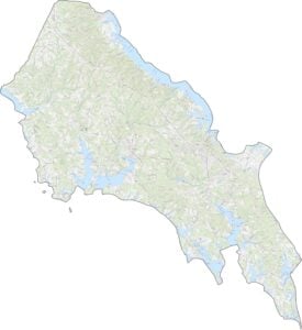
St. Mary’s County Road Map
Examine roads, waterways, and landmarks in detail with our road map and zoom tool below. For example, Route 235 and Route 5 form the main north-south arteries serving the peninsula.
SATELLITE IMAGERY
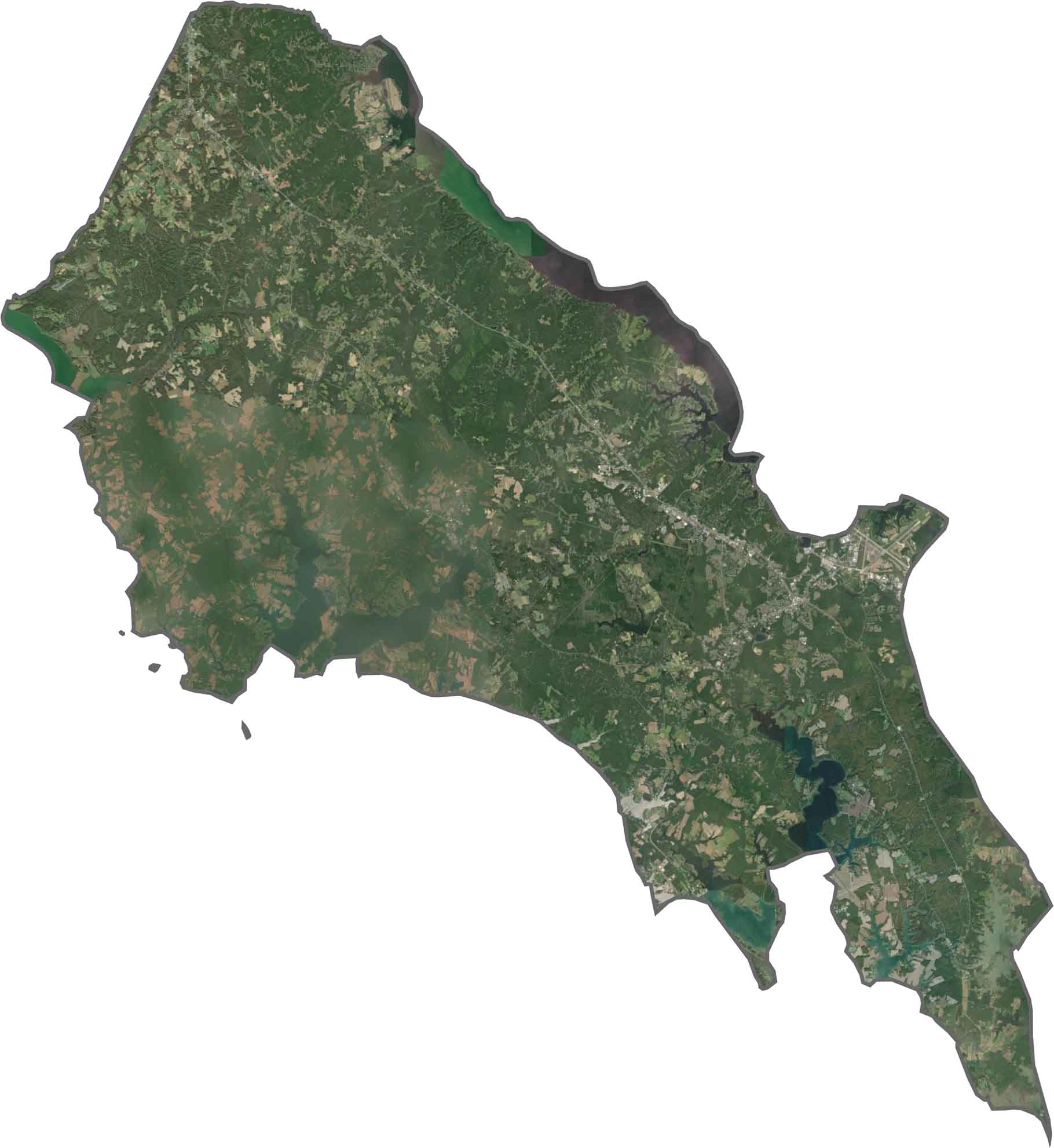
St. Mary’s County Satellite Map
Our satellite shows St. Mary’s County as a network of peninsulas and inlets. Dense forests alternate with agricultural fields and waterfront developments.
OUTLINE MAP
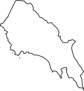
St. Mary’s County Blank Map
St. Mary’s County is surrounded by water on three sides with only a small northern connection to Charles County.

Neighboring Counties
Here are the 6 neighboring counties of St. Mary’s County:


Maryland County Map

With 23 counties and Baltimore City, Maryland gives you a distinct experience in every corner. City life, small towns, and outdoor adventures all come together. Learn more in our Maryland county maps.