Cambria County Map, Pennsylvania

Cambria County Map Collection


We allow you to use our Cambria County map. Attribution is required.
Cambria County, Pennsylvania

Cambria County lies in the heart of western Pennsylvania. It’s a place with a rich industrial past and natural beauty. It’s where the Allegheny Mountains meet the Laurel Highlands.
Johnstown, the largest city in the county, has a story to tell. The Great Flood of 1889 reshaped its history. But the county seat is Ebensburg in the center of the county.
Today, the area is known for its hiking trails that wind through state parks. The Ghost Town Trail attracts cyclists from all over. Winters bring skiers to the slopes. From steel mills to tech startups, Cambria keeps evolving.
| Category | Details |
|---|---|
| County Name | Cambria County |
| County Seat | Ebensburg |
| Population | Approximately 125,000 |
| Cities, Towns, and Communities | Johnstown, Ebensburg, Westmont, Nanty Glo, Portage, Cresson, Northern Cambria |
| Interstates and Highways | U.S. Highway 22, U.S. Highway 219, State Highway 56, State Highway 403 |
| FIPS Code | 42-021 |
| Total Area (Land and Water) | 694 square miles (688 sq mi land, 6 sq mi water) |
| Adjacent Counties (and Direction) | Clearfield County (North), Blair County (East), Bedford County (Southeast), Somerset County (South), Westmoreland County (Southwest), Indiana County (West) |
| Time Zone | Eastern Time Zone (EST) |
| State | Pennsylvania |
| Coordinates | 40°29’N, 78°43’W |
| Etymology | Named after the nation of Wales (Cambria is the Latin name for Wales) |
| Major Landmarks | Johnstown Flood National Memorial, Allegheny Portage Railroad National Historic Site, Staple Bend Tunnel |
| Website | Cambria County Website |
PHYSICAL MAP
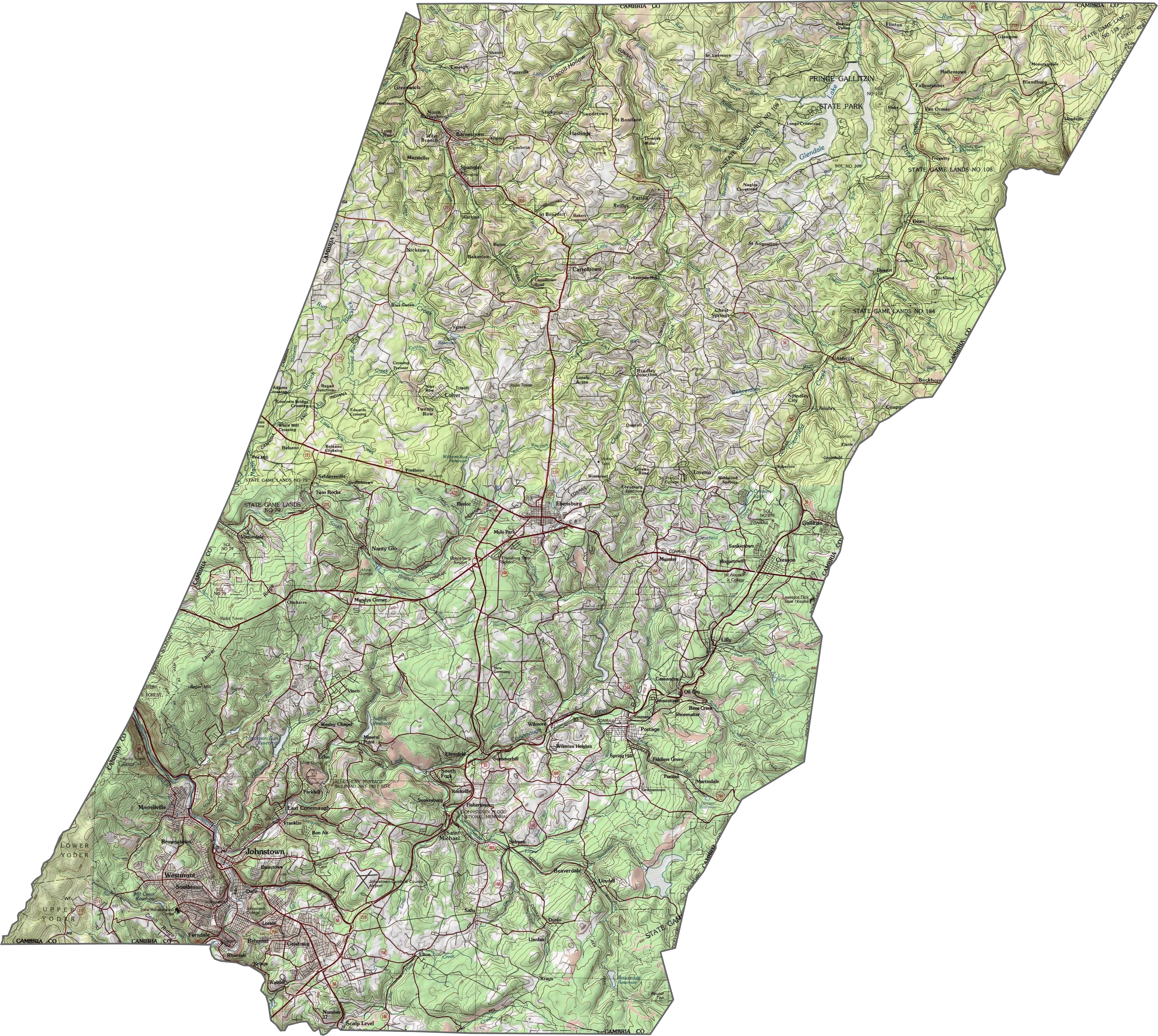
Cambria County Topographic Map
Cambria County is rugged. Ridges rise in long rows across the county, cut by sharp valleys. Elevation changes fast, especially near river gorges. It’s one of the more mountainous areas in this part of Pennsylvania.
TRANSPORTATION MAP
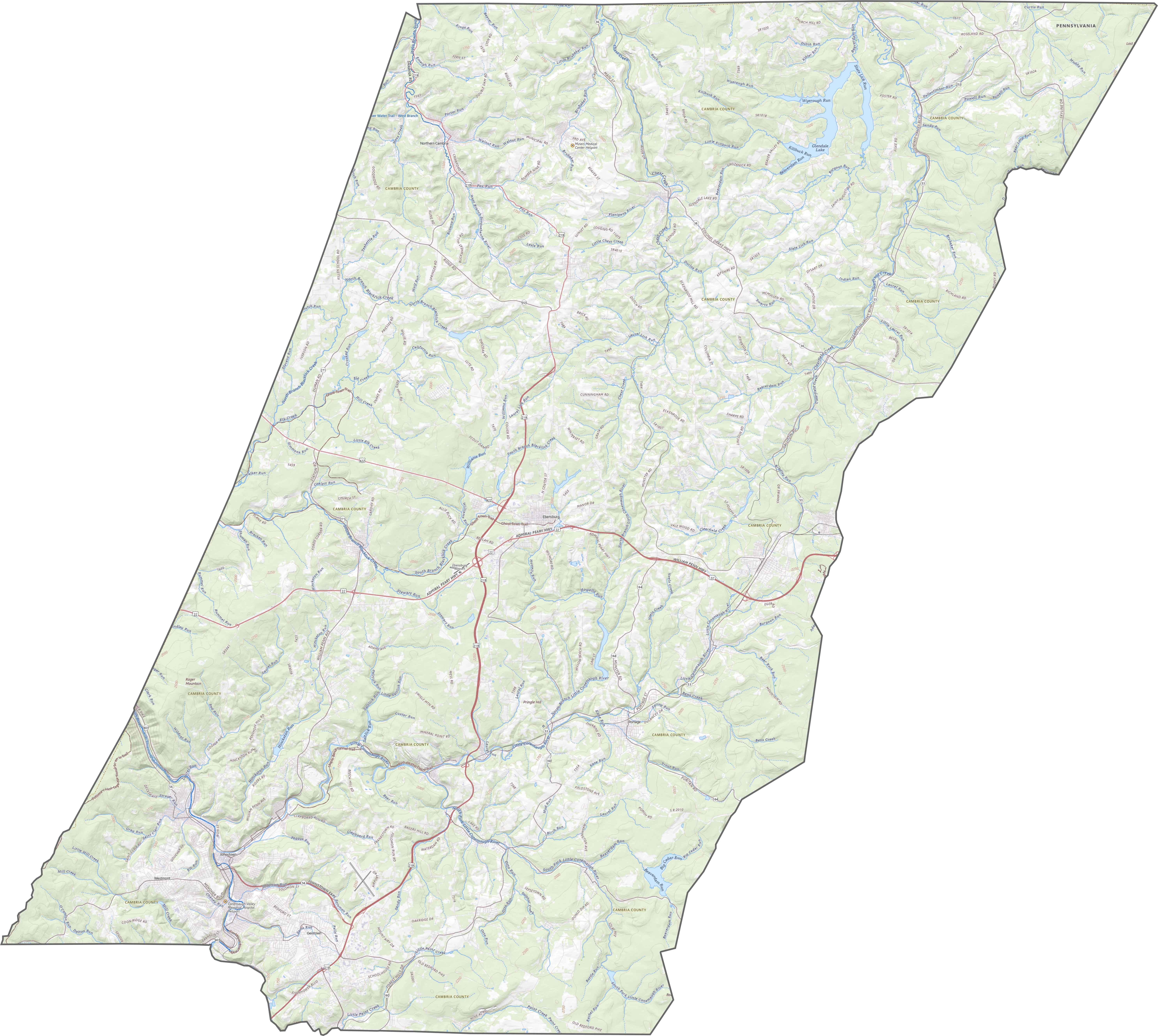
Cambria County Road Map
The road network in Cambria County twists and turns through mountains and valleys. Traffic varies by season, especially in and out of Johnstown. Explore all the highways and roads with our road map below.
SATELLITE IMAGERY
Cambria County Satellite Map
Dark green forests cover much of the map. Johnstown appears as a cluster of light gray in a deep valley. Rail lines and roads are visible, winding through tight spaces. Waterways and reservoirs are key here, such as Glendale Lake.

OUTLINE MAP
Cambria County Blank Map
Cambria County’s outline is jagged and irregular. The southern border follows twists in the Stony Creek River for a stretch. The rest of the edges bend around topographic features, roads or survey lines.

Neighboring Counties
Here are the 6 neighboring counties of Cambria County:


Pennsylvania County Map

Pennsylvania’s 67 counties contains steel city lights, Amish country backroads, and Pocono mountain escapes. Mileage may vary, but the stories won’t.