Canyon County Map, Idaho

Canyon County Map Collection
We allow you to use our Canyon County map. Attribution is required.
Canyon County, Idaho

Canyon County is Idaho’s agricultural heartland, sprawling across the western Snake River Plain. Nampa and Caldwell, the biggest towns, are evolving from sleepy farm communities into Boise suburbs.
You’ll see onion fields next to new subdivisions. The area is famous for its wineries. Folks call it the ‘Sunnyslope Wine Trail’. It’s not exactly Napa, but the views are nice. The Snake River forms the southern border, good for fishing and boating.
Summers are hot and dry. It’s perfect for growing crops, but it’s tough on people. There’s a big Latino population here, adding some spice to local culture. Rodeos are still a place to go here. So is the county fair.
| Category | Details |
|---|---|
| County Name | Canyon County |
| County Seat | Caldwell |
| Population | 275,000 |
| Cities, Towns, and Communities | Caldwell, Nampa, Middleton, Greenleaf, Notus, and more |
| Interstates and Highways | Interstate 84, U.S. Route 20, Idaho State Highway 19 |
| FIPS Code | 16-027 |
| Total Area | 602 square miles (land: 585 sq mi; water: 17 sq mi) |
| Adjacent Counties | Payette County (North), Gem County (Northeast), Ada County (East), Owyhee County (South), Malheur County, Oregon (West) |
| Time Zone | Mountain Time Zone |
| State | Idaho |
| Coordinates | 43.7° N, 116.6° W |
| Etymology | Named after the canyon along the Boise River, which was named for its dramatic geological features. |
| Major Landmarks | Lake Lowell, Caldwell’s Indian Creek Plaza, Nampa’s Warhawk Air Museum, Boise River Greenbelt |
| Website | Canyon County Website |
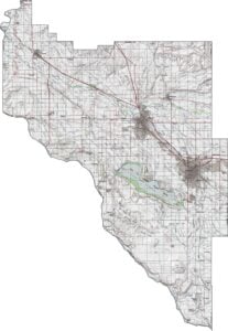
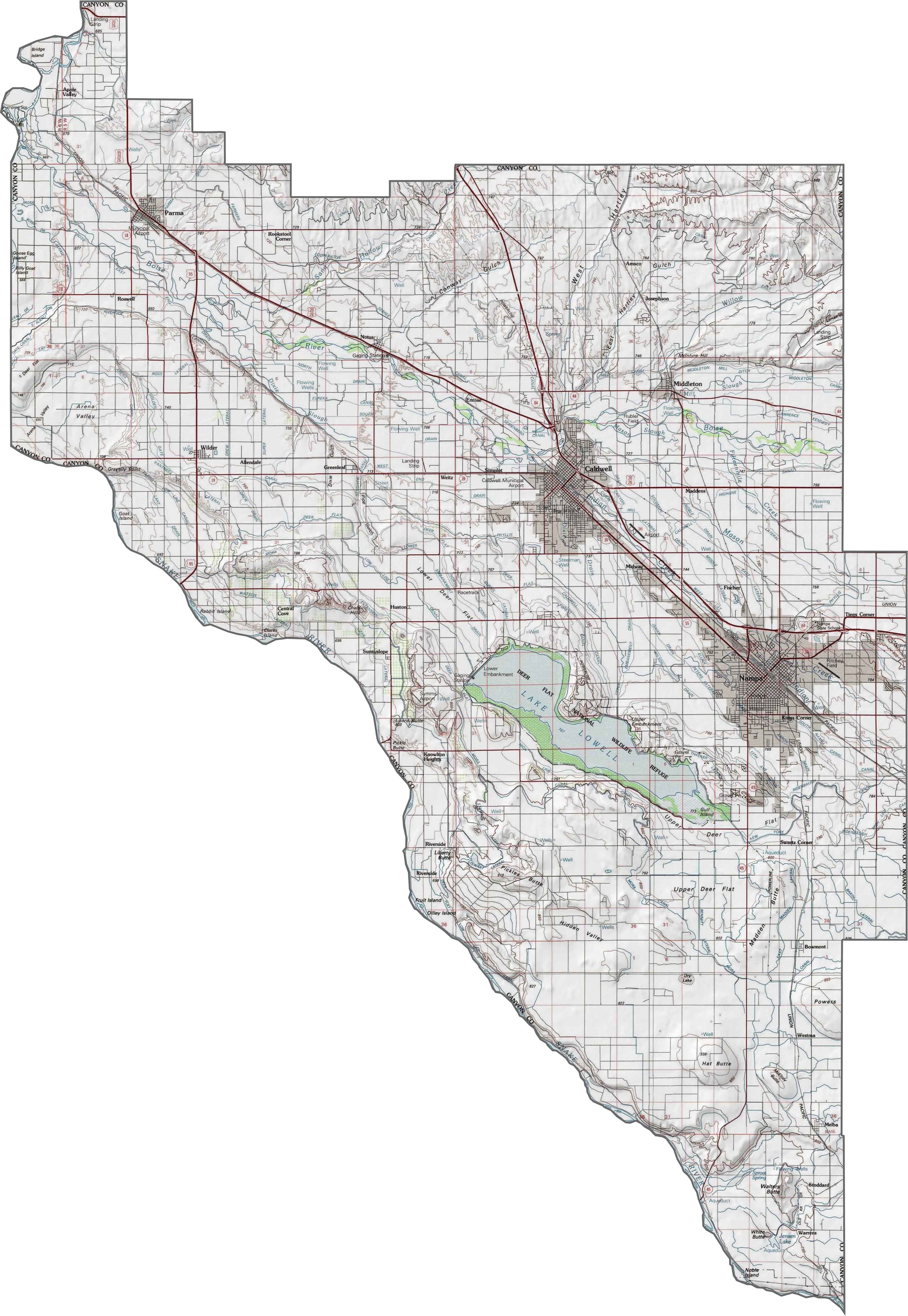
PHYSICAL MAP
Canyon County Topographic Map
Our Canyon County topographic map shows that it’s wide-open and full of farmland. Use our zoom tool to see Lake Lowell. You can find it south of Caldwell and west of Nampa. Yep, you can almost feel the quiet of the plains.
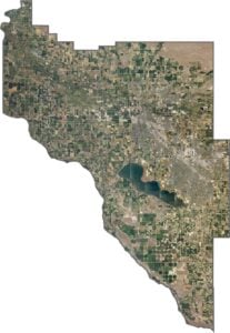
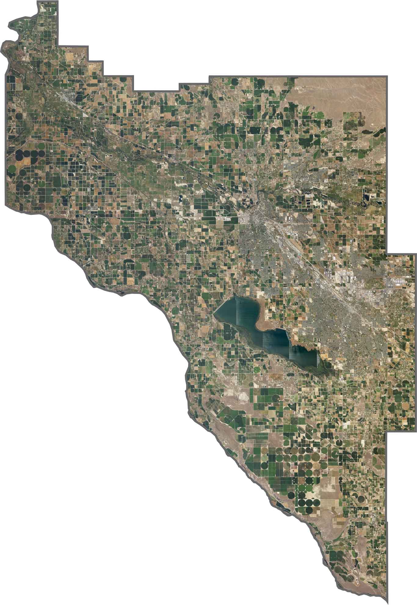
SATELLITE IMAGERY
Canyon County Satellite Map
Canyon County looks wide and open from above. The Snake River cuts through the west, winding its way past agricultural fields and pivot irrigation. You can see the farm roads making little patterns across the land.
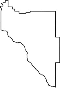
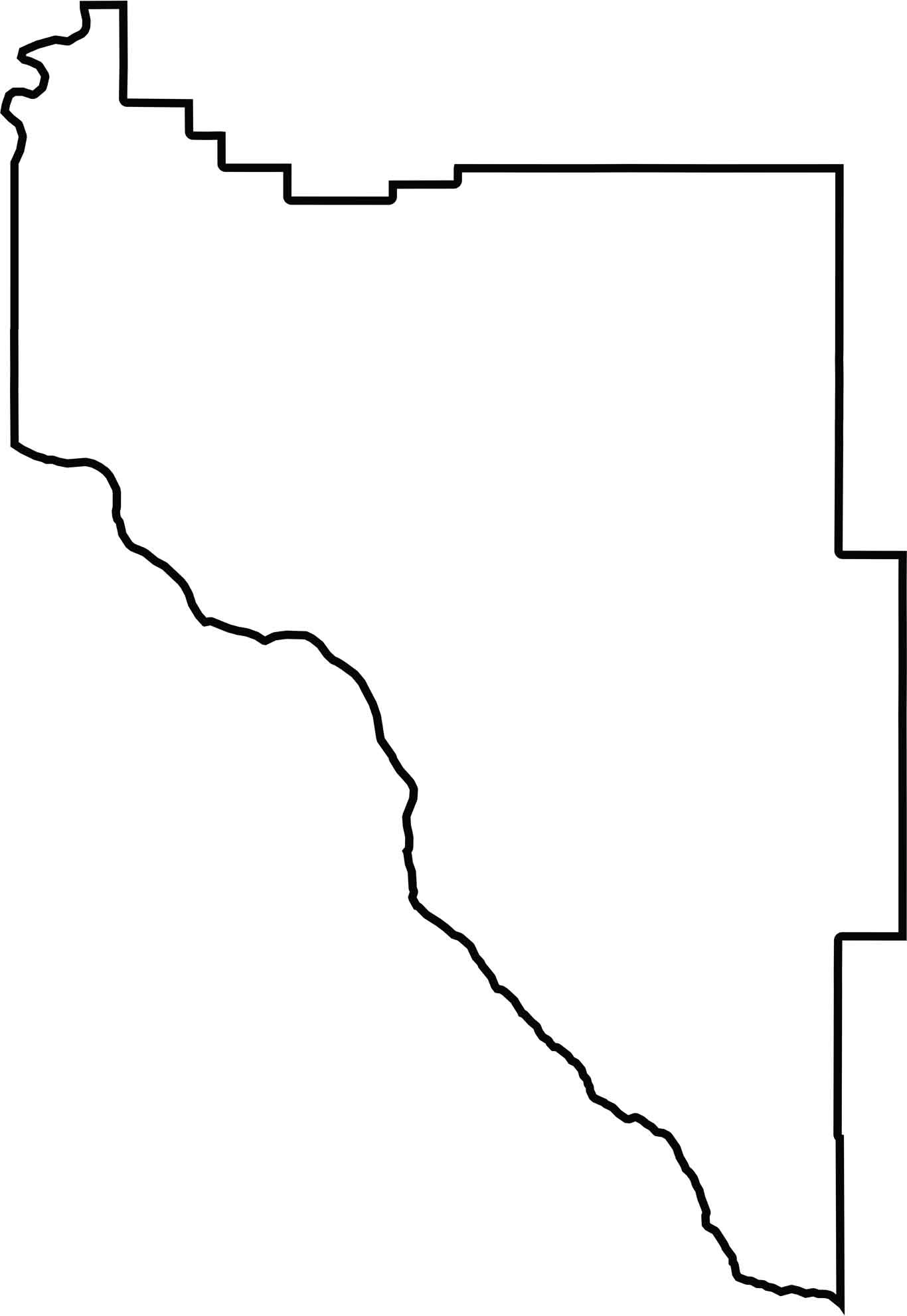
OUTLINE MAP
Canyon County Blank Map
Canyon County’s outline is a big, blocky triangle shape with a few jagged edges. Snake River forms the southwestern boundary. The county looks like it was drawn with a ruler but got a little rough in some spots.
Neighboring Counties
Here are the 5 neighboring counties of Canyon County:


Idaho County Map

Discover Idaho’s diverse counties. Rugged mountains. Rolling plains. Explore Boise’s heart, Teton’s wild beauty, and Shoshone’s untamed forests. Grab an Idaho County map and uncover its best-kept secrets