Carroll County Map, Georgia

Carroll County Map Collection


We allow you to use our Carroll County map. Attribution is required.
Carroll County, Georgia

How about we talk about Carroll County? It’s a decent-sized chunk of west Georgia, right on the Alabama line. Carrollton is the county seat, a college town that’s home to the University of West Georgia. The county is named after Charles Carroll, the last surviving signer of the Declaration of Independence.
You’ve got a mix of rural and suburban here. Farms still are across the landscape, but Atlanta’s sprawl is creeping in. Lake Carroll is a popular spot for fishing and boating. The Little Tallapoosa River winds through, adding to the scenery.
Carroll County has a bit of everything. You’ve got your college crowd in Carrollton, your farmers out in the county, and your commuters heading to Atlanta. It’s not quite city, not quite county. Folks here like their football, their barbecue, and their quiet life. But not necessarily in that order.
| Category | Details |
|---|---|
| County Name | Carroll County |
| County Seat | Carrollton |
| Population | Approximately 135,000 |
| Cities, Towns, and Communities | Carrollton, Villa Rica, Bremen, Temple, Bowdon |
| Interstates and Highways | I-20, US 27, US 78, State Routes 113, 61, 166 |
| FIPS Code | 13-045 |
| Total Area (Land and Water) | 499 square miles (land: 496 sq mi, water: 3 sq mi) |
| Adjacent Counties (and Direction) | Paulding County (North), Douglas County (East), Fulton County (East), Coweta County (Southeast), Heard County (South), Randolph County, Alabama (Southwest), Cleburne County, Alabama (West), Haralson County (Northwest) |
| Time Zone | Eastern Time Zone (ET) |
| State | Georgia |
| Coordinates | 33.5727° N, 85.0837° W |
| Etymology | Named in honor of Charles Carroll of Carrollton, a signer of the Declaration of Independence |
| Major Landmarks | Carrollton’s historic downtown, Lake Carroll, McIntosh Reserve Park |
| Website | Carroll County Website |
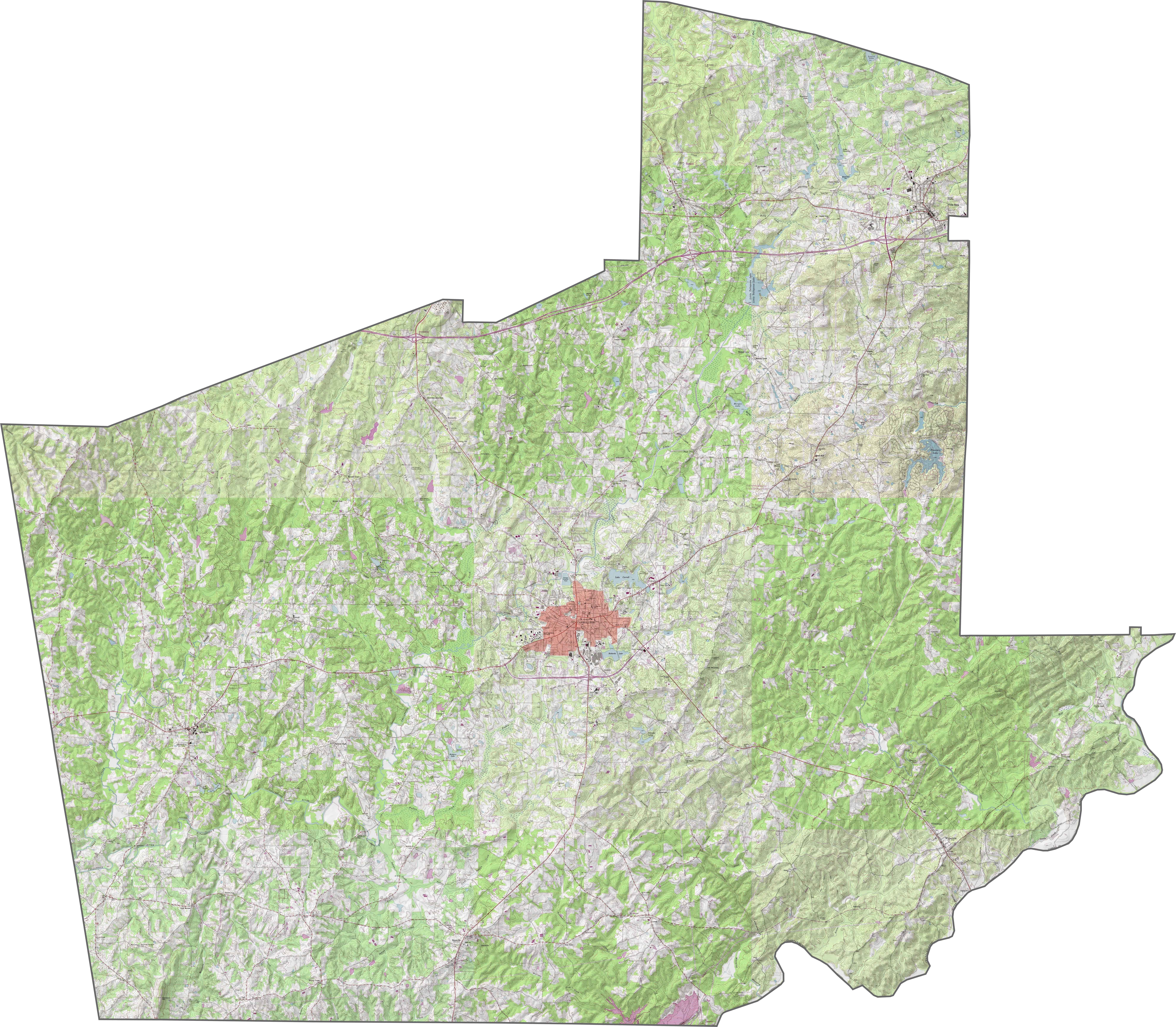
PHYSICAL MAP
Carroll County Topographic Map
Our topographic map shows Carroll County’s hills and valleys across its terrain. Carrollton sits on higher ground with Snake Creek flowing along its western edge. Use our zoom tool to view the Little Tallapoosa River, which cuts through the lowland area.
SATELLITE IMAGERY
Carroll County Satellite Map
This satellite map shows Carroll’s mix of farmland and wooded areas. The eastern edge borders metro Atlanta with more developed areas and subdivisions. Western sections show rural landscapes with scattered small towns and Lake Carroll.

OUTLINE MAP
Carroll County Blank Map
Carroll County has a nearly square shape with slight irregularities. The Chattahoochee River forms part of the southern border, separating Carroll from neighboring Alabama.

Neighboring Counties
Here are the 8 neighboring counties of Carroll County:


Georgia County Map

Just launched! Our Georgia county map shows all 159 counties in stunning detail. It’s the perfect resource you’ve been waiting for. Don’t miss out on the Peach State.