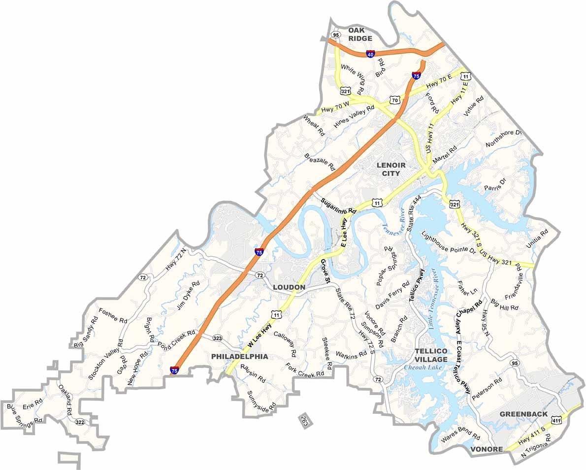
Loudon County Map, Tennessee
We allow you to use our Loudon County map. Attribution is required.
Loudon County, Tennessee

Loudon County sits in East Tennessee, not far from Knoxville. The Tennessee River runs right through it and makes for some pretty views.
Loudon is the county seat and has a cute little downtown. Old buildings, local shops. You know the type. The county has a mix of old and new. There’s the historic Loudon County Courthouse, sure.
But there’s also a huge Wampler’s Farm Sausage plant that brings in jobs. Tellico Village is a big retirement community here. Lots of golf courses. The Great Smoky Mountains aren’t far. You might be able to see them on a clear day. It’s a nice place to live. Quiet, but not too quiet.
| Category | Details |
|---|---|
| County Name | Loudon County |
| County Seat | Loudon |
| Population | Approximately 55,000 |
| Cities, Towns, and Communities | Loudon, Lenoir City, Greenback, Philadelphia |
| Interstates and Highways | Interstate 75, U.S. Highway 11, U.S. Highway 321 |
| FIPS Code | 47-105 |
| Total Area (Land and Water) | 247 square miles (229 sq mi land, 18 sq mi water) |
| Adjacent Counties (and Direction) | Knox County (Northeast), Blount County (East), Monroe County (South), McMinn County (Southwest), Roane County (Northwest) |
| Time Zone | Eastern Time Zone (EST) |
| State | Tennessee |
| Coordinates | 35°44’N, 84°17’W |
| Etymology | Named after Fort Loudoun, which was named in honor of John Campbell, 4th Earl of Loudoun |
| Major Landmarks | Fort Loudoun State Historic Park, Tellico Lake, Lenoir City Museum |
| Website | Loudon County Website |
Tennessee County Maps
Get to know all the counties in Tennessee with our map collection.


