Natrona County Map, Wyoming

Natrona County Map Collection


We allow you to use our Natrona County map. Attribution is required.
Natrona County, Wyoming

Natrona County sits right in the middle of Wyoming. It’s home to Casper, the state’s second-largest city. The county has a bit of everything, including mountains, prairies, and the North Platte River running through it.
Oil and gas are big here. So is ranching. Locals love the outdoors. The county’s history is tied to the Old West and the oil boom.
Casper Mountain looms over the city, offering skiing in winter and trails in summer. It’s not all nature though. The county has museums, shops, and a growing food scene. People here are friendly, with a strong sense of community.
| Category | Details |
|---|---|
| County Name | Natrona County |
| County Seat | Casper |
| Population | Approximately 80,000 |
| Cities, Towns, and Communities | Casper, Evansville, Mills, Bar Nunn, Midwest |
| Interstates and Highways | I-25, US-20, US-26, WY-220 |
| FIPS Code | 56-025 |
| Total Area (Land and Water) | 5,376 sq mi (Land: 5,340 sq mi; Water: 36 sq mi) |
| Adjacent Counties (and Direction) | Johnson County (North), Converse County (East), Albany County (Southeast), Carbon County (South), Fremont County (West), Washakie County (Northwest) |
| Time Zone | Mountain Time Zone (MT) |
| State | Wyoming |
| Coordinates | 42.8666° N, 106.3131° W |
| Etymology | Named for the Natrona formation, a geological feature in the area |
| Major Landmarks | Casper Mountain, Fort Caspar Museum, Hogadon Basin Ski Area |
| Website | Natrona County Website |
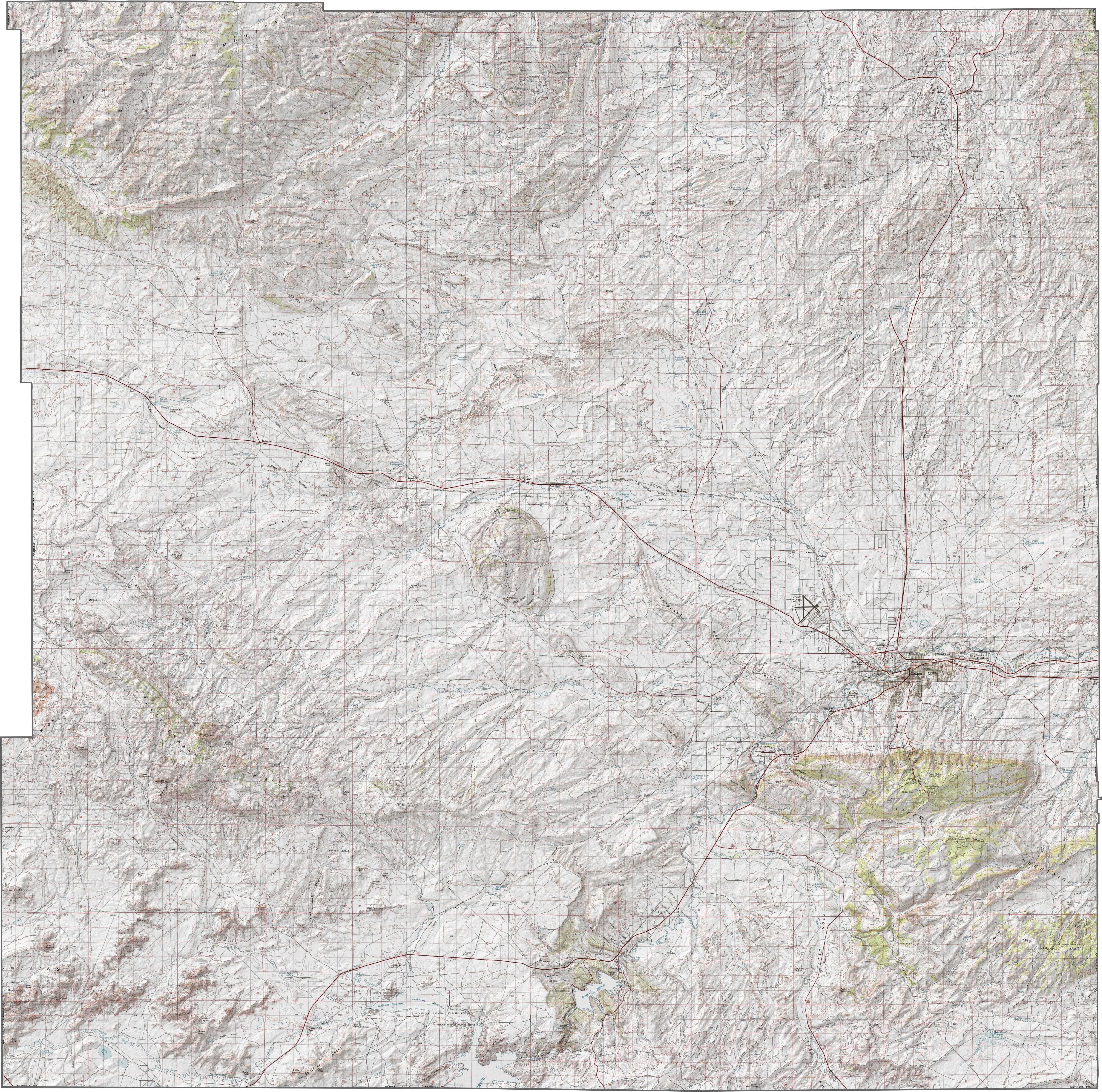
PHYSICAL MAP
Natrona County Topographic Map
Natrona County features a rugged mix of terrain. The Casper Arch runs through the area, lifting the land into high ridges and broad valleys. The other big feature here is the Pathfinder Reservoir directly on the southern border.
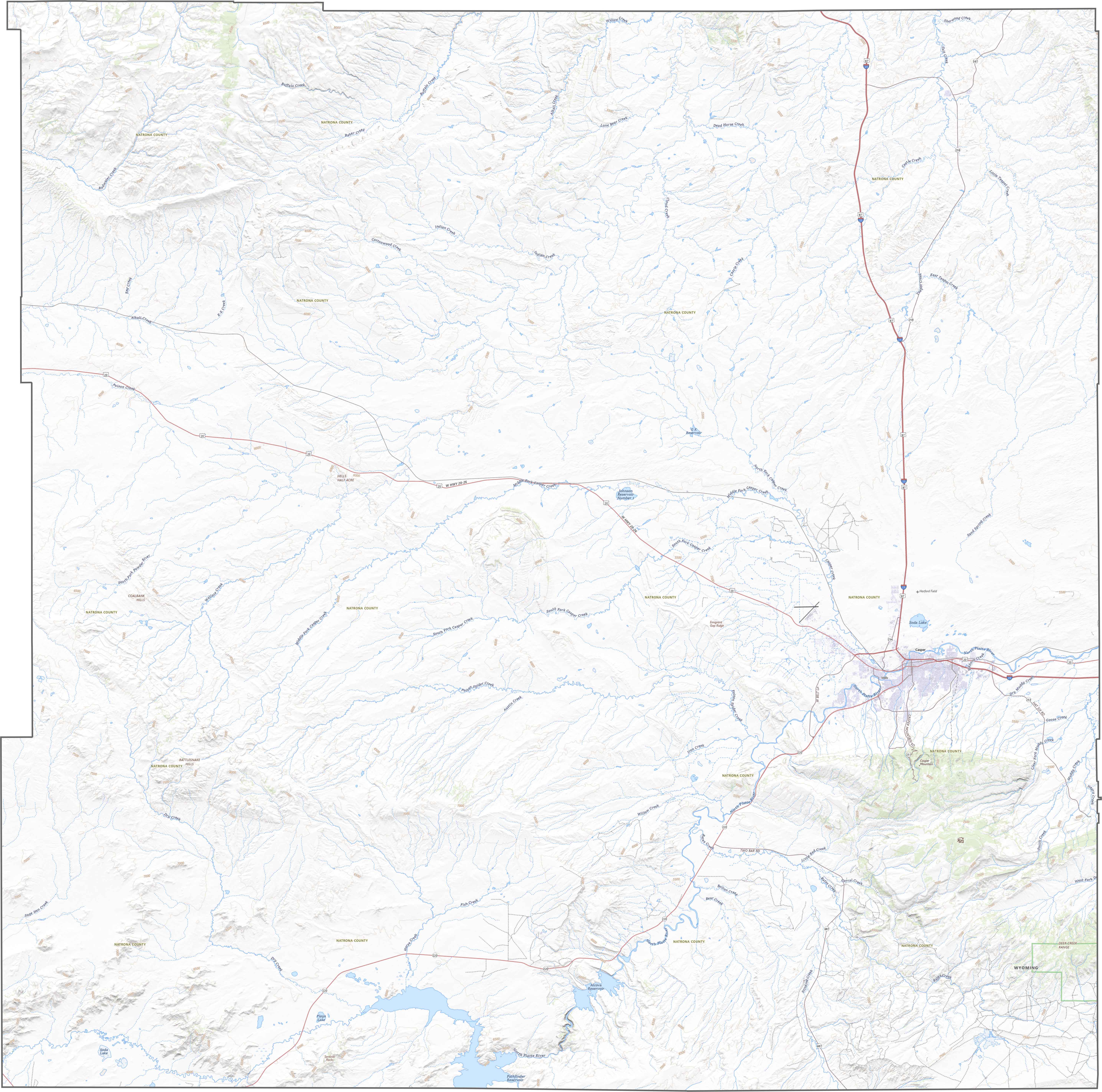
TRANSPORTATION MAP
Natrona County Road Map
Casper is a hub, so several highways meet here. Interstate 25 cuts through, linking the county to both the north and east. But smaller routes head west like U.S. Highway 20. The interstate is fast, many scenic roads are worth the slower pace.
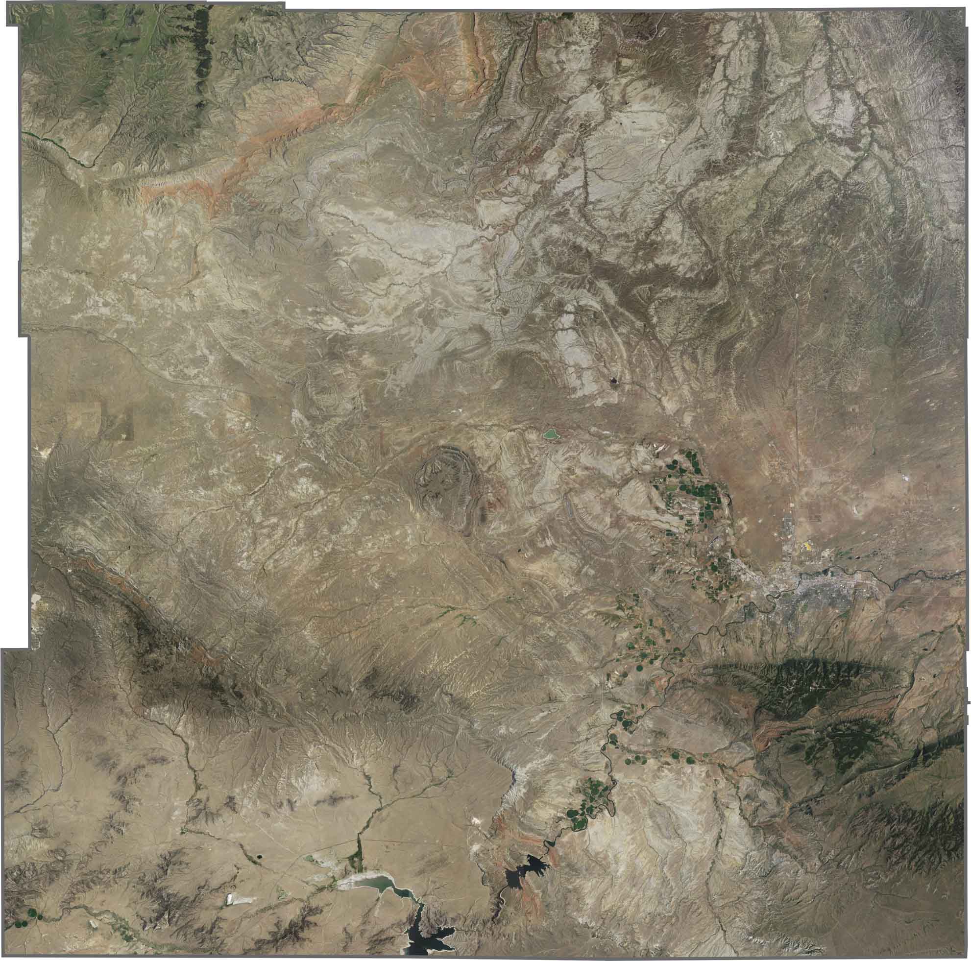
SATELLITE IMAGERY
Natrona County Satellite Map
At first glance, you’ll think Natrona County looks pretty bare. The majority is. But one spot to look at is the city of Casper in the east. But zoom out, and rocky terrain quickly takes over. Dry riverbeds, reservoirs, and barren ridges stand out the most here.
OUTLINE MAP
Natrona County Blank Map
Natrona County is roughly square but dips along the western border. The county doesn’t border another state, only other Wyoming counties.

Neighboring Counties
Here are the 6 neighboring counties of Natrona County:


Wyoming County Map

Get ready for wide skies and long drives. Wyoming’s 23 counties don’t do crowded. But what I do know is that it’s big, it’s bold, and it doesn’t try to impress you. It comes naturally.