Shawnee County Map, Kansas

Shawnee County Map Collection


We allow you to use our Shawnee County map. Attribution is required.
Shawnee County, Kansas

Shawnee County is in northeast Kansas and includes Topeka, the state capital. Being the capital, there’s a lot of government action here.
There’s more diversity and job opportunities here than in many parts of Kansas. Lake Shawnee offers fishing, boating, and a beautiful place to relax.
The county has some cool attractions like the Gage Park mini-train and the NOTO Arts District. Overall, it has a decent blend of urban and suburban areas.
| Category | Details |
|---|---|
| County Name | Shawnee County |
| County Seat | Topeka |
| Population | 200,000 |
| Cities, Towns, and Communities | Topeka (largest city), Auburn, Silver Lake, and Rossville |
| Interstates and Highways | Interstate 70, Interstate 470, U.S. Highway 24, U.S. Highway 75 |
| FIPS Code | 20-177 |
| Total Area (Land and Water) | 1,247 square miles (land: 1,240 sq mi, water: 7 sq mi) |
| Adjacent Counties (and Direction) | Jackson County (North), Jefferson County (Northeast), Douglas County (Southeast), Osage County (South), Wabaunsee County (West), Pottawatomie County (Northwest) |
| Time Zone | Central Time Zone (CST) |
| State | Kansas |
| Coordinates | 39.04°N, 95.69°W |
| Etymology | Named in honor of the Shawnee Native American tribe, which historically lived in the region. |
| Major Landmarks | Kansas State Capitol, Topeka Zoo, and the Brown v. Board of Education National Historic Site. |
| Website | Shawnee County Website |
TRANSPORTATION MAP
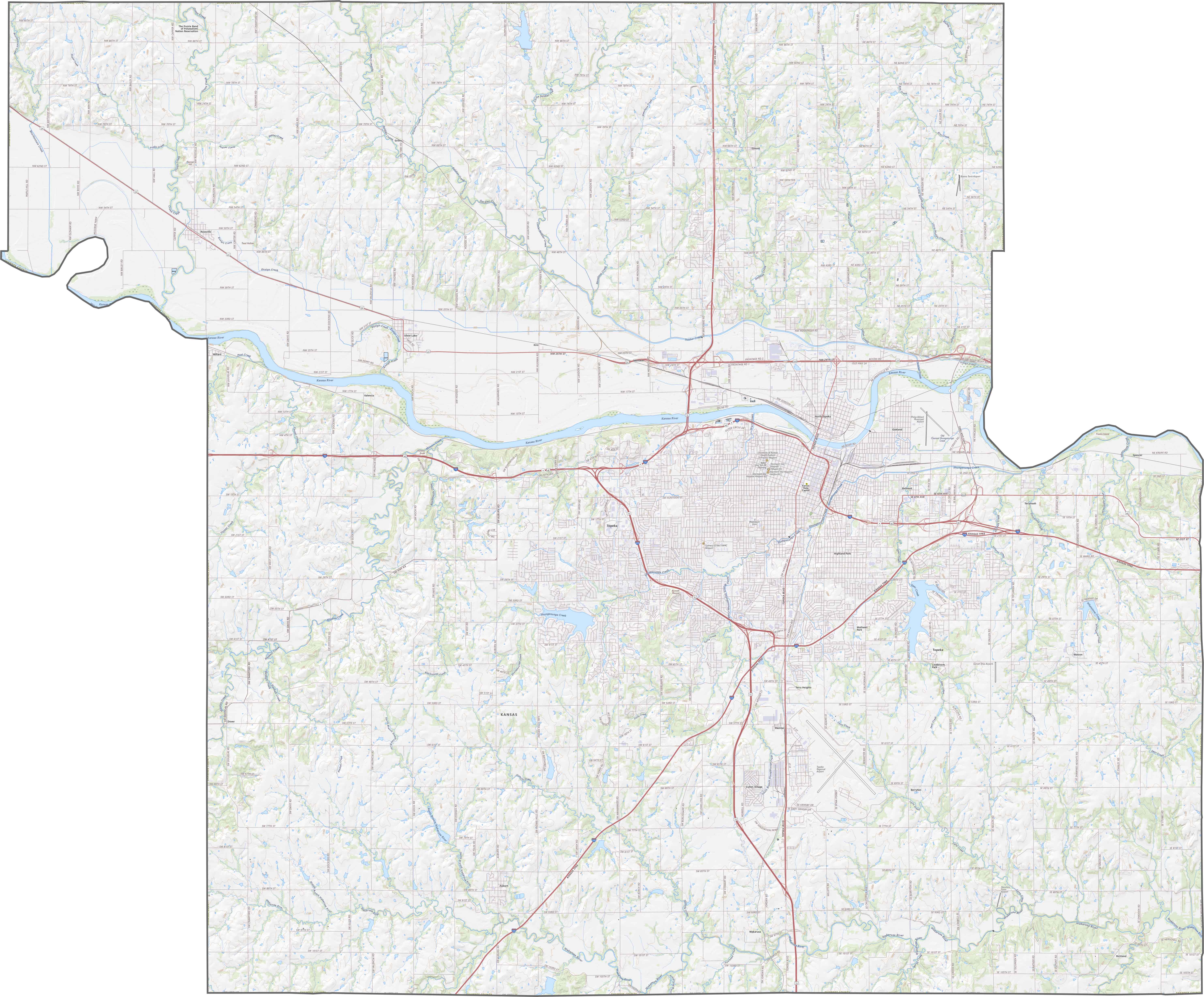
Shawnee County Road Map
Shawnee County’s roads follow both grids and winding paths. I-70 speeds east-west, though US-75 runs north-south. County roads vary. Some are gravel, others paved. Despite Topeka’s busy streets, rural lanes stay quiet. Zoom in on our map to see the details.
SATELLITE IMAGERY
Shawnee County Satellite Map
Topeka’s urban core is made up of streets and buildings. Outside the city, the land opens into fields and rolling hills. The Kansas River curves through with straight crop lines in the outskirts.

OUTLINE MAP
Shawnee County Blank Map
Shawnee County’s outline is irregular, with jagged edges on the left and right sides. The Kansas River forms part of both the western and eastern boundaries.

Neighboring Counties
Here are the 6 neighboring counties of Shawnee County:


Kansas County Map

Flat? Only to the distracted. Because Kansas is where the horizon isn’t the end… It’s the beginning. Drive slow. Listen close. The middle of everything has stories to tell.