Allegany County Map, Maryland

Allegany County Map Collection
We allow you to use our Allegany County map. Attribution is required.
Allegany County, Maryland

Allegany County is out in Western Maryland. It’s a place where the Appalachian Mountains roll through, creating a landscape that’ll make you want to grab your hiking boots.
The county seat is Cumberland. It was once a major transportation hub and still has a historic downtown. Locals love to explore the Great Allegheny Passage, a rail trail.
You might be surprised to learn that this rural county was once a hotbed of industry, with coal mining and glass production playing big roles in its past. These days, it’s all about outdoor recreation and small-town living.
| Category | Details |
|---|---|
| County Name | Allegany County |
| County Seat | Cumberland |
| Population | 70,000 |
| Cities, Towns, and Communities | Cumberland (county seat), Frostburg, LaVale, Westernport, and various unincorporated communities |
| Interstates and Highways | I-68, U.S. Highway 40, U.S. Highway 220 |
| FIPS Code | 24-001 |
| Total Area (Land and Water) | 431 square miles (land: 418 sq mi, water: 13 sq mi) |
| Adjacent Counties (and Direction) | Somerset County, Pennsylvania (Northwest), Bedford County, Pennsylvania (North), Fulton County, Pennsylvania (Northeast), Washington County (East), Morgan County, West Virginia (Southeast), Hampshire County, West Virginia (South), Mineral County, West Virginia (Southwest), Garrett County (West) |
| Time Zone | Eastern Time Zone (EST) |
| State | Maryland |
| Coordinates | 39.65°N, 78.76°W |
| Etymology | Named after “oolikhanna”, which means “beautiful stream” |
| Major Landmarks | The Great Allegany Passage (part of the Allegheny Highlands), Western Maryland Scenic Railroad, and the C&O Canal National Historical Park |
| Website | Allegany County Website |
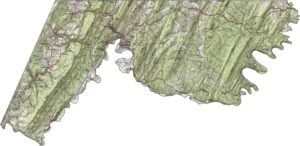
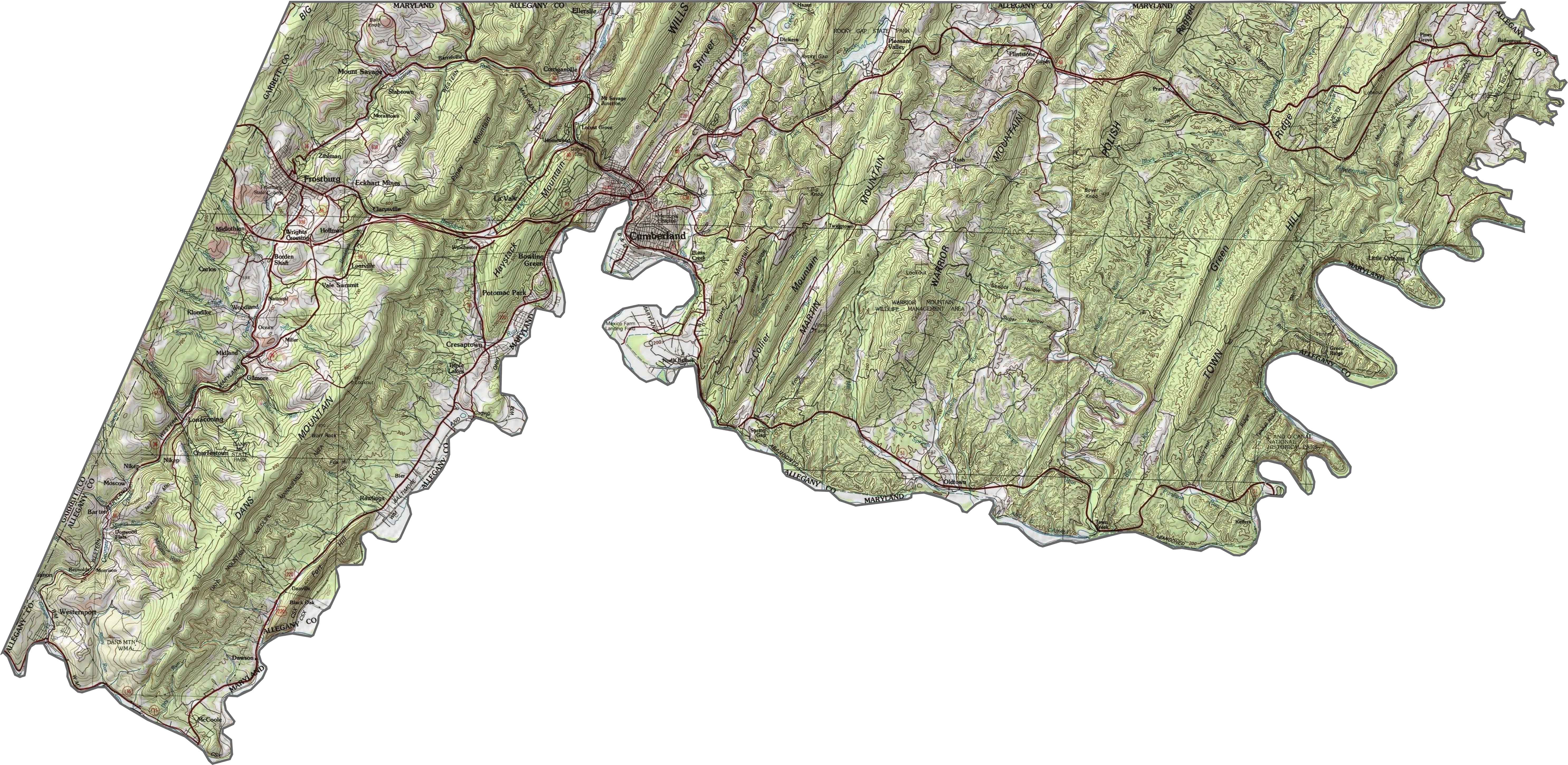
PHYSICAL MAP
Allegany County Topographic Map
Mountains dominate here, with ridges and valleys stacked high and low. The Potomac River marks the lowest point in the east, while Dans Mountain looms in the west. Steep slopes drop suddenly near Cumberland, where roads occupy to the hillsides.
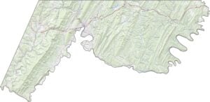
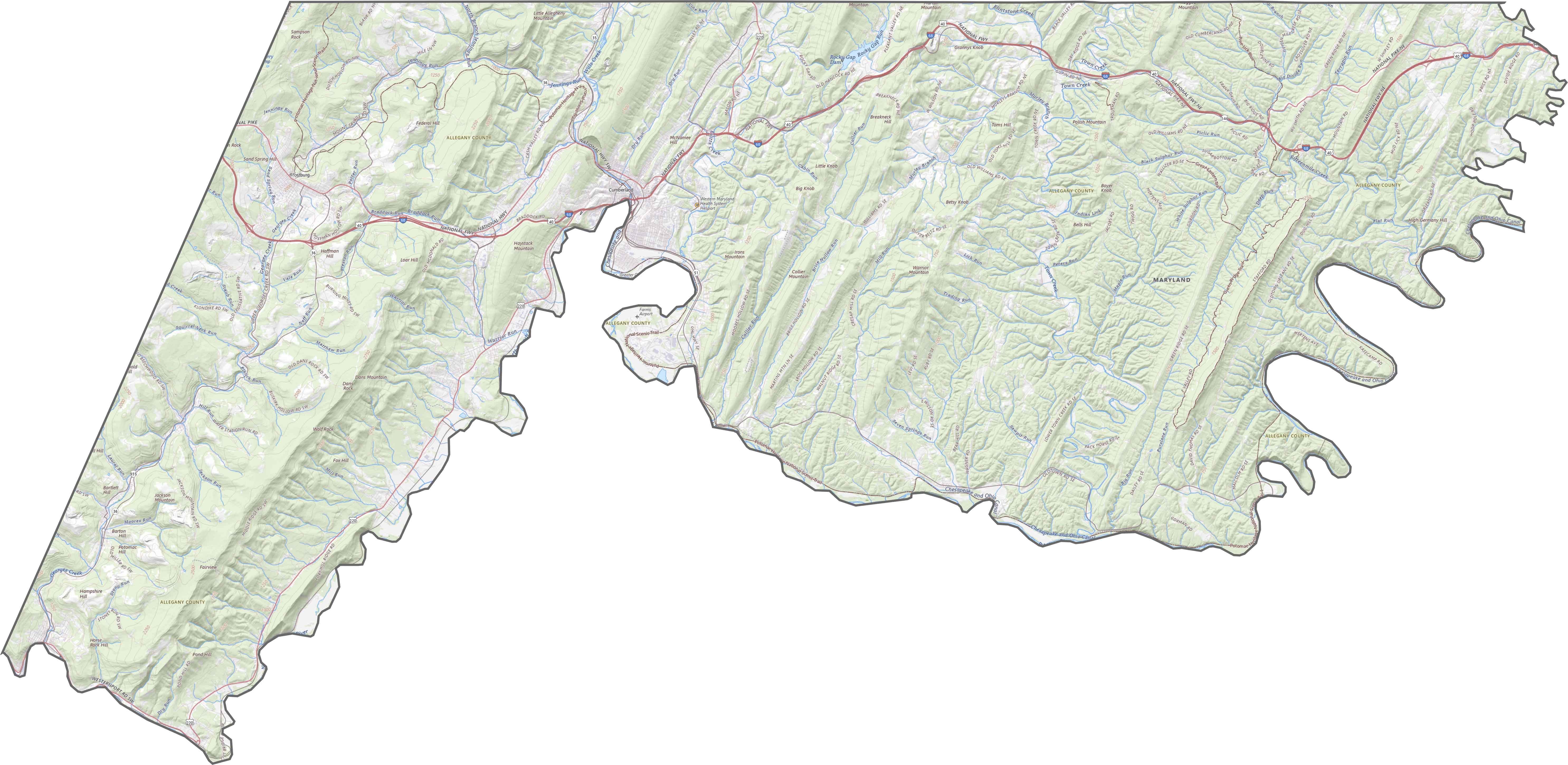
TRANSPORTATION MAP
Allegany County Road Map
Allegany County is crossed by several key highways. I-68 runs east-west, connecting it to West Virginia. But there are also other routes like US-220 that also serve the area. Some roads wind through the mountainous terrain. Explore these routes using our zoom tool below.
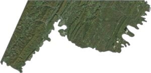
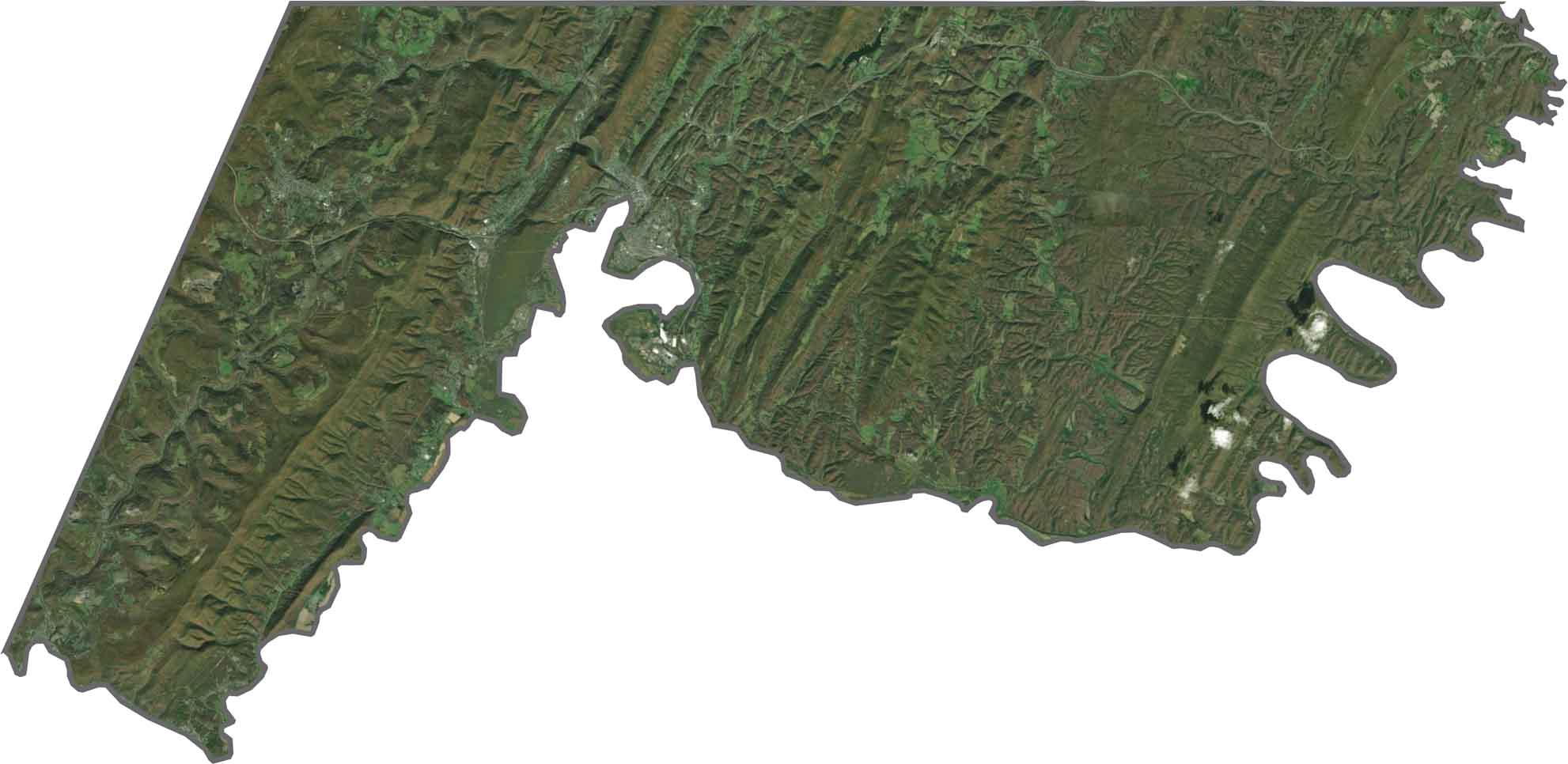
SATELLITE IMAGERY
Allegany County Satellite Map
From above, Allegany County is a mix of dense forests and rolling hills. The green landscape dominates, yet small towns like Cumberland stand out. Rivers carve through the terrain, creating a contrasts between water and land.
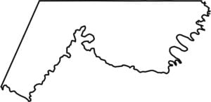
OUTLINE MAP
Allegany County Blank Map
The county has a long, narrow shape. The Potomac River forms its eastern border, sitting next to West Virginia. Pennsylvania is directly in the north.

Neighboring Counties
Here are the 8 neighboring counties of Allegany County:


Maryland County Map

With 23 counties and Baltimore City, Maryland gives you a distinct experience in every corner. City life, small towns, and outdoor adventures all come together. Learn more in our Maryland county maps.