Eau Claire County Map, Wisconsin

Eau Claire County Map Collection

We allow you to use our Eau Claire County map. Attribution is required.
Eau Claire County, Wisconsin

Rivers shape the story of Eau Claire County in west-central Wisconsin. The Eau Claire and Chippewa Rivers meet in the county seat, also named Eau Claire.
It’s a former lumber town turned creative hub. Music festivals draw crowds in summer. The county’s mix of urban and rural appeals to many. You’ll find trendy cafes and working farms within a short drive.
Outdoor recreation is big here. Locals tube down the river on hot days. The Chippewa Valley Trail System connects communities. Fall brings apple picking and corn mazes. It’s a place that balances progress with tradition.
| Category | Details |
|---|---|
| County Name | Eau Claire County |
| County Seat | Eau Claire |
| Population | Approximately 107,000 |
| Cities, Towns, and Communities | Eau Claire, Altoona, Augusta, Fairchild, Fall Creek |
| Interstates and Highways | I-94, US-12, WI-37, WI-93 |
| FIPS Code | 55-035 |
| Total Area (Land and Water) | 645 sq mi (Land: 637 sq mi; Water: 8 sq mi) |
| Adjacent Counties (and Direction) | Chippewa County (North), Clark County (East), Jackson County (Southeast), Trempealeau County (South), Buffalo County (Southwest), Pepin County (West), Dunn County (West) |
| Time Zone | Central Time Zone (CT) |
| State | Wisconsin |
| Coordinates | 44.7265° N, 91.2858° W |
| Etymology | Named after the Eau Claire River, which runs through the county |
| Major Landmarks | Carson Park, Chippewa River State Trail, Paul Bunyan Logging Camp Museum |
| Website | Eau Claire County Website |
PHYSICAL MAP
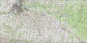
Eau Claire County Topographic Map
Eau Claire County is gently hilly, with broad uplands and scattered valleys. The Chippewa and Eau Claire Rivers are the standout features. Small bluffs and ridges rise in the northwestern parts, but nothing too extreme.
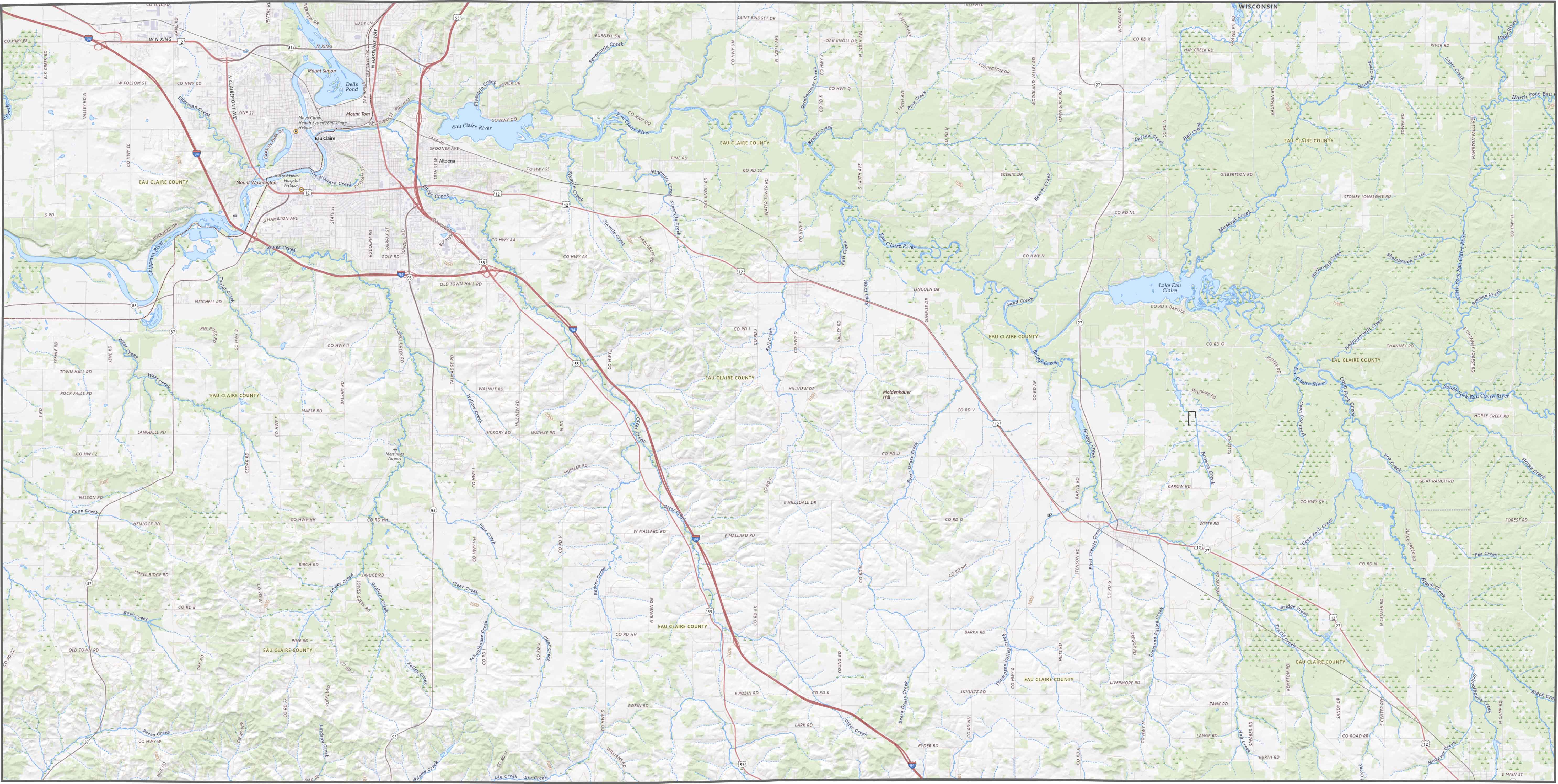
TRANSPORTATION MAP
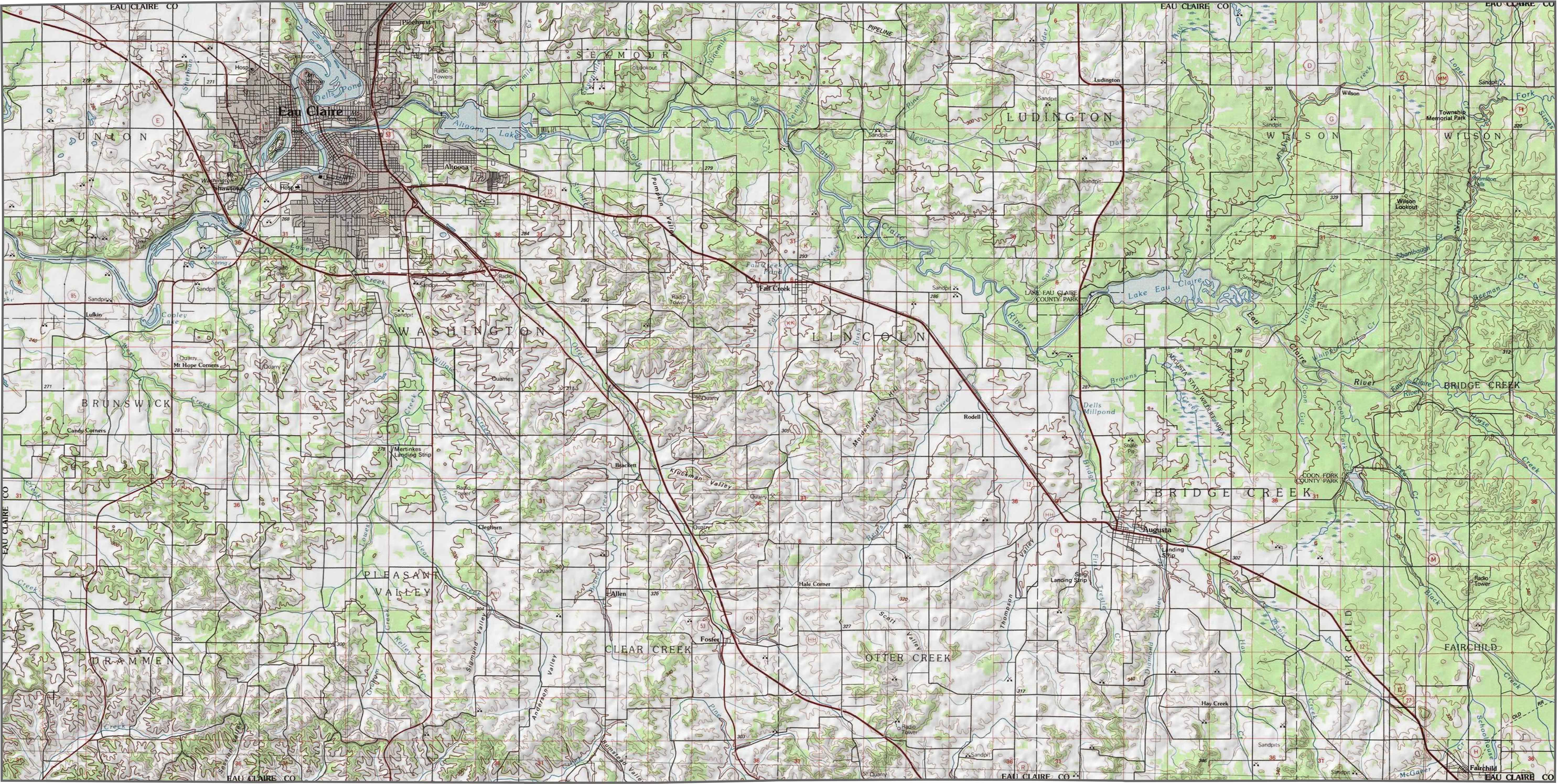
Eau Claire County Road Map
Interstate 94 crosses the western portion of Eau Claire County. Some roads cut across river valleys. Others wind through forested stretches. But navigation is easy overall. Explore the highway layout in more detail with our zoom tool.
SATELLITE IMAGERY
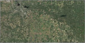
Eau Claire County Satellite Map
Eau Claire County itself shows up as a dense patch of development surrounded by greenery. The Chippewa River is clearly visible and curves through the middle of the image. Outside the city, you’ll spot farmland and forest in almost equal measure.

OUTLINE MAP
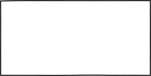
Eau Claire County Blank Map
This county’s shape is basically a perfect rectangle. It doesn’t touch another state and borders several Wisconsin counties on all sides.

Neighboring Counties
Here are the 7 neighboring counties of Eau Claire County:


Wisconsin County Map

Forget the beer and cheese stereotypes. Wisconsin’s 72 counties have more going on than tailgates and taverns. Some hug Great Lakes shorelines, others stretch through dairy farms, forests, or rolling bluffs.