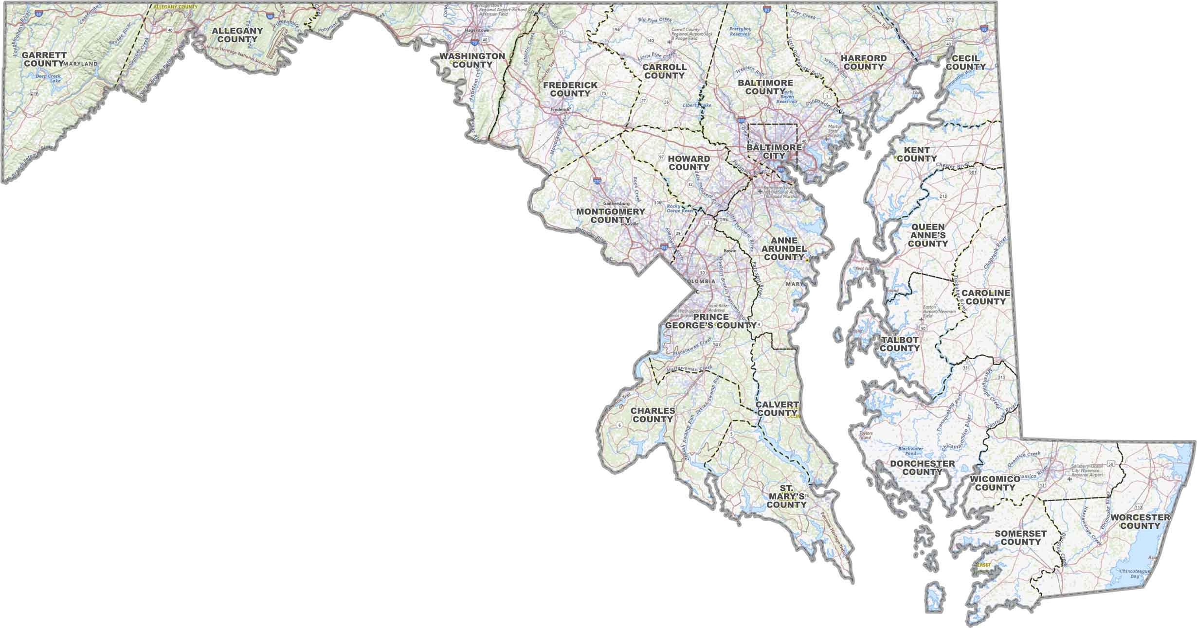
Maryland County Map

Maryland County Map Collection
We allow you to use our Maryland County map. Attribution is required.
Maryland County Maps
Maryland has 23 counties and one independent city. Click on a map below to learn about its geography.


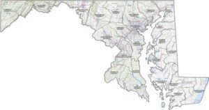
PHYSICAL MAP
Maryland Topographic County Map
Our map of Maryland keeps things clear. It has counties, main highways, and major cities to help you get your bearings. From the mountains in the west to the Chesapeake Bay, it gives you a good overview.
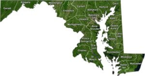
SATELLITE IMAGERY
Maryland Satellite County Map
Maryland’s a mix of busy city areas, thick woods, and a whole lot of water. Our satellite map shows it all, with county lines added so you can see how the state’s laid out.

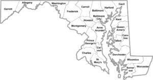
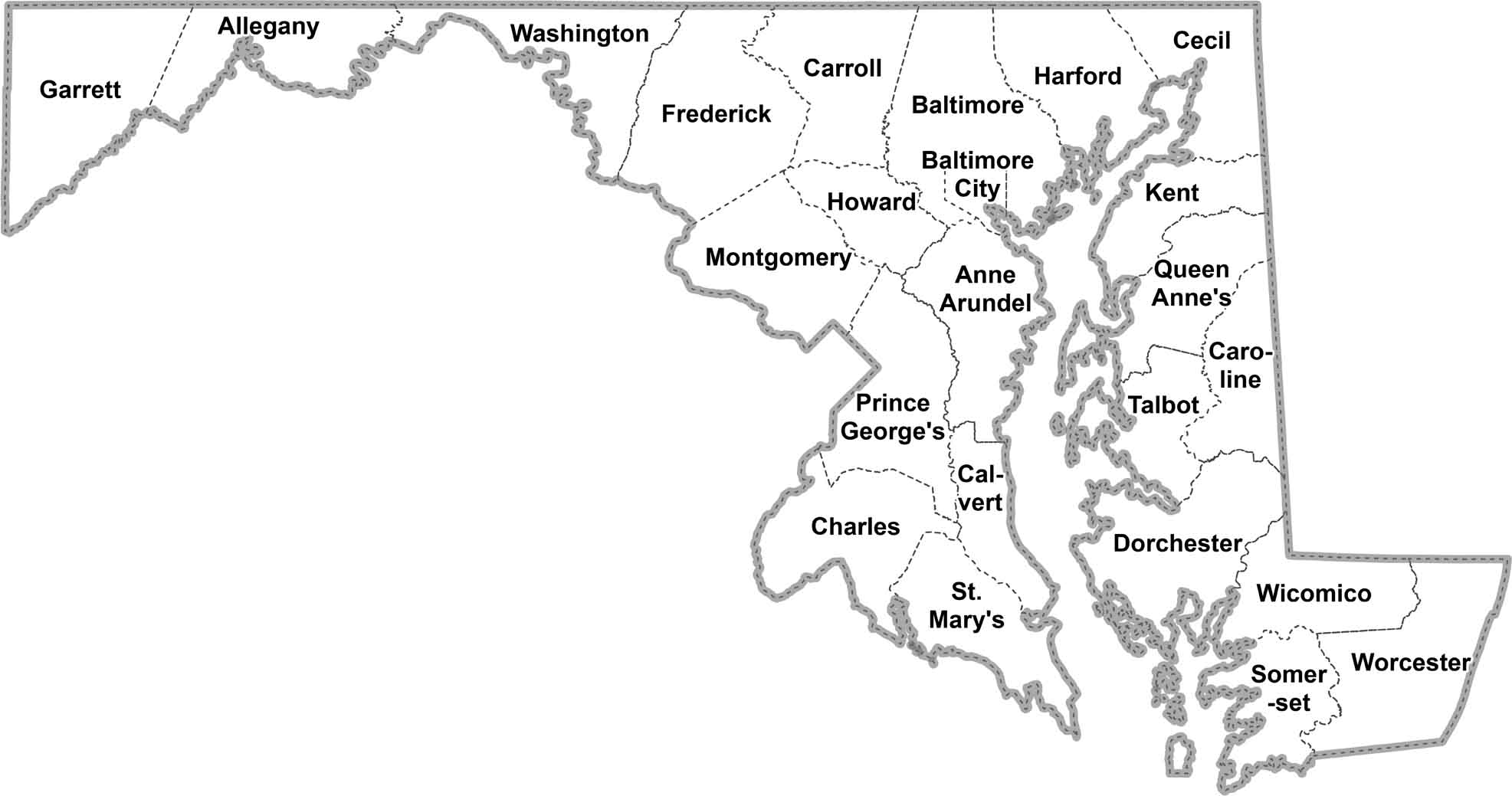
OUTLINE MAP
Maryland Simple County Map
Here’s a simple look at Maryland, broken down by county. No clutter. It just labels counties so you can easily spot what’s where.
Maryland Counties
Montgomery County is Maryland’s most populous county. It’s not hard to see why as it’s right next door to Washington D.C. This makes it a prime spot for government workers. As for Maryland’s least populous county, that’s Kent County. It’s a rural area on the Eastern Shore, full of farmland and small towns.
Most Populous: Montgomery County
Least Populous: Kent County

Size wise, Frederick County is the biggest for landmass… so that means excluding water. It stretches from the Potomac River to the Pennsylvania border. Overall, it covers 660 square miles.
What’s the smallest county you ask? That’d be Howard County. Don’t let its size fool you, though. It’s home to Columbia, one of the first planned communities in the U.S. However, Baltimore City is only 92 square miles (80.9 square miles is its landmass).
Largest Area: Frederick County
Smallest Area: Howard County
Maryland’s counties have some interesting stories behind their names. Take Calvert County, for example. It’s named after the Calvert family, the founders of Maryland colony. The first counties in Maryland were set up way back in the 1630s, with St. Mary’s County being one of the oldest.
Maryland County List
Find out more about Maryland’s 23 counties and 1 independent city:
| FIPS Code | Name | Land % | Water % | Total Area (sq mi) |
|---|---|---|---|---|
| 24-001 | Allegany County | 98.7 | 1.3 | 427.9 |
| 24-003 | Anne Arundel County | 70.6 | 29.4 | 587.8 |
| 24-005 | Baltimore County | 87.8 | 12.2 | 681.7 |
| 24-009 | Calvert County | 61.8 | 38.2 | 345.1 |
| 24-011 | Caroline County | 98.0 | 2.0 | 325.9 |
| 24-013 | Carroll County | 98.9 | 1.1 | 452.7 |
| 24-015 | Cecil County | 82.9 | 17.1 | 417.8 |
| 24-017 | Charles County | 71.2 | 28.8 | 642.9 |
| 24-019 | Dorchester County | 55.0 | 45.0 | 983.0 |
| 24-021 | Frederick County | 99.0 | 1.0 | 667.4 |
| 24-023 | Garrett County | 98.7 | 1.3 | 657.8 |
| 24-025 | Harford County | 83.0 | 17.0 | 526.7 |
| 24-027 | Howard County | 99.0 | 1.0 | 253.4 |
| 24-029 | Kent County | 67.0 | 33.0 | 413.4 |
| 24-031 | Montgomery County | 97.3 | 2.7 | 506.9 |
| 24-033 | Prince George’s County | 96.8 | 3.2 | 498.8 |
| 24-035 | Queen Anne’s County | 72.8 | 27.2 | 510.7 |
| 24-037 | St. Mary’s County | 46.9 | 53.1 | 764.2 |
| 24-039 | Somerset County | 52.4 | 47.6 | 610.3 |
| 24-041 | Talbot County | 56.3 | 43.7 | 476.8 |
| 24-043 | Washington County | 98.0 | 2.0 | 467.3 |
| 24-045 | Wicomico County | 93.6 | 6.4 | 400.2 |
| 24-047 | Worcester County | 67.4 | 32.6 | 694.9 |
| 24-510 | Baltimore City | 87.9 | 12.1 | 92.0 |
Source: United States Census Bureau