Randall County Map, Texas

Randall County Map Collection

We allow you to use our Randall County map. Attribution is required.
Randall County, Texas

The Panhandle of Texas is home to Randall County. It’s a place where the wide-open sky meets endless prairie. Canyon is the county seat and is where you’ll find West Texas A&M University.
It’s not all flat land, though. Palo Duro Canyon, the second-largest canyon in the United States, cuts through the eastern part of the county. Locals love to hike its colorful rock formations. Amarillo, the region’s biggest city, spills over into Randall County from the north.
Ranching is still big business here. You can often spot cowboys tending to cattle on the sprawling ranches. The county is named after Horace Randal, a Confederate brigadier general. Funny thing is, they misspelled his name when naming the county. Oh well. It stuck.
| Category | Details |
|---|---|
| County Name | Randall County |
| County Seat | Canyon |
| Population | Approximately 140,000 |
| Cities, Towns, and Communities | Canyon, Amarillo, Bushland |
| Interstates and Highways | Interstate 27, U.S. Highway 60, U.S. Highway 84 |
| FIPS Code | 48-381 |
| Total Area (Land and Water) | 1,089 square miles (1,086 sq mi land, 3 sq mi water) |
| Adjacent Counties (and Direction) | Potter County (North), Oldham County (Northwest), Armstrong County (East), Carson County (Northeast), Swisher County (South), Briscoe County (Southeast), Castro County (Southwest), Deaf Smith County (West) |
| Time Zone | Central Time Zone (CST) |
| State | Texas |
| Coordinates | 34°59’N, 101°55’W |
| Etymology | Named after Horace Randal, a Confederate brigadier general |
| Major Landmarks | Palo Duro Canyon, Panhandle-Plains Historical Museum |
| Website | Randall County Website |
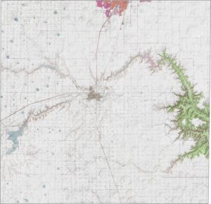
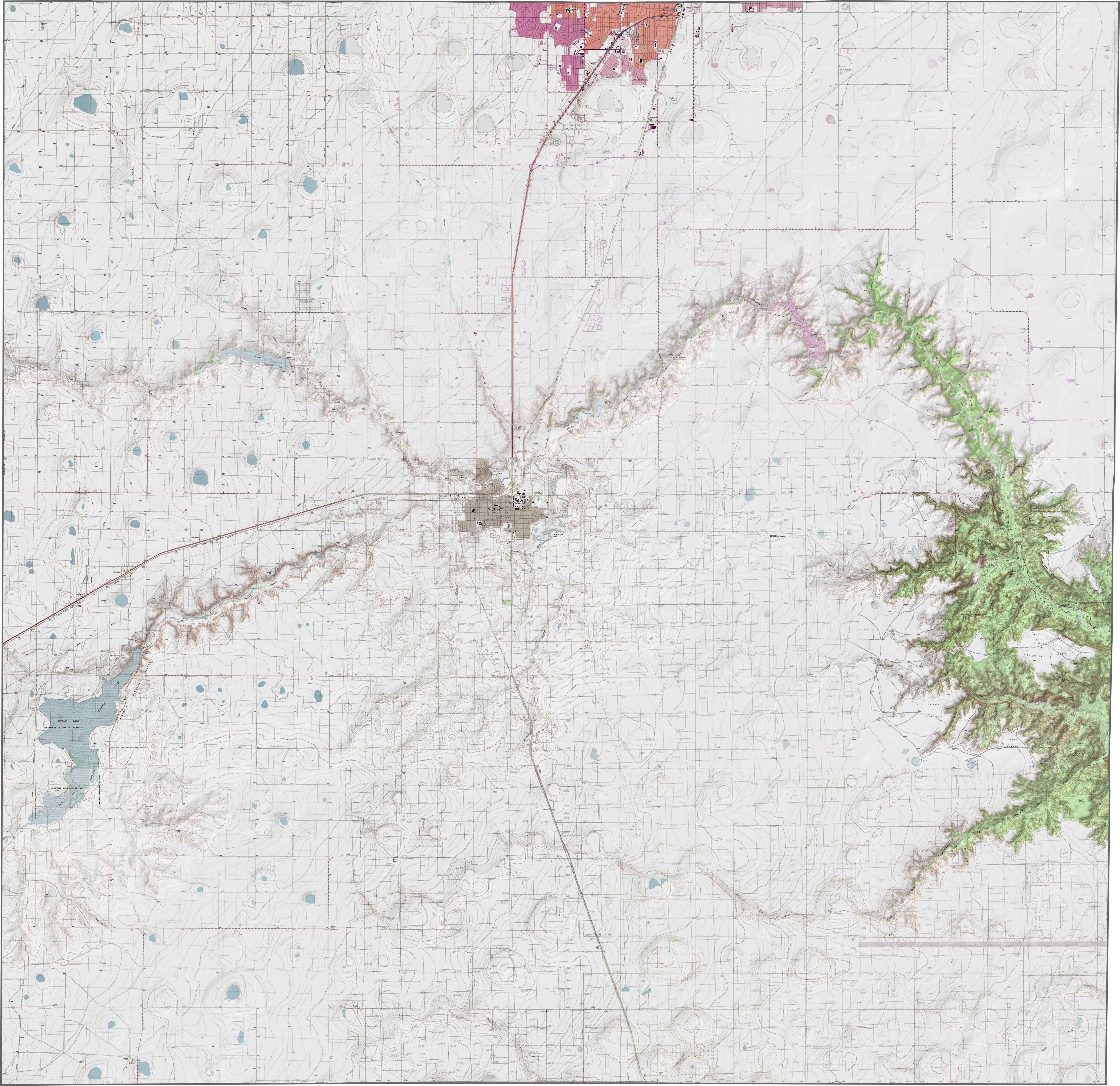
PHYSICAL MAP
Randall County Topographic Map
Randall County is known for Palo Duro Canyon, which cuts across the southeast section of the county. While much of the land is flat and treeless, that canyon changes everything. It’s Texas’s answer to the Grand Canyon. But it’s only more orange.
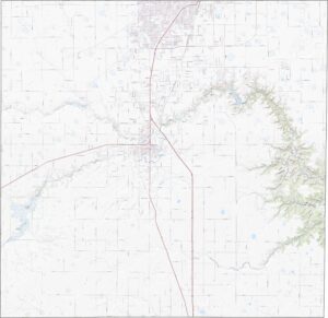
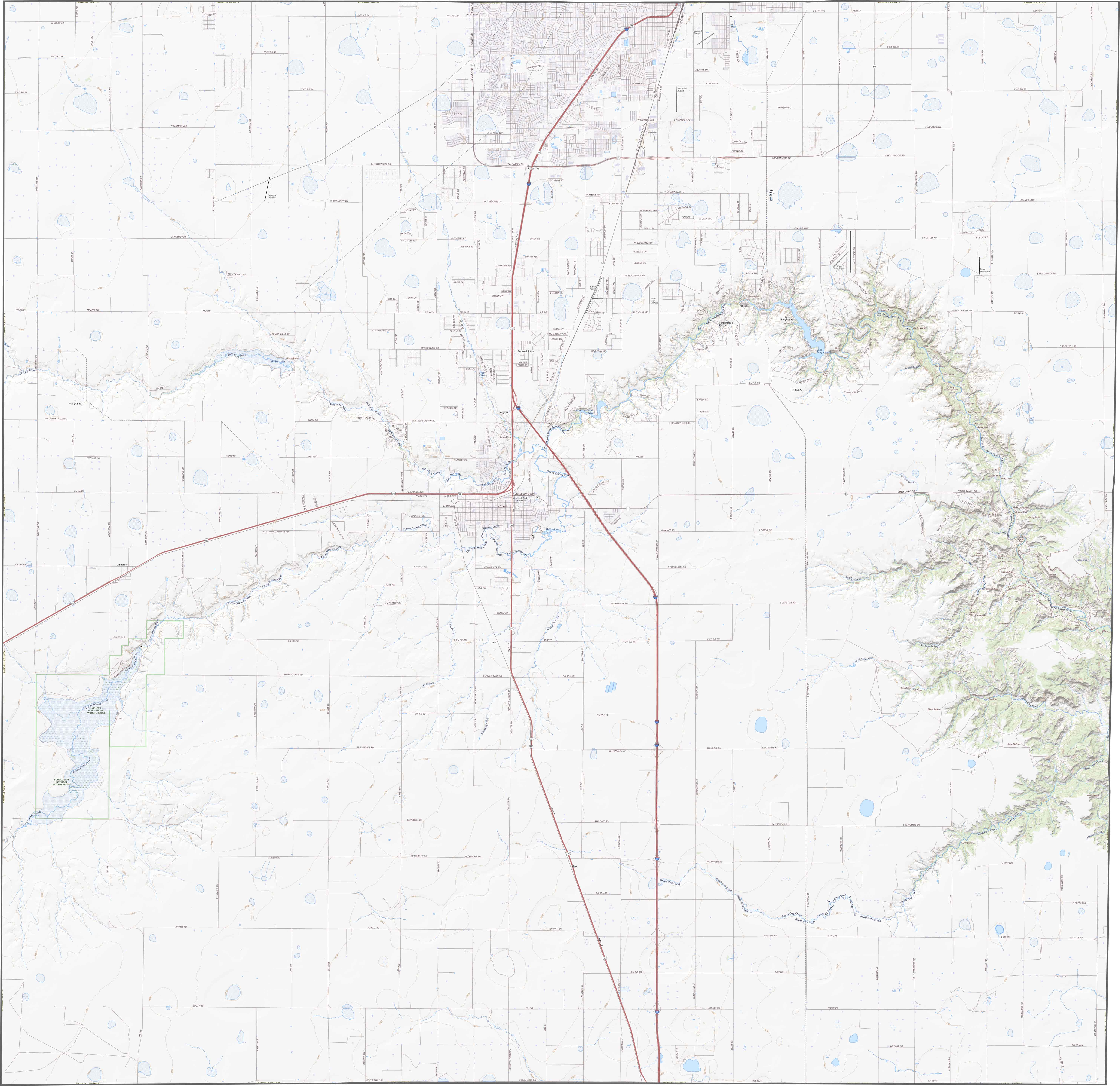
TRANSPORTATION MAP
Randall County Road Map
This county has strong north-south links running straight through Amarillo with I-27. But that’s just half the story. Rural roads dart off in every direction. Some climb gradually toward the canyonlands, while others flatten out into grasslands. You can explore each path in detail using our zoomable map.
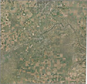
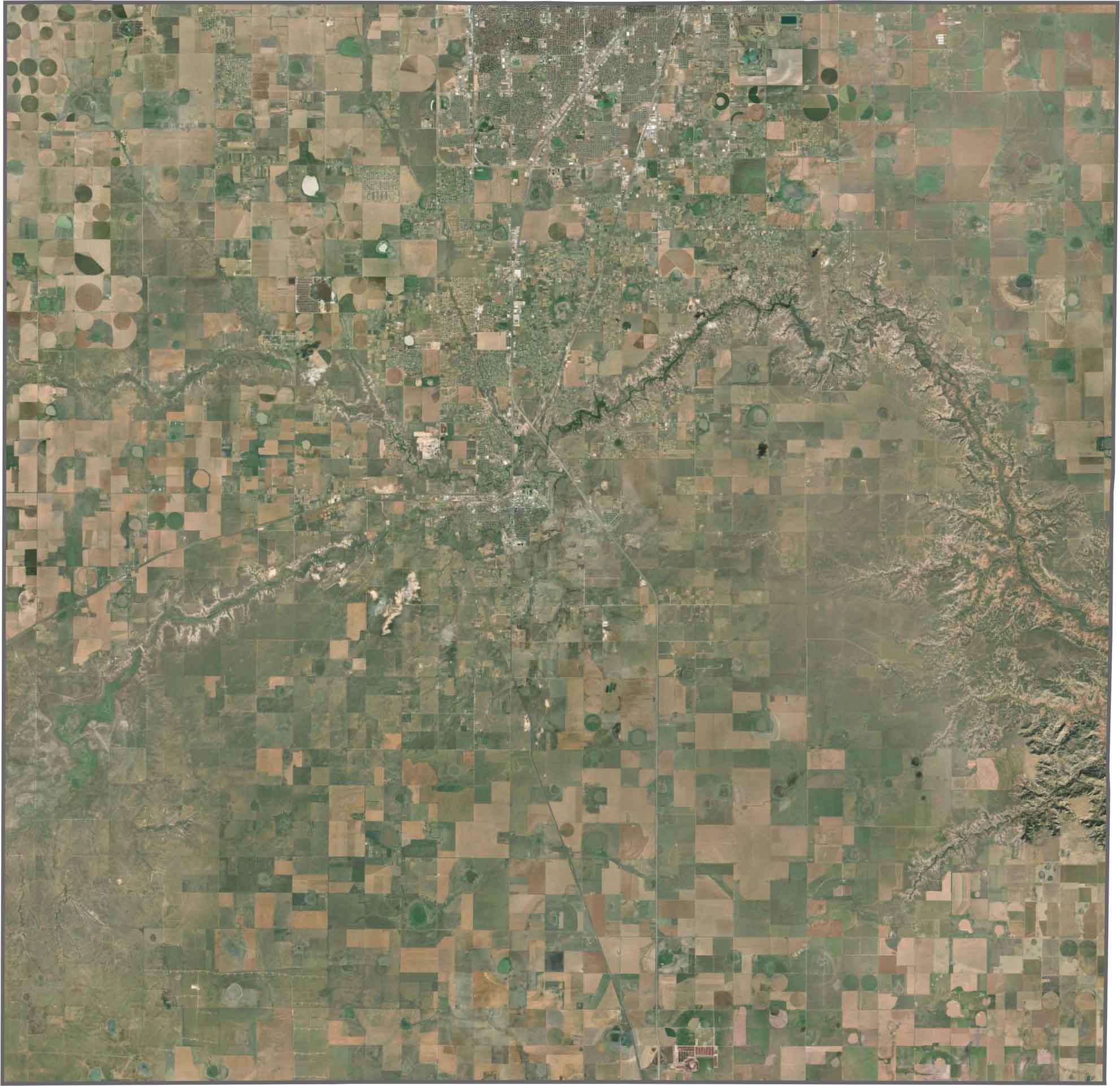
SATELLITE IMAGERY
Randall County Satellite Map
One glance and Palo Duro stands out immediately. The rest? A checkerboard of agriculture, with suburban development creeping in near Amarillo. Despite that, vast areas remain untouched and open.
OUTLINE MAP
Randall County Blank Map
Randall County is shaped like a square. It’s clean on most sides without a river boundary. It also doesn’t border any other state.

Neighboring Counties
Here are the 8 neighboring counties of Randall County:


Texas County Map

254 legendary Texas county maps. From the Panhandle to the Rio Grande, we’ve got the Lone Star State mapped. That means more rodeos, honky-tonk, and Texas BBQ.